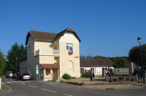
Bretagnolles (Bretagnolles)

- commune in Eure, France
- Country:

- Postal Code: 27220
- Coordinates: 48° 57' 6" N, 1° 21' 9" E


- GPS tracks (wikiloc): [Link]
- AboveSeaLevel: 140 м m
- Area: 3.78 sq km
- Population: 196
- Wikipedia en: wiki(en)
- Wikipedia: wiki(fr)
- Wikidata storage: Wikidata: Q1073262
- Wikipedia Commons Category: [Link]
- Freebase ID: [/m/03mhqsq]
- Freebase ID: [/m/03mhqsq]
- GeoNames ID: Alt: [6616279]
- GeoNames ID: Alt: [6616279]
- SIREN number: [212701114]
- SIREN number: [212701114]
- BnF ID: [15253350b]
- BnF ID: [15253350b]
- INSEE municipality code: 27111
- INSEE municipality code: 27111
Shares border with regions:
Foucrainville
- commune in Eure, France
- Country:
- Postal Code: 27220
- Coordinates: 48° 55' 52" N, 1° 19' 24" E
- GPS tracks (wikiloc): [Link]
- Area: 5.26 sq km
- Population: 73
Fresney
- commune in Eure, France
- Country:
- Postal Code: 27220
- Coordinates: 48° 57' 0" N, 1° 18' 17" E
- GPS tracks (wikiloc): [Link]
- Area: 6.34 sq km
- Population: 340
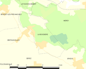
La Boissière
- commune in Eure, France
- Country:
- Postal Code: 27220
- Coordinates: 48° 56' 43" N, 1° 22' 5" E
- GPS tracks (wikiloc): [Link]
- Area: 3.45 sq km
- Population: 274
- Web site: [Link]


Boisset-les-Prévanches
- commune in Eure, France
- Country:
- Postal Code: 27120
- Coordinates: 48° 58' 5" N, 1° 19' 44" E
- GPS tracks (wikiloc): [Link]
- Area: 7.46 sq km
- Population: 451