Breuil-le-Vert (Breuil-le-Vert)

- commune in Oise, France
- Country:

- Postal Code: 60600
- Coordinates: 49° 21' 39" N, 2° 26' 12" E


- GPS tracks (wikiloc): [Link]
- Area: 7.37 sq km
- Population: 3049
- Web site: http://www.mairie-breuil-le-vert.fr
- Wikipedia en: wiki(en)
- Wikipedia: wiki(fr)
- Wikidata storage: Wikidata: Q943707
- Wikipedia Commons Category: [Link]
- Freebase ID: [/m/03qfv_x]
- GeoNames ID: Alt: [3030202]
- SIREN number: [216001073]
- BnF ID: [152673468]
- PACTOLS thesaurus ID: [pcrtGlkEEjX1SR]
- INSEE municipality code: 60107
Shares border with regions:


Rantigny
- commune in Oise, France
- Country:
- Postal Code: 60290
- Coordinates: 49° 19' 47" N, 2° 26' 29" E
- GPS tracks (wikiloc): [Link]
- Area: 4.16 sq km
- Population: 2519
- Web site: [Link]

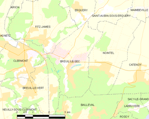
Breuil-le-Sec
- commune in Oise, France
- Country:
- Postal Code: 60600
- Coordinates: 49° 22' 13" N, 2° 27' 8" E
- GPS tracks (wikiloc): [Link]
- Area: 8.89 sq km
- Population: 2582
- Web site: [Link]
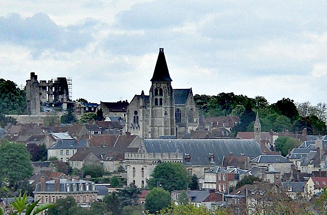

Clermont
- commune in Oise, France
- Country:
- Postal Code: 60600
- Coordinates: 49° 22' 44" N, 2° 24' 45" E
- GPS tracks (wikiloc): [Link]
- Area: 5.81 sq km
- Population: 10548
- Web site: [Link]

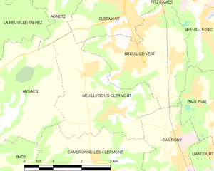
Neuilly-sous-Clermont
- commune in Oise, France
- Country:
- Postal Code: 60290
- Coordinates: 49° 20' 42" N, 2° 24' 41" E
- GPS tracks (wikiloc): [Link]
- Area: 7.74 sq km
- Population: 1669
- Web site: [Link]


Bailleval
- commune in Oise, France
- Country:
- Postal Code: 60140
- Coordinates: 49° 20' 52" N, 2° 27' 27" E
- GPS tracks (wikiloc): [Link]
- Area: 8.01 sq km
- Population: 1494
- Web site: [Link]