Brignano Gera d'Adda (Brignano Gera d'Adda)
.svg)
- Italian comune
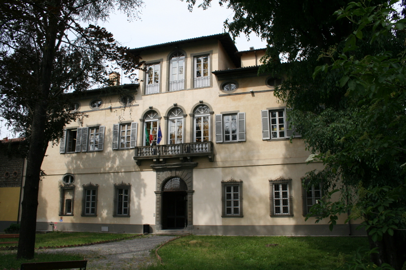
 Hiking in Brignano Gera d'Adda
Brignano Gera d'Adda is located in the Lombardy region of Italy and offers a unique landscape for hiking enthusiasts. While the area may not be as globally renowned as some of Italy's larger national parks, it boasts picturesque scenery and natural beauty that can provide a pleasant hiking experience.
Hiking Trails:
-
Local Trails: There are various local trails around Brignano Gera d'Adda that feature a mix of flat terrain and gentle inclines, making them suitable for hikers of all levels. These paths often wind through fields, forests, and along the Adda River.
-
Parco Adda Nord: This nearby regional park offers a variety of trails that showcase the natural beauty of the Adda River, its banks, and the surrounding woodlands. The park features marked paths that allow hikers to explore the diverse flora and fauna.
-
Cultural Routes: Some trails may take you past historical sites and picturesque villages, allowing you to absorb the local culture and architecture while enjoying nature.
Tips for Hiking in the Area:
- Best Time to Hike: Spring (April to June) and fall (September to October) are ideal times for hiking in this region due to pleasant weather and beautiful natural colors.
- What to Bring: Always carry plenty of water, snacks, a map or GPS device, and wear appropriate footwear. A first aid kit is also advisable.
- Respect the Environment: Stay on marked trails, and take care to respect the natural surroundings. Carry out any trash you bring in.
- Local Guide Services: If you're unfamiliar with the area, consider hiring a local guide who can enhance your experience with insights about the local ecology and history.
Accommodations and Amenities:
Look for local agriturismos or small hotels that provide a comfortable base for your hiking activities, and check nearby areas for restaurants and cafes where you can enjoy the local cuisine after a day of hiking.
By exploring Brignano Gera d'Adda and its surroundings, you'll find a combination of natural beauty and local charm that can make your hiking experience quite enjoyable.
- Country:

- Postal Code: 24053
- Local Dialing Code: 0363
- Licence Plate Code: BG
- Coordinates: 45° 32' 0" N, 9° 38' 0" E


- GPS tracks (wikiloc): [Link]
- AboveSeaLevel: 131 м m
- Area: 12.11 sq km
- Population: 6009
- Web site: http://www.comune.brignano.bg.it
- Wikipedia en: wiki(en)
- Wikipedia: wiki(it)
- Wikidata storage: Wikidata: Q100015
- Wikipedia Commons Gallery: [Link]
- Wikipedia Commons Category: [Link]
- Freebase ID: [/m/0gj8_1]
- GeoNames ID: Alt: [6541991]
- VIAF ID: Alt: [245448120]
- OSM relation ID: [45263]
- TGN ID: [5002517]
- UN/LOCODE: [ITBGA]
- ISTAT ID: 016040
- Italian cadastre code: B178
Shares border with regions:


Caravaggio, Lombardy
- Italian comune
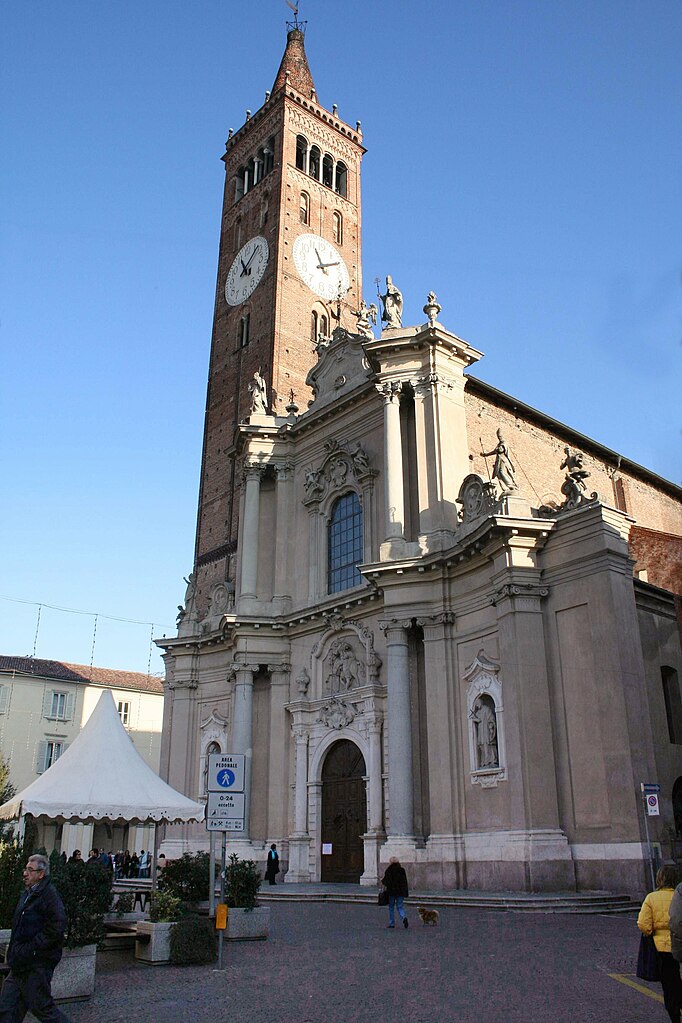
Hiking in Caravaggio, Lombardy
Caravaggio, located in the Lombardy region of Italy, is not primarily known as a hiking destination, but it does offer some opportunities for outdoor enthusiasts looking to explore the surrounding areas. The town itself is steeped in history and art, being the namesake of the famous Caravaggio, the Baroque painter....
- Country:
- Postal Code: 24043
- Local Dialing Code: 0363
- Licence Plate Code: BG
- Coordinates: 45° 29' 52" N, 9° 38' 35" E
- GPS tracks (wikiloc): [Link]
- AboveSeaLevel: 111 м m
- Area: 32.81 sq km
- Population: 16261
- Web site: [Link]


Castel Rozzone
- Italian comune
Hiking in Castel Rozzone
Castel Rozzone, located in the province of Bergamo in Italy, offers a mix of natural beauty and historical intrigue for hikers. While it may not be as widely recognized as some other hiking destinations, it provides a variety of trails suited for different skill levels, surrounded by picturesque landscapes of the Lombardy region....
- Country:
- Postal Code: 24040
- Local Dialing Code: 0363
- Licence Plate Code: BG
- Coordinates: 45° 33' 0" N, 9° 38' 0" E
- GPS tracks (wikiloc): [Link]
- AboveSeaLevel: 140 м m
- Area: 1.71 sq km
- Population: 2849
- Web site: [Link]


Cologno al Serio
- Italian comune
Hiking in Cologno al Serio
Cologno al Serio is a small town located in the Lombardy region of Italy, near the Adda River and not far from the beautiful landscapes of the Italian Alps. While Cologno al Serio itself might not be a major hiking destination, there are several hiking opportunities in the surrounding areas....
- Country:
- Postal Code: 24055
- Local Dialing Code: 035
- Licence Plate Code: BG
- Coordinates: 45° 35' 0" N, 9° 42' 0" E
- GPS tracks (wikiloc): [Link]
- AboveSeaLevel: 156 м m
- Area: 18.52 sq km
- Population: 11180
- Web site: [Link]


Lurano
- Italian comune
Hiking in Lurano
Lurano, a small municipality in Italy, may not be widely known as a hiking destination compared to some of the more popular regions, but it can offer some serene and picturesque trails suitable for those looking to explore nature away from the crowds....
- Country:
- Postal Code: 24050
- Local Dialing Code: 035
- Licence Plate Code: BG
- Coordinates: 45° 34' 0" N, 9° 38' 0" E
- GPS tracks (wikiloc): [Link]
- AboveSeaLevel: 147 м m
- Area: 4.05 sq km
- Population: 2841
- Web site: [Link]

Morengo
- Italian comune
Hiking in Morengo
It seems like you may be referring to a specific hiking area, but "Morengo" isn't widely recognized as a popular hiking destination in the general hiking community. It’s possible you meant "Morrison," which is known for its hiking trails near Red Rocks in Colorado, or perhaps a location in another region altogether....
- Country:
- Postal Code: 24050
- Local Dialing Code: 0363
- Licence Plate Code: BG
- Coordinates: 45° 32' 0" N, 9° 42' 0" E
- GPS tracks (wikiloc): [Link]
- AboveSeaLevel: 126 м m
- Area: 9.57 sq km
- Population: 2535
- Web site: [Link]


Pagazzano
- Italian comune
Hiking in Pagazzano
Pagazzano is a charming town located in the Lombardy region of Italy, not far from the more well-known city of Bergamo. While Pagazzano itself may not be a major hiking destination, its surrounding areas offer a variety of trails and natural beauty suitable for hiking enthusiasts....
- Country:
- Postal Code: 24040
- Local Dialing Code: 0363
- Licence Plate Code: BG
- Coordinates: 45° 32' 3" N, 9° 40' 16" E
- GPS tracks (wikiloc): [Link]
- AboveSeaLevel: 126 м m
- Area: 5.24 sq km
- Population: 2083
- Web site: [Link]


Spirano
- Italian comune
Hiking in Spirano
Spirano, a small town located in the province of Bergamo in Lombardy, Italy, offers a serene environment and picturesque landscapes suitable for hiking enthusiasts. While it may not be as renowned for hiking as some larger areas in the Italian Alps, Spirano and its surrounding regions provide a variety of trails that cater to different experience levels....
- Country:
- Postal Code: 24050
- Local Dialing Code: 035
- Licence Plate Code: BG
- Coordinates: 45° 34' 58" N, 9° 40' 9" E
- GPS tracks (wikiloc): [Link]
- AboveSeaLevel: 154 м m
- Area: 9.61 sq km
- Population: 5730
- Web site: [Link]

Treviglio
- Italian comune
Hiking in Treviglio
Treviglio is located in the Lombardy region of northern Italy, not far from Milan. While Treviglio itself may not be a major hiking destination, it serves as a good base for accessing nearby natural areas and hiking trails in the surrounding region....
- Country:
- Postal Code: 24047
- Local Dialing Code: 0363
- Licence Plate Code: BG
- Coordinates: 45° 31' 17" N, 9° 35' 34" E
- GPS tracks (wikiloc): [Link]
- AboveSeaLevel: 125 м m
- Area: 32.22 sq km
- Population: 29815
- Web site: [Link]