
Province of Bergamo (provincia di Bergamo)
- province of Italy
Hiking in the Province of Bergamo, located in the Lombardy region of Italy, offers a stunning array of trails and scenic beauty. This area is characterized by its diverse landscapes, ranging from the picturesque plains to the dramatic peaks of the Lombardy Alps. Here’s a guide to hiking in this beautiful province:
Key Areas for Hiking
-
Orobie Mountains:
- The Orobie range is a highlight for hikers, offering a mix of well-marked trails ranging from easy walks to challenging routes. Notable peaks include Pizzo Arera and Pizzo dei Tre Signori.
- The area is also home to several mountain huts (rifugi) that provide rest and local cuisine.
-
Val Seriana:
- This valley has numerous trails, including the famous Sentiero dei Fiori, which offers panoramic views and the chance to see a variety of flora.
- Trails like those leading to Lago di Endine are highly recommended for their accessibility and beauty.
-
Valtaleggio:
- Known for its stunning landscapes, this area provides several trails suitable for both casual and expert hikers.
- Don’t miss the chance to hike to the scenic viewpoints overlooking the valley.
-
Lake Iseo:
- While primarily known for the lake itself, the surrounding hills offer excellent hiking opportunities. The Sentiero delle Valli provides stunning views of the lake and surroundings.
-
Città Alta (Bergamo’s Upper Town):
- For those seeking a mix of history and nature, the paths around the historic upper town include scenic viewpoints and beautiful gardens.
Tips for Hiking in Bergamo
- Trail Maps: Make sure to carry a detailed map or GPS device. Local tourist offices often provide trail guides and maps.
- Equipment: Wear sturdy hiking boots and pack layers, as weather conditions can change rapidly in the mountains. Always bring sufficient water and snacks.
- Local Regulations: Respect nature and follow any guidelines or regulations posted in the parks and reserves.
- Guided Tours: If you’re unfamiliar with the area, consider joining a guided hiking tour. Local guides can provide valuable insight into the region’s flora, fauna, and history.
Best Time to Hike
- The best hiking seasons are late spring to early fall (May to October), when the weather is typically mild, and the trails are most accessible.
Additional Attractions
- Culinary Experiences: After a long hike, indulge in local Bergamasque cuisine, known for dishes like "Casoncelli" (stuffed pasta) and local cheeses.
- Cultural Sites: Explore historic sites in Bergamo, including its Venetian walls, churches, and art galleries, to enrich your hiking experience.
Whether you are a beginner or an experienced hiker, the Province of Bergamo offers a wealth of trails and natural beauty that will satisfy your outdoor adventures.
- Country:

- Capital: Bergamo
- Postal Code: 24121-24129 (Bergamo), 23806, 24000-24100, (provincia)
- Licence Plate Code: BG
- Coordinates: 45° 41' 42" N, 9° 40' 12" E


- GPS tracks (wikiloc): [Link]
- AboveSeaLevel: 249 м m
- Area: 2722.86 sq km
- Population: 1109933
- Web site: http://www.provincia.bergamo.it
- Wikipedia en: wiki(en)
- Wikipedia: wiki(it)
- Wikidata storage: Wikidata: Q16137
- Wikipedia Commons Gallery: [Link]
- Wikipedia Commons Category: [Link]
- Freebase ID: [/m/03wxzl]
- GeoNames ID: Alt: [3182163]
- VIAF ID: Alt: [136077614]
- GND ID: Alt: [4080363-6]
- archINFORM location ID: [2336]
- Library of Congress authority ID: Alt: [n83048393]
- MusicBrainz area ID: [635918ca-8936-4732-9bb8-f0567be2e8db]
- TGN ID: [7005023]
- NUTS code: [ITC46]
- ISTAT ID: 016
- ISO 3166-2 code: IT-BG
Includes regions:


Brignano Gera d'Adda
- Italian comune
 Hiking in Brignano Gera d'Adda
Brignano Gera d'Adda is located in the Lombardy region of Italy and offers a unique landscape for hiking enthusiasts. While the area may not be as globally renowned as some of Italy's larger national parks, it boasts picturesque scenery and natural beauty that can provide a pleasant hiking experience....
- Country:

- Postal Code: 24053
- Local Dialing Code: 0363
- Licence Plate Code: BG
- Coordinates: 45° 32' 0" N, 9° 38' 0" E


- GPS tracks (wikiloc): [Link]
- AboveSeaLevel: 131 м m
- Area: 12.11 sq km
- Population: 6009
- Web site: [Link]


Brumano
- Italian comune
Brumano is a picturesque town located in the Lombardy region of Italy, nestled in the Bergamo Alps. It offers a variety of hiking opportunities that cater to different skill levels, making it a great destination for outdoor enthusiasts....
- Country:

- Postal Code: 24037
- Local Dialing Code: 035
- Licence Plate Code: BG
- Coordinates: 45° 51' 0" N, 9° 30' 0" E


- GPS tracks (wikiloc): [Link]
- AboveSeaLevel: 911 м m
- Area: 8.14 sq km
- Population: 119
- Web site: [Link]


Brusaporto
- Italian comune
Brusaporto is a charming town located in the province of Bergamo in Northern Italy, surrounded by the beautiful landscapes of the Lombardy region. While Brusaporto itself may not be a major hiking destination, it is conveniently situated near the foothills of the Bergamo Alps, offering various hiking opportunities in the surrounding area....
- Country:

- Postal Code: 24060
- Local Dialing Code: 035-68
- Licence Plate Code: BG
- Coordinates: 45° 40' 0" N, 9° 46' 0" E


- GPS tracks (wikiloc): [Link]
- AboveSeaLevel: 255 м m
- Area: 4.99 sq km
- Population: 5600
- Web site: [Link]


Calcinate
- Italian comune
Calcinate, located in the province of Bergamo in Italy, is not particularly known as a prime hiking destination, but it offers access to the scenic landscapes and trails in the surrounding regions of Lombardy. Here are some suggestions and information about hiking in and around Calcinate:...
- Country:

- Postal Code: 24050
- Local Dialing Code: 035
- Licence Plate Code: BG
- Coordinates: 45° 37' 16" N, 9° 48' 1" E


- GPS tracks (wikiloc): [Link]
- AboveSeaLevel: 186 м m
- Area: 15.08 sq km
- Population: 5985
- Web site: [Link]

Calcio, Lombardy
- Italian comune
Calcio, a small town in Lombardy near the Adda River, may not be as widely recognized as a hiking destination compared to other areas in Italy, but it offers charming landscapes and opportunities for outdoor activities. While the town itself is not a major hiking hub, it’s surrounded by beautiful natural areas that can be explored on foot....
- Country:

- Postal Code: 24054
- Local Dialing Code: 0363
- Licence Plate Code: BG
- Coordinates: 45° 30' 30" N, 9° 51' 3" E


- GPS tracks (wikiloc): [Link]
- AboveSeaLevel: 123 м m
- Area: 15.67 sq km
- Population: 5326
- Web site: [Link]

Calusco d'Adda
- Italian comune
Calusco d'Adda, located in the Lombardy region of Italy, offers a charming setting for hiking enthusiasts. The area is characterized by picturesque landscapes, rolling hills, and the meandering Adda River. Here are some key points to consider when hiking in and around Calusco d'Adda:...
- Country:

- Postal Code: 24033
- Local Dialing Code: 035
- Licence Plate Code: BG
- Coordinates: 45° 41' 0" N, 9° 29' 0" E


- GPS tracks (wikiloc): [Link]
- AboveSeaLevel: 273 м m
- Area: 8.33 sq km
- Population: 8378
- Web site: [Link]


Calvenzano
- Italian comune
Calvenzano, located in the province of Bergamo in northern Italy, is a charming area that offers beautiful landscapes and several hiking opportunities. While it's not as well-known as some of the larger national parks in Italy, it does provide a peaceful escape into nature and a chance to explore the surrounding countryside....
- Country:

- Postal Code: 24040
- Local Dialing Code: 0363
- Licence Plate Code: BG
- Coordinates: 45° 29' 42" N, 9° 35' 58" E


- GPS tracks (wikiloc): [Link]
- AboveSeaLevel: 114 м m
- Area: 6.72 sq km
- Population: 4240
- Web site: [Link]


Camerata Cornello
- Italian comune
Camerata Cornello is a picturesque village located in the Italian Alps, specifically in the Lombardy region, within the province of Bergamo. It offers a variety of hiking opportunities with stunning natural landscapes, historical sites, and charming alpine scenery....
- Country:

- Postal Code: 24010
- Local Dialing Code: 0345
- Licence Plate Code: BG
- Coordinates: 45° 54' 0" N, 9° 39' 0" E


- GPS tracks (wikiloc): [Link]
- AboveSeaLevel: 570 м m
- Area: 12.94 sq km
- Population: 616
- Web site: [Link]


Canonica d'Adda
- Italian comune
Canonica d'Adda is a picturesque town located in the Lombardy region of Italy, along the banks of the Adda River. It offers a number of beautiful trails and scenic vistas for hiking enthusiasts. Here’s what you should know about hiking in this area:...
- Country:

- Postal Code: 24040
- Local Dialing Code: 02
- Licence Plate Code: BG
- Coordinates: 45° 34' 31" N, 9° 32' 20" E


- GPS tracks (wikiloc): [Link]
- AboveSeaLevel: 99 м m
- Area: 3.21 sq km
- Population: 4504
- Web site: [Link]


Capizzone
- Italian comune
Capizzone is a charming town located in the Lombardy region of Italy, nestled in the foothills of the Alps. It is a great area for hiking enthusiasts, offering a variety of trails that showcase the stunning landscapes, lush greenery, and breathtaking views of the surrounding mountains and valleys....
- Country:

- Postal Code: 24030
- Local Dialing Code: 035
- Licence Plate Code: BG
- Coordinates: 45° 47' 8" N, 9° 34' 0" E


- GPS tracks (wikiloc): [Link]
- AboveSeaLevel: 454 м m
- Area: 4.68 sq km
- Population: 1231
- Web site: [Link]


Capriate San Gervasio
- Italian comune
 Hiking in Capriate San Gervasio
Capriate San Gervasio, located in the Lombardy region of northern Italy, offers a variety of outdoor activities, including hiking. This area is not as well-known for hiking compared to other regions in Italy, but it can still provide pleasant nature walks and scenic routes for those looking to explore the local landscape....
- Country:

- Postal Code: 24042
- Local Dialing Code: 02
- Licence Plate Code: BG
- Coordinates: 45° 36' 32" N, 9° 31' 41" E


- GPS tracks (wikiloc): [Link]
- AboveSeaLevel: 188 м m
- Area: 5.83 sq km
- Population: 8173
- Web site: [Link]

Caprino Bergamasco
- Italian comune
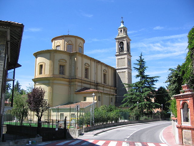
Caprino Bergamasco, located in the Lombardy region of Italy, offers a variety of hiking opportunities amidst beautiful landscapes. The area is characterized by rolling hills, picturesque villages, and stunning views of the surrounding valleys and mountains....
- Country:

- Postal Code: 24030
- Local Dialing Code: 035
- Licence Plate Code: BG
- Coordinates: 45° 45' 25" N, 9° 29' 4" E


- GPS tracks (wikiloc): [Link]
- AboveSeaLevel: 315 м m
- Area: 8.78 sq km
- Population: 3067
- Web site: [Link]


Caravaggio, Lombardy
- Italian comune
 Hiking in Caravaggio, Lombardy
Caravaggio, located in the Lombardy region of Italy, is not primarily known as a hiking destination, but it does offer some opportunities for outdoor enthusiasts looking to explore the surrounding areas. The town itself is steeped in history and art, being the namesake of the famous Caravaggio, the Baroque painter....
- Country:

- Postal Code: 24043
- Local Dialing Code: 0363
- Licence Plate Code: BG
- Coordinates: 45° 29' 52" N, 9° 38' 35" E


- GPS tracks (wikiloc): [Link]
- AboveSeaLevel: 111 м m
- Area: 32.81 sq km
- Population: 16261
- Web site: [Link]

Carobbio degli Angeli
- Italian comune
 Hiking in Carobbio degli Angeli
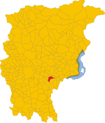
Carobbio degli Angeli is a quaint municipality located in the province of Bergamo, in the Lombardy region of Italy. While it may not be as well-known for hiking as other areas in Italy, it offers some beautiful natural surroundings and trails that can appeal to outdoor enthusiasts....
- Country:

- Postal Code: 24060
- Local Dialing Code: 035
- Licence Plate Code: BG
- Coordinates: 45° 40' 0" N, 9° 50' 0" E


- GPS tracks (wikiloc): [Link]
- AboveSeaLevel: 232 м m
- Area: 6.82 sq km
- Population: 4700
- Web site: [Link]


Carona, Lombardy
- Italian comune
Carona, located in the beautiful Lombardy region of Italy, is a fantastic destination for hiking enthusiasts. Nestled in the Bergamo Alps, Carona offers a range of trails suitable for various skill levels, marked by stunning landscapes, lush forests, and picturesque views of the surrounding mountains and valleys....
- Country:

- Postal Code: 24010
- Local Dialing Code: 0345
- Licence Plate Code: BG
- Coordinates: 46° 1' 20" N, 9° 47' 2" E


- GPS tracks (wikiloc): [Link]
- AboveSeaLevel: 1110 м m
- Area: 44.15 sq km
- Population: 313
- Web site: [Link]

Carvico
- Italian comune
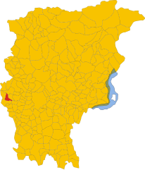
Carvico, located in the Lombardy region of Italy, is a charming destination for hikers and nature enthusiasts. Situated near the stunning Orobie Alps and not far from the picturesque Lake Como, Carvico offers a variety of trails that cater to different skill levels, from leisurely walks to more challenging hikes....
- Country:

- Postal Code: 24030
- Local Dialing Code: 035
- Licence Plate Code: BG
- Coordinates: 45° 42' 0" N, 9° 29' 0" E


- GPS tracks (wikiloc): [Link]
- AboveSeaLevel: 287 м m
- Area: 4.59 sq km
- Population: 4659
- Web site: [Link]

Casazza
- Italian comune
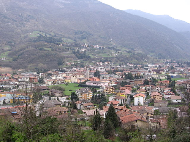
Casazza is a charming town located in the Bergamo province of Italy, situated in the foothills of the Italian Alps. The area offers a variety of hiking opportunities that provide stunning views of the surrounding landscapes, including the nearby mountains and lush valleys....
- Country:

- Postal Code: 24060
- Local Dialing Code: 035
- Licence Plate Code: BG
- Coordinates: 45° 44' 55" N, 9° 54' 23" E


- GPS tracks (wikiloc): [Link]
- AboveSeaLevel: 349 м m
- Area: 7.11 sq km
- Population: 4004
- Web site: [Link]


Casirate d'Adda
- Italian comune
Casirate d'Adda is a charming town located in the province of Bergamo in Lombardy, Italy. While it may not be as famous for hiking as some of the larger national parks or mountainous regions in the area, there are still opportunities for outdoor activities and enjoying nature in and around the town....
- Country:

- Postal Code: 24040
- Local Dialing Code: 0363
- Licence Plate Code: BG
- Coordinates: 45° 30' 0" N, 9° 34' 0" E


- GPS tracks (wikiloc): [Link]
- AboveSeaLevel: 114 м m
- Area: 10.17 sq km
- Population: 4120
- Web site: [Link]


Casnigo
- Italian comune
Casnigo is a charming town located in the province of Bergamo, in the Lombardy region of northern Italy. Nestled within the Seriana Valley, it boasts stunning natural scenery, making it an excellent spot for hiking enthusiasts. Here are some key highlights for hiking in and around Casnigo:...
- Country:

- Postal Code: 24020
- Local Dialing Code: 035
- Licence Plate Code: BG
- Coordinates: 45° 48' 59" N, 9° 52' 0" E


- GPS tracks (wikiloc): [Link]
- AboveSeaLevel: 514 м m
- Area: 13.62 sq km
- Population: 3221
- Web site: [Link]


Cassiglio
- Italian comune
Cassiglio is a picturesque village located in the province of Bergamo, in the Lombardy region of Italy. It lies in the heart of the Italian Alps, making it a fantastic destination for hiking enthusiasts. Here are some key points about hiking in and around Cassiglio:...
- Country:

- Postal Code: 24010
- Local Dialing Code: 0345
- Licence Plate Code: BG
- Coordinates: 45° 58' 0" N, 9° 36' 44" E


- GPS tracks (wikiloc): [Link]
- AboveSeaLevel: 602 м m
- Area: 13.68 sq km
- Population: 110
- Web site: [Link]


Castel Rozzone
- Italian comune
Castel Rozzone, located in the province of Bergamo in Italy, offers a mix of natural beauty and historical intrigue for hikers. While it may not be as widely recognized as some other hiking destinations, it provides a variety of trails suited for different skill levels, surrounded by picturesque landscapes of the Lombardy region....
- Country:

- Postal Code: 24040
- Local Dialing Code: 0363
- Licence Plate Code: BG
- Coordinates: 45° 33' 0" N, 9° 38' 0" E


- GPS tracks (wikiloc): [Link]
- AboveSeaLevel: 140 м m
- Area: 1.71 sq km
- Population: 2849
- Web site: [Link]
Castelli Calepio
- Italian comune
Castelli Calepio is a charming area located in the province of Bergamo, Northern Italy, known for its beautiful landscapes that blend hills, vineyards, and natural reserves. Hiking in this region offers a great opportunity to experience the stunning scenery and the rich cultural heritage of the area....
- Country:

- Postal Code: 24060
- Local Dialing Code: 035
- Licence Plate Code: BG
- Coordinates: 45° 38' 0" N, 9° 54' 0" E


- GPS tracks (wikiloc): [Link]
- AboveSeaLevel: 259 м m
- Area: 10.15 sq km
- Population: 10453
- Web site: [Link]


Castione della Presolana
- Italian comune
 Hiking in Castione della Presolana
Castione della Presolana, located in the province of Bergamo in northern Italy, is a beautiful destination for hiking enthusiasts. Nestled in the picturesque Italian Alps, it offers stunning landscapes, diverse flora and fauna, and a range of trails suited for various skill levels. Here’s what you need to know about hiking in this charming area:...
- Country:

- Postal Code: 24020
- Local Dialing Code: 0346
- Licence Plate Code: BG
- Coordinates: 45° 54' 0" N, 10° 2' 0" E


- GPS tracks (wikiloc): [Link]
- AboveSeaLevel: 986 м m
- Area: 42.5 sq km
- Population: 3419
- Web site: [Link]


Castro
- comune in the Province of Bergamo in the Italian region of Lombardy
Hiking in Castro, a charming village located in the Lombardy region of Italy, offers stunning views and a variety of trails suitable for different skill levels. Nestled along the eastern shore of Lake Iseo, Castro provides a perfect blend of natural beauty, cultural richness, and outdoor activities....
- Country:

- Postal Code: 24063
- Local Dialing Code: 035
- Licence Plate Code: BG
- Coordinates: 45° 48' 0" N, 10° 4' 0" E


- GPS tracks (wikiloc): [Link]
- AboveSeaLevel: 200 м m
- Area: 2.59 sq km
- Population: 1306
- Web site: [Link]


Cavernago
- Italian comune
Cavernago is a charming village located in the Lombardy region of Italy, close to Bergamo. While it may not be as widely recognized for hiking as some other areas in the region, it does offer opportunities for outdoor activities and exploration of the surrounding countryside....
- Country:

- Postal Code: 24050
- Local Dialing Code: 035
- Licence Plate Code: BG
- Coordinates: 45° 38' 0" N, 9° 46' 0" E


- GPS tracks (wikiloc): [Link]
- AboveSeaLevel: 199 м m
- Area: 7.65 sq km
- Population: 2587
- Web site: [Link]


Cazzano Sant'Andrea
- Italian comune
Cazzano Sant'Andrea is a picturesque village located in the province of Bergamo, in the Lombardy region of Italy. This area is known for its natural beauty, rolling hills, and mountainous terrain, making it a wonderful destination for hiking enthusiasts....
- Country:

- Postal Code: 24026
- Local Dialing Code: 035
- Licence Plate Code: BG
- Coordinates: 45° 49' 0" N, 9° 53' 0" E


- GPS tracks (wikiloc): [Link]
- AboveSeaLevel: 504 м m
- Area: 2.02 sq km
- Population: 1670
- Web site: [Link]


Cenate Sopra
- Italian comune
Cenate Sopra is a picturesque town located in the province of Bergamo in Lombardy, Italy. It sits at the foothills of the Pre-Alps, making it an attractive base for hikers and nature enthusiasts. The area offers a variety of trails that cater to different skill levels, from leisurely walks to more challenging treks....
- Country:

- Postal Code: 24060
- Local Dialing Code: 035
- Licence Plate Code: BG
- Coordinates: 45° 42' 42" N, 9° 49' 20" E


- GPS tracks (wikiloc): [Link]
- AboveSeaLevel: 330 м m
- Area: 6.97 sq km
- Population: 2571
- Web site: [Link]


Cenate Sotto
- Italian comune
Cenate Sotto is a charming town located in the province of Bergamo in Lombardy, Italy. It's surrounded by beautiful landscapes, making it an excellent destination for hiking enthusiasts. Here’s a brief overview of what you can expect when hiking in this area:...
- Country:

- Postal Code: 24069
- Local Dialing Code: 035
- Licence Plate Code: BG
- Coordinates: 45° 42' 0" N, 9° 49' 0" E


- GPS tracks (wikiloc): [Link]
- AboveSeaLevel: 267 м m
- Area: 4.62 sq km
- Population: 3825
- Web site: [Link]


Cene
- Italian comune
Cene is a small town located in the province of Bergamo, Lombardy, Italy. It is situated near the foothills of the Alps, which provides a beautiful setting for hiking enthusiasts. Here are some key points if you're considering hiking in and around Cene:...
- Country:

- Postal Code: 24020
- Local Dialing Code: 035
- Licence Plate Code: BG
- Coordinates: 45° 46' 46" N, 9° 49' 33" E


- GPS tracks (wikiloc): [Link]
- AboveSeaLevel: 368 м m
- Area: 8.6 sq km
- Population: 4267
- Web site: [Link]


Cerete
- Italian comune
Cerete, located in the province of Brescia in northern Italy, offers a scenic backdrop for hiking enthusiasts. This area is characterized by its beautiful landscapes, charming villages, and Mediterranean climate, making it an attractive destination for outdoor activities, including hiking....
- Country:

- Postal Code: 24020
- Local Dialing Code: 0346
- Licence Plate Code: BG
- Coordinates: 45° 52' 0" N, 10° 3' 0" E


- GPS tracks (wikiloc): [Link]
- AboveSeaLevel: 612 м m
- Area: 14.07 sq km
- Population: 1597
- Web site: [Link]


Chignolo d'Isola
- Italian comune
Chignolo d'Isola is a small village located in the Lombardy region of Italy, not far from the larger city of Bergamo. The area surrounding Chignolo d'Isola typically features beautiful landscapes, agricultural fields, and gentle hills, making it suitable for a variety of outdoor activities, including hiking....
- Country:

- Postal Code: 24040
- Local Dialing Code: 035
- Licence Plate Code: BG
- Coordinates: 45° 39' 59" N, 9° 31' 39" E


- GPS tracks (wikiloc): [Link]
- AboveSeaLevel: 229 м m
- Area: 5.55 sq km
- Population: 3417
- Web site: [Link]
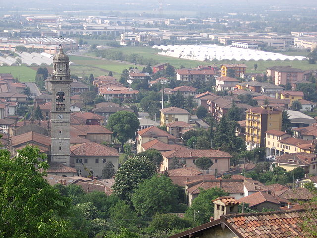

Chiuduno
- Italian comune
Chiuduno is a small town in the province of Bergamo in Lombardy, Italy. Surrounded by beautiful landscapes and located near the foothills of the Alps, it offers a variety of hiking opportunities for all levels of hikers. Here are some highlights and tips for hiking in and around Chiuduno:...
- Country:

- Postal Code: 24060
- Local Dialing Code: 035
- Licence Plate Code: BG
- Coordinates: 45° 39' 0" N, 9° 51' 0" E


- GPS tracks (wikiloc): [Link]
- AboveSeaLevel: 218 м m
- Area: 6.88 sq km
- Population: 6037
- Web site: [Link]


Cisano Bergamasco
- Italian comune
Cisano Bergamasco is a picturesque town located in the province of Bergamo, Lombardy, Italy. It's nestled near the Adda River and surrounded by lush green landscapes, making it an attractive destination for hiking enthusiasts. Here are some highlights and tips for hiking in and around Cisano Bergamasco:...
- Country:

- Postal Code: 24034
- Local Dialing Code: 035
- Licence Plate Code: BG
- Coordinates: 45° 44' 35" N, 9° 28' 15" E


- GPS tracks (wikiloc): [Link]
- AboveSeaLevel: 268 м m
- Area: 7.82 sq km
- Population: 6377
- Web site: [Link]


Ciserano
- Italian comune
Ciserano is a small town located in the Lombardy region of Italy, not far from Bergamo. While it may not be the first place that comes to mind for hiking, there are several opportunities for outdoor activities in the surrounding areas. Here are some aspects you might consider if you're planning a hiking trip near Ciserano:...
- Country:

- Postal Code: 24040
- Local Dialing Code: 035
- Licence Plate Code: BG
- Coordinates: 45° 35' 0" N, 9° 36' 0" E


- GPS tracks (wikiloc): [Link]
- AboveSeaLevel: 159 м m
- Area: 5.31 sq km
- Population: 5696
- Web site: [Link]

Cividate al Piano
- Italian comune
Cividate al Piano is a quaint town in the province of Bergamo, located in Lombardy, Italy. Nestled in the picturesque landscape at the foot of the Alps, it offers a variety of hiking opportunities for both novice and experienced hikers....
- Country:

- Postal Code: 24050
- Local Dialing Code: 0363
- Licence Plate Code: BG
- Coordinates: 45° 33' 0" N, 9° 49' 0" E


- GPS tracks (wikiloc): [Link]
- AboveSeaLevel: 147 м m
- Area: 9.73 sq km
- Population: 5185
- Web site: [Link]


Clusone
- town and commune in Lombardy, Italy
Clusone is a charming town located in the Italian Alps, within the province of Bergamo in Lombardy. It's a wonderful area for hiking, offering a mix of scenic beauty, cultural landmarks, and varying levels of trails suitable for different experience levels....
- Country:

- Postal Code: 24023
- Local Dialing Code: 0346
- Licence Plate Code: BG
- Coordinates: 45° 53' 0" N, 9° 57' 0" E


- GPS tracks (wikiloc): [Link]
- AboveSeaLevel: 647 м m
- Area: 25 sq km
- Population: 8625
- Web site: [Link]


Colere
- place and comune in Lombardy, Italy
Colere is a charming village located in the Italian Alps, specifically in the region of Lombardy. Known for its natural beauty, stunning landscapes, and a variety of hiking trails, it offers a great destination for outdoor enthusiasts. Here are some key highlights and information about hiking in Colere:...
- Country:

- Postal Code: 24020
- Local Dialing Code: 0346
- Licence Plate Code: BG
- Coordinates: 45° 58' 24" N, 10° 4' 50" E


- GPS tracks (wikiloc): [Link]
- AboveSeaLevel: 1013 м m
- Area: 18.63 sq km
- Population: 1122
- Web site: [Link]

Cologno al Serio
- Italian comune
Cologno al Serio is a small town located in the Lombardy region of Italy, near the Adda River and not far from the beautiful landscapes of the Italian Alps. While Cologno al Serio itself might not be a major hiking destination, there are several hiking opportunities in the surrounding areas....
- Country:

- Postal Code: 24055
- Local Dialing Code: 035
- Licence Plate Code: BG
- Coordinates: 45° 35' 0" N, 9° 42' 0" E


- GPS tracks (wikiloc): [Link]
- AboveSeaLevel: 156 м m
- Area: 18.52 sq km
- Population: 11180
- Web site: [Link]


Colzate
- Italian comune
Colzate is a charming village located in the Lombardy region of Italy, nestled in the Alps near the Seriana Valley. It's an excellent destination for hikers, offering picturesque landscapes, lush forests, and a variety of trails suitable for different skill levels. Here are some key points to consider when hiking in Colzate:...
- Country:

- Postal Code: 24020
- Local Dialing Code: 035
- Licence Plate Code: BG
- Coordinates: 45° 49' 0" N, 9° 52' 0" E


- GPS tracks (wikiloc): [Link]
- AboveSeaLevel: 424 м m
- Area: 6 sq km
- Population: 1638
- Web site: [Link]

Comun Nuovo
- Italian comune
Comun Nuovo, located in the Lombardy region of Italy, offers a picturesque setting for hiking enthusiasts. Although it’s a small town, it's surrounded by a beautiful landscape that features a mix of urban and natural environments. Here are some highlights for hiking in and around Comun Nuovo:...
- Country:

- Postal Code: 24040
- Local Dialing Code: 035
- Licence Plate Code: BG
- Coordinates: 45° 37' 22" N, 9° 39' 49" E


- GPS tracks (wikiloc): [Link]
- AboveSeaLevel: 188 м m
- Area: 6.45 sq km
- Population: 4389
- Web site: [Link]

Corna Imagna
- Italian comune
Corna Imagna is a beautiful area located in the Lombardy region of Italy, known for its stunning landscapes and hiking opportunities. Situated in the Bergamo province, it offers a mix of natural beauty, historical sites, and charming villages, making it a perfect destination for hikers of all skill levels....
- Country:

- Postal Code: 24030
- Local Dialing Code: 035
- Licence Plate Code: BG
- Coordinates: 45° 50' 0" N, 9° 33' 0" E


- GPS tracks (wikiloc): [Link]
- AboveSeaLevel: 736 м m
- Area: 4.5 sq km
- Population: 921
- Web site: [Link]


Cornalba
- Italian comune
Cornalba is a picturesque village located in the Lombardy region of Italy, nestled in the Bergamo Alps. Its stunning landscapes, lush forests, and scenic views make it a fantastic destination for hiking enthusiasts. Here’s what you need to know about hiking in and around Cornalba:...
- Country:

- Postal Code: 24017
- Local Dialing Code: 0345
- Licence Plate Code: BG
- Coordinates: 45° 51' 0" N, 9° 45' 0" E


- GPS tracks (wikiloc): [Link]
- AboveSeaLevel: 893 м m
- Area: 9.25 sq km
- Population: 305
- Web site: [Link]

Cortenuova
- Italian comune
Cortenuova, located in the Lombardy region of Italy, is not primarily known for hiking as it is situated in a relatively flat area. However, the surrounding region of Lombardy offers a variety of outdoor activities, including hiking, especially if you venture a bit farther into the nearby foothills and mountains....
- Country:

- Postal Code: 24050
- Local Dialing Code: 0363
- Licence Plate Code: BG
- Coordinates: 45° 32' 20" N, 9° 47' 16" E


- GPS tracks (wikiloc): [Link]
- AboveSeaLevel: 133 м m
- Area: 7.35 sq km
- Population: 1986
- Web site: [Link]


Costa Valle Imagna
- Italian comune
Costa Valle Imagna, located in the Lombardy region of Italy, offers a wonderful hiking experience characterized by picturesque landscapes, charming villages, and a rich cultural heritage. Here are some key points about hiking in this area:...
- Country:

- Postal Code: 24030
- Local Dialing Code: 035
- Licence Plate Code: BG
- Coordinates: 45° 48' 0" N, 9° 30' 0" E


- GPS tracks (wikiloc): [Link]
- AboveSeaLevel: 1014 м m
- Area: 4.21 sq km
- Population: 587
- Web site: [Link]
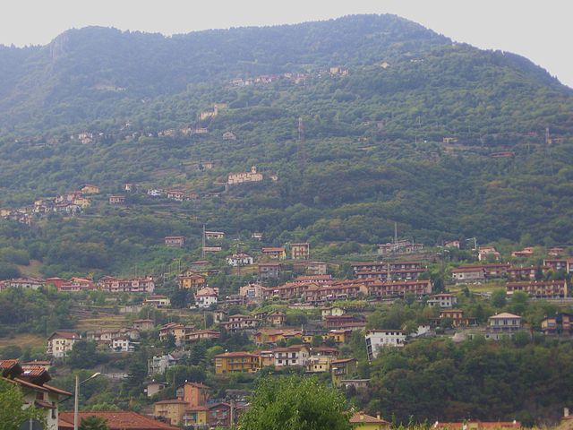

Costa Volpino
- Italian comune
Costa Volpino, located in the province of Bergamo in the Lombardy region of Italy, is a beautiful destination for hiking enthusiasts. Nestled near the shores of Lake Iseo and surrounded by the stunning landscapes of the Valcamonica valley and the Alps, it offers a variety of trails suitable for different skill levels....
- Country:

- Postal Code: 24062
- Local Dialing Code: 035
- Licence Plate Code: BG
- Coordinates: 45° 49' 50" N, 10° 5' 57" E


- GPS tracks (wikiloc): [Link]
- AboveSeaLevel: 192 м m
- Area: 18.67 sq km
- Population: 9151
- Web site: [Link]

Costa di Mezzate
- Italian comune
Costa di Mezzate is a charming location in Italy, located in the province of Bergamo in Lombardy. It's a great spot for hiking, particularly for those who enjoy scenic trails and beautiful landscapes. Here are some details about hiking in Costa di Mezzate:...
- Country:

- Postal Code: 24060
- Local Dialing Code: 035
- Licence Plate Code: BG
- Coordinates: 45° 40' 0" N, 9° 48' 0" E


- GPS tracks (wikiloc): [Link]
- AboveSeaLevel: 218 м m
- Area: 5.22 sq km
- Population: 3374
- Web site: [Link]
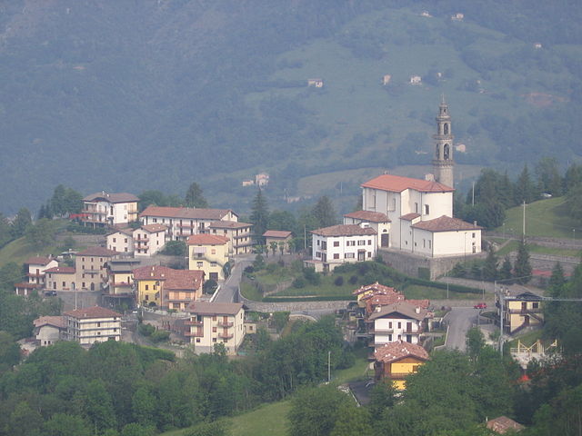

Costa di Serina
- Italian comune
Costa Serina, located in the province of Bergamo in the Lombardy region of Italy, is a beautiful destination for hiking enthusiasts. Nestled in the scenic foothills of the Alps, it offers a variety of trails that cater to different levels of experience, from casual walkers to seasoned hikers. Here are some key details about hiking in this area:...
- Country:

- Postal Code: 24010
- Local Dialing Code: 0345
- Licence Plate Code: BG
- Coordinates: 45° 49' 58" N, 9° 44' 30" E


- GPS tracks (wikiloc): [Link]
- AboveSeaLevel: 868 м m
- Area: 12.3 sq km
- Population: 912
- Web site: [Link]

Covo
- Italian comune
Covo is a charming destination for hiking, located in Italy’s beautiful region of Abruzzo. While it might not be as widely known as other hiking hotspots, it offers a unique blend of natural beauty and cultural experiences....
- Country:

- Postal Code: 24050
- Local Dialing Code: 0363
- Licence Plate Code: BG
- Coordinates: 45° 30' 0" N, 9° 46' 0" E


- GPS tracks (wikiloc): [Link]
- AboveSeaLevel: 115 м m
- Area: 12.94 sq km
- Population: 4088
- Web site: [Link]


Curno
- Italian comune
Curno is a small town located near Bergamo in Northern Italy, offering a pleasant environment for hiking and outdoor activities. While Curno itself might not be known as a major hiking destination, it serves as a great base for exploring the surrounding areas, particularly the regional parks and hills....
- Country:

- Postal Code: 24035
- Local Dialing Code: 035
- Licence Plate Code: BG
- Coordinates: 45° 41' 28" N, 9° 36' 45" E


- GPS tracks (wikiloc): [Link]
- AboveSeaLevel: 239 м m
- Area: 4.7 sq km
- Population: 7574
- Web site: [Link]


Cusio, Lombardy
- Italian comune
Cusio, located in the Lombardy region of Italy, is a picturesque area known for its stunning landscapes, including parts of Lake Orta and the surrounding mountains. This region offers a variety of hiking opportunities that cater to different skill levels, from leisurely walks along the shores of the lake to more challenging mountain trails....
- Country:

- Postal Code: 24010
- Local Dialing Code: 0345
- Licence Plate Code: BG
- Coordinates: 45° 59' 27" N, 9° 36' 9" E


- GPS tracks (wikiloc): [Link]
- AboveSeaLevel: 1050 м m
- Area: 9.41 sq km
- Population: 278
- Web site: [Link]


Dalmine
- Italian comune
Dalmine, located in the Lombardy region of Italy, is primarily an urban area, but it offers access to several nearby natural attractions and hiking opportunities. While Dalmine itself may not have extensive trails directly within the city, there are several options in the surrounding regions....
- Country:

- Postal Code: 24044
- Local Dialing Code: 035
- Licence Plate Code: BG
- Coordinates: 45° 39' 0" N, 9° 36' 0" E


- GPS tracks (wikiloc): [Link]
- AboveSeaLevel: 201 м m
- Area: 11.81 sq km
- Population: 23495
- Web site: [Link]
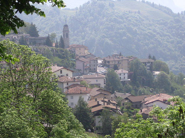

Dossena
- Italian comune
Dossena is a charming municipality located in the province of Bergamo, Lombardy, Italy. It's nestled in the foothills of the Alps and offers a variety of hiking opportunities, showcasing beautiful landscapes, lush forests, and historical sites....
- Country:

- Postal Code: 24010
- Local Dialing Code: 0345
- Licence Plate Code: BG
- Coordinates: 45° 53' 0" N, 9° 42' 0" E


- GPS tracks (wikiloc): [Link]
- AboveSeaLevel: 986 м m
- Area: 19.56 sq km
- Population: 919
- Web site: [Link]


Endine Gaiano
- Italian comune
Endine Gaiano is a lovely town located in the province of Bergamo in Italy, situated near the shores of Lake Endine. The area is known for its picturesque landscapes, charming villages, and outdoor recreational opportunities, making it a great destination for hiking enthusiasts....
- Country:

- Postal Code: 24060
- Local Dialing Code: 035
- Licence Plate Code: BG
- Coordinates: 45° 47' 0" N, 9° 58' 0" E


- GPS tracks (wikiloc): [Link]
- AboveSeaLevel: 400 м m
- Area: 21.07 sq km
- Population: 3460
- Web site: [Link]
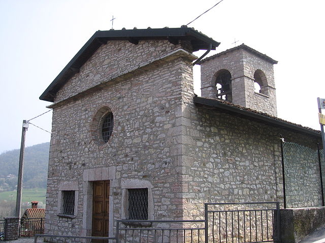

Entratico
- Italian comune
Entratico is a charming village located in the province of Bergamo, in the Lombardy region of Italy. Surrounded by beautiful landscapes, it offers a variety of hiking opportunities for enthusiasts of all levels. Here’s what you can expect when hiking in Entratico:...
- Country:

- Postal Code: 24060
- Local Dialing Code: 035
- Licence Plate Code: BG
- Coordinates: 45° 43' 0" N, 9° 52' 0" E


- GPS tracks (wikiloc): [Link]
- AboveSeaLevel: 299 м m
- Area: 4.15 sq km
- Population: 1979
- Web site: [Link]

Fara Gera d'Adda
- Italian comune
Fara Gera d'Adda is a charming town located in the Lombardy region of Italy, near the Adda River. While it may not be as well-known as some larger hiking destinations, it offers a variety of outdoor activities and scenic trails that can be appealing to hikers....
- Country:

- Postal Code: 24045
- Local Dialing Code: 0363
- Licence Plate Code: BG
- Coordinates: 45° 33' 0" N, 9° 32' 0" E


- GPS tracks (wikiloc): [Link]
- AboveSeaLevel: 131 м m
- Area: 10.79 sq km
- Population: 8043
- Web site: [Link]

Fara Olivana con Sola
- Italian comune
 Hiking in Fara Olivana con Sola
Fara Olivana con Sola is a picturesque village located in the province of Bergamo, Italy, surrounded by the beautiful landscape of the Lombardy region. While it may not be as renowned as some other hiking destinations, it offers some lovely trails and opportunities to explore the natural beauty of the area....
- Country:

- Postal Code: 24058
- Local Dialing Code: 0363
- Licence Plate Code: BG
- Coordinates: 45° 29' 42" N, 9° 44' 57" E


- GPS tracks (wikiloc): [Link]
- AboveSeaLevel: 107 м m
- Area: 5.04 sq km
- Population: 1292
- Web site: [Link]


Filago
- Italian comune
Filago, located in the Lombardy region of Italy, offers a serene experience for hikers looking to explore the picturesque landscapes of Northern Italy. While it may not be as widely known as some other hiking destinations, it is surrounded by beautiful natural areas and charming villages that enhance the hiking experience....
- Country:

- Postal Code: 24040
- Local Dialing Code: 035
- Licence Plate Code: BG
- Coordinates: 45° 38' 0" N, 9° 33' 0" E


- GPS tracks (wikiloc): [Link]
- AboveSeaLevel: 190 м m
- Area: 5.42 sq km
- Population: 3182
- Web site: [Link]


Fino del Monte
- Italian comune
Fino del Monte is a charming destination for hiking enthusiasts, located in the Bergamo area of Lombardy, Italy. Nestled in the Orobie Alps, this quaint village offers stunning landscapes, rich flora and fauna, and a variety of hiking trails that cater to different skill levels....
- Country:

- Postal Code: 24020
- Local Dialing Code: 0346
- Licence Plate Code: BG
- Coordinates: 45° 53' 0" N, 10° 2' 0" E


- GPS tracks (wikiloc): [Link]
- AboveSeaLevel: 662 м m
- Area: 4.29 sq km
- Population: 1142
- Web site: [Link]
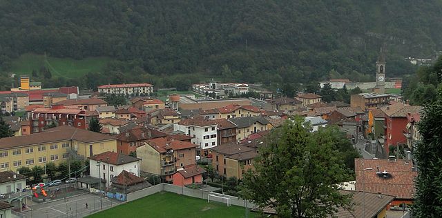

Fiorano al Serio
- Italian comune
Fiorano al Serio is a charming town located in the province of Bergamo, in the Lombardy region of northern Italy. Surrounded by the stunning natural beauty of the Orobian Alps, it offers a variety of hiking opportunities for both beginners and experienced hikers....
- Country:

- Postal Code: 24020
- Local Dialing Code: 035
- Licence Plate Code: BG
- Coordinates: 45° 48' 7" N, 9° 50' 35" E


- GPS tracks (wikiloc): [Link]
- AboveSeaLevel: 396 м m
- Area: 1.06 sq km
- Population: 3016
- Web site: [Link]

Fontanella, Lombardy
- Italian comune
 Hiking in Fontanella, Lombardy
Fontanella is a charming village located in the province of Bergamo, Lombardy, Italy, surrounded by stunning natural landscapes that make it an attractive destination for hikers. The area offers a variety of trails that accommodate different skill levels, from leisurely walks to more challenging hikes....
- Country:

- Postal Code: 24056
- Local Dialing Code: 0363
- Licence Plate Code: BG
- Coordinates: 45° 28' 0" N, 9° 48' 0" E


- GPS tracks (wikiloc): [Link]
- AboveSeaLevel: 105 м m
- Area: 17.8 sq km
- Population: 4464
- Web site: [Link]


Fonteno
- Italian comune
Fonteno is a charming town located in the province of Bergamo in Italy, perched on the hills overlooking Lake Iseo. It offers a variety of hiking opportunities that cater to different skill levels and preferences. Here are some highlights and tips for hiking in the Fonteno area:...
- Country:

- Postal Code: 24060
- Local Dialing Code: 035
- Licence Plate Code: BG
- Coordinates: 45° 46' 0" N, 10° 1' 0" E


- GPS tracks (wikiloc): [Link]
- AboveSeaLevel: 606 м m
- Area: 10.93 sq km
- Population: 583
- Web site: [Link]


Foppolo
- Italian comune
Foppolo, located in the Italian Alps in the Lombardy region, is a popular destination for hiking enthusiasts. Known for its stunning mountain scenery, lush valleys, and crystal-clear streams, Foppolo offers a variety of trails suitable for both novice and experienced hikers....
- Country:

- Postal Code: 24010
- Local Dialing Code: 0345
- Licence Plate Code: BG
- Coordinates: 46° 2' 34" N, 9° 45' 31" E


- GPS tracks (wikiloc): [Link]
- AboveSeaLevel: 1615 м m
- Area: 16.14 sq km
- Population: 185
- Web site: [Link]

Foresto Sparso
- Italian comune
Foresto Sparso, located in the province of Sondrio in Northern Italy, is a beautiful area known for its stunning natural landscapes and hiking opportunities. Nestled in the Valtellina region, it offers a variety of trails that cater to different skill levels, from leisurely walks to more challenging hikes....
- Country:

- Postal Code: 24060
- Local Dialing Code: 035
- Licence Plate Code: BG
- Coordinates: 45° 42' 0" N, 9° 54' 0" E


- GPS tracks (wikiloc): [Link]
- AboveSeaLevel: 346 м m
- Area: 7.87 sq km
- Population: 3130
- Web site: [Link]

Fornovo San Giovanni
- Italian comune
 Hiking in Fornovo San Giovanni
Fornovo San Giovanni, located in the Lombardy region of Italy, is not only known for its picturesque landscapes but also offers a variety of hiking opportunities amidst its natural beauty. Here’s an overview of what hiking in that area entails:...
- Country:

- Postal Code: 24040
- Local Dialing Code: 0363
- Licence Plate Code: BG
- Coordinates: 45° 29' 48" N, 9° 40' 38" E


- GPS tracks (wikiloc): [Link]
- AboveSeaLevel: 109 м m
- Area: 7.04 sq km
- Population: 3435
- Web site: [Link]


Fuipiano Valle Imagna
- Italian comune
 Hiking in Fuipiano Valle Imagna
Fuipiano Valle Imagna is a picturesque area located in the Lombardy region of Italy, surrounded by the stunning natural beauty of the Italian Alps. This region is known for its serene landscapes, lush greenery, and traditional Italian villages, making it a wonderful destination for hikers of all skill levels....
- Country:

- Postal Code: 24030
- Local Dialing Code: 035
- Licence Plate Code: BG
- Coordinates: 45° 51' 0" N, 9° 32' 0" E


- GPS tracks (wikiloc): [Link]
- AboveSeaLevel: 1019 м m
- Area: 4.28 sq km
- Population: 211
- Web site: [Link]


Gandellino
- Italian comune
Gandellino is a charming village located within the scenic Bergamo province in the northern part of Italy, specifically in the Lombardy region. It is situated in the impressive Val Seriana, known for its breathtaking landscapes, alpine scenery, and diverse hiking trails....
- Country:

- Postal Code: 24020
- Local Dialing Code: 0346
- Licence Plate Code: BG
- Coordinates: 45° 59' 24" N, 9° 56' 47" E


- GPS tracks (wikiloc): [Link]
- AboveSeaLevel: 675 м m
- Area: 25.13 sq km
- Population: 991
- Web site: [Link]
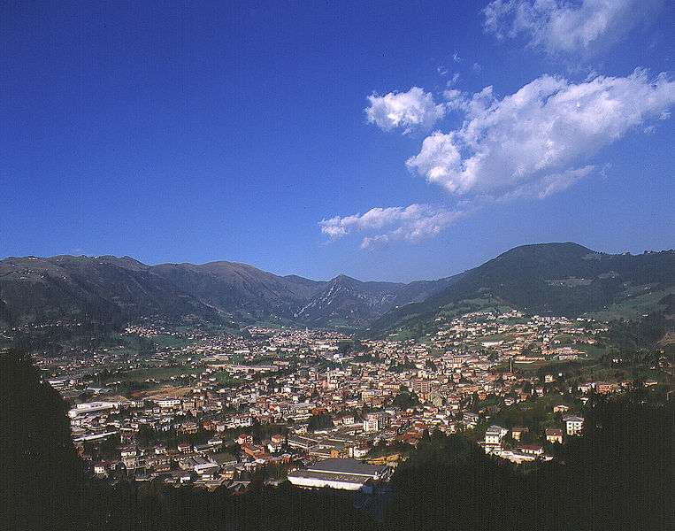

Gandino
- Italian comune
Gandino is a charming village located in the province of Bergamo, Lombardy, Italy. Nestled in the Seriana Valley and surrounded by stunning mountain landscapes, it offers a variety of hiking opportunities for outdoor enthusiasts. Here are some key aspects to consider when hiking in Gandino:...
- Country:

- Postal Code: 24024
- Local Dialing Code: 035
- Licence Plate Code: BG
- Coordinates: 45° 48' 42" N, 9° 54' 11" E


- GPS tracks (wikiloc): [Link]
- AboveSeaLevel: 553 м m
- Area: 29.03 sq km
- Population: 5390
- Web site: [Link]


Gandosso
- Italian comune
Gandosso is a charming village located in the province of Bergamo, in the Lombardy region of Italy. The area is known for its beautiful landscapes, making it a great destination for hiking enthusiasts....
- Country:

- Postal Code: 24060
- Local Dialing Code: 035
- Licence Plate Code: BG
- Coordinates: 45° 39' 0" N, 9° 54' 0" E


- GPS tracks (wikiloc): [Link]
- AboveSeaLevel: 488 м m
- Area: 3.13 sq km
- Population: 1478
- Web site: [Link]


Gaverina Terme
- Italian comune
Gaverina Terme, located in the province of Bergamo in Lombardy, Italy, is a charming destination known for its natural beauty, thermal springs, and outdoor activities, including hiking. Here are some key points about hiking in and around Gaverina Terme:...
- Country:

- Postal Code: 24060
- Local Dialing Code: 035
- Licence Plate Code: BG
- Coordinates: 45° 46' 0" N, 9° 53' 0" E


- GPS tracks (wikiloc): [Link]
- AboveSeaLevel: 509 м m
- Area: 5.2 sq km
- Population: 868
- Web site: [Link]


Gazzaniga
- Italian comune
Gazzaniga, a town located in the Lombardy region of Italy, is surrounded by beautiful natural landscapes that provide fantastic opportunities for hiking enthusiasts. While the town itself may not be a well-known hiking destination, its proximity to the Orobian Alps and the Seriana Valley offers a variety of trails suitable for all levels of hikers....
- Country:

- Postal Code: 24025
- Local Dialing Code: 035
- Licence Plate Code: BG
- Coordinates: 45° 48' 0" N, 9° 50' 0" E


- GPS tracks (wikiloc): [Link]
- AboveSeaLevel: 386 м m
- Area: 14.41 sq km
- Population: 5058
- Web site: [Link]


Ghisalba
- Italian comune
Ghisalba is a small town located in the province of Bergamo in northern Italy. While it may not be widely recognized as a prominent hiking destination, its surrounding areas offer opportunities for nature walks and outdoor activities. Here’s what you can expect when hiking near Ghisalba:...
- Country:

- Postal Code: 24050
- Local Dialing Code: 0363
- Licence Plate Code: BG
- Coordinates: 45° 36' 0" N, 9° 45' 0" E


- GPS tracks (wikiloc): [Link]
- AboveSeaLevel: 170 м m
- Area: 10.59 sq km
- Population: 6170
- Web site: [Link]


Gorlago
- Italian comune
Gorlago is a picturesque town located in the Lombardy region of northern Italy, near the city of Bergamo. The area around Gorlago offers a variety of hiking opportunities that showcase the stunning landscapes of the Italian countryside, including rolling hills, forests, and panoramic views of the surrounding mountains....
- Country:

- Postal Code: 24060
- Local Dialing Code: 035
- Licence Plate Code: BG
- Coordinates: 45° 40' 0" N, 9° 49' 0" E


- GPS tracks (wikiloc): [Link]
- AboveSeaLevel: 233 м m
- Area: 5.7 sq km
- Population: 5188
- Web site: [Link]


Gorle
- Italian comune
Gorle, a small municipality in the Lombardy region of Italy, is located near the city of Bergamo. While it's not as internationally renowned for hiking as some of its neighboring regions, it still offers opportunities for outdoor activities in a picturesque setting....
- Country:

- Postal Code: 24020
- Local Dialing Code: 035
- Licence Plate Code: BG
- Coordinates: 45° 42' 14" N, 9° 43' 9" E


- GPS tracks (wikiloc): [Link]
- AboveSeaLevel: 268 м m
- Area: 2.52 sq km
- Population: 6557
- Web site: [Link]

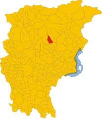
Gorno
- Italian comune
Gorno is a small town in Bulgaria, located in the Pirin Mountains, which offers a variety of hiking opportunities for all levels of hikers. Here are some key points and tips for hiking in and around Gorno:...
- Country:

- Postal Code: 24020
- Local Dialing Code: 035
- Licence Plate Code: BG
- Coordinates: 45° 52' 0" N, 9° 50' 0" E


- GPS tracks (wikiloc): [Link]
- AboveSeaLevel: 710 м m
- Area: 10 sq km
- Population: 1580
- Web site: [Link]


Grassobbio
- Italian comune
Grassobbio is a charming town located in the Lombardy region of northern Italy, near Bergamo. The area is known for its beautiful landscapes, rich history, and proximity to both the Orobie Alps and the foothills of the Prealps, making it a great destination for hiking enthusiasts....
- Country:

- Postal Code: 24050
- Local Dialing Code: 035
- Licence Plate Code: BG
- Coordinates: 45° 39' 24" N, 9° 43' 26" E


- GPS tracks (wikiloc): [Link]
- AboveSeaLevel: 225 м m
- Area: 8.74 sq km
- Population: 6401
- Web site: [Link]


Gromo
- Italian comune
Gromo is a charming village located in the Bergamo Alps of northern Italy, known for its stunning natural landscapes and outdoor activities, including hiking. Here are some key points to consider if you're planning to hike in Gromo:...
- Country:

- Postal Code: 24020
- Local Dialing Code: 0346
- Licence Plate Code: BG
- Coordinates: 45° 57' 52" N, 9° 55' 39" E


- GPS tracks (wikiloc): [Link]
- AboveSeaLevel: 676 м m
- Area: 20.07 sq km
- Population: 1205
- Web site: [Link]

Grone
- Italian comune
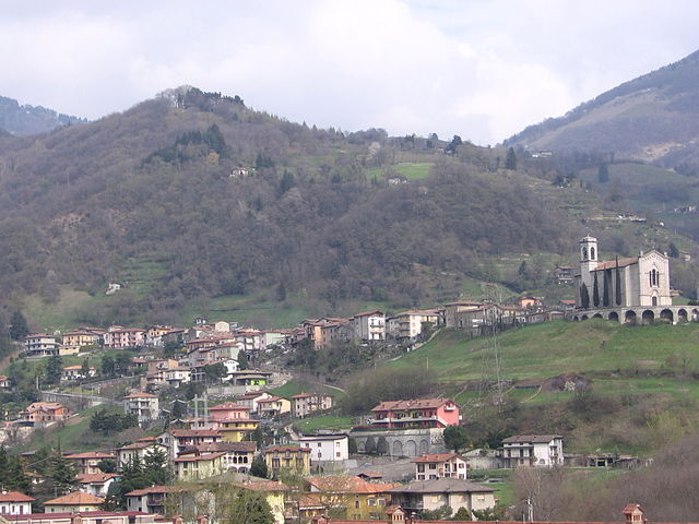
Grone is a small town located in the Lombardy region of northern Italy, nestled in the picturesque hills of the Bergamo area. This region is renowned for its stunning natural landscapes, including mountains, forests, and lakes, making it a fantastic destination for hiking enthusiasts....
- Country:

- Postal Code: 24060
- Local Dialing Code: 035
- Licence Plate Code: BG
- Coordinates: 45° 44' 0" N, 9° 55' 0" E


- GPS tracks (wikiloc): [Link]
- AboveSeaLevel: 388 м m
- Area: 7.78 sq km
- Population: 905
- Web site: [Link]


Grumello del Monte
- Italian comune
Grumello del Monte, located in Lombardy, Italy, is a great destination for hiking enthusiasts. Nestled between the city of Bergamo and the lush hills, it offers a mix of scenic trails, beautiful landscapes, and a chance to experience the local culture. Here’s what you need to know about hiking in the area:...
- Country:

- Postal Code: 24064
- Local Dialing Code: 035
- Licence Plate Code: BG
- Coordinates: 45° 38' 0" N, 9° 52' 0" E


- GPS tracks (wikiloc): [Link]
- AboveSeaLevel: 208 м m
- Area: 9.94 sq km
- Population: 7427
- Web site: [Link]

Isola di Fondra
- Italian comune
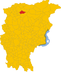
Isola di Fondra is a picturesque village in the province of Bergamo, located in the Lombardy region of northern Italy. Nestled in the heart of the Alps, it offers stunning landscapes, lush forests, and beautiful trails for hiking enthusiasts. Here are some key points to consider when hiking in Isola di Fondra:...
- Country:

- Postal Code: 24010
- Local Dialing Code: 0345
- Licence Plate Code: BG
- Coordinates: 45° 59' 0" N, 9° 45' 0" E


- GPS tracks (wikiloc): [Link]
- AboveSeaLevel: 799 м m
- Area: 12.83 sq km
- Population: 174
- Web site: [Link]

Isso, Lombardy
- Italian comune
Hiking in Isso, a charming village in Lombardy, Italy, offers an excellent opportunity to enjoy the beautiful landscapes and rich cultural heritage of the region. Nestled near the city of Cremona, Isso serves as a gateway to explore the natural beauty of the surrounding countryside, which features rolling hills, vineyards, and picturesque rural scenery....
- Country:

- Postal Code: 24040
- Local Dialing Code: 0363
- Licence Plate Code: BG
- Coordinates: 45° 28' 36" N, 9° 45' 34" E


- GPS tracks (wikiloc): [Link]
- AboveSeaLevel: 104 м m
- Area: 5.06 sq km
- Population: 638
- Web site: [Link]

Lallio
- Italian comune
Lallio is a small town in Italy, located in the Lombardy region, near Bergamo. While it might not be known for extensive hiking trails directly in its vicinity, it serves as a good base for exploring nearby natural areas. The Bergamasque Alps and other surrounding regions offer numerous hiking opportunities, including picturesque trails, diverse landscapes, and stunning views....
- Country:

- Postal Code: 24040
- Local Dialing Code: 035
- Licence Plate Code: BG
- Coordinates: 45° 39' 58" N, 9° 37' 53" E


- GPS tracks (wikiloc): [Link]
- AboveSeaLevel: 216 м m
- Area: 2.16 sq km
- Population: 4112
- Web site: [Link]

Leffe, Lombardy
- Italian comune
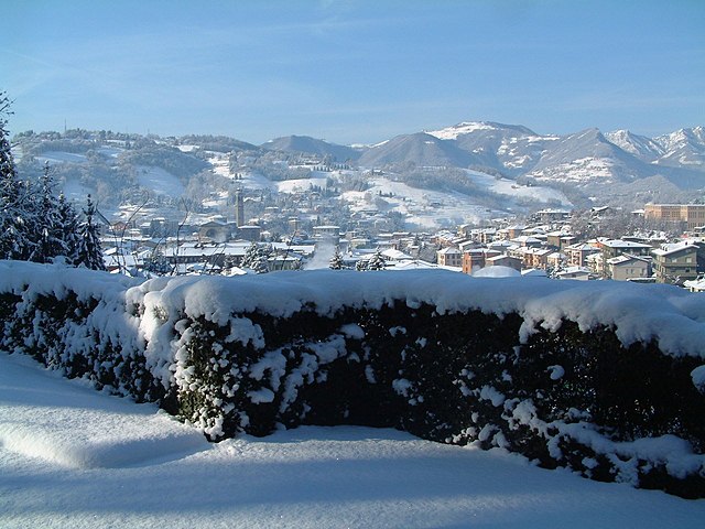
Leffe, located in the Lombardy region of northern Italy, is a charming village situated near Lake Iseo and is surrounded by beautiful natural landscapes, making it an excellent spot for hiking enthusiasts. Here are a few highlights and tips for hiking in and around Leffe:...
- Country:

- Postal Code: 24026
- Local Dialing Code: 035
- Licence Plate Code: BG
- Coordinates: 45° 48' 0" N, 9° 54' 0" E


- GPS tracks (wikiloc): [Link]
- AboveSeaLevel: 453 м m
- Area: 6.69 sq km
- Population: 4463
- Web site: [Link]


Lenna, Lombardy
- Italian comune
Lenna is a quaint village located in the Bergamo province of Lombardy, Italy. It is situated in a picturesque part of the Italian Alps, making it a great base for hiking enthusiasts. The area is characterized by stunning landscapes, rich flora and fauna, and a variety of trails that cater to different skill levels....
- Country:

- Postal Code: 24010
- Local Dialing Code: 0345
- Licence Plate Code: BG
- Coordinates: 45° 56' 36" N, 9° 40' 39" E


- GPS tracks (wikiloc): [Link]
- AboveSeaLevel: 465 м m
- Area: 12.74 sq km
- Population: 592
- Web site: [Link]


Levate
- Italian comune
Levate, located in the province of Bergamo in Northern Italy, offers beautiful landscapes and diverse hiking opportunities. The area is characterized by picturesque rolling hills, charming villages, and lush nature, making it an excellent place for outdoor enthusiasts....
- Country:

- Postal Code: 24040
- Local Dialing Code: 035
- Licence Plate Code: BG
- Coordinates: 45° 38' 0" N, 9° 37' 0" E


- GPS tracks (wikiloc): [Link]
- AboveSeaLevel: 185 м m
- Area: 5.53 sq km
- Population: 3780
- Web site: [Link]

Locatello
- Italian comune
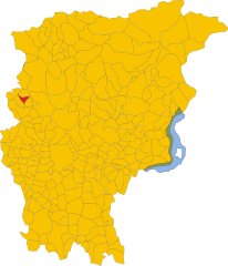
Locatello, located in the province of Bergamo in northern Italy, offers a range of hiking opportunities, particularly for those who enjoy the beauty of the Italian Alps and surrounding landscapes. Here are some highlights and tips for hiking in Locatello:...
- Country:

- Postal Code: 24030
- Local Dialing Code: 035
- Licence Plate Code: BG
- Coordinates: 45° 50' 0" N, 9° 32' 0" E


- GPS tracks (wikiloc): [Link]
- AboveSeaLevel: 557 м m
- Area: 3.79 sq km
- Population: 810
- Web site: [Link]


Lovere
- Italian comune
Lovere, a picturesque town located on the shores of Lake Iseo in northern Italy, offers a fantastic backdrop for hiking enthusiasts. The surrounding area is characterized by stunning landscapes, lush greenery, and charming villages. Here are some highlights and tips for hiking in and around Lovere:...
- Country:

- Postal Code: 24065
- Local Dialing Code: 035
- Licence Plate Code: BG
- Coordinates: 45° 48' 45" N, 10° 4' 12" E


- GPS tracks (wikiloc): [Link]
- AboveSeaLevel: 208 м m
- Area: 7.92 sq km
- Population: 5224
- Web site: [Link]


Lurano
- Italian comune
Lurano, a small municipality in Italy, may not be widely known as a hiking destination compared to some of the more popular regions, but it can offer some serene and picturesque trails suitable for those looking to explore nature away from the crowds....
- Country:

- Postal Code: 24050
- Local Dialing Code: 035
- Licence Plate Code: BG
- Coordinates: 45° 34' 0" N, 9° 38' 0" E


- GPS tracks (wikiloc): [Link]
- AboveSeaLevel: 147 м m
- Area: 4.05 sq km
- Population: 2841
- Web site: [Link]


Luzzana
- Italian comune
Luzzana is a small town located in the province of Bergamo in the Lombardy region of Italy. While it may not be as well-known as some larger hiking destinations, it offers access to beautiful natural landscapes that are perfect for outdoor enthusiasts....
- Country:

- Postal Code: 24069
- Local Dialing Code: 035
- Licence Plate Code: BG
- Coordinates: 45° 43' 0" N, 9° 53' 0" E


- GPS tracks (wikiloc): [Link]
- AboveSeaLevel: 310 м m
- Area: 3.48 sq km
- Population: 917
- Web site: [Link]


Madone
- Italian comune
Hiking in the Madone area can be a wonderful experience, as it's located in a picturesque region often associated with stunning natural landscapes and diverse hiking trails. While "Madone" could refer to various places, the most prominent reference might be to the Madone di Campiglio in the Italian Alps, known for its breathtaking views, accessible trails, and beautiful alpine scenery....
- Country:

- Postal Code: 24040
- Local Dialing Code: 035
- Licence Plate Code: BG
- Coordinates: 45° 39' 0" N, 9° 33' 0" E


- GPS tracks (wikiloc): [Link]
- AboveSeaLevel: 202 м m
- Area: 3.07 sq km
- Population: 4068
- Web site: [Link]


Mapello
- Italian comune
Mapello, located in the Lombardy region of Italy, is a charming area that offers various opportunities for hiking enthusiasts. The landscape surrounding Mapello features rolling hills, woodlands, and scenic views of the surrounding mountains and countryside, making it a great destination for outdoor activities....
- Country:

- Postal Code: 24030
- Local Dialing Code: 035
- Licence Plate Code: BG
- Coordinates: 45° 42' 32" N, 9° 32' 52" E


- GPS tracks (wikiloc): [Link]
- AboveSeaLevel: 255 м m
- Area: 8.66 sq km
- Population: 6840
- Web site: [Link]

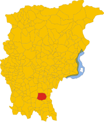
Martinengo
- Italian comune
Martinengo is a charming town located in the Lombardy region of Italy, known for its picturesque landscapes and historical architecture. While it is not a well-known hiking destination, there are several opportunities to explore the natural beauty of the surrounding area....
- Country:

- Postal Code: 24057
- Local Dialing Code: 0363
- Licence Plate Code: BG
- Coordinates: 45° 34' 20" N, 9° 46' 3" E


- GPS tracks (wikiloc): [Link]
- AboveSeaLevel: 149 м m
- Area: 22.05 sq km
- Population: 10560
- Web site: [Link]


Medolago
- Italian comune
Medolago is a small town located in the Lombardy region of Italy, close to the city of Bergamo. While it may not be as widely known for hiking as some of the more mountainous areas in Italy, there are still opportunities for nature walks and hiking in the surrounding areas....
- Country:

- Postal Code: 24030
- Local Dialing Code: 035
- Licence Plate Code: BG
- Coordinates: 45° 40' 0" N, 9° 30' 0" E


- GPS tracks (wikiloc): [Link]
- AboveSeaLevel: 246 м m
- Area: 3.8 sq km
- Population: 2398
- Web site: [Link]


Mezzoldo
- Italian comune
Mezzoldo is a charming village located in the Lombardy region of Italy, nestled in the Bergamo Alps. It's a wonderful destination for hikers, offering a blend of natural beauty, historical sites, and a variety of trails catering to different skill levels....
- Country:

- Postal Code: 24010
- Local Dialing Code: 0345
- Licence Plate Code: BG
- Coordinates: 46° 0' 47" N, 9° 39' 53" E


- GPS tracks (wikiloc): [Link]
- AboveSeaLevel: 835 м m
- Area: 18.84 sq km
- Population: 161
- Web site: [Link]


Misano di Gera d'Adda
- Italian comune
 Hiking in Misano di Gera d'Adda
Misano di Gera d'Adda is a charming town located in the Lombardy region of Italy, not far from the Adda River. While it may not be as widely recognized for hiking as some other areas in Italy, there are still opportunities for outdoor enthusiasts to explore the natural beauty and picturesque landscapes of the surrounding countryside....
- Country:

- Postal Code: 24040
- Local Dialing Code: 0363
- Licence Plate Code: BG
- Coordinates: 45° 28' 10" N, 9° 37' 15" E


- GPS tracks (wikiloc): [Link]
- AboveSeaLevel: 104 м m
- Area: 6.11 sq km
- Population: 2957
- Web site: [Link]


Moio de' Calvi
- Italian comune
Moio de' Calvi is a charming village located in the province of Bergamo, Italy, in the Lombardy region. Nestled in the foothills of the Alps, it offers a picturesque setting for hiking enthusiasts. While the village itself is small and not overly commercialized, it serves as a gateway to some beautiful hiking routes in the surrounding area....
- Country:

- Postal Code: 24070
- Local Dialing Code: 0345
- Licence Plate Code: BG
- Coordinates: 45° 57' 6" N, 9° 42' 3" E


- GPS tracks (wikiloc): [Link]
- AboveSeaLevel: 654 м m
- Area: 6.36 sq km
- Population: 206
- Web site: [Link]


Monasterolo del Castello
- Italian comune
 Hiking in Monasterolo del Castello
Monasterolo del Castello is a beautiful village located in the province of Bergamo in northern Italy, nestled in the foothills of the Alps and near the shores of Lake Endine. This scenic area offers a range of hiking opportunities suitable for various skill levels, providing stunning views of the lake, surrounding mountains, and lush landscapes....
- Country:

- Postal Code: 24060
- Local Dialing Code: 035
- Licence Plate Code: BG
- Coordinates: 45° 46' 0" N, 9° 56' 0" E


- GPS tracks (wikiloc): [Link]
- AboveSeaLevel: 365 м m
- Area: 8.75 sq km
- Population: 1147
- Web site: [Link]
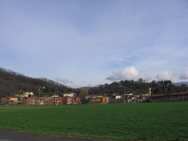

Montello, Lombardy
- Italian comune
Montello is a beautiful area in Lombardy, Italy, known for its picturesque landscapes, rich natural beauty, and various outdoor activities, including hiking. Here are some key points about hiking in Montello:...
- Country:

- Postal Code: 24060
- Local Dialing Code: 035
- Licence Plate Code: BG
- Coordinates: 45° 40' 0" N, 9° 48' 0" E


- GPS tracks (wikiloc): [Link]
- AboveSeaLevel: 229 м m
- Area: 1.82 sq km
- Population: 3263
- Web site: [Link]

Morengo
- Italian comune
It seems like you may be referring to a specific hiking area, but "Morengo" isn't widely recognized as a popular hiking destination in the general hiking community. It’s possible you meant "Morrison," which is known for its hiking trails near Red Rocks in Colorado, or perhaps a location in another region altogether....
- Country:

- Postal Code: 24050
- Local Dialing Code: 0363
- Licence Plate Code: BG
- Coordinates: 45° 32' 0" N, 9° 42' 0" E


- GPS tracks (wikiloc): [Link]
- AboveSeaLevel: 126 м m
- Area: 9.57 sq km
- Population: 2535
- Web site: [Link]


Mornico al Serio
- Italian comune
Mornico al Serio is a quaint village located in the province of Bergamo in Lombardy, Italy. While it may not be a well-known hiking destination, it is surrounded by beautiful landscapes that offer opportunities for outdoor activities, including hiking....
- Country:

- Postal Code: 24050
- Local Dialing Code: 035
- Licence Plate Code: BG
- Coordinates: 45° 35' 33" N, 9° 48' 32" E


- GPS tracks (wikiloc): [Link]
- AboveSeaLevel: 162 м m
- Area: 6.92 sq km
- Population: 2942
- Web site: [Link]


Mozzanica
- Italian comune
Mozzanica is a small town located in the Lombardy region of Italy, close to the Oglio River. While it may not be widely recognized as a hiking destination, the surrounding areas offer scenic landscapes, agricultural fields, and charming rural settings that are perfect for hiking enthusiasts looking for a peaceful outdoor experience....
- Country:

- Postal Code: 24050
- Local Dialing Code: 0363
- Licence Plate Code: BG
- Coordinates: 45° 28' 36" N, 9° 41' 19" E


- GPS tracks (wikiloc): [Link]
- AboveSeaLevel: 102 м m
- Area: 9.46 sq km
- Population: 4551
- Web site: [Link]


Mozzo
- Italian comune
Mozzo, a small town located near Bergamo in the Lombardy region of Italy, offers several hiking opportunities for outdoor enthusiasts. While it may not be as well-known as other hiking destinations in the Italian Alps, there are beautiful trails and scenic views to be explored....
- Country:

- Postal Code: 24030
- Local Dialing Code: 035
- Licence Plate Code: BG
- Coordinates: 45° 41' 55" N, 9° 36' 31" E


- GPS tracks (wikiloc): [Link]
- AboveSeaLevel: 252 м m
- Area: 3.64 sq km
- Population: 7425
- Web site: [Link]


Nembro
- Italian comune
Nembro is a charming town located in the province of Bergamo, in the Lombardy region of northern Italy. It is surrounded by beautiful natural landscapes, making it a great destination for hiking enthusiasts. Here are some details about hiking in and around Nembro:...
- Country:

- Postal Code: 24027
- Local Dialing Code: 035
- Licence Plate Code: BG
- Coordinates: 45° 44' 38" N, 9° 45' 34" E


- GPS tracks (wikiloc): [Link]
- AboveSeaLevel: 309 м m
- Area: 15.24 sq km
- Population: 11530
- Web site: [Link]


Olmo al Brembo
- Italian comune
Olmo al Brembo is a charming village located in the Lombardy region of Italy, nestled in the scenic Brembana Valley. It's surrounded by stunning natural landscapes, making it a fantastic destination for hiking enthusiasts. Here are some highlights and tips for hiking in and around Olmo al Brembo:...
- Country:

- Postal Code: 24010
- Local Dialing Code: 0345
- Licence Plate Code: BG
- Coordinates: 45° 58' 20" N, 9° 38' 57" E


- GPS tracks (wikiloc): [Link]
- AboveSeaLevel: 556 м m
- Area: 7.9 sq km
- Population: 500
- Web site: [Link]


Oltre il Colle
- Italian comune
Oltre il Colle is a beautiful destination for hiking enthusiasts, located in the Seriana Valley in Italy, close to Bergamo. Known for its stunning landscapes, the area offers a range of trails suitable for various skill levels, from leisurely walks to more challenging hikes....
- Country:

- Postal Code: 24013
- Local Dialing Code: 0345
- Licence Plate Code: BG
- Coordinates: 45° 53' 0" N, 9° 46' 0" E


- GPS tracks (wikiloc): [Link]
- AboveSeaLevel: 1030 м m
- Area: 32.89 sq km
- Population: 1004
- Web site: [Link]


Oltressenda Alta
- Italian comune
Oltressenda Alta is a beautiful area in the Italian Alps, part of the Bergamo province in Lombardy. This region offers breathtaking landscapes, rich natural beauty, and a variety of hiking options suitable for different skill levels. Here are some highlights and tips for hiking in Oltressenda Alta:...
- Country:

- Postal Code: 24020
- Local Dialing Code: 0346
- Licence Plate Code: BG
- Coordinates: 45° 55' 0" N, 9° 56' 0" E


- GPS tracks (wikiloc): [Link]
- AboveSeaLevel: 714 м m
- Area: 17.33 sq km
- Population: 146
- Web site: [Link]


Oneta, Lombardy
- Italian comune
Oneta, located in the Lombardy region of Italy, is a picturesque village nestled within the Orobian Alps, making it an excellent spot for hiking enthusiasts. The area boasts stunning landscapes, including lush forests, rocky terrains, and panoramic views of the surrounding mountains....
- Country:

- Postal Code: 24020
- Local Dialing Code: 035
- Licence Plate Code: BG
- Coordinates: 45° 52' 0" N, 9° 49' 0" E


- GPS tracks (wikiloc): [Link]
- AboveSeaLevel: 740 м m
- Area: 18.66 sq km
- Population: 598
- Web site: [Link]


Onore
- Italian comune
Onore, a charming village in the Italian Alps, is a great destination for hiking enthusiasts. Nestled in the Province of Bergamo in Lombardy, it offers a combination of stunning landscapes, rich natural biodiversity, and a taste of local culture....
- Country:

- Postal Code: 24020
- Local Dialing Code: 0346
- Licence Plate Code: BG
- Coordinates: 45° 53' 0" N, 10° 1' 0" E


- GPS tracks (wikiloc): [Link]
- AboveSeaLevel: 700 м m
- Area: 11.78 sq km
- Population: 896
- Web site: [Link]


Orio al Serio
- Italian comune
Orio al Serio is a small town in Italy, located close to Bergamo and not far from the stunning landscapes of the Alps. While it might not be a traditional hiking destination, the surrounding areas offer beautiful hiking opportunities that you can explore if you are staying in Orio al Serio....
- Country:

- Postal Code: 24050
- Local Dialing Code: 035
- Licence Plate Code: BG
- Coordinates: 45° 40' 48" N, 9° 41' 26" E


- GPS tracks (wikiloc): [Link]
- AboveSeaLevel: 241 м m
- Area: 3.04 sq km
- Population: 1734
- Web site: [Link]
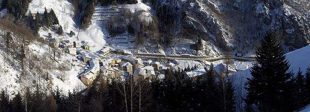

Ornica
- Italian comune
Ornica is a small village in the Lombardy region of northern Italy, situated in the Bergamasque Alps. It offers a beautiful natural setting for hikers and outdoor enthusiasts. Here are some highlights and important information regarding hiking in Ornica:...
- Country:

- Postal Code: 24010
- Local Dialing Code: 0345
- Licence Plate Code: BG
- Coordinates: 45° 59' 18" N, 9° 34' 45" E


- GPS tracks (wikiloc): [Link]
- AboveSeaLevel: 922 м m
- Area: 15.1 sq km
- Population: 152
- Web site: [Link]


Osio Sopra
- Italian comune
Osio Sopra is a small town in the Lombardy region of Italy, located near Bergamo. While Osio Sopra is primarily an urban area, there are opportunities for hiking and outdoor activities in the surrounding regions. Here are some insights for hiking enthusiasts:...
- Country:

- Postal Code: 24040
- Local Dialing Code: 035
- Licence Plate Code: BG
- Coordinates: 45° 38' 0" N, 9° 35' 0" E


- GPS tracks (wikiloc): [Link]
- AboveSeaLevel: 192 м m
- Area: 5.18 sq km
- Population: 5273
- Web site: [Link]

Osio Sotto
- Italian comune
Osio Sotto, located in the Lombardy region of Italy, is not primarily known as a hiking destination, but it does offer some opportunities for outdoor activities and exploration. Its proximity to the larger city of Bergamo and the magnificent landscapes of the nearby Pre-Alps and the Orobie Alps means that there are many hiking trails available not too far from Osio Sotto....
- Country:

- Postal Code: 24046
- Local Dialing Code: 035
- Licence Plate Code: BG
- Coordinates: 45° 37' 0" N, 9° 36' 0" E


- GPS tracks (wikiloc): [Link]
- AboveSeaLevel: 182 м m
- Area: 7.59 sq km
- Population: 12474
- Web site: [Link]

Pagazzano
- Italian comune
Pagazzano is a charming town located in the Lombardy region of Italy, not far from the more well-known city of Bergamo. While Pagazzano itself may not be a major hiking destination, its surrounding areas offer a variety of trails and natural beauty suitable for hiking enthusiasts....
- Country:

- Postal Code: 24040
- Local Dialing Code: 0363
- Licence Plate Code: BG
- Coordinates: 45° 32' 3" N, 9° 40' 16" E


- GPS tracks (wikiloc): [Link]
- AboveSeaLevel: 126 м m
- Area: 5.24 sq km
- Population: 2083
- Web site: [Link]


Paladina
- Italian comune
Paladina, located in Italy, is a charming area that offers a mix of natural beauty and historic sights, making it a great destination for hiking enthusiasts. While the specific trails can vary in difficulty and length, the general landscape features rolling hills, lush greenery, and panoramic views....
- Country:

- Postal Code: 24030
- Local Dialing Code: 035
- Licence Plate Code: BG
- Coordinates: 45° 44' 0" N, 9° 37' 0" E


- GPS tracks (wikiloc): [Link]
- AboveSeaLevel: 272 м m
- Area: 2.09 sq km
- Population: 4048
- Web site: [Link]


Palazzago
- Italian comune
Palazzago, located in the Lombardy region of Italy, offers a picturesque setting for hiking enthusiasts. Nestled in the foothills of the Bergamasque Alps, this area features a mix of natural beauty, historical sites, and charming villages, making it an attractive destination for outdoor activities....
- Country:

- Postal Code: 24030
- Local Dialing Code: 035
- Licence Plate Code: BG
- Coordinates: 45° 45' 7" N, 9° 32' 7" E


- GPS tracks (wikiloc): [Link]
- AboveSeaLevel: 397 м m
- Area: 13.98 sq km
- Population: 4497
- Web site: [Link]
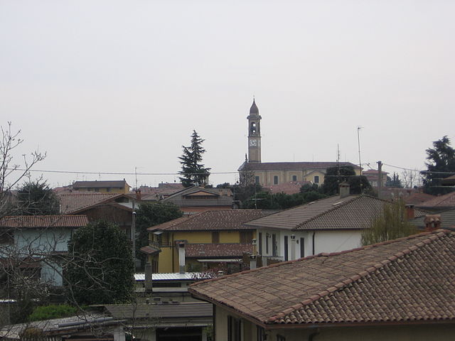

Palosco
- Italian comune
Palosco is a small town in the Lombardy region of Italy, located near the foothills of the Alps and within striking distance of a variety of natural landscapes. While it may not be as famous as other hiking destinations in Italy, it offers some beautiful trails and opportunities for outdoor activities....
- Country:

- Postal Code: 24050
- Local Dialing Code: 035
- Licence Plate Code: BG
- Coordinates: 45° 35' 0" N, 9° 50' 0" E


- GPS tracks (wikiloc): [Link]
- AboveSeaLevel: 157 м m
- Area: 10.79 sq km
- Population: 5808
- Web site: [Link]


Parre
- Italian comune
Parre, a small town in the province of Bergamo, Italy, offers a charming backdrop for hikers with its stunning landscapes, picturesque views, and various trails. It's nestled in the Seriana Valley, surrounded by the captivating Orobie Mountains, which provide ample hiking opportunities for enthusiasts of all levels....
- Country:

- Postal Code: 24020
- Local Dialing Code: 035
- Licence Plate Code: BG
- Coordinates: 45° 52' 0" N, 9° 54' 0" E


- GPS tracks (wikiloc): [Link]
- AboveSeaLevel: 650 м m
- Area: 22.28 sq km
- Population: 2732
- Web site: [Link]


Parzanica
- Italian comune
Parzanica is a small village located in Italy, within the province of Bergamo in the Lombardy region. It sits on the eastern shore of Lake Iseo, surrounded by beautiful natural landscapes, making it a lovely destination for hiking enthusiasts. Here are some highlights about hiking in Parzanica:...
- Country:

- Postal Code: 24060
- Local Dialing Code: 035
- Licence Plate Code: BG
- Coordinates: 45° 44' 0" N, 10° 2' 0" E


- GPS tracks (wikiloc): [Link]
- AboveSeaLevel: 753 м m
- Area: 9.82 sq km
- Population: 362
- Web site: [Link]


Pedrengo
- Italian comune
Pedrengo is a charming town in the province of Bergamo, Italy, known for its beautiful landscapes and proximity to the Bergamasque Alps, making it an excellent starting point for hiking enthusiasts. The area offers a variety of trails suitable for different skill levels, ranging from leisurely walks to more challenging hikes....
- Country:

- Postal Code: 24066
- Local Dialing Code: 035
- Licence Plate Code: BG
- Coordinates: 45° 41' 54" N, 9° 44' 2" E


- GPS tracks (wikiloc): [Link]
- AboveSeaLevel: 262 м m
- Area: 3.6 sq km
- Population: 6026
- Web site: [Link]
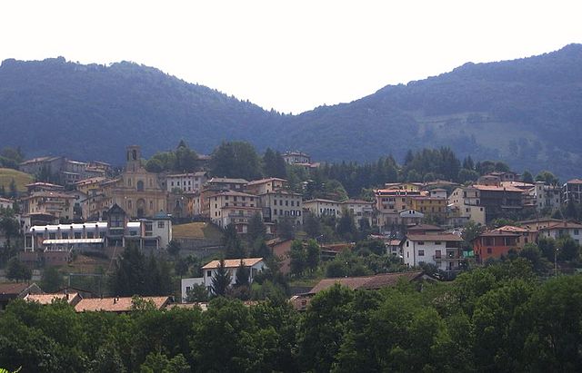

Peia
- Italian comune
Peia, located in Italy's Lombardy region near Lake Iseo, is a picturesque area that offers a variety of hiking opportunities. Nestled in the foothills of the Alps, the region boasts beautiful landscapes, stunning views, and charming local villages....
- Country:

- Postal Code: 24020
- Local Dialing Code: 035
- Licence Plate Code: BG
- Coordinates: 45° 48' 0" N, 9° 54' 0" E


- GPS tracks (wikiloc): [Link]
- AboveSeaLevel: 570 м m
- Area: 4.48 sq km
- Population: 1818
- Web site: [Link]


Pianico
- Italian comune
Pianico is a picturesque village located in the province of Bergamo, in the Lombardy region of Italy. It is surrounded by the stunning landscapes of the Italian Alps, making it an excellent destination for hiking enthusiasts. Here are some key points about hiking in and around Pianico:...
- Country:

- Postal Code: 24060
- Local Dialing Code: 035
- Licence Plate Code: BG
- Coordinates: 45° 48' 38" N, 10° 2' 38" E


- GPS tracks (wikiloc): [Link]
- AboveSeaLevel: 328 м m
- Area: 2.7 sq km
- Population: 1452
- Web site: [Link]


Piario
- Italian comune
Piario, located in the Lombardy region of Italy, is surrounded by stunning natural landscapes, making it a great destination for hiking enthusiasts. Nestled in the Seriana Valley, the area features a mix of mountainous terrain, wooded areas, and picturesque villages which offer a variety of hiking options suitable for different skill levels....
- Country:

- Postal Code: 24020
- Local Dialing Code: 0346
- Licence Plate Code: BG
- Coordinates: 45° 53' 46" N, 9° 55' 26" E


- GPS tracks (wikiloc): [Link]
- AboveSeaLevel: 539 м m
- Area: 1.55 sq km
- Population: 1074
- Web site: [Link]
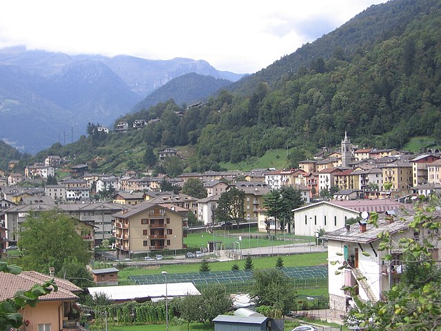
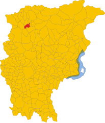
Piazza Brembana
- Italian comune
Piazza Brembana is a picturesque valley located in the Bergamo province of Lombardy, Italy. It's surrounded by the stunning Orobie Alps, making it an excellent destination for hiking enthusiasts. The area boasts a variety of trails, ranging from easy walks suitable for families to challenging hikes for more experienced trekkers....
- Country:

- Postal Code: 24014
- Local Dialing Code: 0345
- Licence Plate Code: BG
- Coordinates: 45° 56' 50" N, 9° 40' 30" E


- GPS tracks (wikiloc): [Link]
- AboveSeaLevel: 518 м m
- Area: 6.77 sq km
- Population: 1213
- Web site: [Link]


Piazzatorre
- Italian comune
Piazzatorre, located in the Lombardy region of Italy, is a picturesque mountain village that offers a variety of hiking opportunities amidst beautiful natural landscapes. Surrounded by the Bergamasque Alps, it provides stunning views, diverse terrain, and a chance to experience the local flora and fauna....
- Country:

- Postal Code: 24010
- Local Dialing Code: 0345
- Licence Plate Code: BG
- Coordinates: 46° 0' 0" N, 9° 41' 0" E


- GPS tracks (wikiloc): [Link]
- AboveSeaLevel: 868 м m
- Area: 24.24 sq km
- Population: 399
- Web site: [Link]
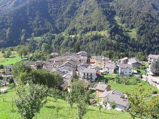

Piazzolo
- Italian comune
Piazzolo, located in the beautiful region of Italy, particularly near the eastern Alpin Valley, offers stunning landscapes and an array of hiking opportunities. While specific trails may vary, here are some general tips and highlights that can enhance your hiking experience in the area:...
- Country:

- Postal Code: 24010
- Local Dialing Code: 0345
- Licence Plate Code: BG
- Coordinates: 45° 58' 47" N, 9° 40' 14" E


- GPS tracks (wikiloc): [Link]
- AboveSeaLevel: 702 м m
- Area: 4.15 sq km
- Population: 92
- Web site: [Link]


Pognano
- Italian comune
Pognano, located in the province of Bergamo in northern Italy, is a charming town that provides access to beautiful landscapes and hiking opportunities. While Pognano itself is not a major hiking destination, it is situated near scenic areas in the Lombardy region, which hosts numerous trails suitable for various skill levels....
- Country:

- Postal Code: 24040
- Local Dialing Code: 035
- Licence Plate Code: BG
- Coordinates: 45° 35' 13" N, 9° 38' 27" E


- GPS tracks (wikiloc): [Link]
- AboveSeaLevel: 157 м m
- Area: 3.29 sq km
- Population: 1625
- Web site: [Link]


Ponte Nossa
- Italian comune
Ponte Nossa is a picturesque town located in the Lombardy region of northern Italy, part of the Bergamo province. Surrounded by the stunning Orobie Alps, it offers a variety of hiking opportunities, making it an excellent destination for both novice and experienced hikers....
- Country:

- Postal Code: 24028
- Local Dialing Code: 035
- Licence Plate Code: BG
- Coordinates: 45° 52' 0" N, 9° 53' 0" E


- GPS tracks (wikiloc): [Link]
- AboveSeaLevel: 465 м m
- Area: 5.59 sq km
- Population: 1761
- Web site: [Link]


Ponte San Pietro
- Italian comune
Ponte San Pietro, located in the province of Bergamo in Lombardy, Italy, is a picturesque area that serves as a gateway to various hiking opportunities in the surrounding region. Here are some aspects to consider if you're planning to hike in and around Ponte San Pietro:...
- Country:

- Postal Code: 24036
- Local Dialing Code: 035
- Licence Plate Code: BG
- Coordinates: 45° 42' 21" N, 9° 35' 26" E


- GPS tracks (wikiloc): [Link]
- AboveSeaLevel: 224 м m
- Area: 4.59 sq km
- Population: 11502
- Web site: [Link]


Ponteranica
- Italian comune
Ponteranica is a charming community situated in the Lombardy region of Italy, near the city of Bergamo. The area is known for its beautiful landscapes, lush forests, and proximity to the Orobie Alps, making it an excellent destination for hiking enthusiasts. Here's what you should know about hiking in and around Ponteranica:...
- Country:

- Postal Code: 24010
- Local Dialing Code: 035
- Licence Plate Code: BG
- Coordinates: 45° 44' 0" N, 9° 39' 0" E


- GPS tracks (wikiloc): [Link]
- AboveSeaLevel: 545 м m
- Area: 8.48 sq km
- Population: 6862
- Web site: [Link]


Pontida
- Italian comune
Pontida is a charming town located in the province of Bergamo, in the Lombardy region of northern Italy. It is situated near the foothills of the Italian Alps, which makes it an excellent base for hiking and outdoor activities. Here's what you should know about hiking in and around Pontida:...
- Country:

- Postal Code: 24030
- Local Dialing Code: 035
- Licence Plate Code: BG
- Coordinates: 45° 44' 2" N, 9° 30' 23" E


- GPS tracks (wikiloc): [Link]
- AboveSeaLevel: 313 м m
- Area: 10.38 sq km
- Population: 3358
- Web site: [Link]


Pontirolo Nuovo
- Italian comune
Pontirolo Nuovo, a small town in the Lombardy region of Italy, is not specifically known as a hiking destination, but it is surrounded by a countryside that offers some opportunities for walking and outdoor activities. Here are some suggestions and information relevant to hiking in and around Pontirolo Nuovo:...
- Country:

- Postal Code: 24040
- Local Dialing Code: 0363
- Licence Plate Code: BG
- Coordinates: 45° 34' 9" N, 9° 34' 2" E


- GPS tracks (wikiloc): [Link]
- AboveSeaLevel: 155 м m
- Area: 11.1 sq km
- Population: 4983
- Web site: [Link]

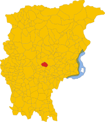
Pradalunga
- Italian comune
Pradalunga, located in the Lombardy region of Italy, offers a beautiful area for hiking enthusiasts. Nestled in the hills near Bergamo, it features a mix of scenic landscapes, charming villages, and lush nature. Here’s what you can expect when hiking in this area:...
- Country:

- Postal Code: 24020
- Local Dialing Code: 035
- Licence Plate Code: BG
- Coordinates: 45° 44' 48" N, 9° 46' 59" E


- GPS tracks (wikiloc): [Link]
- AboveSeaLevel: 327 м m
- Area: 8.2 sq km
- Population: 4674
- Web site: [Link]
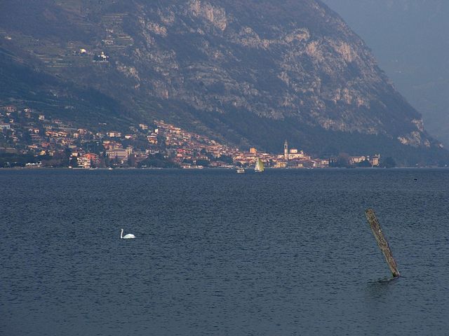

Predore
- Italian comune
Predore is a charming village located on the shores of Lake Iseo in northern Italy, making it a picturesque destination for hiking enthusiasts. While the village itself is relatively small, the surrounding area offers a variety of hiking trails that provide stunning views of the lake, nearby mountains, and the beautiful countryside....
- Country:

- Postal Code: 24060
- Local Dialing Code: 035
- Licence Plate Code: BG
- Coordinates: 45° 41' 0" N, 10° 1' 0" E


- GPS tracks (wikiloc): [Link]
- AboveSeaLevel: 190 м m
- Area: 10.96 sq km
- Population: 1864
- Web site: [Link]


Premolo
- Italian comune
Premolo is a charming village located in the Bergamo province in Lombardy, northern Italy. Nestled in the Seriana Valley, surrounded by the stunning Orobie Alps, it offers a variety of hiking opportunities for both beginners and experienced hikers....
- Country:

- Postal Code: 24020
- Local Dialing Code: 035
- Licence Plate Code: BG
- Coordinates: 45° 52' 0" N, 9° 53' 0" E


- GPS tracks (wikiloc): [Link]
- AboveSeaLevel: 625 м m
- Area: 17.63 sq km
- Population: 1122
- Web site: [Link]


Presezzo
- Italian comune
Presezzo is a charming municipality located in the province of Bergamo, in the Lombardy region of Italy. While it may not be one of the most famous hiking destinations, it offers several opportunities for nature lovers and outdoor enthusiasts to explore its scenic landscapes, particularly around the nearby hills and forests....
- Country:

- Postal Code: 24030
- Local Dialing Code: 035
- Licence Plate Code: BG
- Coordinates: 45° 41' 29" N, 9° 33' 59" E


- GPS tracks (wikiloc): [Link]
- AboveSeaLevel: 236 м m
- Area: 2.28 sq km
- Population: 4905
- Web site: [Link]

Pumenengo
- Italian comune
It seems there might be some confusion, as there isn't a well-known hiking destination specifically named "Pumenengo." It's possible you meant a different location, or it could be a lesser-known area....
- Country:

- Postal Code: 24050
- Local Dialing Code: 0363
- Licence Plate Code: BG
- Coordinates: 45° 28' 0" N, 9° 52' 0" E


- GPS tracks (wikiloc): [Link]
- AboveSeaLevel: 106 м m
- Area: 10.12 sq km
- Population: 1715
- Web site: [Link]


Ranica
- Italian comune
Ranica is a picturesque area located in Italy, known for its stunning natural landscapes, making it a great destination for hiking enthusiasts. Here are some key points to consider if you’re planning to hike in Ranica:...
- Country:

- Postal Code: 24020
- Local Dialing Code: 035
- Licence Plate Code: BG
- Coordinates: 45° 44' 0" N, 9° 43' 0" E


- GPS tracks (wikiloc): [Link]
- AboveSeaLevel: 293 м m
- Area: 4.06 sq km
- Population: 5945
- Web site: [Link]

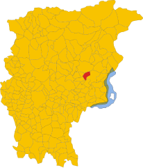
Ranzanico
- Italian comune
Ranzanico is a small town located in the province of Bergamo in the Lombardy region of Italy. Nestled near the shores of Lake Endine and surrounded by the picturesque landscapes of the Italian Alps, Ranzanico offers various hiking opportunities that cater to different skill levels....
- Country:

- Postal Code: 24060
- Local Dialing Code: 035
- Licence Plate Code: BG
- Coordinates: 45° 47' 0" N, 9° 56' 0" E


- GPS tracks (wikiloc): [Link]
- AboveSeaLevel: 519 м m
- Area: 7.21 sq km
- Population: 1230
- Web site: [Link]


Riva di Solto
- Italian comune
Riva di Solto is a beautiful village located on the shores of Lake Iseo in northern Italy. It offers stunning views, lush landscapes, and a variety of trails that cater to different skill levels. Here's what you should know about hiking in this area:...
- Country:

- Postal Code: 24060
- Local Dialing Code: 035
- Licence Plate Code: BG
- Coordinates: 45° 46' 0" N, 10° 2' 0" E


- GPS tracks (wikiloc): [Link]
- AboveSeaLevel: 186 м m
- Area: 8.52 sq km
- Population: 913
- Web site: [Link]


Rogno
- Italian comune
Rogno is a charming town located in the Lombardy region of northern Italy, near Lake Iseo and the beautiful Val Camonica. The area surrounding Rogno offers some fantastic hiking opportunities, with well-marked trails that showcase the stunning natural beauty of the region....
- Country:

- Postal Code: 24060
- Local Dialing Code: 035
- Licence Plate Code: BG
- Coordinates: 45° 51' 27" N, 10° 7' 59" E


- GPS tracks (wikiloc): [Link]
- AboveSeaLevel: 215 м m
- Area: 15.81 sq km
- Population: 3931
- Web site: [Link]
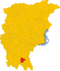
Romano di Lombardia
- Italian comune
Romano di Lombardia is a charming town located in the Lombardy region of northern Italy. While it may not be as famous for hiking as other areas in the Alps or Dolomites, there are still opportunities for outdoor enthusiasts to enjoy the beautiful scenery and natural landscapes in and around this area....
- Country:

- Postal Code: 24058
- Local Dialing Code: 0363
- Licence Plate Code: BG
- Coordinates: 45° 31' 0" N, 9° 45' 0" E


- GPS tracks (wikiloc): [Link]
- AboveSeaLevel: 120 м m
- Area: 19.38 sq km
- Population: 20486
- Web site: [Link]


Roncobello
- Italian comune
Roncobello is a charming village located in the Bergamasque Alps in northern Italy. It’s a fantastic destination for hiking enthusiasts, offering a range of trails that cater to different skill levels and preferences. Here are some highlights:...
- Country:

- Postal Code: 24010
- Local Dialing Code: 0345
- Licence Plate Code: BG
- Coordinates: 45° 57' 0" N, 9° 45' 0" E


- GPS tracks (wikiloc): [Link]
- AboveSeaLevel: 1007 м m
- Area: 25.39 sq km
- Population: 433
- Web site: [Link]


Roncola
- Italian comune
Roncola is a picturesque area in Italy, situated in the Lombardy region, near the beautiful Bergamo Alps. It's known for its stunning landscapes, rich history, and various hiking opportunities. Here are some key points to consider if you're planning a hiking trip in and around Roncola:...
- Country:

- Postal Code: 24030
- Local Dialing Code: 035
- Licence Plate Code: BG
- Coordinates: 45° 46' 0" N, 9° 33' 0" E


- GPS tracks (wikiloc): [Link]
- AboveSeaLevel: 854 м m
- Area: 5.07 sq km
- Population: 780
- Web site: [Link]


Rota d'Imagna
- Italian comune
Rota d'Imagna, located in the Bergamo region of northern Italy, offers beautiful hiking opportunities framed by stunning landscapes and rich natural beauty. The area is characterized by its rolling hills, valleys, and picturesque trails, making it a great destination for hikers of various skill levels....
- Country:

- Postal Code: 24037
- Local Dialing Code: 035
- Licence Plate Code: BG
- Coordinates: 45° 50' 0" N, 9° 31' 0" E


- GPS tracks (wikiloc): [Link]
- AboveSeaLevel: 690 м m
- Area: 6.03 sq km
- Population: 920
- Web site: [Link]


Rovetta
- Italian comune
Rovetta, located in the Bergamasque Alps of northern Italy, offers a fantastic hiking experience due to its stunning landscapes, charming village atmosphere, and variety of trails suited for different skill levels....
- Country:

- Postal Code: 24020
- Local Dialing Code: 0346
- Coordinates: 45° 53' 0" N, 9° 59' 0" E


- GPS tracks (wikiloc): [Link]
- AboveSeaLevel: 650 м m
- Area: 24.53 sq km
- Population: 4168
- Web site: [Link]


San Giovanni Bianco
- Italian comune
San Giovanni Bianco is a charming village located in the Lombardy region of Italy, surrounded by the breathtaking landscapes of the Orobic Alps. It offers a variety of hiking opportunities for both beginners and experienced hikers, thanks to its diverse terrain and well-marked trails....
- Country:

- Postal Code: 24015
- Local Dialing Code: 0345
- Licence Plate Code: BG
- Coordinates: 45° 52' 0" N, 9° 39' 0" E


- GPS tracks (wikiloc): [Link]
- AboveSeaLevel: 448 м m
- Area: 31.03 sq km
- Population: 4798
- Web site: [Link]


San Paolo d'Argon
- Italian comune
San Paolo d'Argon, located in the province of Bergamo in northern Italy, offers a variety of hiking opportunities amidst beautiful landscapes. The region is characterized by its rolling hills, vineyards, and scenic views of the surrounding valleys and mountains, including the nearby Orobian Alps....
- Country:

- Postal Code: 24060
- Local Dialing Code: 035
- Licence Plate Code: BG
- Coordinates: 45° 41' 21" N, 9° 48' 11" E


- GPS tracks (wikiloc): [Link]
- AboveSeaLevel: 255 м m
- Area: 5.25 sq km
- Population: 5725
- Web site: [Link]


San Pellegrino Terme
- Italian comune
 Hiking in San Pellegrino Terme
San Pellegrino Terme, located in the Lombardy region of Italy, is known for its thermal springs and beautiful natural landscapes, making it an excellent destination for hiking enthusiasts. Here are some highlights of hiking in this picturesque area:...
- Country:

- Postal Code: 24016
- Local Dialing Code: 0345
- Licence Plate Code: BG
- Coordinates: 45° 50' 0" N, 9° 40' 0" E


- GPS tracks (wikiloc): [Link]
- AboveSeaLevel: 358 м m
- Area: 22.95 sq km
- Population: 4827
- Web site: [Link]


Sant'Omobono Terme
- Italian comune
Sant'Omobono Terme is a charming town located in the province of Bergamo, Lombardy, Italy. It is well-known for its thermal springs and beautiful surrounding landscapes, making it an attractive destination for hikers and outdoor enthusiasts....
- Country:

- Postal Code: 24038
- Local Dialing Code: 035
- Licence Plate Code: BG
- Coordinates: 45° 48' 33" N, 9° 32' 14" E


- GPS tracks (wikiloc): [Link]
- AboveSeaLevel: 427 м m
- Area: 16.43 sq km
- Population: 3940
- Web site: [Link]


Santa Brigida
- Italian comune in Lombardy
Santa Brigida, located in the Lombardy region of northern Italy, is a wonderful destination for hiking enthusiasts. It is nestled in the Bergamo Alps, providing stunning landscapes, rich flora and fauna, and various trail options for different skill levels....
- Country:

- Postal Code: 24010
- Local Dialing Code: 0345
- Licence Plate Code: BG
- Coordinates: 45° 59' 0" N, 9° 37' 0" E


- GPS tracks (wikiloc): [Link]
- AboveSeaLevel: 805 м m
- Area: 13.8 sq km
- Population: 549
- Web site: [Link]


Sarnico
- Italian comune
Sarnico, located on the shores of Lake Iseo in the Lombardy region of northern Italy, offers a beautiful backdrop for hiking enthusiasts. The area is characterized by its picturesque landscapes, charming villages, and scenic lakeside views, making it an ideal destination for outdoor activities....
- Country:

- Postal Code: 24067
- Local Dialing Code: 035
- Licence Plate Code: BG
- Coordinates: 45° 40' 0" N, 9° 57' 0" E


- GPS tracks (wikiloc): [Link]
- AboveSeaLevel: 197 м m
- Area: 6.66 sq km
- Population: 6688
- Web site: [Link]
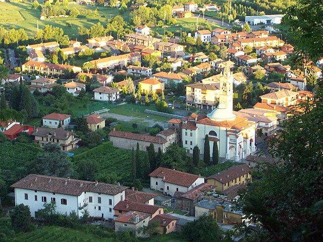

Scanzorosciate
- Italian comune
Scanzorosciate is a charming town located in the Lombardy region of northern Italy, near the city of Bergamo. The area offers a variety of hiking opportunities that allow you to explore its stunning landscapes, nature, and cultural heritage....
- Country:

- Postal Code: 24020
- Local Dialing Code: 035
- Licence Plate Code: BG
- Coordinates: 45° 42' 41" N, 9° 44' 9" E


- GPS tracks (wikiloc): [Link]
- AboveSeaLevel: 297 м m
- Area: 10.69 sq km
- Population: 10076
- Web site: [Link]

Schilpario
- Italian comune
Schilpario is a charming small village located in the Italian Alps, specifically in the province of Bergamo, Lombardy. It’s nestled within the Seriana Valley and is surrounded by stunning mountain scenery, making it a great destination for hiking enthusiasts....
- Country:

- Postal Code: 24020
- Local Dialing Code: 0346
- Licence Plate Code: BG
- Coordinates: 46° 1' 0" N, 10° 9' 0" E


- GPS tracks (wikiloc): [Link]
- AboveSeaLevel: 1124 м m
- Area: 63.97 sq km
- Population: 1184
- Web site: [Link]


Sedrina
- Italian comune
Sedrina, a charming locality in the province of Bergamo in Italy, offers beautiful hiking opportunities amidst the stunning backdrop of the Italian Alps. Here are some highlights and suggestions if you're considering hiking in the area:...
- Country:

- Postal Code: 24010
- Local Dialing Code: 0345
- Licence Plate Code: BG
- Coordinates: 45° 46' 55" N, 9° 37' 25" E


- GPS tracks (wikiloc): [Link]
- AboveSeaLevel: 328 м m
- Area: 5.85 sq km
- Population: 2465
- Web site: [Link]

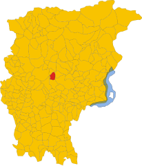
Selvino
- Italian comune
Selvino, located in the Bergamo Alps of northern Italy, is a charming destination for hiking enthusiasts. Nestled in the Orobie Mountains, it offers stunning views, diverse landscapes, and a variety of trails suitable for all skill levels. Here’s what you can expect when hiking in Selvino:...
- Country:

- Postal Code: 24020
- Local Dialing Code: 035
- Licence Plate Code: BG
- Coordinates: 45° 47' 0" N, 9° 45' 0" E


- GPS tracks (wikiloc): [Link]
- AboveSeaLevel: 960 м m
- Area: 6.53 sq km
- Population: 2044
- Web site: [Link]


Seriate
- Italian comune
Seriate is a town located in the Lombardy region of northern Italy, close to the city of Bergamo. While it may not be as widely recognized for hiking as some other locations in the Italian Alps, it does have access to several beautiful hiking trails and natural landscapes that outdoor enthusiasts can enjoy....
- Country:

- Postal Code: 24068
- Local Dialing Code: 035
- Licence Plate Code: BG
- Coordinates: 45° 41' 5" N, 9° 43' 4" E


- GPS tracks (wikiloc): [Link]
- AboveSeaLevel: 247 м m
- Area: 12.53 sq km
- Population: 25358
- Web site: [Link]


Serina, Lombardy
- Italian comune
Serina, located in the Lombardy region of Italy, is a beautiful area for hiking enthusiasts. Nestled in the Seriana Valley, Serina offers stunning landscapes characterized by lush forests, rocky escarpments, and panoramic views of the surrounding mountains. Here are some key points to consider if you're planning a hiking trip to Serina:...
- Country:

- Postal Code: 24017
- Local Dialing Code: 0345
- Licence Plate Code: BG
- Coordinates: 45° 52' 0" N, 9° 44' 0" E


- GPS tracks (wikiloc): [Link]
- AboveSeaLevel: 720 м m
- Area: 27.34 sq km
- Population: 2077
- Web site: [Link]


Solto Collina
- Italian comune
Solto Collina is a charming destination located near Lake Iseo in Italy, offering a variety of hiking opportunities amidst beautiful landscapes, lush greenery, and panoramic views of the lake and surrounding mountains....
- Country:

- Postal Code: 24060
- Local Dialing Code: 035
- Licence Plate Code: BG
- Coordinates: 45° 47' 0" N, 10° 1' 0" E


- GPS tracks (wikiloc): [Link]
- AboveSeaLevel: 449 м m
- Area: 11.76 sq km
- Population: 1799
- Web site: [Link]


Solza
- Italian comune
As of my last update, Solza is a small town in Italy, situated near the beautiful landscape of the Bergamo region in Lombardy. While it may not be a renowned hiking destination in itself, it is in proximity to several areas that offer fantastic hiking opportunities....
- Country:

- Postal Code: 24030
- Local Dialing Code: 035
- Licence Plate Code: BG
- Coordinates: 45° 40' 43" N, 9° 29' 27" E


- GPS tracks (wikiloc): [Link]
- AboveSeaLevel: 254 м m
- Area: 1.23 sq km
- Population: 2075
- Web site: [Link]


Songavazzo
- Italian comune
Songavazzo is a picturesque village located in the province of Bergamo in the Lombardy region of northern Italy. It's nestled in the valleys of the Orobie Alps and is known for its beautiful natural landscapes, traditional architecture, and rich history. Hiking in and around Songavazzo offers a variety of trails suitable for different skill levels, allowing you to enjoy the stunning scenery of the Italian mountains....
- Country:

- Postal Code: 24020
- Local Dialing Code: 0346
- Licence Plate Code: BG
- Coordinates: 45° 53' 0" N, 9° 59' 0" E


- GPS tracks (wikiloc): [Link]
- AboveSeaLevel: 640 м m
- Area: 12.94 sq km
- Population: 706
- Web site: [Link]


Sorisole
- Italian comune
Sorisole, located in the Lombardy region of Italy, is a beautiful destination for hiking enthusiasts. Nestled in the foothills of the Alps, it offers a range of trails that vary in difficulty, making it suitable for both beginners and experienced hikers....
- Country:

- Postal Code: 24010
- Local Dialing Code: 035
- Licence Plate Code: BG
- Coordinates: 45° 44' 15" N, 9° 39' 23" E


- GPS tracks (wikiloc): [Link]
- AboveSeaLevel: 415 м m
- Area: 12.25 sq km
- Population: 9042
- Web site: [Link]


Sotto il Monte Giovanni XXIII
- Italian comune
 Hiking in Sotto il Monte Giovanni XXIII
Sotto il Monte Giovanni XXIII is a picturesque area located in the Lombardy region of Italy, known for its natural beauty, rolling hills, and historical significance, particularly as the birthplace of Pope John XXIII. Hiking in this area offers a blend of serene landscapes, cultural landmarks, and opportunities for various outdoor activities....
- Country:

- Postal Code: 24039
- Local Dialing Code: 035
- Licence Plate Code: BG
- Coordinates: 45° 42' 26" N, 9° 29' 57" E


- GPS tracks (wikiloc): [Link]
- AboveSeaLevel: 305 м m
- Area: 5.02 sq km
- Population: 3864
- Web site: [Link]
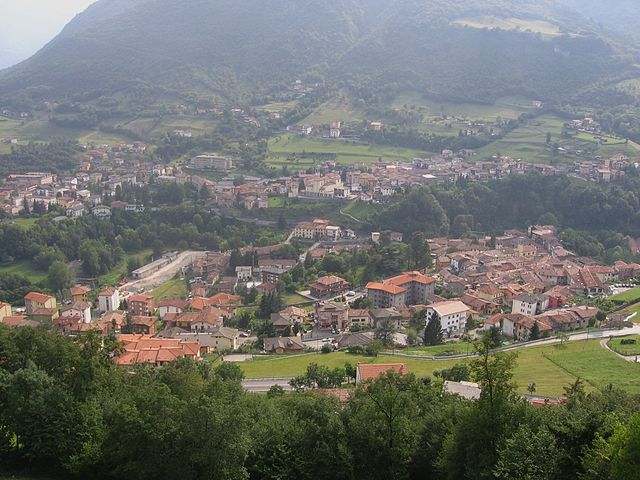

Sovere
- Italian comune
Sovere, located in the Province of Bergamo in northern Italy, is surrounded by beautiful landscapes and offers a variety of hiking opportunities. Nestled in the foothills of the Alps and near Lake Iseo, the area features diverse terrain ranging from gentle hills to more challenging mountain trails....
- Country:

- Postal Code: 24060
- Local Dialing Code: 035
- Licence Plate Code: BG
- Coordinates: 45° 49' 0" N, 10° 2' 0" E


- GPS tracks (wikiloc): [Link]
- AboveSeaLevel: 479 м m
- Area: 18.02 sq km
- Population: 5319
- Web site: [Link]


Spinone al Lago
- Italian comune
Spinone al Lago, located in the Lombardy region of Italy, is a charming village situated near the shores of Lake Iseo and surrounded by the breathtaking landscape of the Orobie Alps. Hiking in this area offers a range of beautiful trails that cater to different fitness levels and preferences....
- Country:

- Postal Code: 24060
- Local Dialing Code: 035
- Licence Plate Code: BG
- Coordinates: 45° 45' 0" N, 9° 55' 0" E


- GPS tracks (wikiloc): [Link]
- AboveSeaLevel: 360 м m
- Area: 1.97 sq km
- Population: 1023
- Web site: [Link]

Spirano
- Italian comune
Spirano, a small town located in the province of Bergamo in Lombardy, Italy, offers a serene environment and picturesque landscapes suitable for hiking enthusiasts. While it may not be as renowned for hiking as some larger areas in the Italian Alps, Spirano and its surrounding regions provide a variety of trails that cater to different experience levels....
- Country:

- Postal Code: 24050
- Local Dialing Code: 035
- Licence Plate Code: BG
- Coordinates: 45° 34' 58" N, 9° 40' 9" E


- GPS tracks (wikiloc): [Link]
- AboveSeaLevel: 154 м m
- Area: 9.61 sq km
- Population: 5730
- Web site: [Link]


Stezzano
- Italian comune
Stezzano is a small town located in the Lombardy region of Italy, near Bergamo. While it may not be as widely recognized for hiking compared to more mountainous areas, there are several outdoor opportunities and nearby areas that you can explore....
- Country:

- Postal Code: 24040
- Local Dialing Code: 035
- Licence Plate Code: BG
- Coordinates: 45° 35' 0" N, 9° 40' 0" E


- GPS tracks (wikiloc): [Link]
- AboveSeaLevel: 211 м m
- Area: 9.37 sq km
- Population: 13112
- Web site: [Link]


Strozza
- Italian comune
Strozza is a charming village located in the Lombardy region of Italy, nestled in the Bergamasque Alps. It offers a unique blend of cultural experiences and outdoor activities, making it an excellent destination for hiking enthusiasts....
- Country:

- Postal Code: 24030
- Local Dialing Code: 035
- Licence Plate Code: BG
- Coordinates: 45° 46' 0" N, 9° 35' 0" E


- GPS tracks (wikiloc): [Link]
- AboveSeaLevel: 378 м m
- Area: 3.83 sq km
- Population: 1071
- Web site: [Link]


Suisio
- Italian comune
Suisio, a small town located in the Lombardy region of Italy near Bergamo, offers a variety of hiking opportunities for outdoor enthusiasts. While it may not be as well-known as some of the larger mountain ranges in the area, it still provides beautiful landscapes, scenic trails, and a chance to experience the natural beauty of northern Italy....
- Country:

- Postal Code: 24040
- Local Dialing Code: 035
- Licence Plate Code: BG
- Coordinates: 45° 39' 0" N, 9° 30' 0" E


- GPS tracks (wikiloc): [Link]
- AboveSeaLevel: 234 м m
- Area: 4.59 sq km
- Population: 3780
- Web site: [Link]


Taleggio, Lombardy
- Italian comune
Taleggio is a picturesque valley located in the Bergamo province of Lombardy, Italy. It is renowned for its stunning landscapes, rich history, and traditional agriculture, including the famous Taleggio cheese. Hiking in this region offers a variety of trails, ranging from easy walks to more challenging routes, catering to different skill levels. Here are some highlights and tips for hiking in Taleggio:...
- Country:

- Postal Code: 24010
- Local Dialing Code: 0345
- Licence Plate Code: BG
- Coordinates: 45° 54' 0" N, 9° 34' 0" E


- GPS tracks (wikiloc): [Link]
- AboveSeaLevel: 758 м m
- Area: 46.59 sq km
- Population: 552
- Web site: [Link]
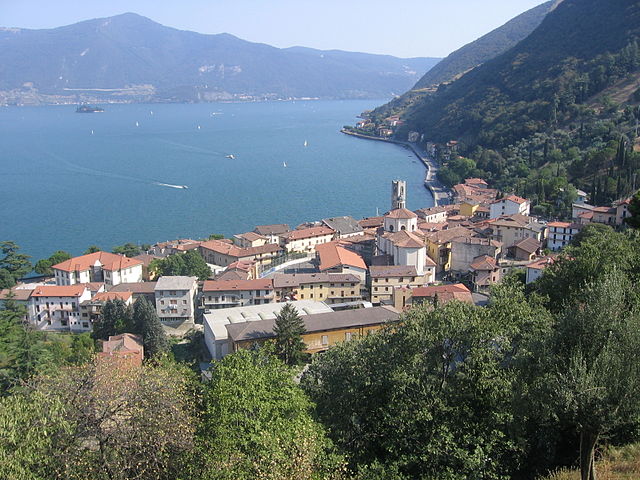
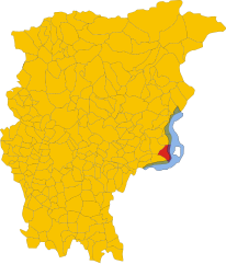
Tavernola Bergamasca
- Italian comune
 Hiking in Tavernola Bergamasca
Tavernola Bergamasca is a picturesque town located in the Bergamo province of Italy, overlooking Lago d'Iseo (Lake Iseo), which is known for its stunning landscapes, charming villages, and numerous hiking trails. Here are some highlights for hiking in and around Tavernola Bergamasca:...
- Country:

- Postal Code: 24060
- Local Dialing Code: 035
- Licence Plate Code: BG
- Coordinates: 45° 43' 0" N, 10° 3' 0" E


- GPS tracks (wikiloc): [Link]
- AboveSeaLevel: 191 м m
- Area: 11.17 sq km
- Population: 2042
- Web site: [Link]


Telgate
- Italian comune
Telgate is a charming town located in the Lombardy region of Italy, nestled in the hills near Lake Iseo and the Orobian Alps. While it may not be as widely known as some larger hiking destinations, it offers a variety of outdoor activities, including hiking trails that cater to different skill levels....
- Country:

- Postal Code: 24060
- Local Dialing Code: 035
- Licence Plate Code: BG
- Coordinates: 45° 38' 0" N, 9° 51' 0" E


- GPS tracks (wikiloc): [Link]
- AboveSeaLevel: 191 м m
- Area: 8.3 sq km
- Population: 5040
- Web site: [Link]


Terno d'Isola
- Italian comune
Terno d'Isola is a charming town located in the province of Bergamo, Lombardy, Italy. While it’s not typically recognized as a primary hiking destination, the surrounding region offers some lovely trails and opportunities for outdoor activities. Here are some insights about hiking in and around Terno d'Isola:...
- Country:

- Postal Code: 24030
- Local Dialing Code: 035
- Licence Plate Code: BG
- Coordinates: 45° 41' 0" N, 9° 32' 0" E


- GPS tracks (wikiloc): [Link]
- AboveSeaLevel: 299 м m
- Area: 4.13 sq km
- Population: 8106
- Web site: [Link]


Torre Boldone
- Italian comune
Torre Boldone is a charming municipality located in the province of Bergamo in Lombardy, Italy. Nestled at the foothills of the beautiful Alps, it offers diverse hiking opportunities that cater to various skill levels....
- Country:

- Postal Code: 24020
- Local Dialing Code: 035
- Licence Plate Code: BG
- Coordinates: 45° 43' 0" N, 9° 42' 0" E


- GPS tracks (wikiloc): [Link]
- AboveSeaLevel: 280 м m
- Area: 3.48 sq km
- Population: 8755
- Web site: [Link]

Torre Pallavicina
- Italian comune
Torre Pallavicina is located in the province of Bergamo, in northern Italy. It is a small town that offers an excellent opportunity for nature lovers and hiking enthusiasts to explore the beautiful landscapes of the Lombardy region. While the town itself may not be widely known as a hiking destination, there are several trails nearby that allow hikers to experience the stunning scenery, rich culture, and diverse flora and fauna typical of the area....
- Country:

- Postal Code: 24050
- Local Dialing Code: 0363
- Licence Plate Code: BG
- Coordinates: 45° 27' 0" N, 9° 52' 0" E


- GPS tracks (wikiloc): [Link]
- AboveSeaLevel: 95 м m
- Area: 10.62 sq km
- Population: 1067
- Web site: [Link]
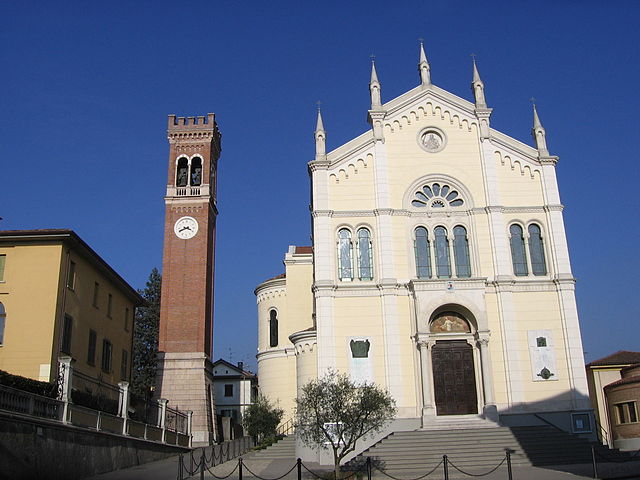

Torre de' Roveri
- Italian comune
Torre de' Roveri is a charming town located in the province of Bergamo, Lombardy, Italy. It's surrounded by beautiful landscapes, making it a great spot for hiking enthusiasts. Here are some highlights and tips for hiking in and around Torre de' Roveri:...
- Country:

- Postal Code: 24060
- Local Dialing Code: 035
- Licence Plate Code: BG
- Coordinates: 45° 42' 0" N, 9° 46' 20" E


- GPS tracks (wikiloc): [Link]
- AboveSeaLevel: 271 м m
- Area: 2.69 sq km
- Population: 2470
- Web site: [Link]


Trescore Balneario
- Italian comune
Trescore Balneario, located in the province of Bergamo in northern Italy, is a charming town known for its thermal baths and scenic landscapes. While it's not as widely recognized for hiking as some other areas in the Italian Alps, it can serve as a great base for exploring nearby trails and natural attractions....
- Country:

- Postal Code: 24069
- Local Dialing Code: 035
- Licence Plate Code: BG
- Coordinates: 45° 42' 0" N, 9° 51' 0" E


- GPS tracks (wikiloc): [Link]
- AboveSeaLevel: 271 м m
- Area: 13.51 sq km
- Population: 9814
- Web site: [Link]
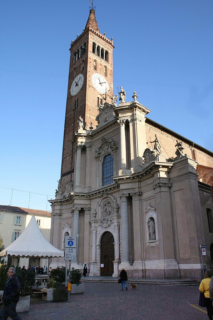

Treviglio
- Italian comune
Treviglio is located in the Lombardy region of northern Italy, not far from Milan. While Treviglio itself may not be a major hiking destination, it serves as a good base for accessing nearby natural areas and hiking trails in the surrounding region....
- Country:

- Postal Code: 24047
- Local Dialing Code: 0363
- Licence Plate Code: BG
- Coordinates: 45° 31' 17" N, 9° 35' 34" E


- GPS tracks (wikiloc): [Link]
- AboveSeaLevel: 125 м m
- Area: 32.22 sq km
- Population: 29815
- Web site: [Link]


Treviolo
- Italian comune
Treviolo is a charming municipality located in the province of Bergamo, Italy. It offers a mix of scenic landscapes, historical sites, and opportunities for outdoor activities, making it a lovely destination for hiking enthusiasts. Here are some key points to consider when hiking in Treviolo:...
- Country:

- Postal Code: 24048
- Local Dialing Code: 035
- Licence Plate Code: BG
- Coordinates: 45° 40' 22" N, 9° 36' 56" E


- GPS tracks (wikiloc): [Link]
- AboveSeaLevel: 225 м m
- Area: 8.49 sq km
- Population: 10870
- Web site: [Link]
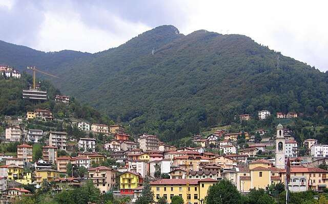

Ubiale Clanezzo
- Italian comune
Ubiale Clanezzo is a picturesque area located in the province of Bergamo, in Lombardy, Italy. This region is known for its beautiful landscapes, lush forests, and charming villages, making it a great destination for hiking enthusiasts....
- Country:

- Postal Code: 24010
- Local Dialing Code: 0345
- Licence Plate Code: BG
- Coordinates: 45° 47' 0" N, 9° 37' 0" E


- GPS tracks (wikiloc): [Link]
- AboveSeaLevel: 336 м m
- Area: 7.35 sq km
- Population: 1377
- Web site: [Link]


Urgnano
- Italian comune
Urgnano is a small town located in Lombardy, Italy, close to Bergamo. While Urgnano itself may not be a prominent hiking destination, it is surrounded by beautiful landscapes and trails that appeal to hiking enthusiasts....
- Country:

- Postal Code: 24059
- Local Dialing Code: 035
- Licence Plate Code: BG
- Coordinates: 45° 35' 50" N, 9° 41' 42" E


- GPS tracks (wikiloc): [Link]
- AboveSeaLevel: 173 м m
- Area: 14.78 sq km
- Population: 9908
- Web site: [Link]


Valbondione
- Italian comune
Valbondione is a stunning valley located in the Bergamo Alps of northern Italy, offering a wealth of hiking opportunities for all levels of outdoor enthusiasts. Here are some key highlights and practical tips for hiking in this beautiful area:...
- Country:

- Postal Code: 24020
- Local Dialing Code: 0346
- Licence Plate Code: BG
- Coordinates: 46° 2' 16" N, 10° 0' 47" E


- GPS tracks (wikiloc): [Link]
- AboveSeaLevel: 900 м m
- Area: 96.89 sq km
- Population: 1051
- Web site: [Link]


Valbrembo
- Italian comune
Valbrembo is a charming village located in the province of Bergamo, Italy, nestled among the scenic landscapes of the Lombardy region. It offers several hiking opportunities for both beginners and experienced hikers. Here are some key points about hiking in Valbrembo:...
- Country:

- Postal Code: 24030
- Local Dialing Code: 035
- Licence Plate Code: BG
- Coordinates: 45° 43' 8" N, 9° 36' 34" E


- GPS tracks (wikiloc): [Link]
- AboveSeaLevel: 261 м m
- Area: 3.8 sq km
- Population: 4280
- Web site: [Link]


Valgoglio
- Italian comune
Valgoglio is a picturesque area located in the province of Bergamo, Lombardy, Italy, known for its stunning natural landscapes and rich hiking opportunities. The region is characterized by its rugged mountains, lush forests, and tranquil valleys, making it an excellent destination for outdoor enthusiasts and hikers of all skill levels....
- Country:

- Postal Code: 24020
- Local Dialing Code: 0346
- Licence Plate Code: BG
- Coordinates: 45° 58' 0" N, 9° 55' 0" E


- GPS tracks (wikiloc): [Link]
- AboveSeaLevel: 929 м m
- Area: 31.89 sq km
- Population: 596
- Web site: [Link]
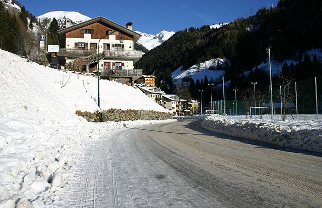

Valleve
- Italian comune
Valleve, located in the Bergamo province of Italy, offers stunning landscapes and a variety of hiking opportunities for all levels of outdoor enthusiasts. Nestled in the Italian Alps, Valleve is characterized by its picturesque valleys, lush forests, and breathtaking mountain views....
- Country:

- Postal Code: 24010
- Local Dialing Code: 0345
- Licence Plate Code: BG
- Coordinates: 46° 2' 0" N, 9° 45' 0" E


- GPS tracks (wikiloc): [Link]
- AboveSeaLevel: 1141 м m
- Area: 14.76 sq km
- Population: 133
- Web site: [Link]
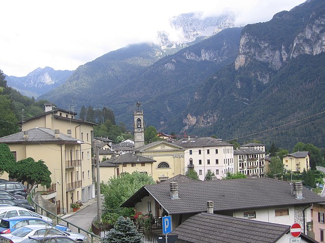

Valnegra
- Italian comune
Valnegra, a picturesque village located in the province of Bergamo in the Lombardy region of Italy, is an excellent destination for hikers. Nestled in the Italian Alps, it offers stunning landscapes, lush forests, and a variety of trails suitable for different skill levels....
- Country:

- Postal Code: 24010
- Local Dialing Code: 0345
- Licence Plate Code: BG
- Coordinates: 45° 57' 0" N, 9° 41' 26" E


- GPS tracks (wikiloc): [Link]
- AboveSeaLevel: 581 м m
- Area: 2.23 sq km
- Population: 211
- Web site: [Link]


Valtorta, Lombardy
- Italian comune
Valtorta is a beautiful area in Lombardy, Italy, particularly popular for hiking enthusiasts looking for stunning alpine landscapes. Nestled in the Bergamasque Alps, Valtorta offers a variety of trails that range in difficulty, making it a suitable destination for both beginners and experienced hikers....
- Country:

- Postal Code: 24010
- Local Dialing Code: 0345
- Licence Plate Code: BG
- Coordinates: 45° 58' 39" N, 9° 32' 5" E


- GPS tracks (wikiloc): [Link]
- AboveSeaLevel: 935 м m
- Area: 30.9 sq km
- Population: 270
- Web site: [Link]


Vedeseta
- Italian comune
Vedeseta is a picturesque village located in the province of Bergamo in Lombardy, Italy, known for its stunning natural landscapes and hiking opportunities. The area is surrounded by the Italian Alps and offers various trails suitable for different skill levels, making it an attractive destination for hikers....
- Country:

- Postal Code: 24010
- Local Dialing Code: 0345
- Licence Plate Code: BG
- Coordinates: 45° 53' 27" N, 9° 32' 23" E


- GPS tracks (wikiloc): [Link]
- AboveSeaLevel: 820 м m
- Area: 19.29 sq km
- Population: 205
- Web site: [Link]
Verdellino
- Italian comune
Verdellino is a village located in the Lombardy region of northern Italy, specifically in the province of Bergamo. While Verdellino itself is more urban and suburban in nature, there are several outdoor and hiking opportunities in the surrounding areas, particularly in the nearby hills and mountains....
- Country:

- Postal Code: 24040
- Local Dialing Code: 035
- Licence Plate Code: BG
- Coordinates: 45° 36' 7" N, 9° 36' 32" E


- GPS tracks (wikiloc): [Link]
- AboveSeaLevel: 172 м m
- Area: 3.82 sq km
- Population: 7569
- Web site: [Link]
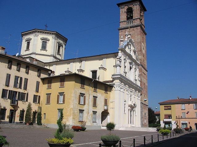

Verdello
- Italian comune
Verdello is a small town in Italy, located in the Lombardy region, close to the city of Bergamo. While it may not be as famous for hiking as the larger nearby mountain ranges, such as the Orobie Alps, there are still some opportunities for outdoor activities and exploring the natural beauty of the region....
- Country:

- Postal Code: 24049
- Local Dialing Code: 035
- Licence Plate Code: BG
- Coordinates: 45° 36' 18" N, 9° 37' 47" E


- GPS tracks (wikiloc): [Link]
- AboveSeaLevel: 173 м m
- Area: 7.34 sq km
- Population: 8082
- Web site: [Link]


Vertova
- Italian comune
Vertova is a charming town located in the Bergamo province of Lombardy, Italy, surrounded by picturesque mountains and beautiful landscapes, making it an appealing spot for hikers. The area is characterized by its rich natural beauty, featuring forests, rivers, and stunning views of the surrounding Alps....
- Country:

- Postal Code: 24029
- Local Dialing Code: 035
- Licence Plate Code: BG
- Coordinates: 45° 49' 0" N, 9° 51' 0" E


- GPS tracks (wikiloc): [Link]
- AboveSeaLevel: 397 м m
- Area: 15.69 sq km
- Population: 4642
- Web site: [Link]


Viadanica
- Italian comune
Viadanica is a small village located in the province of Bergamo in northern Italy, nestled in the beautiful area of the Lombardy region. The surrounding natural landscapes and proximity to the Orobie Alps make it a charming destination for hikers and outdoor enthusiasts....
- Country:

- Postal Code: 24060
- Local Dialing Code: 035
- Licence Plate Code: BG
- Coordinates: 45° 41' 0" N, 9° 58' 0" E


- GPS tracks (wikiloc): [Link]
- AboveSeaLevel: 336 м m
- Area: 5.45 sq km
- Population: 1135
- Web site: [Link]


Vigano San Martino
- Italian comune
Vigano San Martino is a charming village located in the Lombardy region of northern Italy, nestled within the beautiful landscape of the Pre-Alps. This area offers various hiking opportunities, allowing you to enjoy the scenic beauty of the region, including forests, hills, and captivating vistas of the surrounding mountains....
- Country:

- Postal Code: 24060
- Local Dialing Code: 035
- Licence Plate Code: BG
- Coordinates: 45° 43' 35" N, 9° 53' 40" E


- GPS tracks (wikiloc): [Link]
- AboveSeaLevel: 363 м m
- Area: 3.76 sq km
- Population: 1345
- Web site: [Link]


Vigolo
- Italian comune
Vigolo is a picturesque region in northern Italy, often defined by its stunning natural landscapes and opportunities for outdoor activities, including hiking. While I don't have specific trails in Vigolo, I can provide some general insights into what you might expect when hiking in this area:...
- Country:

- Postal Code: 24060
- Local Dialing Code: 035
- Licence Plate Code: BG
- Coordinates: 45° 43' 0" N, 10° 1' 0" E


- GPS tracks (wikiloc): [Link]
- AboveSeaLevel: 616 м m
- Area: 12.31 sq km
- Population: 579
- Web site: [Link]


Villa d'Adda
- Italian comune
Villa d'Adda is a charming location in Italy, situated on the banks of the Adda River in the Lombardy region. This area is well-suited for hiking enthusiasts, offering scenic trails, beautiful landscapes, and opportunities to experience local culture....
- Country:

- Postal Code: 24030
- Local Dialing Code: 035
- Licence Plate Code: BG
- Coordinates: 45° 43' 0" N, 9° 28' 0" E


- GPS tracks (wikiloc): [Link]
- AboveSeaLevel: 286 м m
- Area: 5.98 sq km
- Population: 4681
- Web site: [Link]


Villa d'Almè
- Italian comune
Villa d'Almè is a charming town located in the province of Bergamo in northern Italy, surrounded by beautiful landscapes that are ideal for hiking enthusiasts. Nestled in the foothills of the Italian Alps, Villa d'Almè offers a variety of trails suitable for different skill levels, from easy walks to more challenging hikes....
- Country:

- Postal Code: 24018
- Local Dialing Code: 035
- Licence Plate Code: BG
- Coordinates: 45° 45' 0" N, 9° 37' 0" E


- GPS tracks (wikiloc): [Link]
- AboveSeaLevel: 300 м m
- Area: 6.49 sq km
- Population: 6672
- Web site: [Link]


Villa d'Ogna
- Italian comune
Villa d'Ogna is a charming village located in the province of Bergamo, Lombardy, Italy. Nestled in the scenic Val Seriana valley, it offers a range of hiking opportunities that allow you to explore the stunning natural landscape of the region....
- Country:

- Postal Code: 24020
- Local Dialing Code: 0346
- Licence Plate Code: BG
- Coordinates: 45° 54' 0" N, 9° 56' 0" E


- GPS tracks (wikiloc): [Link]
- AboveSeaLevel: 542 м m
- Area: 5.16 sq km
- Population: 1869
- Web site: [Link]


Villa di Serio
- Italian comune
Villa di Serio is a charming area located in the province of Bergamo in northern Italy, surrounded by beautiful landscapes and nature, making it a great destination for hiking enthusiasts. Here are some details about hiking opportunities in and around Villa di Serio:...
- Country:

- Postal Code: 24020
- Local Dialing Code: 035
- Licence Plate Code: BG
- Coordinates: 45° 43' 18" N, 9° 44' 6" E


- GPS tracks (wikiloc): [Link]
- AboveSeaLevel: 275 м m
- Area: 4.6 sq km
- Population: 6777
- Web site: [Link]
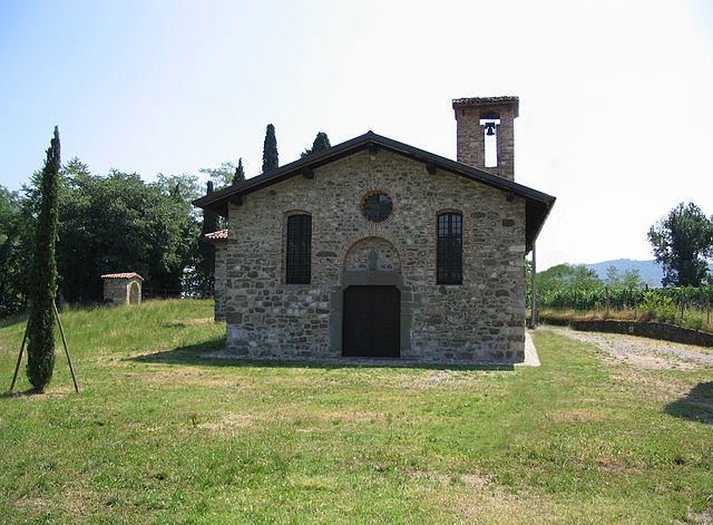

Villongo
- Italian comune
Villongo is a charming town in the Lombardy region of Italy, situated near Lake Iseo. While it may not be as widely recognized for hiking as other areas in the Italian Alps or Dolomites, it offers some beautiful trails and a picturesque backdrop for outdoor enthusiasts. Here are some key points regarding hiking in and around Villongo:...
- Country:

- Postal Code: 24060
- Local Dialing Code: 035
- Licence Plate Code: BG
- Coordinates: 45° 40' 0" N, 9° 56' 0" E


- GPS tracks (wikiloc): [Link]
- AboveSeaLevel: 233 м m
- Area: 6.04 sq km
- Population: 8147
- Web site: [Link]


Vilminore di Scalve
- Italian comune
Vilminore di Scalve is a picturesque town located in the Val di Scalve region of Italy, nestled in the Alps of Lombardy. The area is known for its stunning scenic beauty and variety of hiking opportunities, making it an excellent destination for outdoor enthusiasts....
- Country:

- Postal Code: 24020
- Local Dialing Code: 0346
- Licence Plate Code: BG
- Coordinates: 46° 0' 0" N, 10° 6' 0" E


- GPS tracks (wikiloc): [Link]
- AboveSeaLevel: 1019 м m
- Area: 41 sq km
- Population: 1479
- Web site: [Link]


Zandobbio
- Italian comune
Zandobbio is a charming village located in the province of Bergamo, Italy, nestled in the foothills of the Alps and surrounded by beautiful natural landscapes. Hiking in this region offers a variety of trails that cater to different skill levels, making it an excellent destination for both novice and experienced hikers....
- Country:

- Postal Code: 24060
- Local Dialing Code: 035
- Licence Plate Code: BG
- Coordinates: 45° 41' 18" N, 9° 51' 9" E


- GPS tracks (wikiloc): [Link]
- AboveSeaLevel: 278 м m
- Area: 6.43 sq km
- Population: 2732
- Web site: [Link]


Zanica
- Italian comune
Zanica is a charming town located in the Lombardy region of Italy, close to the city of Bergamo. While it may not be as widely known for its hiking as some larger destinations, there are several trails and natural areas nearby that offer beautiful scenery and opportunities for outdoor activities....
- Country:

- Postal Code: 24050
- Local Dialing Code: 035
- Licence Plate Code: BG
- Coordinates: 45° 38' 22" N, 9° 41' 3" E


- GPS tracks (wikiloc): [Link]
- AboveSeaLevel: 208 м m
- Area: 14.66 sq km
- Population: 8744
- Web site: [Link]


Zogno
- Italian comune
Zogno is a charming village located in the province of Bergamo, Lombardy, Italy. Nestled in the Seriana Valley, it offers stunning landscapes, rich history, and a variety of hiking trails that cater to different skill levels. Here’s an overview of what you can expect when hiking in Zogno:...
- Country:

- Postal Code: 24019
- Local Dialing Code: 0345
- Licence Plate Code: BG
- Coordinates: 45° 47' 38" N, 9° 39' 56" E


- GPS tracks (wikiloc): [Link]
- AboveSeaLevel: 334 м m
- Area: 35.21 sq km
- Population: 8926
- Web site: [Link]


circle of Bergamo
- circle of the italian province of Bergamo
Circondario di Bergamo, located in the Lombardy region of Italy, offers a diverse range of hiking opportunities with stunning landscapes, charming villages, and rich cultural heritage. Here are some highlights and tips for hiking in this beautiful area:...
- Capital: Bergamo
- Coordinates: 45° 41' 42" N, 9° 40' 12" E


- GPS tracks (wikiloc): [Link]
- Population: 201310

Val Brembilla
- Italian comune
Val Brembilla is a beautiful valley located in the Lombardy region of Italy, nestled within the larger Bergamasque Alps. It offers a variety of hiking trails that cater to different skill levels, making it an excellent destination for hikers. Here are some highlights and tips for hiking in Val Brembilla:...
- Country:

- Postal Code: 24012
- Licence Plate Code: BG
- Coordinates: 45° 49' 0" N, 9° 36' 0" E


- GPS tracks (wikiloc): [Link]
- AboveSeaLevel: 425 м m
- Area: 31.44 sq km
- Population: 4328
- Web site: [Link]


Credaro
- Italian comune
Credaro, located in the Lombardy region of Italy, is a charming area known for its scenic landscapes and outdoor activities, including hiking. While it may not be one of the most famous hiking destinations in Italy, it offers beautiful trails that cater to various skill levels....
- Country:

- Postal Code: 24060
- Local Dialing Code: 035
- Licence Plate Code: BG
- Coordinates: 45° 40' 0" N, 9° 56' 0" E


- GPS tracks (wikiloc): [Link]
- AboveSeaLevel: 255 м m
- Area: 3.41 sq km
- Population: 3517
- Web site: [Link]
Torre de' Busi
- Italian comune
Torre de' Busi is a small town located in the Lombardy region of Italy, nestled in the hills near the scenic area of Bergamo. The surrounding landscape offers numerous opportunities for hiking enthusiasts and nature lovers alike. Here’s a guide to hiking in Torre de' Busi and its surroundings:...
- Country:

- Postal Code: 24032; 23806
- Local Dialing Code: 035
- Licence Plate Code: BG
- Coordinates: 45° 46' 0" N, 9° 29' 0" E


- GPS tracks (wikiloc): [Link]
- AboveSeaLevel: 472 м m
- Area: 8.97 sq km
- Population: 2077
- Web site: [Link]


Albino, Lombardy
- Italian comune
Albino, located in the Lombardy region of Italy, is a charming town nestled in the foothills of the Bergamasque Alps. The area offers a variety of hiking opportunities, making it a great destination for outdoor enthusiasts....
- Country:

- Postal Code: 24021
- Local Dialing Code: 035
- Licence Plate Code: BG
- Coordinates: 45° 45' 38" N, 9° 47' 49" E


- GPS tracks (wikiloc): [Link]
- AboveSeaLevel: 342 м m
- Area: 31.81 sq km
- Population: 17903
- Web site: [Link]


Bergamo
- Italian comune
Bergamo, located in northern Italy, is surrounded by stunning landscapes and offers a variety of hiking opportunities for all skill levels. The area is characterized by its beautiful hills, mountains, and the iconic Alps in the distance. Here’s a guide to hiking in Bergamo:...
- Country:

- Postal Code: 24129; 24128; 24127; 24126; 24125; 24124; 24123; 24122; 24121
- Local Dialing Code: 035
- Licence Plate Code: BG
- Coordinates: 45° 41' 42" N, 9° 40' 12" E


- GPS tracks (wikiloc): [Link]
- AboveSeaLevel: 249 м m
- Area: 39 sq km
- Population: 119806
- Web site: [Link]


Adrara San Martino
- Italian comune
Adrara San Martino is a beautiful area located in the province of Bergamo in northern Italy. Known for its stunning landscapes, lush forests, and panoramic views, it offers a variety of hiking opportunities suitable for different skill levels. Here's what you need to know about hiking in this area:...
- Country:

- Postal Code: 24060
- Local Dialing Code: 035
- Licence Plate Code: BG
- Coordinates: 45° 42' 0" N, 9° 57' 0" E


- GPS tracks (wikiloc): [Link]
- AboveSeaLevel: 355 м m
- Area: 12.61 sq km
- Population: 2239
- Web site: [Link]


Adrara San Rocco
- Italian comune
Adrara San Rocco is a picturesque village located in the province of Bergamo, northern Italy. The surrounding area is characterized by beautiful landscapes, lush forests, and a series of trails suitable for various hiking levels....
- Country:

- Postal Code: 24060
- Local Dialing Code: 035
- Licence Plate Code: BG
- Coordinates: 45° 42' 51" N, 9° 57' 30" E


- GPS tracks (wikiloc): [Link]
- AboveSeaLevel: 431 м m
- Area: 9.23 sq km
- Population: 825
- Web site: [Link]
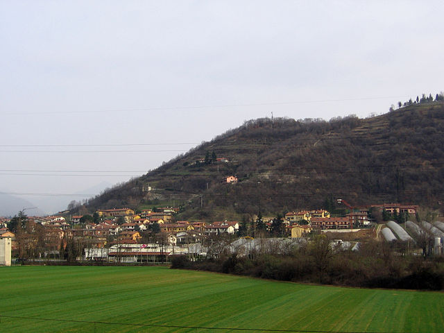

Albano Sant'Alessandro
- Italian comune
 Hiking in Albano Sant'Alessandro
Albano Sant'Alessandro is a charming town located in the province of Bergamo, in the Lombardy region of northern Italy. It's situated in a picturesque area characterized by lush landscapes, hills, and proximity to the beautiful Orobie Alps, making it a fantastic destination for hiking enthusiasts....
- Country:

- Postal Code: 24061
- Local Dialing Code: 035
- Licence Plate Code: BG
- Coordinates: 45° 41' 9" N, 9° 46' 4" E


- GPS tracks (wikiloc): [Link]
- AboveSeaLevel: 243 м m
- Area: 5.12 sq km
- Population: 8244
- Web site: [Link]

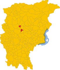
Algua
- Italian comune
It seems there might be a typo in your query, as "Algua" doesn’t correspond to any well-known hiking destination or region. However, if you meant a specific area, such as "Algarve" in Portugal, "Alguacil" in Spain, or "Algul" in another region, please clarify....
- Country:

- Postal Code: 24010
- Local Dialing Code: 0345
- Licence Plate Code: BG
- Coordinates: 45° 50' 0" N, 9° 43' 0" E


- GPS tracks (wikiloc): [Link]
- AboveSeaLevel: 432 м m
- Area: 8.32 sq km
- Population: 673
- Web site: [Link]


Almenno San Bartolomeo
- Italian comune
 Hiking in Almenno San Bartolomeo
Almenno San Bartolomeo is a picturesque commune located in the Lombardy region of Italy, near Bergamo. The area is known for its beautiful landscapes, charming villages, and a network of hiking trails that cater to various experience levels. Here are some highlights and tips for hiking in Almenno San Bartolomeo:...
- Country:

- Postal Code: 24030
- Local Dialing Code: 035
- Licence Plate Code: BG
- Coordinates: 45° 44' 56" N, 9° 34' 47" E


- GPS tracks (wikiloc): [Link]
- AboveSeaLevel: 352 м m
- Area: 10.61 sq km
- Population: 6247
- Web site: [Link]
Almenno San Salvatore
- Italian comune
 Hiking in Almenno San Salvatore
Almenno San Salvatore, located in the province of Bergamo in Lombardy, Italy, is a charming area that offers a variety of hiking opportunities. Nestled in the foothills of the Alps, it features scenic landscapes that include lush forests, rolling hills, and panoramic views over the surrounding valleys and mountains....
- Country:

- Postal Code: 24031
- Local Dialing Code: 035
- Licence Plate Code: BG
- Coordinates: 45° 45' 0" N, 9° 35' 15" E


- GPS tracks (wikiloc): [Link]
- AboveSeaLevel: 328 м m
- Area: 4.73 sq km
- Population: 5677
- Web site: [Link]


Almè
- Italian comune
Almè is a quaint town located in the province of Bergamo, Lombardy, Italy. Nestled in the foothills of the Alps, it offers a variety of hiking opportunities for both beginners and experienced hikers. Here are some key features and recommendations for hiking in and around Almè:...
- Country:

- Postal Code: 24011
- Local Dialing Code: 035
- Licence Plate Code: BG
- Coordinates: 45° 44' 13" N, 9° 36' 55" E


- GPS tracks (wikiloc): [Link]
- AboveSeaLevel: 294 м m
- Area: 2 sq km
- Population: 5604
- Web site: [Link]


Alzano Lombardo
- Italian comune
Alzano Lombardo is a charming town located in the Lombardy region of Italy, nestled near the foothills of the Bergamasque Alps. The area offers various hiking opportunities that cater to different skill levels and preferences. Here are some highlights of hiking in and around Alzano Lombardo:...
- Country:

- Postal Code: 24022
- Local Dialing Code: 035
- Licence Plate Code: BG
- Coordinates: 45° 43' 54" N, 9° 43' 42" E


- GPS tracks (wikiloc): [Link]
- AboveSeaLevel: 304 м m
- Area: 13.68 sq km
- Population: 13637
- Web site: [Link]
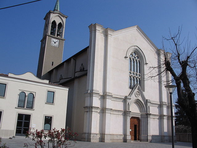

Ambivere
- Italian comune
Ambivere, located in the Indian state of Karnataka, is a hidden gem for hiking enthusiasts. Nestled in the picturesque landscapes of the Western Ghats, this area offers a range of outdoor activities amid lush greenery, hills, and serene natural beauty. Here’s what you might want to know about hiking in Ambivere:...
- Country:

- Postal Code: 24030
- Local Dialing Code: 035
- Licence Plate Code: BG
- Coordinates: 45° 43' 4" N, 9° 32' 55" E


- GPS tracks (wikiloc): [Link]
- AboveSeaLevel: 261 м m
- Area: 3.28 sq km
- Population: 2348
- Web site: [Link]

Antegnate
- Italian comune
Antegnate is a small town located in the Lombardy region of northern Italy. It is not as well-known for hiking as some other areas in Italy, but it does offer access to beautiful countryside and opportunities for outdoor activities....
- Country:

- Postal Code: 24051
- Local Dialing Code: 0363
- Licence Plate Code: BG
- Coordinates: 45° 29' 7" N, 9° 47' 20" E


- GPS tracks (wikiloc): [Link]
- AboveSeaLevel: 112 м m
- Area: 9.73 sq km
- Population: 3206
- Web site: [Link]


Arcene
- Italian comune
It seems like there might be a small mix-up with the name "Arcene." If you meant "Arcen" in the Netherlands or potentially another location, I can provide general guidance on hiking in that area, or if you are referring to a different destination, please clarify!...
- Country:

- Postal Code: 24040
- Local Dialing Code: 035
- Licence Plate Code: BG
- Coordinates: 45° 34' 34" N, 9° 36' 51" E


- GPS tracks (wikiloc): [Link]
- AboveSeaLevel: 152 м m
- Area: 4.35 sq km
- Population: 4868
- Web site: [Link]


Ardesio
- Italian comune
Ardesio, located in the Seriana Valley in the Lombardy region of Italy, offers a variety of hiking opportunities for both beginners and experienced hikers. The area is characterized by its stunning landscapes, including lush forests, rocky terrains, and panoramic views of the surrounding mountains....
- Country:

- Postal Code: 24020
- Local Dialing Code: 0346
- Licence Plate Code: BG
- Coordinates: 45° 56' 17" N, 9° 55' 48" E


- GPS tracks (wikiloc): [Link]
- AboveSeaLevel: 608 м m
- Area: 54.44 sq km
- Population: 3485
- Web site: [Link]

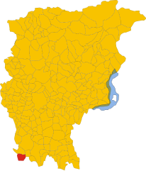
Arzago d'Adda
- Italian comune
Arzago d'Adda is a small town in the Lombardy region of Italy, located along the Adda River. While it may not be one of the most widely recognized hiking destinations, it can offer some lovely outdoor experiences, especially for those looking to explore the scenic countryside and the riverbanks....
- Country:

- Postal Code: 24040
- Local Dialing Code: 0363
- Licence Plate Code: BG
- Coordinates: 45° 28' 55" N, 9° 33' 48" E


- GPS tracks (wikiloc): [Link]
- AboveSeaLevel: 106 м m
- Area: 9.31 sq km
- Population: 2715
- Web site: [Link]

Averara
- Italian comune
Averara is a beautiful destination for hiking enthusiasts, nestled in the Bergamo Alps in the Lombardy region of Italy. This picturesque village offers a range of hiking trails suitable for various skill levels, set against the backdrop of stunning mountain scenery, lush forests, and vibrant flora....
- Country:

- Postal Code: 24010
- Local Dialing Code: 0345
- Licence Plate Code: BG
- Coordinates: 45° 59' 20" N, 9° 37' 53" E


- GPS tracks (wikiloc): [Link]
- AboveSeaLevel: 650 м m
- Area: 10.69 sq km
- Population: 178
- Web site: [Link]


Aviatico
- Italian comune
Aviatico is a charming municipality located in the province of Bergamo, in the Lombardy region of Italy. It's situated in the foothills of the Orobie Alps, making it an excellent destination for hiking enthusiasts. Here are some key highlights and tips about hiking in Aviatico:...
- Country:

- Postal Code: 24020
- Local Dialing Code: 035
- Licence Plate Code: BG
- Coordinates: 45° 48' 2" N, 9° 46' 16" E


- GPS tracks (wikiloc): [Link]
- AboveSeaLevel: 1022 м m
- Area: 8.49 sq km
- Population: 568
- Web site: [Link]


Azzano San Paolo
- Italian comune
Azzano San Paolo, located in the province of Bergamo in Lombardy, Italy, is not primarily known for extensive hiking trails like some other areas in the Alps. However, it does offer some pleasant outdoor experiences and is conveniently situated near more renowned hiking regions....
- Country:

- Postal Code: 24052
- Local Dialing Code: 035
- Licence Plate Code: BG
- Coordinates: 45° 39' 38" N, 9° 40' 32" E


- GPS tracks (wikiloc): [Link]
- AboveSeaLevel: 211 м m
- Area: 4.29 sq km
- Population: 7617
- Web site: [Link]


Azzone
- Italian comune
Azzone is a small village located within the Seriana Valley in the Lombardy region of Italy, nestled in the foothills of the Alps. It is known for its stunning natural landscapes, making it a popular destination for hikers and outdoor enthusiasts. Here are some key points about hiking in Azzone:...
- Country:

- Postal Code: 24020
- Local Dialing Code: 0346
- Licence Plate Code: BG
- Coordinates: 45° 58' 43" N, 10° 6' 43" E


- GPS tracks (wikiloc): [Link]
- AboveSeaLevel: 973 м m
- Area: 17.29 sq km
- Population: 387
- Web site: [Link]


Bagnatica
- Italian comune
Bagnatica is a small municipality located in the Lombardy region of Italy, near the province of Bergamo. While it may not be as well-known as some other hiking destinations in Italy, there are several opportunities for outdoor activities in and around this area....
- Country:

- Postal Code: 24060
- Local Dialing Code: 035
- Licence Plate Code: BG
- Coordinates: 45° 39' 43" N, 9° 46' 52" E


- GPS tracks (wikiloc): [Link]
- AboveSeaLevel: 220 м m
- Area: 6.55 sq km
- Population: 4317
- Web site: [Link]
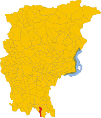
Barbata
- Italian comune
Hiking in Barbata, a beautiful region, can be an exciting experience for outdoor enthusiasts. While Barbata isn't a specific location commonly recognized in hiking guidebooks, it could refer to a local area that may be known for its trails, landscapes, or nature....
- Country:

- Postal Code: 24040
- Local Dialing Code: 0363
- Licence Plate Code: BG
- Coordinates: 45° 29' 0" N, 9° 47' 0" E


- GPS tracks (wikiloc): [Link]
- AboveSeaLevel: 105 м m
- Area: 7.98 sq km
- Population: 712
- Web site: [Link]

Bariano
- Italian comune
Bariano is a small town located in the Lombardy region of Italy, which is characterized by a mix of rolling hills, agricultural landscapes, and nearby natural reserves. While Bariano itself may not be a major hiking destination, it can serve as a good base for exploring the surrounding area....
- Country:

- Postal Code: 24050
- Local Dialing Code: 0363
- Licence Plate Code: BG
- Coordinates: 45° 30' 45" N, 9° 42' 13" E


- GPS tracks (wikiloc): [Link]
- AboveSeaLevel: 114 м m
- Area: 7.07 sq km
- Population: 4270
- Web site: [Link]


Barzana
- Italian comune
Barzana, located in the province of Bergamo in northern Italy, is surrounded by beautiful landscapes and offers various hiking opportunities. The area is characterized by rolling hills, scenic views, and cultural heritage, making it an excellent spot for both novice and experienced hikers....
- Country:

- Postal Code: 24030
- Local Dialing Code: 035
- Licence Plate Code: BG
- Coordinates: 45° 44' 2" N, 9° 34' 3" E


- GPS tracks (wikiloc): [Link]
- AboveSeaLevel: 300 м m
- Area: 2.07 sq km
- Population: 1980
- Web site: [Link]
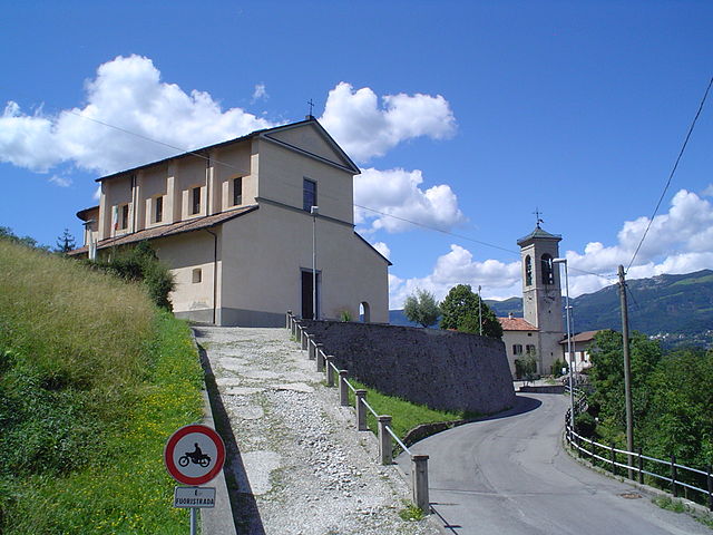

Bedulita
- Italian comune
Bedulita is a small village located in the province of Bergamo, Lombardy, Italy. It is situated in the foothills of the Alps, making it a great starting point for hiking and exploring the natural beauty of the surrounding area....
- Country:

- Postal Code: 24030
- Local Dialing Code: 035
- Licence Plate Code: BG
- Coordinates: 45° 47' 29" N, 9° 33' 4" E


- GPS tracks (wikiloc): [Link]
- AboveSeaLevel: 600 м m
- Area: 4.27 sq km
- Population: 732
- Web site: [Link]
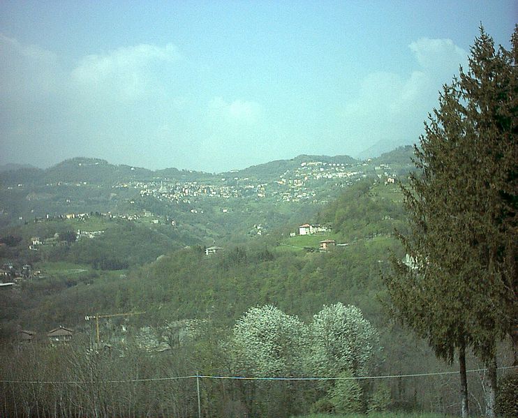

Berbenno
- Italian comune
Berbenno is a charming village located in the province of Sondrio, in the Lombardy region of northern Italy. Set against the stunning backdrop of the Italian Alps, it offers a variety of hiking opportunities that cater to different skill levels and preferences. Here are some highlights about hiking in and around Berbenno:...
- Country:

- Postal Code: 24030
- Local Dialing Code: 035
- Licence Plate Code: BG
- Coordinates: 45° 48' 49" N, 9° 34' 6" E


- GPS tracks (wikiloc): [Link]
- AboveSeaLevel: 675 м m
- Area: 6.14 sq km
- Population: 2357
- Web site: [Link]


Berzo San Fermo
- Italian comune
Berzo San Fermo is a picturesque village located in the Lombardy region of northern Italy, nestled in the Val Camonica, an area known for its stunning natural landscapes and rich history. The region offers a variety of hiking opportunities for outdoor enthusiasts of all skill levels....
- Country:

- Postal Code: 24060
- Local Dialing Code: 035
- Licence Plate Code: BG
- Coordinates: 45° 43' 9" N, 9° 54' 10" E


- GPS tracks (wikiloc): [Link]
- AboveSeaLevel: 350 м m
- Area: 5.86 sq km
- Population: 1377
- Web site: [Link]
Bianzano
- Italian comune
Bianzano is a charming village located in the province of Bergamo in northern Italy. It is surrounded by beautiful landscapes, making it a great destination for hiking enthusiasts. Here are some highlights and details about hiking in and around Bianzano:...
- Country:

- Postal Code: 24060
- Local Dialing Code: 035
- Licence Plate Code: BG
- Coordinates: 45° 46' 26" N, 9° 55' 10" E


- GPS tracks (wikiloc): [Link]
- AboveSeaLevel: 614 м m
- Area: 6.67 sq km
- Population: 610
- Web site: [Link]
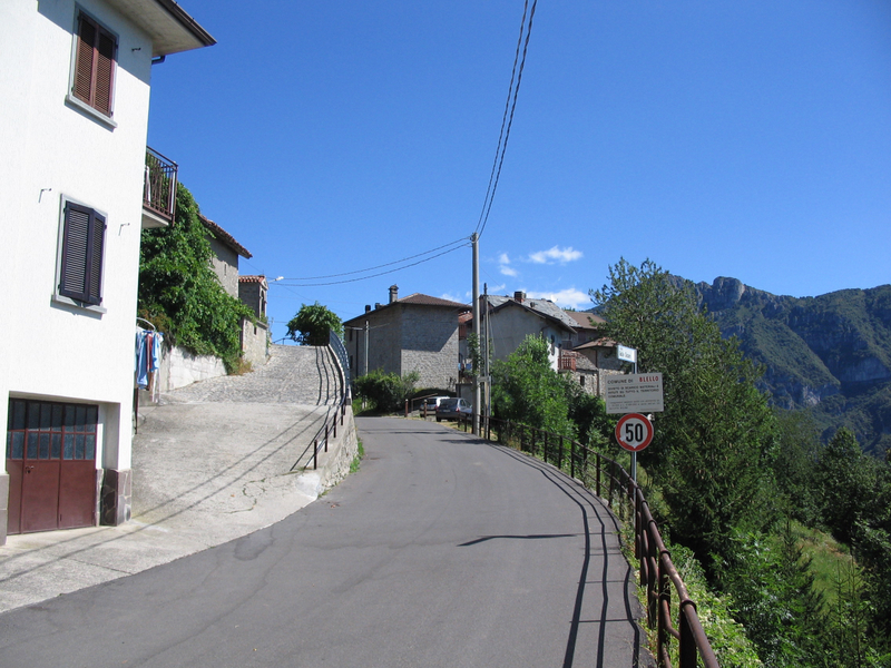

Blello
- Italian comune
Blello, a picturesque village located in the province of Bergamo, Italy, offers a range of hiking opportunities for outdoor enthusiasts. The area is known for its stunning landscapes, characterized by lush valleys, rolling hills, and panoramic mountain views....
- Country:

- Postal Code: 24012
- Local Dialing Code: 0345
- Licence Plate Code: BG
- Coordinates: 45° 50' 0" N, 9° 35' 0" E


- GPS tracks (wikiloc): [Link]
- AboveSeaLevel: 815 м m
- Area: 2.2 sq km
- Population: 75
- Web site: [Link]


Bolgare
- Italian comune
Bolgare is a small town in the province of Bergamo, Lombardy, Italy. Nestled in a beautiful region that offers access to the stunning landscapes of the Italian Alps, Bolgare is a great starting point for various hiking adventures....
- Country:

- Postal Code: 24060
- Local Dialing Code: 035
- Licence Plate Code: BG
- Coordinates: 45° 38' 3" N, 9° 49' 1" E


- GPS tracks (wikiloc): [Link]
- AboveSeaLevel: 199 м m
- Area: 8.59 sq km
- Population: 6183
- Web site: [Link]

Boltiere
- Italian comune
Boltiere is a small town located in the Lombardy region of Italy, primarily known for its agricultural landscape and proximity to larger cities like Bergamo. While Boltiere itself may not be a major hiking destination, the surrounding areas offer excellent opportunities for outdoor activities, including hiking....
- Country:

- Postal Code: 24040
- Local Dialing Code: 035
- Licence Plate Code: BG
- Coordinates: 45° 36' 0" N, 9° 35' 0" E


- GPS tracks (wikiloc): [Link]
- AboveSeaLevel: 171 м m
- Area: 4.21 sq km
- Population: 6102
- Web site: [Link]
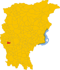
Bonate Sopra
- Italian comune
Bonate Sopra, located in the Lombardy region of Italy, offers a variety of picturesque landscapes and opportunities for hiking enthusiasts. Nestled close to the hills of Bergamo, this area is ideal for those who enjoy nature and scenic views....
- Country:

- Postal Code: 24040
- Local Dialing Code: 035
- Licence Plate Code: BG
- Coordinates: 45° 40' 55" N, 9° 33' 31" E


- GPS tracks (wikiloc): [Link]
- AboveSeaLevel: 320 м m
- Area: 6.15 sq km
- Population: 10020
- Web site: [Link]

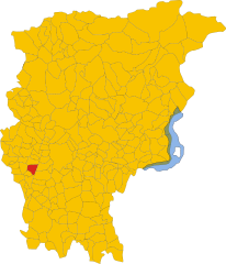
Bonate Sotto
- Italian comune
Bonate Sotto is a charming town located in the Lombardy region of Italy, situated just a few kilometers northeast of Bergamo. While it may not be as well-known as some other hiking destinations, it offers some beautiful landscapes and trails that can be enjoyed by outdoor enthusiasts....
- Country:

- Postal Code: 24040
- Local Dialing Code: 035
- Licence Plate Code: BG
- Coordinates: 45° 40' 0" N, 9° 33' 41" E


- GPS tracks (wikiloc): [Link]
- AboveSeaLevel: 215 м m
- Area: 6.47 sq km
- Population: 6704
- Web site: [Link]


Borgo di Terzo
- Italian comune
Borgo di Terzo, located in the Lombardy region of Italy, offers stunning landscapes and opportunities for hiking enthusiasts. The area is characterized by a mix of rolling hills, wooded areas, and picturesque views of the surrounding countryside. Here are some key points to consider when hiking in Borgo di Terzo:...
- Country:

- Postal Code: 24060
- Local Dialing Code: 035
- Licence Plate Code: BG
- Coordinates: 45° 43' 15" N, 9° 53' 38" E


- GPS tracks (wikiloc): [Link]
- AboveSeaLevel: 300 м m
- Area: 1.83 sq km
- Population: 1164
- Web site: [Link]


Bossico
- Italian comune
Bossico is a charming village located in the Province of Bergamo in northern Italy. It sits at an elevation of about 900 meters (approximately 2,950 feet) above sea level, offering stunning panoramic views of Lake Iseo and the surrounding mountains. Hiking in Bossico allows you to experience the beauty of the Italian Alps, charming landscapes, and rich flora and fauna....
- Country:

- Postal Code: 24060
- Local Dialing Code: 035
- Licence Plate Code: BG
- Coordinates: 45° 49' 39" N, 10° 2' 41" E


- GPS tracks (wikiloc): [Link]
- AboveSeaLevel: 865 м m
- Area: 7.09 sq km
- Population: 993
- Web site: [Link]


Bottanuco
- Italian comune
Bottanuco is a small town in the province of Bergamo, Lombardy, Italy, which serves as a gateway to the beautiful landscapes of the surrounding region. Hiking around Bottanuco offers a blend of scenic views, cultural experiences, and varying difficulty levels. Here are some key points to consider about hiking in Bottanuco:...
- Country:

- Postal Code: 24040
- Local Dialing Code: 035
- Licence Plate Code: BG
- Coordinates: 45° 38' 23" N, 9° 30' 23" E


- GPS tracks (wikiloc): [Link]
- AboveSeaLevel: 222 м m
- Area: 5.77 sq km
- Population: 5137
- Web site: [Link]

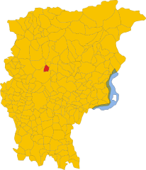
Bracca
- Italian comune
Bracca is a charming town located in the province of Bergamo in Lombardy, Italy. It's nestled in the foothills of the Central Alps and offers a variety of hiking opportunities for outdoor enthusiasts. Here are some highlights about hiking in and around Bracca:...
- Country:

- Postal Code: 24010
- Local Dialing Code: 0345
- Licence Plate Code: BG
- Coordinates: 45° 49' 0" N, 9° 43' 0" E


- GPS tracks (wikiloc): [Link]
- AboveSeaLevel: 400 м m
- Area: 5.47 sq km
- Population: 706
- Web site: [Link]


Branzi
- Italian comune
Branzi, a picturesque village located in the Italian Alps, is a fantastic destination for hiking enthusiasts. Situated in the Valle Brembana in Lombardy, it offers stunning landscapes, diverse trails, and a rich natural environment. Here are some highlights of hiking in Branzi:...
- Country:

- Postal Code: 24010
- Local Dialing Code: 0345
- Licence Plate Code: BG
- Coordinates: 46° 0' 0" N, 9° 46' 0" E


- GPS tracks (wikiloc): [Link]
- AboveSeaLevel: 874 м m
- Area: 26.19 sq km
- Population: 712
- Web site: [Link]


Brembate
- Italian comune
Brembate, located in the province of Bergamo, Italy, is surrounded by beautiful landscapes that offer a variety of hiking opportunities. The area combines natural beauty with historical sites, making it a great destination for both casual hikers and more serious outdoor enthusiasts....
- Country:

- Postal Code: 24041
- Local Dialing Code: 035
- Licence Plate Code: BG
- Coordinates: 45° 36' 0" N, 9° 33' 0" E


- GPS tracks (wikiloc): [Link]
- AboveSeaLevel: 173 м m
- Area: 5.54 sq km
- Population: 8551
- Web site: [Link]


Brembate di Sopra
- Italian comune
Brembate di Sopra, located in the Lombardy region of Italy, is a charming town that offers access to beautiful hiking trails and the surrounding natural landscape. Here are some key points about hiking in and around Brembate di Sopra:...
- Country:

- Postal Code: 24030
- Local Dialing Code: 035
- Licence Plate Code: BG
- Coordinates: 45° 43' 4" N, 9° 34' 50" E


- GPS tracks (wikiloc): [Link]
- AboveSeaLevel: 267 м m
- Area: 4.14 sq km
- Population: 7868
- Web site: [Link]
Shares border with regions:


province of Milan
- province in the Lombardy region, Italy
Hiking in the Province of Milan offers a delightful blend of natural beauty, cultural experiences, and historical landmarks. While Milan is primarily known for its urban landscape, its surrounding areas provide excellent hiking opportunities, especially in the nearby hills and mountains....
- Country:

- Capital: Milan
- Postal Code: 20010–20099; 20121–20162
- Local Dialing Code: 0371; 0363; 0331; 02
- Licence Plate Code: MI
- Coordinates: 45° 27' 51" N, 9° 11' 25" E


- GPS tracks (wikiloc): [Link]
- Area: 1575.65 sq km
- Web site: [Link]


Province of Brescia
- province of Italy
The Province of Brescia, located in the Lombardy region of northern Italy, offers a diverse landscape that is a hiker's paradise. Its mix of mountains, lakes, and valleys provides numerous trails suitable for hikers of all skill levels. Here are some highlights and tips for hiking in this picturesque province:...
- Country:

- Capital: Brescia
- Postal Code: 25010–25089; 25121–25136
- Local Dialing Code: 0365; 035; 0364; 030
- Licence Plate Code: BS
- Coordinates: 45° 32' 20" N, 10° 13' 10" E


- GPS tracks (wikiloc): [Link]
- Area: 4784.36 sq km
- Web site: [Link]


Province of Cremona
- province of Italy
The Province of Cremona, located in the Lombardy region of northern Italy, is not only known for its rich musical heritage and history but also offers various opportunities for outdoor activities, including hiking. While the province itself is relatively flat and agricultural, there are hiking options nearby, particularly in the surrounding areas and countryside....
- Country:

- Capital: Cremona
- Postal Code: 26010–26049; 26100
- Local Dialing Code: 0376; 0375; 0374; 0373; 0372; 0363
- Licence Plate Code: CR
- Coordinates: 45° 8' 0" N, 10° 2' 0" E


- GPS tracks (wikiloc): [Link]
- Area: 1770.57 sq km
- Web site: [Link]
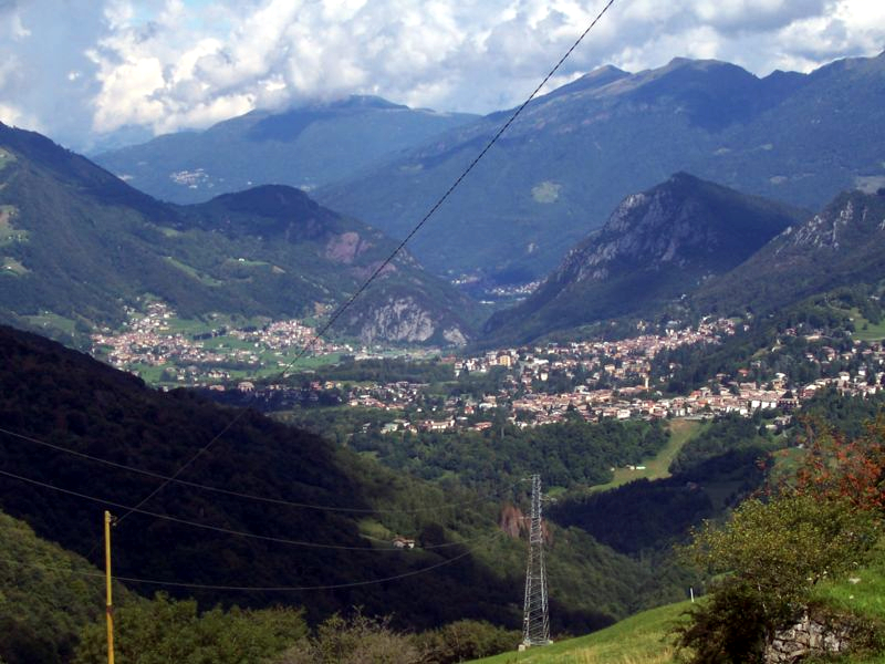

Province of Lecco
- province of Italy
The Province of Lecco, located in the Lombardy region of Italy, offers stunning landscapes and diverse hiking opportunities, making it a popular destination for outdoor enthusiasts. Here are some highlights and considerations for hiking in this beautiful region:...
- Country:

- Capital: Lecco
- Postal Code: 23801–23900
- Local Dialing Code: 039; 035; 0341; 031
- Licence Plate Code: LC
- Coordinates: 45° 51' 0" N, 9° 24' 0" E


- GPS tracks (wikiloc): [Link]
- Area: 816.17 sq km
- Web site: [Link]

Province of Monza and Brianza
- province of Italy
 Hiking in Province of Monza and Brianza
The Province of Monza and Brianza, located in the Lombardy region of Italy, offers a mix of urban and rural hiking opportunities. While largely known for its industrial areas and proximity to Milan, Monza and Brianza also feature beautiful landscapes ideal for hiking and outdoor activities....
- Country:

- Capital: Monza
- Postal Code: 20811–20886; 20900
- Local Dialing Code: 02; 0362; 039
- Licence Plate Code: MB
- Coordinates: 45° 35' 0" N, 9° 16' 0" E


- GPS tracks (wikiloc): [Link]
- Area: 405 sq km
- Web site: [Link]

Province of Sondrio
- province of Italy
The Province of Sondrio, located in northern Italy's Lombardy region, is a stunning destination for hiking enthusiasts. Known for its diverse landscapes, which include the impressive Alps, lush valleys, and picturesque villages, Sondrio offers a wide range of hiking trails suitable for all levels of experience....
- Country:

- Capital: Sondrio
- Postal Code: 23100, 23010-23038
- Licence Plate Code: SO
- Coordinates: 46° 21' 37" N, 9° 56' 38" E


- GPS tracks (wikiloc): [Link]
- Area: 3211.9 sq km
- Web site: [Link]
