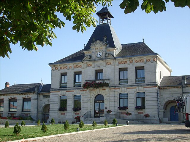
Brives-sur-Charente (Brives-sur-Charente)

- commune in Charente-Maritime, France
- Country:

- Postal Code: 17800
- Coordinates: 45° 40' 16" N, 0° 27' 39" E


- GPS tracks (wikiloc): [Link]
- Area: 5.94 sq km
- Population: 249
- Web site: http://www.mairie-brives-sur-charente.fr/pageLibre00010009.html
- Wikipedia en: wiki(en)
- Wikipedia: wiki(fr)
- Wikidata storage: Wikidata: Q1080744
- Wikipedia Commons Category: [Link]
- Freebase ID: [/m/03mcg9v]
- GeoNames ID: Alt: [3029969]
- SIREN number: [211700695]
- BnF ID: [15248931q]
- INSEE municipality code: 17069
Shares border with regions:

Chérac
- commune in Charente-Maritime, France
- Country:
- Postal Code: 17610
- Coordinates: 45° 42' 12" N, 0° 26' 15" E
- GPS tracks (wikiloc): [Link]
- AboveSeaLevel: 60 м m
- Area: 29.88 sq km
- Population: 1086
- Web site: [Link]

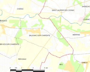
Salignac-sur-Charente
- commune in Charente-Maritime, France
- Country:
- Postal Code: 17800
- Coordinates: 45° 40' 20" N, 0° 25' 23" E
- GPS tracks (wikiloc): [Link]
- Area: 10.22 sq km
- Population: 611


Montils
- commune in Charente-Maritime, France
- Country:
- Postal Code: 17800
- Coordinates: 45° 38' 53" N, 0° 30' 12" E
- GPS tracks (wikiloc): [Link]
- Area: 23.64 sq km
- Population: 835
- Web site: [Link]


Pérignac
- commune in Charente-Maritime, France
- Country:
- Postal Code: 17800
- Coordinates: 45° 37' 25" N, 0° 27' 51" E
- GPS tracks (wikiloc): [Link]
- Area: 27.56 sq km
- Population: 1003
- Web site: [Link]