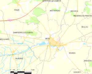
Brou (Brou)
- commune in Eure-et-Loir, France
- Country:

- Postal Code: 28160
- Coordinates: 48° 12' 37" N, 1° 10' 2" E


- GPS tracks (wikiloc): [Link]
- Area: 19.83 sq km
- Population: 3374
- Web site: http://www.brou28.com
- Wikipedia en: wiki(en)
- Wikipedia: wiki(fr)
- Wikidata storage: Wikidata: Q1081996
- Wikipedia Commons Category: [Link]
- Freebase ID: [/m/03nqsd6]
- GeoNames ID: Alt: [6455030]
- SIREN number: [212800619]
- BnF ID: [15253992x]
- VIAF ID: Alt: [248163603]
- Library of Congress authority ID: Alt: [no2012043035]
- INSEE municipality code: 28061
Shares border with regions:


Unverre
- commune in Eure-et-Loir, France
- Country:

- Postal Code: 28160
- Coordinates: 48° 11' 58" N, 1° 5' 36" E


- GPS tracks (wikiloc): [Link]
- Area: 62.33 sq km
- Population: 1223
- Web site: [Link]


Yèvres
- commune in Eure-et-Loir, France
- Country:

- Postal Code: 28160
- Coordinates: 48° 12' 37" N, 1° 11' 25" E


- GPS tracks (wikiloc): [Link]
- Area: 41.75 sq km
- Population: 1680
- Web site: [Link]
