Bulciago (Bulciago)
.svg)
- Italian comune
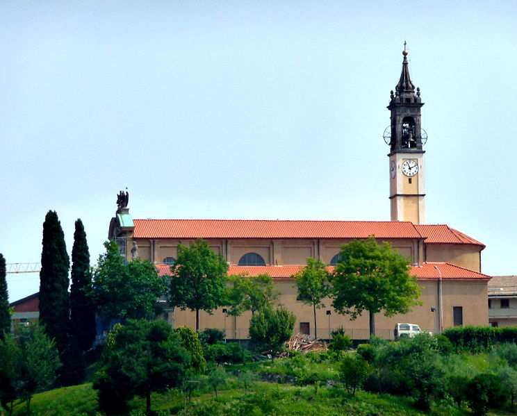
 Hiking in Bulciago
Bulciago is a small town in the Lombardy region of Italy, situated near the scenic Brianza area. This region is known for its beautiful landscapes, rolling hills, and lakes, making it a great destination for hiking enthusiasts. Here are some key points to consider if you're planning to hike in and around Bulciago:
Hiking Trails
-
Brianza Hiking Trails: The area around Bulciago offers several hiking trails that cater to different skill levels. You can enjoy trails that take you through lush forests, past lakes, and across charming villages.
-
Lake Pusiano: A short distance from Bulciago, Lake Pusiano is an excellent spot for hiking. You can find trails that circle the lake, providing beautiful views of the water and the surrounding hills.
-
Parco Regionale della Valle del Lambro: This regional park is nearby and offers numerous trails. It's a great place to explore nature, with paths that wind through woodlands, along the river, and up scenic viewpoints.
Flora and Fauna
The region is rich in biodiversity. As you hike, keep an eye out for various bird species, and enjoy the vibrant plant life. The hillsides are often filled with wildflowers, especially in the spring and early summer months.
Best Time to Hike
The best time for hiking in Bulciago is typically from late spring to early autumn (May to October). During these months, the weather is generally mild, making for comfortable hiking conditions. However, be sure to check local weather conditions before embarking on your hike.
Safety Tips
- Wear Appropriate Gear: Sturdy hiking shoes, weather-appropriate clothing, and a hat can make your experience more enjoyable.
- Stay Hydrated: Carry enough water, especially on warmer days.
- Map and Navigation: Having a map or GPS device can be helpful, as some trails may not be well marked.
- Respect Nature: Stick to marked trails, carry out what you bring in, and leave no trace.
Local Amenities
Bulciago offers basic amenities, and you might find small shops or cafes where you can refuel after a hike. If you’re looking for larger towns for more dining options or accommodations, nearby areas like Lecco or Como are worth exploring.
Conclusion
Hiking in Bulciago provides a unique opportunity to explore the natural beauty of Lombardy. With its varied trails and peaceful landscapes, it is ideal for both seasoned hikers and those looking for a more leisurely outdoor experience.
- Country:

- Postal Code: 23892
- Local Dialing Code: 031
- Licence Plate Code: LC
- Coordinates: 45° 45' 0" N, 9° 17' 0" E


- GPS tracks (wikiloc): [Link]
- AboveSeaLevel: 305 м m
- Area: 3.12 sq km
- Population: 2892
- Web site: http://www.comune.bulciago.lc.it
- Wikipedia en: wiki(en)
- Wikipedia: wiki(it)
- Wikidata storage: Wikidata: Q42276
- Wikipedia Commons Gallery: [Link]
- Wikipedia Commons Category: [Link]
- Freebase ID: [/m/0gr3cs]
- GeoNames ID: Alt: [6543327]
- VIAF ID: Alt: [239647027]
- OSM relation ID: [45978]
- GND ID: Alt: [4603929-6]
- UN/LOCODE: [ITZKJ]
- ISTAT ID: 097011
- Italian cadastre code: B261
Shares border with regions:
Costa Masnaga
- Italian comune
Hiking in Costa Masnaga
Costa Masnaga, located in the province of Lecco in Northern Italy, offers scenic hiking opportunities that showcase the beauty of the Lombardy region. Although it may not be as widely recognized as some other hiking destinations in Italy, it provides a peaceful setting for nature lovers and hiking enthusiasts....
- Country:
- Postal Code: 23845
- Local Dialing Code: 031
- Licence Plate Code: LC
- Coordinates: 45° 46' 0" N, 9° 17' 0" E
- GPS tracks (wikiloc): [Link]
- AboveSeaLevel: 318 м m
- Area: 5.62 sq km
- Population: 4839
- Web site: [Link]
Cremella
- Italian comune
Hiking in Cremella
Cremella, located in the Lombardy region of Italy, offers a picturesque setting for hiking enthusiasts. The area is characterized by its beautiful landscapes, rolling hills, and proximity to the Adda River. Here are some key points to consider if you're planning to hike in Cremella:...
- Country:
- Postal Code: 23894
- Local Dialing Code: 039
- Licence Plate Code: LC
- Coordinates: 45° 44' 0" N, 9° 18' 0" E
- GPS tracks (wikiloc): [Link]
- AboveSeaLevel: 383 м m
- Area: 1.89 sq km
- Population: 1724
- Web site: [Link]


Barzago
- Italian comune
Hiking in Barzago
Barzago, a charming town located in the province of Lecco in northern Italy, offers several hiking opportunities that allow enthusiasts to experience the beautiful landscapes of the Lombardy region. Here are some key points to consider when hiking in the Barzago area:...
- Country:
- Postal Code: 23890
- Local Dialing Code: 031
- Licence Plate Code: LC
- Coordinates: 45° 45' 0" N, 9° 19' 0" E
- GPS tracks (wikiloc): [Link]
- AboveSeaLevel: 358 м m
- Area: 3.56 sq km
- Population: 2408
- Web site: [Link]
Garbagnate Monastero
- Italian comune
Hiking in Garbagnate Monastero
Garbagnate Monastero, located in the Lombardy region of Italy, offers a range of beautiful hiking opportunities that showcase its stunning natural landscape, including hills, woods, and historical sites. Here are some key points to consider when hiking in this area:...
- Country:
- Postal Code: 23846
- Local Dialing Code: 031
- Licence Plate Code: LC
- Coordinates: 45° 46' 0" N, 9° 18' 0" E
- GPS tracks (wikiloc): [Link]
- AboveSeaLevel: 299 м m
- Area: 3.5 sq km
- Population: 2480
- Web site: [Link]
Cassago Brianza
- Italian comune
Hiking in Cassago Brianza
Cassago Brianza, located in the Lombardy region of Italy, offers a charming setting for hiking enthusiasts. Nestled between the scenic hills of Brianza and close to the lakes of Lecco and Como, the area is characterized by rolling landscapes, lush forests, and panoramic views. Here are some key points to consider for hiking in this region:...
- Country:
- Postal Code: 23893
- Local Dialing Code: 039
- Licence Plate Code: LC
- Coordinates: 45° 44' 0" N, 9° 17' 0" E
- GPS tracks (wikiloc): [Link]
- AboveSeaLevel: 334 м m
- Area: 3.55 sq km
- Population: 4371
- Web site: [Link]

Nibionno
- Italian comune
Hiking in Nibionno
Nibionno, a small municipality in the Lombardy region of Italy, offers unique opportunities for hiking enthusiasts. Nestled in the Brianza area, it’s surrounded by beautiful landscapes, including rolling hills, lush forests, and picturesque views of the Alps. Here are some important points to consider when hiking in and around Nibionno:...
- Country:
- Postal Code: 23895
- Local Dialing Code: 031
- Licence Plate Code: LC
- Coordinates: 45° 45' 0" N, 9° 15' 0" E
- GPS tracks (wikiloc): [Link]
- AboveSeaLevel: 306 м m
- Area: 3.51 sq km
- Population: 3696
- Web site: [Link]