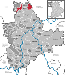
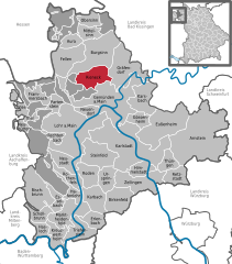
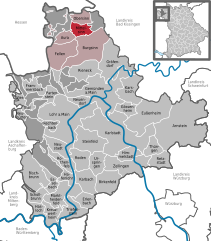
Burgsinn (Burgsinn)
- human settlement in Germany
Burgsinn, a lovely village located in Bavaria, Germany, offers a variety of hiking opportunities that showcase the region's natural beauty and charm. Here are some highlights for hikers interested in exploring this area:
Trails and Scenery
-
Scenic Routes: The area around Burgsinn features picturesque landscapes, including rolling hills, lush forests, and winding rivers. Hikers can enjoy panoramic views and a peaceful atmosphere.
-
Local Trails: There are various well-marked trails that cater to different hiking levels. You can find shorter loops ideal for family hikes as well as longer routes for more experienced hikers.
-
Nature Reserves: Hiking enthusiasts may explore nearby nature reserves, where they can enjoy diverse flora and fauna, as well as the chance to see local wildlife in their natural habitat.
Trail Conditions and Duration
- Trail Markings: Trails are generally well-marked with signs indicating distances and difficulty levels. It’s advisable to carry a local hiking map or download a hiking app for navigation.
- Duration: Depending on your chosen route, hikes can range from easy walks of about an hour to full-day treks.
Helpful Tips
- Weather: Always check the local weather conditions before heading out. Bavaria can have unpredictable weather, so wearing layers is recommended.
- Safety: As with any hike, ensure you have sturdy footwear, plenty of water, and some snacks. Inform someone about your hiking plan and expected return time.
Culture and History
After a day of hiking, you can explore the cultural aspects of Burgsinn, which may include local events or traditional Bavarian cuisine at nearby inns or restaurants.
Conclusion
Burgsinn is a delightful starting point for hiking adventures in Bavaria, offering a mix of natural beauty, tranquility, and local culture. Whether you're a seasoned hiker or a casual walker, there's something for everyone in this charming village and its surroundings.
- Country:

- Postal Code: 97775
- Local Dialing Code: 09356
- Licence Plate Code: MSP
- Coordinates: 50° 9' 0" N, 9° 39' 0" E


- GPS tracks (wikiloc): [Link]
- AboveSeaLevel: 190 м m
- Area: 51.38 sq km
- Population: 2626
- Web site: http://www.sinngrundallianz.de/seite/al/main-spessart/04/-/Burgsinn.html
- Wikipedia en: wiki(en)
- Wikipedia: wiki(de)
- Wikidata storage: Wikidata: Q503812
- Wikipedia Commons Gallery: [Link]
- Wikipedia Commons Category: [Link]
- Freebase ID: [/m/02q4hgy]
- GeoNames ID: Alt: [2941159]
- VIAF ID: Alt: [246596269]
- OSM relation ID: [349935]
- GND ID: Alt: [4215902-7]
- MusicBrainz area ID: [cfd84ee3-c2f3-473c-9087-77b588368cdd]
- WOEID: [642631]
- Bavarikon ID: [ODB_A00000426]
- German municipality key: 09677122
Shares border with regions:


Forst Aura
- unincorporated area in Germany
Forst Aura, located in the scenic region of Germany, offers a variety of hiking opportunities for outdoor enthusiasts. Nestled within lush greenery and diverse landscapes, this area is perfect for both beginners and experienced hikers....
- Country:

- Coordinates: 50° 11' 48" N, 9° 33' 31" E


- GPS tracks (wikiloc): [Link]
Herrnwald
- unincorporated area in Germany
Herrenwald is a forested area located in Germany, particularly noted for its beautiful landscapes and variety of trails. Hiking in Herrenwald offers a great opportunity to explore nature, enjoy scenic views, and witness diverse flora and fauna....
- Country:

- Coordinates: 50° 6' 52" N, 9° 34' 20" E


- GPS tracks (wikiloc): [Link]


Gräfendorf
- municipality of Germany
Gräfendorf, located in Bavaria, Germany, is an excellent spot for hiking enthusiasts. Nestled in the scenic landscapes of the region, it offers a mix of lush forests, rolling hills, and picturesque views of the countryside. Here are some highlights and tips for hiking in the Gräfendorf area:...
- Country:

- Postal Code: 97782
- Local Dialing Code: 09357
- Licence Plate Code: MSP
- Coordinates: 50° 7' 0" N, 9° 45' 0" E


- GPS tracks (wikiloc): [Link]
- AboveSeaLevel: 333 м m
- Area: 45.30 sq km
- Population: 1452
- Web site: [Link]


Rieneck
- human settlement in Germany
Rieneck is a charming town in Bavaria, Germany, surrounded by beautiful landscapes that offer fantastic hiking opportunities. The area features rolling hills, dense forests, and scenic views, making it an ideal destination for outdoor enthusiasts. Here are some highlights for hiking in and around Rieneck:...
- Country:

- Postal Code: 97794
- Local Dialing Code: 09354
- Licence Plate Code: MSP
- Coordinates: 50° 6' 0" N, 9° 38' 0" E


- GPS tracks (wikiloc): [Link]
- AboveSeaLevel: 182 м m
- Area: 26.20 sq km
- Population: 2096
- Web site: [Link]


Mittelsinn
- municipality of Germany
Mittelsinn is a quaint village located in the Lower Franconia region of Bavaria, Germany, and is surrounded by beautiful natural landscapes that are perfect for hiking. The area offers a variety of trails suitable for hikers of all levels, from gentle walks to more challenging hikes. Here are some key points to consider if you're planning to hike in Mittelsinn:...
- Country:

- Postal Code: 97785
- Local Dialing Code: 09356
- Licence Plate Code: MSP
- Coordinates: 50° 12' 0" N, 9° 37' 0" E


- GPS tracks (wikiloc): [Link]
- AboveSeaLevel: 208 м m
- Area: 14.32 sq km
- Population: 947
- Web site: [Link]


Wartmannsroth
- municipality of Germany
Wartmannsroth is a charming village located in the Bavaria region of Germany, surrounded by beautiful landscapes, forests, and hills. Hiking in this area can provide a wonderful experience for both novice and experienced hikers. Here are some key points to consider when hiking in Wartmannsroth:...
- Country:

- Postal Code: 97797
- Local Dialing Code: 09737
- Licence Plate Code: KG
- Coordinates: 50° 10' 0" N, 9° 47' 0" E


- GPS tracks (wikiloc): [Link]
- AboveSeaLevel: 340 м m
- Area: 53.45 sq km
- Population: 2383
- Web site: [Link]


Fellen
- municipality of Germany
Fellen is a small village located in the picturesque region of the Swiss Alps, and it offers various hiking opportunities for outdoor enthusiasts. The area is known for its stunning landscapes, alpine meadows, and panoramic views of the surrounding mountains. Here’s an overview of what you can expect when hiking in Fellen:...
- Country:

- Postal Code: 97778
- Local Dialing Code: 09356
- Licence Plate Code: MSP
- Coordinates: 50° 9' 0" N, 9° 35' 0" E


- GPS tracks (wikiloc): [Link]
- AboveSeaLevel: 236 м m
- Area: 34.33 sq km
- Population: 972
- Web site: [Link]


Aura im Sinngrund
- municipality of Germany
Aura im Sinngrund, located in Bavaria, Germany, offers a charming hiking experience characterized by its picturesque landscapes, rolling hills, and serene natural beauty. The region is part of the larger Spessart forest area, which is known for its dense woodlands, diverse flora and fauna, and well-marked hiking trails....
- Country:

- Postal Code: 97773
- Local Dialing Code: 0 93 56
- Licence Plate Code: MSP
- Coordinates: 50° 10' 0" N, 9° 34' 0" E


- GPS tracks (wikiloc): [Link]
- AboveSeaLevel: 282 м m
- Area: 12.07 sq km
- Population: 1134
- Web site: [Link]

