Main-Spessart (Landkreis Main-Spessart)

- district in Bavaria, Germany
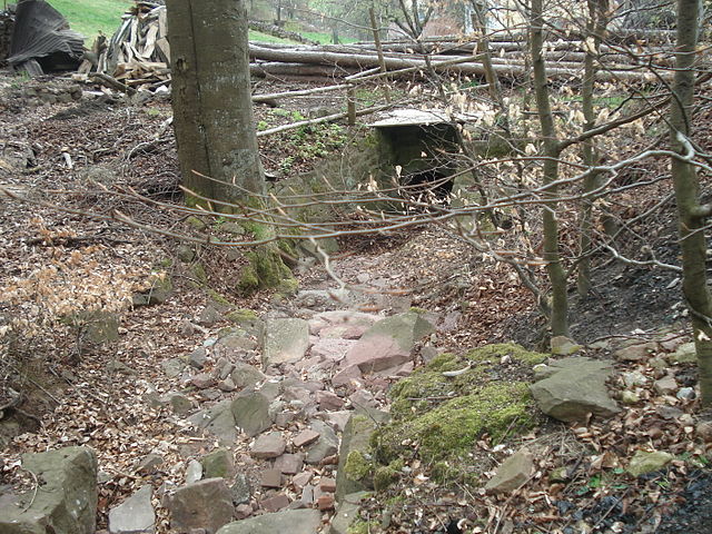
 Hiking in Main-Spessart
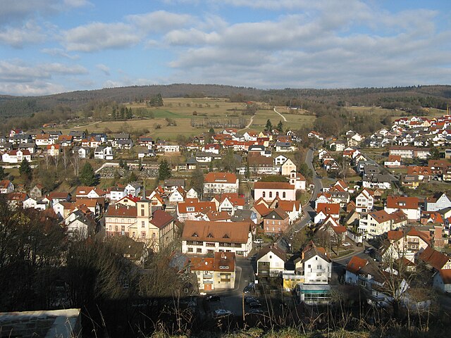
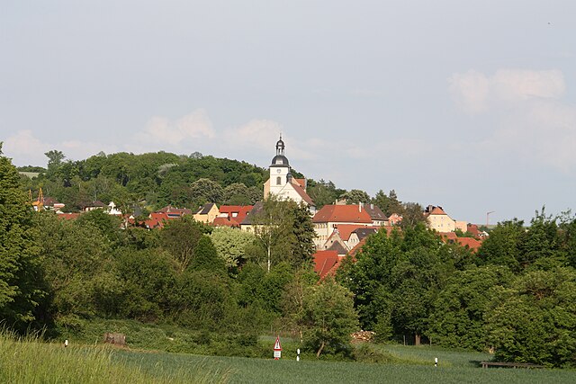
Main-Spessart is a beautiful region located in Bavaria, Germany, known for its scenic landscapes, charming villages, and rich cultural heritage. It's a fantastic destination for hiking enthusiasts, offering a variety of trails that cater to different skill levels. Here’s what you can expect when hiking in Main-Spessart:
Hiking Trails
-
The Main-Spessart Trail (Main-Spessart-Weg): This trail is about 150 kilometers long and stretches from Wertheim to Lohr am Main. It’s marked with the blue and yellow sign and offers diverse landscapes including vineyards, forests, and river views.
-
Spessart Nature Park: The park features numerous trails, with the Saalfelder Höhe and Burgweg options being particularly popular. Hiking here lets you experience the region's dense beech forests, wildlife, and natural springs.
-
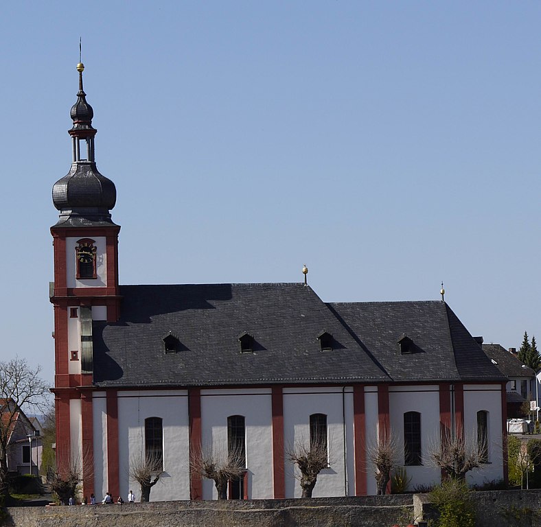
Shorter Hiking Options: If you prefer a shorter trek, you can find many circular trails around picturesque villages like Rothenfels, and Zellingen, which range from easy to moderate.
Scenic Views
Hiking in Main-Spessart presents stunning views, especially when following trails that lead to hilltops or along the Main River. Look out for panoramic vantage points like the Hohe Wart or Trockener Stein, which offer spectacular sights of the surrounding countryside.
Wildlife and Nature
The region is home to a rich variety of flora and fauna. As you hike, you might spot deer, boars, and numerous bird species. The diverse habitats, coupled with the area's dedication to conservation, make Main-Spessart a haven for nature lovers.
Cultural Landmarks
As you hike through the area, you’ll encounter charming villages and historical sites, including:
- Ruins of medieval castles (e.g., Burg Rieneck)
- Traditional Franconian wine towns
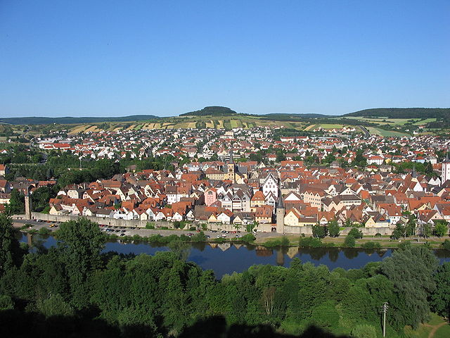
- Historical towns like Wertheim and Lohr, where you can explore local culture and gastronomy.
Hiking Tips
- Season: Spring and autumn are the best times to hike, with pleasant weather and beautiful foliage. Summer can be hot, while winters may have snow, making trails more challenging.
- Equipment: Wear sturdy hiking shoes, and carry water, snacks, and a map or GPS device. Many trails are well-marked, but it’s beneficial to have a backup.
- Weather: Be mindful of the weather forecast, as conditions can change quickly in the forested areas.
- Respect Nature: Follow local guidelines to protect the environment and enjoy the beauty of the surroundings.
Overall, Main-Spessart offers a wonderful hiking experience with a mix of natural beauty, charming locales, and cultural richness, making it a great destination for both seasoned hikers and newcomers alike.
- Country:

- Capital: Karlstadt am Main
- Licence Plate Code: MSP
- Coordinates: 49° 55' 12" N, 9° 45' 0" E


- GPS tracks (wikiloc): [Link]
- AboveSeaLevel: 313 м m
- Area: 1321.4186 sq km
- Population: 125915
- Web site: http://www.mainspessart.de
- Wikipedia en: wiki(en)
- Wikipedia: wiki(de)
- Wikidata storage: Wikidata: Q10469
- Wikipedia Commons Category: [Link]
- Freebase ID: [/m/021bsj]
- GeoNames ID: Alt: [3220893]
- VIAF ID: Alt: [173712968]
- OSM relation ID: [62641]
- GND ID: Alt: [4037120-7]
- archINFORM location ID: [4098]
- Library of Congress authority ID: Alt: [n81090725]
- TGN ID: [7077078]
- Bavarikon ID: [ODB_A00000421]
- NUTS code: [DE26A]
- BabelNet ID: [03093977n]
- German district key: 09677
Includes regions:

Forst Aura
- unincorporated area in Germany
Hiking in Forst Aura
Forst Aura, located in the scenic region of Germany, offers a variety of hiking opportunities for outdoor enthusiasts. Nestled within lush greenery and diverse landscapes, this area is perfect for both beginners and experienced hikers....
- Country:
- Coordinates: 50° 11' 48" N, 9° 33' 31" E
- GPS tracks (wikiloc): [Link]
Forst Lohrerstraße
- unincorporated area in Germany
Hiking in Forst Lohrerstraße
Forst Lohrerstraße is located in the beautiful region of Bavaria, Germany. While it may not be as widely known as some of the larger national parks or hiking regions, it offers a scenic environment for outdoor enthusiasts. Here are some highlights and tips for hiking in and around Forst Lohrerstraße:...
- Country:
- Coordinates: 49° 58' 17" N, 9° 29' 4" E
- GPS tracks (wikiloc): [Link]
Frammersbacher Forst
- unincorporated area in Germany
Hiking in Frammersbacher Forst
Frammersbacher Forst is a beautiful forest located in Bavaria, Germany, offering a range of hiking opportunities suitable for all skill levels. Here are some highlights and tips for hiking in this area:...
- Country:
- Coordinates: 50° 4' 50" N, 9° 29' 18" E
- GPS tracks (wikiloc): [Link]

Fürstlich Löwensteinscher Park
- unincorporated area in Germany
Hiking in Fürstlich Löwensteinscher Park
Fürstlich Löwensteinscher Park, located near the town of Weikersheim in Germany, is a beautiful park that offers a serene environment for hiking and outdoor activities. The park is known for its picturesque landscapes, well-maintained paths, and historical significance....
- Country:
- Coordinates: 49° 54' 15" N, 9° 29' 49" E
- GPS tracks (wikiloc): [Link]
Burgjoß
- unincorporated area in Germany
Hiking in Burgjoß
Burgjoß is a small, gemeindefreies Gebiet in the district of Main-Spessart in Bavaria, Germany. While it may not be as widely recognized as some other hiking destinations, it offers beautiful natural landscapes and opportunities for outdoor activities, particularly hiking....
- Country:
- Coordinates: 50° 13' 15" N, 9° 31' 12" E
- GPS tracks (wikiloc): [Link]

Rothenberg
- former unincorporated area in Germany
Hiking in Rothenberg
Rothenberg, located in Bavaria, Germany, is known for its stunning natural landscapes, dense forests, and diverse wildlife, making it an excellent destination for hiking enthusiasts. When planning a hike in this gemeindefreies Gebiet (non-municipal area), here are some key points to consider:...
- Country:
- Coordinates: 49° 58' 58" N, 9° 31' 43" E
- GPS tracks (wikiloc): [Link]
- AboveSeaLevel: 456 м m

Partensteiner Forst
- unincorporated area in Germany
Hiking in Partensteiner Forst
Partensteiner Forst, located in Bavaria, Germany, is a beautiful area for hiking, characterized by its dense forests, picturesque landscapes, and a variety of trails suitable for different skill levels. Here are some details to help you plan your hiking experience in this region:...
- Country:
- Coordinates: 50° 1' 8" N, 9° 28' 26" E
- GPS tracks (wikiloc): [Link]
Haurain
- unincorporated area in Germany
Hiking in Haurain
Haurain does not appear to be a widely recognized hiking destination as of my last training cut-off in October 2023. It’s possible that you might be referring to a specific location or a misspelling of a more well-known area. However, if you meant a different place or a mountain range, I would be more than happy to provide information about hiking in that region....
- Country:
- Coordinates: 50° 5' 34" N, 9° 29' 13" E
- GPS tracks (wikiloc): [Link]
- AboveSeaLevel: 465 м m
Herrnwald
- unincorporated area in Germany
Hiking in Herrnwald
Herrenwald is a forested area located in Germany, particularly noted for its beautiful landscapes and variety of trails. Hiking in Herrenwald offers a great opportunity to explore nature, enjoy scenic views, and witness diverse flora and fauna....
- Country:
- Coordinates: 50° 6' 52" N, 9° 34' 20" E
- GPS tracks (wikiloc): [Link]
Langenprozeltener Forst
- unincorporated area in Germany
Hiking in Langenprozeltener Forst
Langenprozeltener Forst is a beautiful forested area located in the southern part of Germany, near the town of Langenprozelten. This region is popular among hikers for its serene landscapes, diverse flora and fauna, and well-maintained trails. Here are some key points to consider if you're planning to hike in Langenprozeltener Forst:...
- Country:
- Coordinates: 50° 4' 0" N, 9° 37' 40" E
- GPS tracks (wikiloc): [Link]
Zellingen
- market municipality in Bavaria, Germany
Hiking in Zellingen
Zellingen, a charming municipality located in Bavaria, Germany, is an ideal location for hiking enthusiasts. It's situated near the Main River, which provides a beautiful backdrop for outdoor activities. Here are some highlights and tips for hiking in and around Zellingen:...
- Country:
- Postal Code: 97225
- Local Dialing Code: 09396; 09364
- Licence Plate Code: MSP
- Coordinates: 49° 54' 0" N, 9° 49' 0" E
- GPS tracks (wikiloc): [Link]
- AboveSeaLevel: 170 м m
- Area: 41.45 sq km
- Population: 5651
- Web site: [Link]
Ruppertshüttener Forst
- unincorporated area in Germany
Hiking in Ruppertshüttener Forst
Ruppertshüttener Forst, located in Germany, is a beautiful area for hiking enthusiasts. The forest is part of a larger network of natural landscapes, providing a range of trails suited for different skill levels, from leisurely walks to more challenging hikes....
- Country:
- Coordinates: 50° 5' 15" N, 9° 33' 49" E
- GPS tracks (wikiloc): [Link]

Kreuzwertheim
- market municipality in Bavaria, Germany
Hiking in Kreuzwertheim
Kreuzwertheim is a picturesque town located at the confluence of the Main and Tauber rivers in Bavaria, Germany. The surrounding area offers various hiking opportunities, showcasing beautiful landscapes, vineyards, and charming villages....
- Country:
- Postal Code: 97892
- Local Dialing Code: 09342
- Licence Plate Code: MSP
- Coordinates: 49° 46' 0" N, 9° 31' 0" E
- GPS tracks (wikiloc): [Link]
- AboveSeaLevel: 144 м m
- Area: 19.98 sq km
- Population: 3813
- Web site: [Link]
Partenstein
- municipality of Germany
Hiking in Partenstein
Partenstein is a charming village located in Bavaria, Germany, and it offers some beautiful hiking opportunities for outdoor enthusiasts. Nestled in a picturesque landscape with rolling hills, forests, and streams, the area is perfect for both leisurely walks and more challenging hikes....
- Country:
- Postal Code: 97846
- Local Dialing Code: 09355
- Licence Plate Code: MSP
- Coordinates: 50° 3' 0" N, 9° 31' 0" E
- GPS tracks (wikiloc): [Link]
- AboveSeaLevel: 194 м m
- Area: 10.47 sq km
- Population: 2883
- Web site: [Link]

Frammersbach
- market municipality in Bavaria, Germany
Hiking in Frammersbach
Frammersbach is a picturesque village located in the Bavarian region of Germany, known for its stunning natural landscapes and a variety of hiking trails. Situated near the Spessart mountain range, Frammersbach offers outdoor enthusiasts a perfect blend of scenic beauty, cultural experiences, and opportunities for adventure....
- Country:
- Postal Code: 97833
- Local Dialing Code: 09355; 06020
- Licence Plate Code: MSP
- Coordinates: 50° 4' 0" N, 9° 28' 0" E
- GPS tracks (wikiloc): [Link]
- AboveSeaLevel: 246 м m
- Area: 19.19 sq km
- Population: 4511
- Web site: [Link]

Burgsinn
- human settlement in Germany
Hiking in Burgsinn
Burgsinn, a lovely village located in Bavaria, Germany, offers a variety of hiking opportunities that showcase the region's natural beauty and charm. Here are some highlights for hikers interested in exploring this area:...
- Country:
- Postal Code: 97775
- Local Dialing Code: 09356
- Licence Plate Code: MSP
- Coordinates: 50° 9' 0" N, 9° 39' 0" E
- GPS tracks (wikiloc): [Link]
- AboveSeaLevel: 190 м m
- Area: 51.38 sq km
- Population: 2626
- Web site: [Link]

Eußenheim
- municipality of Germany
Hiking in Eußenheim
Eußenheim is a charming village located in Bavaria, Germany, surrounded by picturesque landscapes and the beautiful scenery typical of the region. While it's not as widely recognized as some of Germany's major hiking destinations, it serves as a great starting point for exploring the stunning natural environments nearby....
- Country:
- Postal Code: 97776
- Local Dialing Code: 09350
- Licence Plate Code: MSP
- Coordinates: 49° 59' 0" N, 9° 49' 0" E
- GPS tracks (wikiloc): [Link]
- AboveSeaLevel: 178 м m
- Area: 56.84 sq km
- Population: 3191
- Web site: [Link]

Esselbach
- municipality of Germany
Hiking in Esselbach
Esselbach is a charming area in Bavaria, Germany, that offers a variety of hiking opportunities amidst picturesque landscapes of lush forests, rolling hills, and the beautiful Esselbach River. Here are some highlights and tips for hiking in the Esselbach region:...
- Country:
- Postal Code: 97839
- Local Dialing Code: 09394
- Licence Plate Code: MSP
- Coordinates: 49° 51' 19" N, 9° 31' 33" E
- GPS tracks (wikiloc): [Link]
- AboveSeaLevel: 308 м m
- Area: 10.33 sq km
- Population: 1747
- Web site: [Link]

Bischbrunn
- municipality of Germany
Hiking in Bischbrunn
Bischbrunn is a small village located in Bavaria, Germany, known for its picturesque landscapes and access to scenic hiking trails. Nestled near the Spessart Forest, it offers a variety of hiking opportunities suitable for different skill levels, from leisurely walks to more challenging treks....
- Country:
- Postal Code: 97836
- Local Dialing Code: 09394
- Licence Plate Code: MSP
- Coordinates: 49° 52' 13" N, 9° 29' 21" E
- GPS tracks (wikiloc): [Link]
- AboveSeaLevel: 395 м m
- Area: 36.18 sq km
- Population: 1723
- Web site: [Link]
Arnstein
- municipality in Bavaria, Germany
Hiking in Arnstein
Arnstein is a beautiful area for hiking, set amidst picturesque natural landscapes. It is located in Bavaria, Germany, and is characterized by its charming villages, serene countryside, and rolling hills. Here are some highlights and tips for hiking in Arnstein:...
- Country:
- Postal Code: 97450
- Local Dialing Code: 09363
- Licence Plate Code: MSP
- Coordinates: 49° 58' 0" N, 9° 59' 0" E
- GPS tracks (wikiloc): [Link]
- AboveSeaLevel: 228 м m
- Area: 112.12 sq km
- Population: 7640
- Web site: [Link]

Lohr am Main
- town in Bavaria, Germany
Hiking in Lohr am Main
Lohr am Main, located in Bavaria, Germany, is a picturesque town that offers beautiful hiking opportunities amid stunning landscapes. The area surrounding Lohr is characterized by its scenic views of the Main River, lush forests, and rolling hills. Here are some highlights for hiking in and around Lohr am Main:...
- Country:
- Postal Code: 97816
- Local Dialing Code: 09352
- Licence Plate Code: MSP
- Coordinates: 49° 59' 37" N, 9° 34' 42" E
- GPS tracks (wikiloc): [Link]
- AboveSeaLevel: 167 м m
- Area: 90.44 sq km
- Population: 15719
- Web site: [Link]

Gräfendorf
- municipality of Germany
Hiking in Gräfendorf
Gräfendorf, located in Bavaria, Germany, is an excellent spot for hiking enthusiasts. Nestled in the scenic landscapes of the region, it offers a mix of lush forests, rolling hills, and picturesque views of the countryside. Here are some highlights and tips for hiking in the Gräfendorf area:...
- Country:
- Postal Code: 97782
- Local Dialing Code: 09357
- Licence Plate Code: MSP
- Coordinates: 50° 7' 0" N, 9° 45' 0" E
- GPS tracks (wikiloc): [Link]
- AboveSeaLevel: 333 м m
- Area: 45.30 sq km
- Population: 1452
- Web site: [Link]

Gemünden am Main
- municipality in Germany
Hiking in Gemünden am Main
Gemünden am Main, located in Bavaria, Germany, is surrounded by scenic landscapes, making it a great destination for hiking enthusiasts. Here are some highlights and tips about hiking in this area:...
- Country:
- Postal Code: 97737
- Local Dialing Code: 09351
- Coordinates: 50° 2' 59" N, 9° 42' 20" E
- GPS tracks (wikiloc): [Link]
- AboveSeaLevel: 160 м m
- Area: 75.09 sq km
- Population: 10050
- Web site: [Link]

Marktheidenfeld
- human settlement in Germany
Hiking in Marktheidenfeld
Marktheidenfeld is a charming town in Bavaria, Germany, located along the banks of the Main River. The surrounding area offers some beautiful hiking opportunities, particularly due to its picturesque landscapes and scenic routes. Here’s a brief overview of what you can expect when hiking in and around Marktheidenfeld:...
- Country:
- Postal Code: 97828
- Local Dialing Code: 0 93 91
- Coordinates: 49° 51' 0" N, 9° 36' 0" E
- GPS tracks (wikiloc): [Link]
- AboveSeaLevel: 162 м m
- Area: 37.54 sq km
- Population: 10901
- Web site: [Link]

Rieneck
- human settlement in Germany
Hiking in Rieneck
Rieneck is a charming town in Bavaria, Germany, surrounded by beautiful landscapes that offer fantastic hiking opportunities. The area features rolling hills, dense forests, and scenic views, making it an ideal destination for outdoor enthusiasts. Here are some highlights for hiking in and around Rieneck:...
- Country:
- Postal Code: 97794
- Local Dialing Code: 09354
- Licence Plate Code: MSP
- Coordinates: 50° 6' 0" N, 9° 38' 0" E
- GPS tracks (wikiloc): [Link]
- AboveSeaLevel: 182 м m
- Area: 26.20 sq km
- Population: 2096
- Web site: [Link]
Karlstadt am Main
- human settlement in Germany
Hiking in Karlstadt am Main
Karlstadt am Main, located in Bavaria, Germany, is a charming town that offers various hiking opportunities in picturesque landscapes, including nearby forests, rivers, and hills. Here are some details about hiking in and around Karlstadt am Main:...
- Country:
- Postal Code: 97753
- Local Dialing Code: 09359; 09353
- Coordinates: 49° 57' 37" N, 9° 46' 20" E
- GPS tracks (wikiloc): [Link]
- AboveSeaLevel: 163 м m
- Area: 98.11 sq km
- Population: 14885
- Web site: [Link]

Erlenbach bei Marktheidenfeld
- municipality of Germany
Hiking in Erlenbach bei Marktheidenfeld
Erlenbach bei Marktheidenfeld is a picturesque area located in the Franconia region of Bavaria, Germany. The serene landscape, with its rolling hills, dense forests, and riverside trails, offers a variety of hiking opportunities for all skill levels....
- Country:
- Postal Code: 97837
- Local Dialing Code: 09391
- Licence Plate Code: MSP
- Coordinates: 49° 49' 0" N, 9° 38' 0" E
- GPS tracks (wikiloc): [Link]
- AboveSeaLevel: 208 м m
- Area: 15.33 sq km
- Population: 2074
- Web site: [Link]

Himmelstadt
- municipality of Germany
Hiking in Himmelstadt
Himmelstadt, located in Germany, is a charming yet lesser-known destination for hiking enthusiasts. Its picturesque landscapes, rolling hills, and lush forests provide a serene backdrop for outdoor activities. Here are some highlights of hiking in Himmelstadt:...
- Country:
- Postal Code: 97267
- Local Dialing Code: 09364
- Licence Plate Code: MSP
- Coordinates: 49° 55' 0" N, 9° 48' 0" E
- GPS tracks (wikiloc): [Link]
- AboveSeaLevel: 165 м m
- Area: 13.42 sq km
- Population: 1558
- Web site: [Link]

Gössenheim
- municipality of Germany
Hiking in Gössenheim
Gössenheim is a charming village located in Bavaria, Germany, nestled near the beautiful Main River valley. Hiking in and around Gössenheim offers opportunities to explore picturesque landscapes, vineyards, and charming villages. Here are some highlights and tips for hiking in this area:...
- Country:
- Postal Code: 97780
- Local Dialing Code: 09358
- Licence Plate Code: MSP
- Coordinates: 50° 1' 9" N, 9° 46' 58" E
- GPS tracks (wikiloc): [Link]
- AboveSeaLevel: 172 м m
- Area: 11.50 sq km
- Population: 1167
- Web site: [Link]

Mittelsinn
- municipality of Germany
Hiking in Mittelsinn
Mittelsinn is a quaint village located in the Lower Franconia region of Bavaria, Germany, and is surrounded by beautiful natural landscapes that are perfect for hiking. The area offers a variety of trails suitable for hikers of all levels, from gentle walks to more challenging hikes. Here are some key points to consider if you're planning to hike in Mittelsinn:...
- Country:
- Postal Code: 97785
- Local Dialing Code: 09356
- Licence Plate Code: MSP
- Coordinates: 50° 12' 0" N, 9° 37' 0" E
- GPS tracks (wikiloc): [Link]
- AboveSeaLevel: 208 м m
- Area: 14.32 sq km
- Population: 947
- Web site: [Link]

Hafenlohr
- municipality of Germany
Hiking in Hafenlohr
Hafenlohr, located in the Bavarian region of Germany, offers some beautiful hiking opportunities that showcase the natural beauty and scenic landscapes of the area. Here are some key points to consider when planning a hike in Hafenlohr:...
- Country:
- Postal Code: 97840
- Local Dialing Code: 09391
- Licence Plate Code: MSP
- Coordinates: 49° 52' 0" N, 9° 36' 0" E
- GPS tracks (wikiloc): [Link]
- AboveSeaLevel: 170 м m
- Area: 11.33 sq km
- Population: 1867
- Web site: [Link]

Birkenfeld
- municipality of Germany, Main-Spessart area
Hiking in Birkenfeld
Birkenfeld, located in Bavaria, Germany, is a charming town surrounded by beautiful landscapes, ideal for hiking enthusiasts. The region offers a variety of trails that cater to different skill levels, making it accessible for both novice and experienced hikers. Here are some highlights and tips for hiking in the area:...
- Country:
- Postal Code: 97834
- Local Dialing Code: 09398
- Licence Plate Code: MSP
- Coordinates: 49° 52' 0" N, 9° 42' 0" E
- GPS tracks (wikiloc): [Link]
- AboveSeaLevel: 210 м m
- Area: 29.15 sq km
- Population: 2151
- Web site: [Link]

Neustadt am Main
- municipality of Germany
Hiking in Neustadt am Main
Neustadt am Main, nestled in Bavaria, Germany, offers a variety of scenic hiking opportunities for outdoor enthusiasts. The region is characterized by its charming landscapes, rolling hills, and proximity to the Main River, making it an attractive destination for both leisurely strolls and more challenging hikes....
- Country:
- Postal Code: 97845
- Local Dialing Code: 09393
- Licence Plate Code: MSP
- Coordinates: 49° 55' 51" N, 9° 34' 3" E
- GPS tracks (wikiloc): [Link]
- AboveSeaLevel: 150 м m
- Area: 19.81 sq km
- Population: 1301
- Web site: [Link]

Urspringen
- municipality of Germany
Hiking in Urspringen
Urspringen is a small village located in Bavaria, Germany, known for its picturesque landscapes and the surrounding natural beauty, which makes it an attractive destination for hiking. Here are some key points about hiking in and around Urspringen:...
- Country:
- Postal Code: 97857
- Local Dialing Code: 09396
- Licence Plate Code: MSP
- Coordinates: 49° 54' 0" N, 9° 40' 0" E
- GPS tracks (wikiloc): [Link]
- AboveSeaLevel: 258 м m
- Area: 17.99 sq km
- Population: 1160
- Web site: [Link]

Triefenstein
- market municipality in Bavaria, Germany
Hiking in Triefenstein
Triefenstein, a quaint village located in the district of Main-Spessart in Bavaria, Germany, is surrounded by beautiful natural landscapes that make it an excellent spot for hiking enthusiasts. The region offers a variety of trails suitable for different skill levels, from leisurely walks to more challenging hikes....
- Country:
- Postal Code: 97855
- Local Dialing Code: 09395
- Licence Plate Code: MSP
- Coordinates: 49° 48' 0" N, 9° 36' 0" E
- GPS tracks (wikiloc): [Link]
- AboveSeaLevel: 180 м m
- Area: 25.47 sq km
- Population: 4332
- Web site: [Link]
Rechtenbach
- municipality of Germany
Hiking in Rechtenbach
Rechtenbach is a charming area that offers various hiking opportunities, especially for those who enjoy nature and picturesque landscapes. While it might not be as widely known as some larger hiking destinations, its natural beauty is certainly worth exploring....
- Country:
- Postal Code: 97848
- Local Dialing Code: 09352
- Licence Plate Code: MSP
- Coordinates: 49° 59' 0" N, 9° 30' 0" E
- GPS tracks (wikiloc): [Link]
- AboveSeaLevel: 345 м m
- Area: 2.09 sq km
- Population: 1107
- Web site: [Link]

Neuhütten
- municipality of Germany
Hiking in Neuhütten
Neuhütten, located in Germany, offers a variety of hiking opportunities for outdoor enthusiasts. Nestled in the picturesque Spessart forest region, it features dense woods, rolling hills, and beautiful landscapes. Here are some highlights and tips for hiking in Neuhütten:...
- Country:
- Postal Code: 97843
- Local Dialing Code: 06020
- Licence Plate Code: MSP
- Coordinates: 50° 0' 0" N, 9° 25' 0" E
- GPS tracks (wikiloc): [Link]
- AboveSeaLevel: 270 м m
- Area: 5.95 sq km
- Population: 1092
- Web site: [Link]

Retzstadt
- municipality of Germany
Hiking in Retzstadt
Retzstadt, a small picturesque village located in Bavaria, Germany, is a charming destination for hiking enthusiasts. It serves as a gateway to the surrounding natural beauty of the region, which is characterized by rolling hills, vineyards, and scenic landscapes....
- Country:
- Postal Code: 97282
- Local Dialing Code: 09364
- Licence Plate Code: MSP
- Coordinates: 49° 55' 0" N, 9° 53' 0" E
- GPS tracks (wikiloc): [Link]
- AboveSeaLevel: 240 м m
- Area: 18.07 sq km
- Population: 1520
- Web site: [Link]

Schollbrunn
- municipality of Germany
Hiking in Schollbrunn
Schollbrunn is a small municipality located in Bavaria, Germany, known for its beautiful natural scenery and outdoor recreational opportunities. Hiking in and around Schollbrunn offers a chance to explore picturesque landscapes, wooded areas, and the tranquil atmosphere of the Bavarian countryside....
- Country:
- Postal Code: 97852
- Local Dialing Code: 09394
- Licence Plate Code: MSP
- Coordinates: 49° 50' 0" N, 9° 28' 0" E
- GPS tracks (wikiloc): [Link]
- AboveSeaLevel: 412 м m
- Area: 11.23 sq km
- Population: 936
- Web site: [Link]

Obersinn
- market municipality in Bavaria, Germany
Hiking in Obersinn
Obersinn, located in the Bavarian region of Germany, is a charming area that offers various hiking opportunities for both novice and experienced hikers. The region is characterized by its picturesque landscapes, dense forests, rolling hills, and scenic views....
- Country:
- Postal Code: 97791
- Local Dialing Code: 09356
- Licence Plate Code: MSP
- Coordinates: 50° 13' 0" N, 9° 37' 0" E
- GPS tracks (wikiloc): [Link]
- AboveSeaLevel: 200 м m
- Area: 11.69 sq km
- Population: 1221
- Web site: [Link]

Fellen
- municipality of Germany
Hiking in Fellen
Fellen is a small village located in the picturesque region of the Swiss Alps, and it offers various hiking opportunities for outdoor enthusiasts. The area is known for its stunning landscapes, alpine meadows, and panoramic views of the surrounding mountains. Here’s an overview of what you can expect when hiking in Fellen:...
- Country:
- Postal Code: 97778
- Local Dialing Code: 09356
- Licence Plate Code: MSP
- Coordinates: 50° 9' 0" N, 9° 35' 0" E
- GPS tracks (wikiloc): [Link]
- AboveSeaLevel: 236 м m
- Area: 34.33 sq km
- Population: 972
- Web site: [Link]

Aura im Sinngrund
- municipality of Germany
Hiking in Aura im Sinngrund
Aura im Sinngrund, located in Bavaria, Germany, offers a charming hiking experience characterized by its picturesque landscapes, rolling hills, and serene natural beauty. The region is part of the larger Spessart forest area, which is known for its dense woodlands, diverse flora and fauna, and well-marked hiking trails....
- Country:
- Postal Code: 97773
- Local Dialing Code: 0 93 56
- Licence Plate Code: MSP
- Coordinates: 50° 10' 0" N, 9° 34' 0" E
- GPS tracks (wikiloc): [Link]
- AboveSeaLevel: 282 м m
- Area: 12.07 sq km
- Population: 1134
- Web site: [Link]

Thüngen
- market municipality in Bavaria, Germany
Hiking in Thüngen
Thüngen is a small village located in Bavaria, Germany, known for its picturesque landscapes and proximity to natural areas suitable for hiking. While specific trails in Thüngen may not be widely publicized, the region surrounding it offers a variety of hiking opportunities that cater to different skill levels....
- Country:
- Postal Code: 97289
- Local Dialing Code: 09360
- Licence Plate Code: MSP
- Coordinates: 49° 56' 32" N, 9° 51' 34" E
- GPS tracks (wikiloc): [Link]
- AboveSeaLevel: 199 м m
- Area: 13.61 sq km
- Population: 1341
- Web site: [Link]
Wiesthal
- municipality of Germany
Hiking in Wiesthal
Wiesthal, located in Bavaria, Germany, is a picturesque area that offers various hiking opportunities amidst stunning landscapes. The region is part of the larger Bavarian Forest, characterized by dense forests, rolling hills, and panoramic views....
- Country:
- Postal Code: 97859
- Local Dialing Code: 06020
- Licence Plate Code: MSP
- Coordinates: 50° 2' 0" N, 9° 26' 0" E
- GPS tracks (wikiloc): [Link]
- AboveSeaLevel: 250 м m
- Area: 9.18 sq km
- Population: 1407
- Web site: [Link]

Steinfeld
- municipality of Germany
Hiking in Steinfeld
Steinfeld is a charming village located in the Bavaria region of Germany, surrounded by picturesque landscapes and opportunities for outdoor activities, particularly hiking. The area is characterized by rolling hills, lush forests, and scenic views, making it an attractive destination for both seasoned hikers and those looking to enjoy a leisurely walk in nature....
- Country:
- Postal Code: 97854
- Local Dialing Code: 09359
- Licence Plate Code: MSP
- Coordinates: 49° 57' 0" N, 9° 40' 0" E
- GPS tracks (wikiloc): [Link]
- AboveSeaLevel: 277 м m
- Area: 33.69 sq km
- Population: 2060
- Web site: [Link]

Roden
- municipality of Germany
Hiking in Roden
Hiking in Roden, Bavaria, offers beautiful landscapes and a chance to experience the natural beauty that Bavaria is known for. Although Roden is a smaller village, it's situated near larger natural reserves and scenic trails. Here are a few highlights about hiking in this area:...
- Country:
- Postal Code: 97849
- Local Dialing Code: 09396
- Licence Plate Code: MSP
- Coordinates: 49° 53' 0" N, 9° 37' 0" E
- GPS tracks (wikiloc): [Link]
- AboveSeaLevel: 252 м m
- Area: 20.05 sq km
- Population: 872
- Web site: [Link]

Karbach
- market municipality in Bavaria, Germany
Hiking in Karbach
Karbach is a charming village in Bavaria, Germany, nestled in the beautiful landscape of the Franconian region. While it may not be as widely known as some other hiking destinations in Bavaria, it offers numerous opportunities for hiking enthusiasts to explore nature, enjoy picturesque views, and experience local culture....
- Country:
- Postal Code: 97842
- Local Dialing Code: 09391
- Licence Plate Code: MSP
- Coordinates: 49° 52' 0" N, 9° 38' 0" E
- GPS tracks (wikiloc): [Link]
- AboveSeaLevel: 204 м m
- Area: 24.15 sq km
- Population: 1308
- Web site: [Link]

Neuendorf
- municipality in Bavaria state, Germany
Hiking in Neuendorf
Neuendorf, located in Bavaria, Germany, is a charming village that offers various hiking opportunities for outdoor enthusiasts. The picturesque landscapes and lush greenery of the Bavarian countryside provide a perfect backdrop for hiking adventures....
- Country:
- Postal Code: 97788
- Local Dialing Code: 09351
- Licence Plate Code: MSP
- Coordinates: 50° 1' 57" N, 9° 38' 38" E
- GPS tracks (wikiloc): [Link]
- AboveSeaLevel: 156 м m
- Area: 9.65 sq km
- Population: 838
- Web site: [Link]

Hasloch
- municipality of Germany
Hiking in Hasloch
Hasloch, located in the beautiful region of Bavaria, Germany, is a charming village surrounded by scenic landscapes, making it a great destination for hiking enthusiasts....
- Country:
- Postal Code: 97907
- Local Dialing Code: 09342
- Licence Plate Code: MSP
- Coordinates: 49° 48' 0" N, 9° 30' 0" E
- GPS tracks (wikiloc): [Link]
- AboveSeaLevel: 140 м m
- Area: 10.38 sq km
- Population: 1387
- Web site: [Link]

Rothenfels
- town in Bavaria, Germany
Hiking in Rothenfels
Rothenfels is a picturesque village located in Bavaria, Germany, nestled within the beautiful landscape of the Fränkische Schweiz (Franconian Switzerland) region. This area is known for its dramatic limestone cliffs, dense forests, and charming medieval architecture....
- Country:
- Postal Code: 97851
- Local Dialing Code: 09393
- Licence Plate Code: MSP
- Coordinates: 49° 53' 0" N, 9° 35' 0" E
- GPS tracks (wikiloc): [Link]
- AboveSeaLevel: 154 м m
- Area: 12.07 sq km
- Population: 1011
- Web site: [Link]

Karsbach
- municipality of Germany
Hiking in Karsbach
Karsbach is a charming municipality in the Lower Franconia region of Bavaria, Germany, and it offers a variety of hiking opportunities for enthusiasts of all levels. The area is characterized by beautiful landscapes, including rolling hills, forests, and scenic views that can make for a delightful hiking experience....
- Country:
- Postal Code: 97783
- Local Dialing Code: 09358
- Licence Plate Code: MSP
- Coordinates: 50° 3' 0" N, 9° 47' 0" E
- GPS tracks (wikiloc): [Link]
- AboveSeaLevel: 231 м m
- Area: 30.15 sq km
- Population: 1507
- Web site: [Link]
Shares border with regions:

Würzburg
- district of Bavaria, Germany
Hiking in Würzburg
Würzburg, located in the Lower Franconia region of Bavaria, Germany, is surrounded by beautiful landscapes, making it a great starting point for hiking adventures. Here are some highlights and considerations for hiking in and around the Würzburg district:...
- Country:
- Capital: Würzburg
- Licence Plate Code: OCH; WÜ
- Coordinates: 49° 39' 36" N, 10° 0' 0" E
- GPS tracks (wikiloc): [Link]
- AboveSeaLevel: 346 м m
- Area: 967.56 sq km
- Population: 161340
- Web site: [Link]

Schweinfurt
- district of Bavaria, Germany
Hiking in Schweinfurt
Schweinfurt, located in the northern part of Bavaria, Germany, offers a variety of hiking opportunities that showcase the beautiful landscapes of the region. The area is characterized by rolling hills, forests, and scenic valleys, making it ideal for both leisurely strolls and more challenging hikes....
- Country:
- Capital: Schweinfurt
- Licence Plate Code: GEO; SW
- Coordinates: 50° 1' 12" N, 10° 15' 36" E
- GPS tracks (wikiloc): [Link]
- AboveSeaLevel: 222 м m
- Area: 842.00 sq km
- Population: 103697
- Web site: [Link]
Bad Kissingen
- district in Bavaria, Germany
Hiking in Bad Kissingen
Bad Kissingen, located in Bavaria, Germany, is a beautiful spa town known for its healing mineral waters and lovely natural surroundings. The area's scenic landscapes make it an excellent destination for hiking enthusiasts. Here are some key points about hiking in Bad Kissingen:...
- Country:
- Capital: Bad Kissingen
- Licence Plate Code: HAB; BRK; KG
- Coordinates: 50° 15' 0" N, 10° 0' 0" E
- GPS tracks (wikiloc): [Link]
- AboveSeaLevel: 330 м m
- Area: 1137.00 sq km
- Population: 99022
- Web site: [Link]


Aschaffenburg
- district in Bavaria, Germany
Hiking in Aschaffenburg
Aschaffenburg, located in Bavaria, Germany, is known for its beautiful landscapes and proximity to the Spessart mountain range, making it a great destination for hiking enthusiasts. The region offers a mix of nature, historic sites, and charming villages, providing a variety of hiking experiences....
- Country:
- Capital: Aschaffenburg
- Licence Plate Code: ALZ; AB
- Coordinates: 50° 4' 48" N, 9° 10' 12" E
- GPS tracks (wikiloc): [Link]
- AboveSeaLevel: 246 м m
- Area: 699.00 sq km
- Population: 152367


Miltenberg
- district in Bavaria, Germany
Hiking in Miltenberg
Miltenberg, located in the Bavaria region of Germany, is a charming town nestled along the Main River and surrounded by picturesque landscapes, making it an excellent destination for hiking enthusiasts. Here are some highlights about hiking in the Miltenberg district:...
- Country:
- Capital: Miltenberg
- Licence Plate Code: MIL
- Coordinates: 49° 45' 0" N, 9° 15' 0" E
- GPS tracks (wikiloc): [Link]
- AboveSeaLevel: 224 м m
- Area: 716.00 sq km
- Population: 114255
- Web site: [Link]

Main-Kinzig-Kreis
- district in Hesse, Germany
Hiking in Main-Kinzig-Kreis
Main-Kinzig-Kreis, located in the state of Hesse, Germany, offers a diverse array of hiking opportunities suitable for various skill levels and preferences. The region is characterized by beautiful landscapes, including forests, rivers, hills, and quaint villages, making it a great destination for outdoor enthusiasts. Here are some highlights:...
- Country:
- Capital: Gelnhausen
- Licence Plate Code: MKK
- Coordinates: 50° 12' 4" N, 9° 11' 51" E
- GPS tracks (wikiloc): [Link]
- AboveSeaLevel: 202 м m
- Area: 1397.52 sq km
- Population: 407619
- Web site: [Link]


Main-Tauber
- district of Baden-Württemberg, Germany
Hiking in Main-Tauber
Main-Tauber-Kreis, located in the Baden-Württemberg state of Germany, is a beautiful region known for its stunning landscapes, historic towns, and rich cultural heritage, making it an excellent destination for hiking enthusiasts. Here are some key aspects of hiking in this picturesque area:...
- Country:
- Capital: Tauberbischofsheim
- Licence Plate Code: TBB
- Coordinates: 49° 34' 12" N, 9° 42' 36" E
- GPS tracks (wikiloc): [Link]
- AboveSeaLevel: 190 м m
- Area: 1304.41 sq km
- Population: 132181
- Web site: [Link]