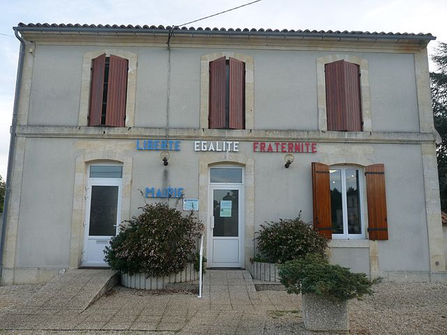
Bussac-Forêt (Bussac-Forêt)

- commune in Charente-Maritime, France
- Country:

- Postal Code: 17210
- Coordinates: 45° 12' 45" N, 0° 22' 11" E


- GPS tracks (wikiloc): [Link]
- Area: 34.78 sq km
- Population: 1011
- Web site: http://www.bussac-foret.fr
- Wikipedia en: wiki(en)
- Wikipedia: wiki(fr)
- Wikidata storage: Wikidata: Q1349685
- Wikipedia Commons Category: [Link]
- Freebase ID: [/m/0261yvp]
- GeoNames ID: Alt: [6447405]
- SIREN number: [211700745]
- BnF ID: [15248936f]
- INSEE municipality code: 17074
Shares border with regions:


Saint-Yzan-de-Soudiac
- commune in Gironde, France
- Country:
- Postal Code: 33920
- Coordinates: 45° 8' 25" N, 0° 24' 38" E
- GPS tracks (wikiloc): [Link]
- Area: 11.14 sq km
- Population: 2344
- Web site: [Link]


Laruscade
- commune in Gironde, France
- Country:
- Postal Code: 33620
- Coordinates: 45° 6' 28" N, 0° 20' 27" E
- GPS tracks (wikiloc): [Link]
- Area: 46.76 sq km
- Population: 2654
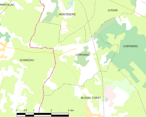
Corignac
- commune in Charente-Maritime, France
- Country:
- Postal Code: 17130
- Coordinates: 45° 14' 54" N, 0° 23' 29" E
- GPS tracks (wikiloc): [Link]
- Area: 11.57 sq km
- Population: 374


Chepniers
- commune in Charente-Maritime, France
- Country:
- Postal Code: 17210
- Coordinates: 45° 15' 26" N, 0° 18' 36" E
- GPS tracks (wikiloc): [Link]
- Area: 28.21 sq km
- Population: 662
- Web site: [Link]


Montlieu-la-Garde
- commune in Charente-Maritime, France
- Country:
- Postal Code: 17210
- Coordinates: 45° 14' 41" N, 0° 15' 19" E
- GPS tracks (wikiloc): [Link]
- AboveSeaLevel: 145 м m
- Area: 31.6 sq km
- Population: 1331
- Web site: [Link]

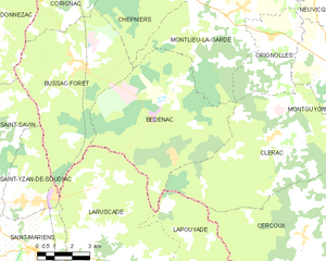
Bedenac
- commune in Charente-Maritime, France
- Country:
- Postal Code: 17210
- Coordinates: 45° 9' 55" N, 0° 18' 7" E
- GPS tracks (wikiloc): [Link]
- Area: 40.23 sq km
- Population: 701


Saint-Savin
- commune in Gironde, France
- Country:
- Postal Code: 33920
- Coordinates: 45° 8' 19" N, 0° 26' 55" E
- GPS tracks (wikiloc): [Link]
- AboveSeaLevel: 95 м m
- Area: 33.87 sq km
- Population: 3179


Donnezac
- commune in Gironde, France
- Country:
- Postal Code: 33860
- Coordinates: 45° 14' 52" N, 0° 26' 36" E
- GPS tracks (wikiloc): [Link]
- Area: 35.75 sq km
- Population: 892