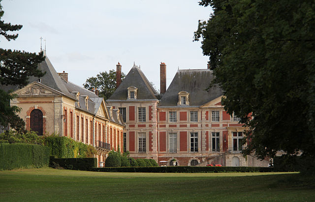
Bussy-Saint-Martin (Bussy-Saint-Martin)

- commune in Seine-et-Marne, France
- Country:

- Postal Code: 77600
- Coordinates: 48° 50' 57" N, 2° 41' 25" E


- GPS tracks (wikiloc): [Link]
- Area: 2.64 sq km
- Population: 698
- Web site: http://www.bussy-saint-martin.com
- Wikipedia en: wiki(en)
- Wikipedia: wiki(fr)
- Wikidata storage: Wikidata: Q1142705
- Wikipedia Commons Category: [Link]
- Freebase ID: [/m/02ppz7x]
- Freebase ID: [/m/02ppz7x]
- GeoNames ID: Alt: [6451167]
- GeoNames ID: Alt: [6451167]
- SIREN number: [217700590]
- SIREN number: [217700590]
- BnF ID: [15275400z]
- BnF ID: [15275400z]
- VIAF ID: Alt: [136389015]
- VIAF ID: Alt: [136389015]
- PACTOLS thesaurus ID: [pcrtzBK3uEd2za]
- PACTOLS thesaurus ID: [pcrtzBK3uEd2za]
- INSEE municipality code: 77059
- INSEE municipality code: 77059
Shares border with regions:


Torcy
- commune in Seine-et-Marne, France
- Country:
- Postal Code: 77200
- Coordinates: 48° 51' 1" N, 2° 39' 3" E
- GPS tracks (wikiloc): [Link]
- AboveSeaLevel: 100 м m
- Area: 6 sq km
- Population: 23558
- Web site: [Link]


Collégien
- commune in Seine-et-Marne, France
- Country:
- Postal Code: 77090
- Coordinates: 48° 50' 13" N, 2° 40' 24" E
- GPS tracks (wikiloc): [Link]
- Area: 4.27 sq km
- Population: 3418
- Web site: [Link]

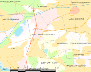
Saint-Thibault-des-Vignes
- commune in Seine-et-Marne, France
- Country:
- Postal Code: 77400
- Coordinates: 48° 52' 9" N, 2° 41' 19" E
- GPS tracks (wikiloc): [Link]
- Area: 4.7 sq km
- Population: 6341
- Web site: [Link]

Guermantes
- commune in Seine-et-Marne, France
- Country:
- Postal Code: 77600
- Coordinates: 48° 51' 16" N, 2° 42' 21" E
- GPS tracks (wikiloc): [Link]
- Area: 1.26 sq km
- Population: 1139
- Web site: [Link]
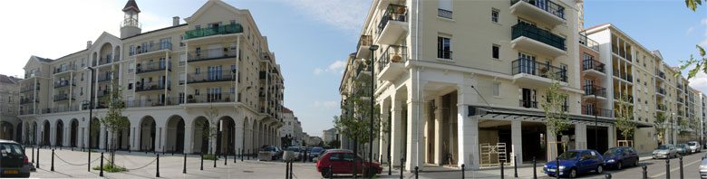

Bussy-Saint-Georges
- commune in Seine-et-Marne, France
- Country:
- Postal Code: 77600
- Coordinates: 48° 50' 30" N, 2° 41' 52" E
- GPS tracks (wikiloc): [Link]
- AboveSeaLevel: 105 м m
- Area: 13.39 sq km
- Population: 26346
- Web site: [Link]


Gouvernes
- commune in Seine-et-Marne, France
- Country:
- Postal Code: 77400
- Coordinates: 48° 51' 38" N, 2° 41' 38" E
- GPS tracks (wikiloc): [Link]
- Area: 2.72 sq km
- Population: 1156
- Web site: [Link]