Cénac-et-Saint-Julien (Cénac-et-Saint-Julien)

- commune in Dordogne, France
- Country:

- Postal Code: 24250
- Coordinates: 44° 48' 0" N, 1° 12' 16" E


- GPS tracks (wikiloc): [Link]
- Area: 19.87 sq km
- Population: 1201
- Web site: http://cenac-stjulien.com/
- Wikipedia en: wiki(en)
- Wikipedia: wiki(fr)
- Wikidata storage: Wikidata: Q196659
- Wikipedia Commons Category: [Link]
- Freebase ID: [/m/03mg570]
- Freebase ID: [/m/03mg570]
- GeoNames ID: Alt: [6447799]
- GeoNames ID: Alt: [6447799]
- SIREN number: [212400915]
- SIREN number: [212400915]
- BnF ID: [152517410]
- BnF ID: [152517410]
- VIAF ID: Alt: [241063011]
- VIAF ID: Alt: [241063011]
- GND ID: Alt: [7697833-3]
- GND ID: Alt: [7697833-3]
- PACTOLS thesaurus ID: [pcrt8X8SETWJRu]
- PACTOLS thesaurus ID: [pcrt8X8SETWJRu]
- INSEE municipality code: 24091
- INSEE municipality code: 24091
Shares border with regions:


Nabirat
- commune in Dordogne, France
- Country:
- Postal Code: 24250
- Coordinates: 44° 45' 12" N, 1° 17' 52" E
- GPS tracks (wikiloc): [Link]
- Area: 16.25 sq km
- Population: 376
- Web site: [Link]


Daglan
- commune in Dordogne, France
- Country:
- Postal Code: 24250
- Coordinates: 44° 44' 31" N, 1° 11' 35" E
- GPS tracks (wikiloc): [Link]
- Area: 19.96 sq km
- Population: 560
- Web site: [Link]
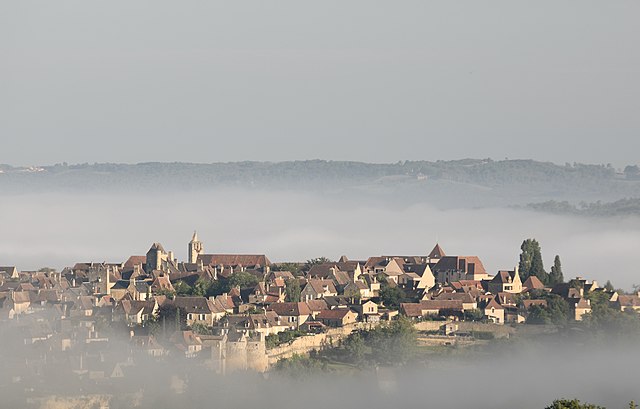
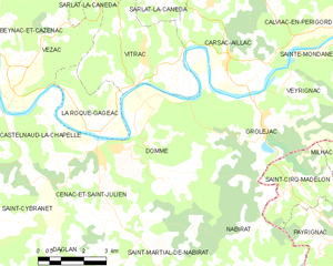
Domme
- commune in Dordogne, France
- Country:
- Postal Code: 24250
- Coordinates: 44° 48' 8" N, 1° 12' 52" E
- GPS tracks (wikiloc): [Link]
- Area: 24.91 sq km
- Population: 923
- Web site: [Link]
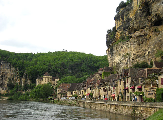

La Roque-Gageac
- commune in Dordogne, France
- Country:
- Postal Code: 24250
- Coordinates: 44° 49' 35" N, 1° 10' 57" E
- GPS tracks (wikiloc): [Link]
- Area: 7.17 sq km
- Population: 467
- Web site: [Link]

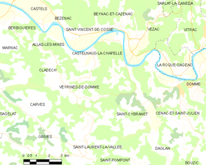
Castelnaud-la-Chapelle
- commune in Dordogne, France
- Country:
- Postal Code: 24250
- Coordinates: 44° 48' 54" N, 1° 8' 55" E
- GPS tracks (wikiloc): [Link]
- AboveSeaLevel: 71 м m
- Area: 20.88 sq km
- Population: 471
- Web site: [Link]