Çaloire (Çaloire)

- commune in Loire, France
- Country:

- Postal Code: 42240
- Coordinates: 45° 25' 8" N, 4° 14' 33" E


- GPS tracks (wikiloc): [Link]
- Area: 4.7 sq km
- Population: 339
- Web site: http://www.caloire.fr
- Wikipedia en: wiki(en)
- Wikipedia: wiki(fr)
- Wikidata storage: Wikidata: Q430475
- Wikipedia Commons Category: [Link]
- Freebase ID: [/m/03nw5d6]
- Freebase ID: [/m/03nw5d6]
- GeoNames ID: Alt: [6448968]
- GeoNames ID: Alt: [6448968]
- SIREN number: [214200313]
- SIREN number: [214200313]
- BnF ID: [15259601d]
- BnF ID: [15259601d]
- INSEE municipality code: 42031
- INSEE municipality code: 42031
Shares border with regions:
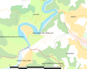
Saint-Paul-en-Cornillon
- commune in Loire, France
- Country:
- Postal Code: 42240
- Coordinates: 45° 23' 50" N, 4° 14' 26" E
- GPS tracks (wikiloc): [Link]
- Area: 3.72 sq km
- Population: 1358

Unieux
- commune in Loire, France
- Country:
- Postal Code: 42240
- Coordinates: 45° 24' 6" N, 4° 15' 41" E
- GPS tracks (wikiloc): [Link]
- Area: 8.58 sq km
- Population: 8975
- Web site: [Link]


Saint-Maurice-en-Gourgois
- commune in Loire, France
- Country:
- Postal Code: 42240
- Coordinates: 45° 24' 5" N, 4° 11' 0" E
- GPS tracks (wikiloc): [Link]
- Area: 31.83 sq km
- Population: 1797
- Web site: [Link]


Saint-Étienne
- commune in Loire, France
- Country:
- Postal Code: 42230; 42000; 42100
- Coordinates: 45° 26' 2" N, 4° 23' 23" E
- GPS tracks (wikiloc): [Link]
- AboveSeaLevel: 516 м m
- Area: 79.97 sq km
- Population: 171057
- Web site: [Link]


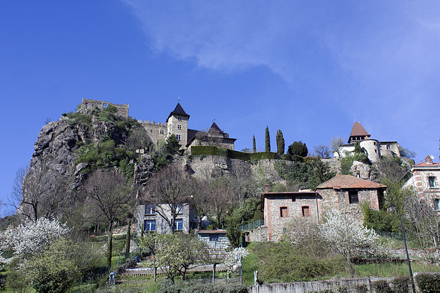
Chambles
- commune in Loire, France
- Country:
- Postal Code: 42170
- Coordinates: 45° 26' 31" N, 4° 14' 18" E
- GPS tracks (wikiloc): [Link]
- Area: 18.9 sq km
- Population: 981