
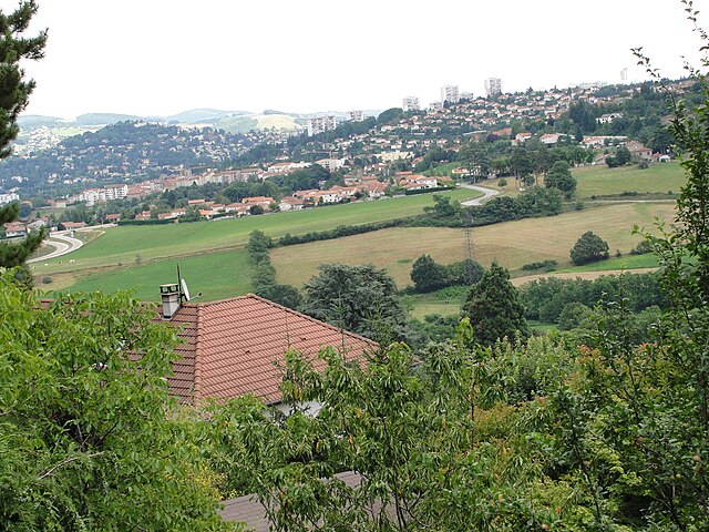
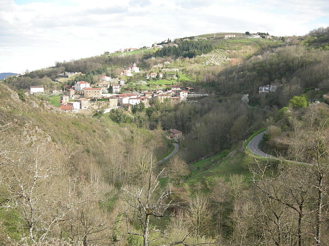
Loire (Loire)


- French department
- Country:

- Capital: Saint-Étienne
- Coordinates: 45° 45' 14" N, 4° 13' 29" E


- GPS tracks (wikiloc): [Link]
- Area: 4781 sq km
- Population: 759411
- Web site: http://www.loire.gouv.fr/
- Wikipedia en: wiki(en)
- Wikipedia: wiki(fr)
- Wikidata storage: Wikidata: Q12569
- Wikipedia Commons Gallery: [Link]
- Wikipedia Commons Category: [Link]
- Freebase ID: [/m/094nc]
- GeoNames ID: Alt: [2997870]
- SIREN number: [224200014]
- BnF ID: [152399234]
- VIAF ID: Alt: [170297260]
- OSM relation ID: [7420]
- GND ID: Alt: [26931-1]
- archINFORM location ID: [2749]
- Library of Congress authority ID: Alt: [n81011157]
- MusicBrainz area ID: [1beed668-10db-4359-beab-81db58e67418]
- Encyclopædia Britannica Online ID: [place/Loire]
- Gran Enciclopèdia Catalana ID: [0038357]
- NUTS code: [FR715]
- INSEE department code: [42]
- BNE ID: Alt: [XX452812]
- ISO 3166-2 code: FR-42
Includes regions:
Aboën
- commune in Loire, France
- Country:
- Postal Code: 42380
- Coordinates: 45° 24' 49" N, 4° 7' 54" E
- GPS tracks (wikiloc): [Link]
- Area: 8.96 sq km
- Population: 424


Ambierle
- commune in Loire, France
- Country:
- Postal Code: 42820
- Coordinates: 46° 6' 16" N, 3° 53' 44" E
- GPS tracks (wikiloc): [Link]
- Area: 30.76 sq km
- Population: 1896
- Web site: [Link]


Colombier
- commune in Loire, France
- Country:
- Postal Code: 42220
- Coordinates: 45° 20' 16" N, 4° 36' 0" E
- GPS tracks (wikiloc): [Link]
- AboveSeaLevel: 818 м m
- Area: 17.86 sq km
- Population: 301

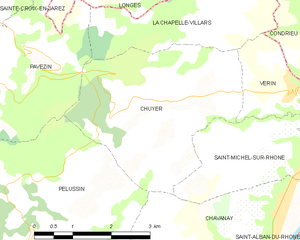
Chuyer
- commune in Loire, France
- Country:
- Postal Code: 42410
- Coordinates: 45° 27' 26" N, 4° 41' 37" E
- GPS tracks (wikiloc): [Link]
- Area: 12.06 sq km
- Population: 779

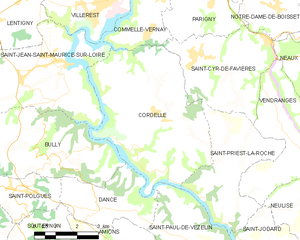
Cordelle
- commune in Loire, France
- Country:
- Postal Code: 42123
- Coordinates: 45° 56' 38" N, 4° 3' 41" E
- GPS tracks (wikiloc): [Link]
- Area: 26.64 sq km
- Population: 902
- Web site: [Link]
La Gimond
- commune in Loire, France
- Country:
- Postal Code: 42140
- Coordinates: 45° 33' 25" N, 4° 24' 36" E
- GPS tracks (wikiloc): [Link]
- Area: 3.37 sq km
- Population: 279
La Côte-en-Couzan
- commune in Loire, France
- Country:
- Postal Code: 42111
- Coordinates: 45° 47' 1" N, 3° 50' 46" E
- GPS tracks (wikiloc): [Link]
- Area: 9.11 sq km
- Population: 71


Croizet-sur-Gand
- commune in Loire, France
- Country:
- Postal Code: 42540
- Coordinates: 45° 54' 57" N, 4° 13' 47" E
- GPS tracks (wikiloc): [Link]
- Area: 5.98 sq km
- Population: 316


Fontanès
- commune in Loire, France
- Country:
- Postal Code: 42140
- Coordinates: 45° 32' 48" N, 4° 26' 14" E
- GPS tracks (wikiloc): [Link]
- Area: 6.63 sq km
- Population: 673

La Fouillouse
- commune in Loire, France
- Country:
- Postal Code: 42480
- Coordinates: 45° 30' 14" N, 4° 18' 49" E
- GPS tracks (wikiloc): [Link]
- Area: 20.57 sq km
- Population: 4383
- Web site: [Link]


Essertines-en-Châtelneuf
- commune in Loire, France
- Country:
- Postal Code: 42600
- Coordinates: 45° 37' 9" N, 3° 59' 52" E
- GPS tracks (wikiloc): [Link]
- Area: 15.2 sq km
- Population: 688


L'Étrat
- commune in Loire, France
- Country:
- Postal Code: 42580
- Coordinates: 45° 29' 8" N, 4° 22' 45" E
- GPS tracks (wikiloc): [Link]
- Area: 8.48 sq km
- Population: 2595
- Web site: [Link]

Cleppé
- commune in Loire, France
- Country:
- Postal Code: 42110
- Coordinates: 45° 46' 9" N, 4° 10' 49" E
- GPS tracks (wikiloc): [Link]
- Area: 15.48 sq km
- Population: 559
Fraisses
- commune in Loire, France
- Country:
- Postal Code: 42490
- Coordinates: 45° 23' 16" N, 4° 15' 58" E
- GPS tracks (wikiloc): [Link]
- AboveSeaLevel: 465 м m
- Area: 4.63 sq km
- Population: 3748

Bully
- commune in Loire, France
- Country:
- Postal Code: 42260
- Coordinates: 45° 55' 39" N, 4° 0' 18" E
- GPS tracks (wikiloc): [Link]
- Area: 19.03 sq km
- Population: 415
Chavanay
- commune in Loire, France
- Country:
- Postal Code: 42410
- Coordinates: 45° 24' 53" N, 4° 43' 52" E
- GPS tracks (wikiloc): [Link]
- Area: 15.06 sq km
- Population: 2889
- Web site: [Link]

Chazelles-sur-Lyon
- commune in Loire, France
- Country:
- Postal Code: 42140
- Coordinates: 45° 38' 19" N, 4° 23' 31" E
- GPS tracks (wikiloc): [Link]
- Area: 20.91 sq km
- Population: 5219
- Web site: [Link]
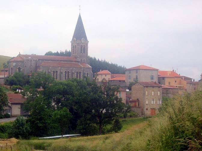
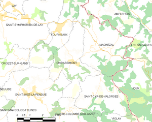
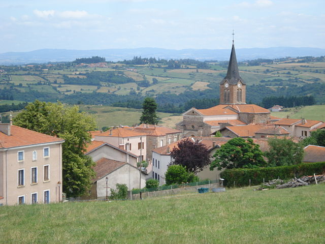
Chirassimont
- commune in Loire, France
- Country:
- Postal Code: 42114
- Coordinates: 45° 54' 49" N, 4° 17' 7" E
- GPS tracks (wikiloc): [Link]
- Area: 10.69 sq km
- Population: 405


Craintilleux
- commune in Loire, France
- Country:
- Postal Code: 42210
- Coordinates: 45° 35' 0" N, 4° 14' 5" E
- GPS tracks (wikiloc): [Link]
- Area: 8.22 sq km
- Population: 1263
- Web site: [Link]


Apinac
- commune in Loire, France
- Country:
- Postal Code: 42550
- Coordinates: 45° 22' 51" N, 3° 59' 46" E
- GPS tracks (wikiloc): [Link]
- Area: 15.35 sq km
- Population: 423
- Web site: [Link]

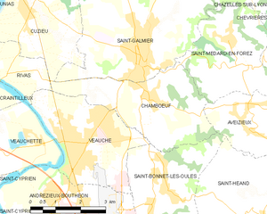
Chambœuf
- commune in Loire, France
- Country:
- Postal Code: 42330
- Coordinates: 45° 34' 41" N, 4° 19' 13" E
- GPS tracks (wikiloc): [Link]
- Area: 11.12 sq km
- Population: 1628
- Web site: [Link]


Le Crozet
- commune in Loire, France
- Country:
- Postal Code: 42310
- Coordinates: 46° 10' 14" N, 3° 51' 18" E
- GPS tracks (wikiloc): [Link]
- AboveSeaLevel: 450 м m
- Area: 13.31 sq km
- Population: 282
- Web site: [Link]
Cuinzier
- commune in Loire, France
- Country:
- Postal Code: 42460
- Coordinates: 46° 7' 39" N, 4° 16' 1" E
- GPS tracks (wikiloc): [Link]
- Area: 5.62 sq km
- Population: 731

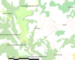
Ailleux
- commune in Loire, France
- Country:
- Postal Code: 42130
- Coordinates: 45° 48' 13" N, 3° 56' 33" E
- GPS tracks (wikiloc): [Link]
- Area: 9.31 sq km
- Population: 152
Cezay
- commune in Loire, France
- Country:
- Postal Code: 42130
- Coordinates: 45° 48' 7" N, 3° 57' 47" E
- GPS tracks (wikiloc): [Link]
- Area: 10.52 sq km
- Population: 223


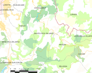
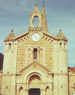
Châteauneuf
- commune in Loire, France
- Country:
- Postal Code: 42800
- Coordinates: 45° 31' 19" N, 4° 37' 29" E
- GPS tracks (wikiloc): [Link]
- AboveSeaLevel: 230 м m
- Area: 13.65 sq km
- Population: 1559
- Web site: [Link]


Le Bessat
- commune in Loire, France
- Country:
- Postal Code: 42660
- Coordinates: 45° 22' 8" N, 4° 30' 53" E
- GPS tracks (wikiloc): [Link]
- Area: 10.06 sq km
- Population: 436

Andrézieux-Bouthéon
- commune in Loire, France
- Country:
- Postal Code: 42160
- Coordinates: 45° 31' 34" N, 4° 15' 37" E
- GPS tracks (wikiloc): [Link]
- Area: 16.28 sq km
- Population: 9947
- Web site: [Link]


Arcinges
- commune in Loire, France
- Country:
- Postal Code: 42460
- Coordinates: 46° 8' 15" N, 4° 16' 51" E
- GPS tracks (wikiloc): [Link]
- Area: 3.44 sq km
- Population: 208
Boyer
- commune in Loire, France
- Country:
- Postal Code: 42460
- Coordinates: 46° 5' 51" N, 4° 12' 34" E
- GPS tracks (wikiloc): [Link]
- Area: 5.18 sq km
- Population: 202

Cellieu
- commune in Loire, France
- Country:
- Postal Code: 42320
- Coordinates: 45° 31' 22" N, 4° 32' 28" E
- GPS tracks (wikiloc): [Link]
- Area: 12.11 sq km
- Population: 1701

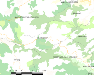
Châtelneuf
- commune in Loire, France
- Country:
- Postal Code: 42940
- Coordinates: 45° 38' 16" N, 3° 58' 59" E
- GPS tracks (wikiloc): [Link]
- Area: 8.48 sq km
- Population: 320


Bonson
- commune in Loire, France
- Country:
- Postal Code: 42160
- Coordinates: 45° 31' 24" N, 4° 12' 57" E
- GPS tracks (wikiloc): [Link]
- Area: 5.15 sq km
- Population: 3747
- Web site: [Link]
Aveizieux
- commune in Loire, France
- Country:
- Postal Code: 42330
- Coordinates: 45° 33' 54" N, 4° 22' 19" E
- GPS tracks (wikiloc): [Link]
- Area: 9.02 sq km
- Population: 1593
- Web site: [Link]

Villars
- commune in Loire, France
- Country:
- Postal Code: 42390
- Coordinates: 45° 28' 8" N, 4° 21' 16" E
- GPS tracks (wikiloc): [Link]
- Area: 5.72 sq km
- Population: 8016
- Web site: [Link]


Saint-Priest-en-Jarez
- commune in Loire, France
- Country:
- Postal Code: 42270
- Coordinates: 45° 28' 27" N, 4° 22' 41" E
- GPS tracks (wikiloc): [Link]
- Area: 3.07 sq km
- Population: 6175
- Web site: [Link]
La Grand-Croix
- commune in Loire, France
- Country:
- Postal Code: 42320
- Coordinates: 45° 30' 11" N, 4° 34' 8" E
- GPS tracks (wikiloc): [Link]
- Area: 4.05 sq km
- Population: 5072
- Web site: [Link]


Saint-Jean-Bonnefonds
- commune in Loire, France
- Country:
- Postal Code: 42650
- Coordinates: 45° 27' 4" N, 4° 26' 47" E
- GPS tracks (wikiloc): [Link]
- Area: 11.59 sq km
- Population: 6680
- Web site: [Link]


Vendranges
- commune in Loire, France
- Country:
- Postal Code: 42590
- Coordinates: 45° 56' 29" N, 4° 8' 11" E
- GPS tracks (wikiloc): [Link]
- Area: 11.14 sq km
- Population: 363


Civens
- commune in Loire, France
- Country:
- Postal Code: 42110
- Coordinates: 45° 46' 48" N, 4° 15' 9" E
- GPS tracks (wikiloc): [Link]
- Area: 13.1 sq km
- Population: 1376


Dargoire
- commune in Loire, France
- Country:
- Postal Code: 42800
- Coordinates: 45° 33' 37" N, 4° 40' 5" E
- GPS tracks (wikiloc): [Link]
- AboveSeaLevel: 245 м m
- Area: 1.92 sq km
- Population: 503


Chalain-d'Uzore
- commune in Loire, France
- Country:
- Postal Code: 42600
- Coordinates: 45° 40' 21" N, 4° 4' 14" E
- GPS tracks (wikiloc): [Link]
- Area: 8.03 sq km
- Population: 535
Amions
- commune in Loire, France
- Country:
- Postal Code: 42260
- Coordinates: 45° 52' 41" N, 4° 2' 2" E
- GPS tracks (wikiloc): [Link]
- Area: 17.01 sq km
- Population: 288
- Web site: [Link]


Briennon
- commune in Loire, France
- Country:
- Postal Code: 42720
- Coordinates: 46° 8' 57" N, 4° 5' 8" E
- GPS tracks (wikiloc): [Link]
- Area: 23.84 sq km
- Population: 1699
- Web site: [Link]


Champoly
- commune in Loire, France
- Country:
- Postal Code: 42430
- Coordinates: 45° 51' 28" N, 3° 50' 8" E
- GPS tracks (wikiloc): [Link]
- Area: 14.89 sq km
- Population: 328
- Web site: [Link]

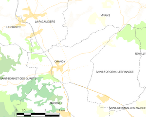
Changy
- commune in Loire, France
- Country:
- Postal Code: 42310
- Coordinates: 46° 8' 31" N, 3° 53' 28" E
- GPS tracks (wikiloc): [Link]
- Area: 13.67 sq km
- Population: 624
- Web site: [Link]


Bussy-Albieux
- commune in Loire, France
- Country:
- Postal Code: 42260
- Coordinates: 45° 47' 35" N, 4° 2' 1" E
- GPS tracks (wikiloc): [Link]
- Area: 19.65 sq km
- Population: 535
- Web site: [Link]


Fourneaux
- commune in Loire, France
- Country:
- Postal Code: 42470
- Coordinates: 45° 56' 13" N, 4° 16' 10" E
- GPS tracks (wikiloc): [Link]
- AboveSeaLevel: 530 м m
- Area: 12.17 sq km
- Population: 596


La Chapelle-en-Lafaye
- commune in Loire, France
- Country:
- Postal Code: 42380
- Coordinates: 45° 27' 46" N, 3° 59' 20" E
- GPS tracks (wikiloc): [Link]
- Area: 8.99 sq km
- Population: 112
Burdignes
- commune in Loire, France
- Country:
- Postal Code: 42220
- Coordinates: 45° 16' 13" N, 4° 34' 0" E
- GPS tracks (wikiloc): [Link]
- Area: 30.81 sq km
- Population: 352


Bard
- commune in Loire, France
- Country:
- Postal Code: 42600
- Coordinates: 45° 35' 15" N, 4° 0' 41" E
- GPS tracks (wikiloc): [Link]
- Area: 13.78 sq km
- Population: 654

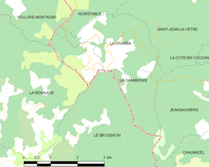
La Chambonie
- commune in Loire, France
- Country:
- Postal Code: 42440
- Coordinates: 45° 44' 50" N, 3° 44' 55" E
- GPS tracks (wikiloc): [Link]
- Area: 4.42 sq km
- Population: 45
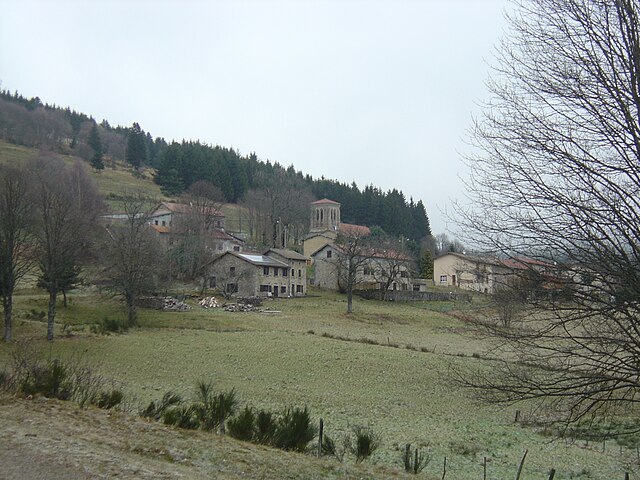

La Chamba
- commune in Loire, France
- Country:
- Postal Code: 42440
- Coordinates: 45° 45' 19" N, 3° 45' 27" E
- GPS tracks (wikiloc): [Link]
- Area: 5.2 sq km
- Population: 52


Chalain-le-Comtal
- commune in Loire, France
- Country:
- Postal Code: 42600
- Coordinates: 45° 38' 43" N, 4° 10' 12" E
- GPS tracks (wikiloc): [Link]
- Area: 18.36 sq km
- Population: 710


Chenereilles
- commune in Loire, France
- Country:
- Postal Code: 42560
- Coordinates: 45° 29' 3" N, 4° 4' 45" E
- GPS tracks (wikiloc): [Link]
- Area: 8.97 sq km
- Population: 521
Chazelles-sur-Lavieu
- commune in Loire, France
- Country:
- Postal Code: 42560
- Coordinates: 45° 32' 20" N, 4° 0' 2" E
- GPS tracks (wikiloc): [Link]
- Area: 9.85 sq km
- Population: 293


Sorbiers
- commune in Loire, France
- Country:
- Postal Code: 42290
- Coordinates: 45° 29' 16" N, 4° 27' 1" E
- GPS tracks (wikiloc): [Link]
- Area: 12.19 sq km
- Population: 8083
- Web site: [Link]


Néronde
- commune in Loire, France
- Country:
- Postal Code: 42510
- Coordinates: 45° 50' 18" N, 4° 14' 13" E
- GPS tracks (wikiloc): [Link]
- Area: 8.57 sq km
- Population: 462


Noailly
- commune in Loire, France
- Country:
- Postal Code: 42640
- Coordinates: 46° 8' 7" N, 4° 0' 45" E
- GPS tracks (wikiloc): [Link]
- Area: 31.45 sq km
- Population: 809
Arcon
- commune in Loire, France
- Country:
- Postal Code: 42370
- Coordinates: 46° 0' 37" N, 3° 53' 17" E
- GPS tracks (wikiloc): [Link]
- Area: 19.19 sq km
- Population: 109
La Valla-sur-Rochefort
- commune in Loire, France
- Country:
- Postal Code: 42111
- Coordinates: 45° 45' 33" N, 3° 51' 8" E
- GPS tracks (wikiloc): [Link]
- AboveSeaLevel: 830 м m
- Area: 8.98 sq km
- Population: 109

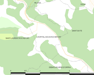
L'Hôpital-sous-Rochefort
- commune in Loire, France
- Country:
- Postal Code: 42130
- Coordinates: 45° 46' 26" N, 3° 56' 1" E
- GPS tracks (wikiloc): [Link]
- AboveSeaLevel: 427 м m
- Area: 1.15 sq km
- Population: 112
- Web site: [Link]


Saint-Jean-Saint-Maurice-sur-Loire
- commune in Loire, France
- Country:
- Postal Code: 42155
- Coordinates: 45° 57' 57" N, 4° 0' 7" E
- GPS tracks (wikiloc): [Link]
- AboveSeaLevel: 430 м m
- Area: 23.57 sq km
- Population: 1138
- Web site: [Link]
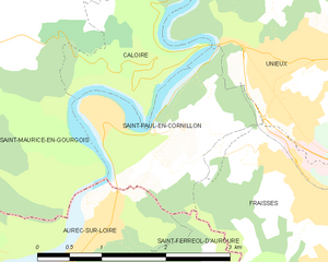
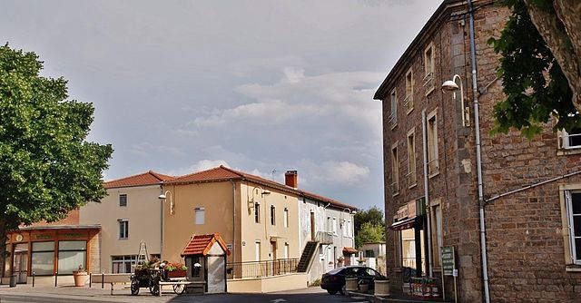
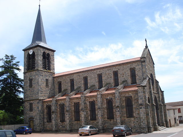
Saint-Paul-en-Cornillon
- commune in Loire, France
- Country:
- Postal Code: 42240
- Coordinates: 45° 23' 50" N, 4° 14' 26" E
- GPS tracks (wikiloc): [Link]
- Area: 3.72 sq km
- Population: 1358
Thélis-la-Combe
- commune in Loire, France
- Country:
- Postal Code: 42220
- Coordinates: 45° 19' 40" N, 4° 33' 17" E
- GPS tracks (wikiloc): [Link]
- Area: 14.57 sq km
- Population: 163


Saint-Sixte
- commune in Loire, France
- Country:
- Postal Code: 42130
- Coordinates: 45° 46' 33" N, 3° 58' 56" E
- GPS tracks (wikiloc): [Link]
- Area: 15.35 sq km
- Population: 722
- Web site: [Link]


La Tuilière
- commune in Loire, France
- Country:
- Postal Code: 42830
- Coordinates: 45° 56' 41" N, 3° 48' 6" E
- GPS tracks (wikiloc): [Link]
- Area: 31.09 sq km
- Population: 287

Saint-Romain-la-Motte
- commune in Loire, France
- Country:
- Postal Code: 42640
- Coordinates: 46° 5' 4" N, 3° 58' 53" E
- GPS tracks (wikiloc): [Link]
- Area: 27.56 sq km
- Population: 1457


Saint-Marcellin-en-Forez
- commune in Loire, France
- Country:
- Postal Code: 42680
- Coordinates: 45° 29' 50" N, 4° 10' 2" E
- GPS tracks (wikiloc): [Link]
- Area: 31.09 sq km
- Population: 4671
- Web site: [Link]
Saint-Léger-sur-Roanne
- commune in Loire, France
- Country:
- Postal Code: 42155
- Coordinates: 46° 2' 24" N, 3° 59' 49" E
- GPS tracks (wikiloc): [Link]
- Area: 4.51 sq km
- Population: 1130

Saint-Paul-de-Vézelin
- commune in Loire, France
- Country:
- Postal Code: 42590
- Coordinates: 45° 53' 5" N, 4° 5' 7" E
- GPS tracks (wikiloc): [Link]
- Area: 13.52 sq km
- Population: 316


Saint-Nizier-de-Fornas
- commune in Loire, France
- Country:
- Postal Code: 42380
- Coordinates: 45° 24' 14" N, 4° 4' 55" E
- GPS tracks (wikiloc): [Link]
- Area: 15.88 sq km
- Population: 669
- Web site: [Link]
Saint-Romain-les-Atheux
- commune in Loire, France
- Country:
- Postal Code: 42660
- Coordinates: 45° 21' 22" N, 4° 22' 34" E
- GPS tracks (wikiloc): [Link]
- Area: 14.68 sq km
- Population: 977

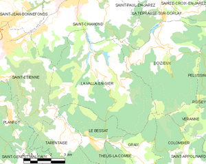
La Valla-en-Gier
- commune in Loire, France
- Country:
- Postal Code: 42131
- Coordinates: 45° 24' 57" N, 4° 30' 59" E
- GPS tracks (wikiloc): [Link]
- AboveSeaLevel: 650 м m
- Area: 34.78 sq km
- Population: 999


Tartaras
- commune in Loire, France
- Country:
- Postal Code: 42800
- Coordinates: 45° 33' 14" N, 4° 40' 7" E
- GPS tracks (wikiloc): [Link]
- Area: 3.91 sq km
- Population: 829


La Terrasse-sur-Dorlay
- commune in Loire, France
- Country:
- Postal Code: 42740
- Coordinates: 45° 26' 54" N, 4° 35' 0" E
- GPS tracks (wikiloc): [Link]
- Area: 8.69 sq km
- Population: 787


La Tour-en-Jarez
- commune in Loire, France
- Country:
- Postal Code: 42580
- Coordinates: 45° 29' 7" N, 4° 23' 19" E
- GPS tracks (wikiloc): [Link]
- Area: 5.05 sq km
- Population: 1461
- Web site: [Link]
Vérin
- commune in Loire, France
- Country:
- Postal Code: 42410
- Coordinates: 45° 27' 15" N, 4° 45' 9" E
- GPS tracks (wikiloc): [Link]
- Area: 3.05 sq km
- Population: 676
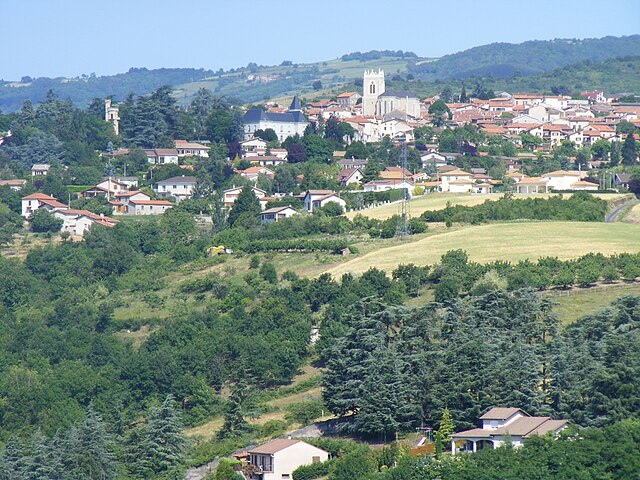
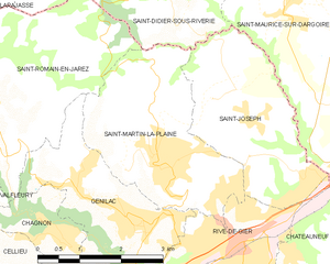
Saint-Martin-la-Plaine
- commune in Loire, France
- Country:
- Postal Code: 42800
- Coordinates: 45° 32' 45" N, 4° 35' 34" E
- GPS tracks (wikiloc): [Link]
- Area: 9.7 sq km
- Population: 3727
- Web site: [Link]

Saint-Romain-en-Jarez
- commune in Loire, France
- Country:
- Postal Code: 42800
- Coordinates: 45° 33' 22" N, 4° 32' 4" E
- GPS tracks (wikiloc): [Link]
- Area: 16.96 sq km
- Population: 1222


Tarentaise
- commune in Loire, France
- Country:
- Postal Code: 42660
- Coordinates: 45° 22' 23" N, 4° 29' 19" E
- GPS tracks (wikiloc): [Link]
- Area: 12.57 sq km
- Population: 465

Unieux
- commune in Loire, France
- Country:
- Postal Code: 42240
- Coordinates: 45° 24' 6" N, 4° 15' 41" E
- GPS tracks (wikiloc): [Link]
- Area: 8.58 sq km
- Population: 8975
- Web site: [Link]

Valfleury
- commune in Loire, France
- Country:
- Postal Code: 42320
- Coordinates: 45° 31' 21" N, 4° 29' 33" E
- GPS tracks (wikiloc): [Link]
- Area: 8.77 sq km
- Population: 706
Saint-Michel-sur-Rhône
- commune in Loire, France
- Country:
- Postal Code: 42410
- Coordinates: 45° 26' 46" N, 4° 44' 41" E
- GPS tracks (wikiloc): [Link]
- Area: 5.87 sq km
- Population: 805
- Web site: [Link]

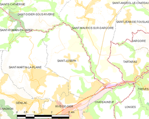
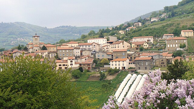
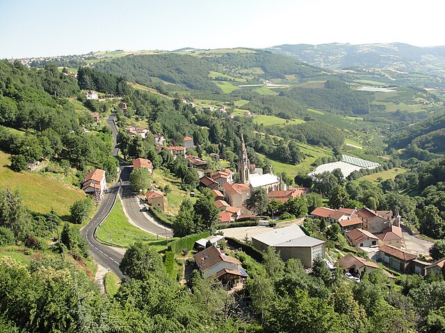
Saint-Joseph
- commune in Loire, France
- Country:
- Postal Code: 42800
- Coordinates: 45° 33' 25" N, 4° 37' 4" E
- GPS tracks (wikiloc): [Link]
- Area: 8.05 sq km
- Population: 1897


Saint-Julien-Molin-Molette
- commune in Loire, France
- Country:
- Postal Code: 42220
- Coordinates: 45° 19' 20" N, 4° 36' 56" E
- GPS tracks (wikiloc): [Link]
- Area: 9.45 sq km
- Population: 1160
- Web site: [Link]


Saint-Genest-Malifaux
- commune in Loire, France
- Country:
- Postal Code: 42660
- Coordinates: 45° 20' 24" N, 4° 25' 11" E
- GPS tracks (wikiloc): [Link]
- Area: 47.08 sq km
- Population: 2874
- Web site: [Link]


Saint-Héand
- commune in Loire, France
- Country:
- Postal Code: 42570
- Coordinates: 45° 31' 43" N, 4° 22' 22" E
- GPS tracks (wikiloc): [Link]
- Area: 31.3 sq km
- Population: 3600
- Web site: [Link]

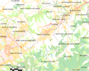
L'Horme
- commune in Loire, France
- Country:
- Postal Code: 42152
- Coordinates: 45° 29' 11" N, 4° 32' 41" E
- GPS tracks (wikiloc): [Link]
- Area: 4.4 sq km
- Population: 4820
- Web site: [Link]


Roche-la-Molière
- commune in Loire, France
- Country:
- Postal Code: 42230
- Coordinates: 45° 26' 2" N, 4° 19' 25" E
- GPS tracks (wikiloc): [Link]
- Area: 17.44 sq km
- Population: 9868
- Web site: [Link]


Saint-Christo-en-Jarez
- commune in Loire, France
- Country:
- Postal Code: 42320
- Coordinates: 45° 32' 41" N, 4° 29' 12" E
- GPS tracks (wikiloc): [Link]
- Area: 21.77 sq km
- Population: 1828
- Web site: [Link]


Saint-Appolinard
- commune in Loire, France
- Country:
- Postal Code: 42520
- Coordinates: 45° 20' 31" N, 4° 39' 8" E
- GPS tracks (wikiloc): [Link]
- Area: 9.84 sq km
- Population: 668

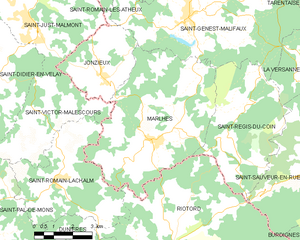
Marlhes
- commune in Loire, France
- Country:
- Postal Code: 42660
- Coordinates: 45° 16' 59" N, 4° 23' 41" E
- GPS tracks (wikiloc): [Link]
- Area: 32.6 sq km
- Population: 1304
- Web site: [Link]


Roisey
- commune in Loire, France
- Country:
- Postal Code: 42520
- Coordinates: 45° 23' 15" N, 4° 40' 19" E
- GPS tracks (wikiloc): [Link]
- AboveSeaLevel: 510 м m
- Area: 13.03 sq km
- Population: 903
- Web site: [Link]

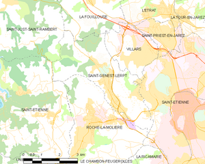
Saint-Genest-Lerpt
- commune in Loire, France
- Country:
- Postal Code: 42530
- Coordinates: 45° 26' 46" N, 4° 20' 12" E
- GPS tracks (wikiloc): [Link]
- Area: 12.68 sq km
- Population: 6112
- Web site: [Link]


Planfoy
- commune in Loire, France
- Country:
- Postal Code: 42660
- Coordinates: 45° 22' 59" N, 4° 26' 26" E
- GPS tracks (wikiloc): [Link]
- Area: 12.27 sq km
- Population: 1011
- Web site: [Link]


Doizieux
- commune in Loire, France
- Country:
- Postal Code: 42740
- Coordinates: 45° 25' 38" N, 4° 35' 10" E
- GPS tracks (wikiloc): [Link]
- Area: 28.07 sq km
- Population: 832

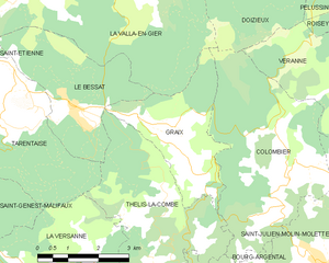
Graix
- commune in Loire, France
- Country:
- Postal Code: 42220
- Coordinates: 45° 20' 52" N, 4° 34' 9" E
- GPS tracks (wikiloc): [Link]
- Area: 8.58 sq km
- Population: 151


Farnay
- commune in Loire, France
- Country:
- Postal Code: 42320
- Coordinates: 45° 29' 37" N, 4° 35' 52" E
- GPS tracks (wikiloc): [Link]
- Area: 7.93 sq km
- Population: 1402


La Versanne
- commune in Loire, France
- Country:
- Postal Code: 42220
- Coordinates: 45° 19' 3" N, 4° 31' 33" E
- GPS tracks (wikiloc): [Link]
- Area: 15.13 sq km
- Population: 366


Malleval
- commune in Loire, France
- Country:
- Postal Code: 42520
- Coordinates: 45° 23' 2" N, 4° 43' 36" E
- GPS tracks (wikiloc): [Link]
- Area: 5.06 sq km
- Population: 579
- Web site: [Link]

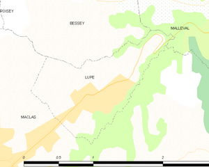
Lupé
- commune in Loire, France
- Country:
- Postal Code: 42520
- Coordinates: 45° 22' 22" N, 4° 42' 16" E
- GPS tracks (wikiloc): [Link]
- Area: 1.47 sq km
- Population: 312
- Web site: [Link]
Jonzieux
- commune in Loire, France
- Country:
- Postal Code: 42660
- Coordinates: 45° 18' 49" N, 4° 21' 44" E
- GPS tracks (wikiloc): [Link]
- Area: 10.32 sq km
- Population: 1161
- Web site: [Link]

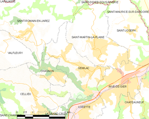
Genilac
- commune in Loire, France
- Country:
- Postal Code: 42800
- Coordinates: 45° 31' 56" N, 4° 34' 54" E
- GPS tracks (wikiloc): [Link]
- AboveSeaLevel: 413 м m
- Area: 8.67 sq km
- Population: 3888


Bessey
- commune in Loire, France
- Country:
- Postal Code: 42520
- Coordinates: 45° 23' 9" N, 4° 41' 43" E
- GPS tracks (wikiloc): [Link]
- Area: 6.24 sq km
- Population: 448


Saint-Régis-du-Coin
- commune in Loire, France
- Country:
- Postal Code: 42660
- Coordinates: 45° 17' 2" N, 4° 26' 39" E
- GPS tracks (wikiloc): [Link]
- Area: 20.4 sq km
- Population: 379

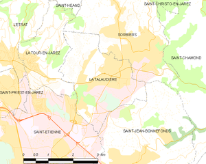
La Talaudière
- commune in Loire, France
- Country:
- Postal Code: 42350
- Coordinates: 45° 28' 53" N, 4° 25' 55" E
- GPS tracks (wikiloc): [Link]
- Area: 7.63 sq km
- Population: 6608
- Web site: [Link]


Le Chambon-Feugerolles
- commune in Loire, France
- Country:
- Postal Code: 42500
- Coordinates: 45° 23' 46" N, 4° 19' 30" E
- GPS tracks (wikiloc): [Link]
- Area: 17.51 sq km
- Population: 12656
- Web site: [Link]


Verrières-en-Forez
- commune in Loire, France
- Country:
- Postal Code: 42600
- Coordinates: 45° 34' 15" N, 3° 59' 48" E
- GPS tracks (wikiloc): [Link]
- Area: 21.17 sq km
- Population: 683

Saint-Chamond
- commune in Loire, France
- Country:
- Postal Code: 42400
- Coordinates: 45° 28' 35" N, 4° 30' 53" E
- GPS tracks (wikiloc): [Link]
- AboveSeaLevel: 375 м m
- Area: 54.88 sq km
- Population: 34870
- Web site: [Link]


Belmont-de-la-Loire
- commune in Loire, France
- Country:
- Postal Code: 42670
- Coordinates: 46° 9' 55" N, 4° 20' 47" E
- GPS tracks (wikiloc): [Link]
- Area: 23.71 sq km
- Population: 1552
- Web site: [Link]

Firminy
- commune in Loire, France
- Country:
- Postal Code: 42700
- Coordinates: 45° 23' 17" N, 4° 17' 14" E
- GPS tracks (wikiloc): [Link]
- Area: 10.45 sq km
- Population: 16839
- Web site: [Link]


Pavezin
- commune in Loire, France
- Country:
- Postal Code: 42410
- Coordinates: 45° 27' 56" N, 4° 40' 15" E
- GPS tracks (wikiloc): [Link]
- Area: 8.87 sq km
- Population: 355
Çaloire
- commune in Loire, France
- Country:
- Postal Code: 42240
- Coordinates: 45° 25' 8" N, 4° 14' 33" E
- GPS tracks (wikiloc): [Link]
- Area: 4.7 sq km
- Population: 339
- Web site: [Link]


Lorette
- commune in Loire, France
- Country:
- Postal Code: 42420
- Coordinates: 45° 30' 43" N, 4° 34' 52" E
- GPS tracks (wikiloc): [Link]
- Area: 3.41 sq km
- Population: 4724
Grammond
- commune in Loire, France
- Country:
- Postal Code: 42140
- Coordinates: 45° 33' 55" N, 4° 26' 29" E
- GPS tracks (wikiloc): [Link]
- Area: 8.13 sq km
- Population: 893


Saint-Bonnet-des-Quarts
- commune in Loire, France
- Country:
- Postal Code: 42310
- Coordinates: 46° 7' 54" N, 3° 50' 35" E
- GPS tracks (wikiloc): [Link]
- Area: 32.45 sq km
- Population: 340

La Ricamarie
- commune in Loire, France
- Country:
- Postal Code: 42150
- Coordinates: 45° 24' 11" N, 4° 21' 52" E
- GPS tracks (wikiloc): [Link]
- Area: 6.95 sq km
- Population: 7865
- Web site: [Link]

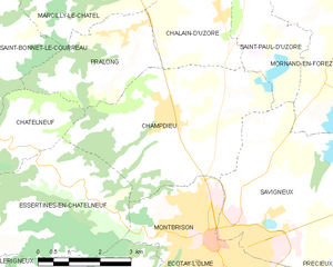
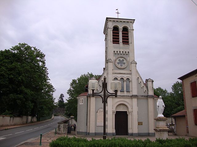
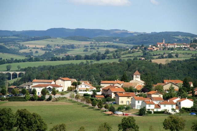
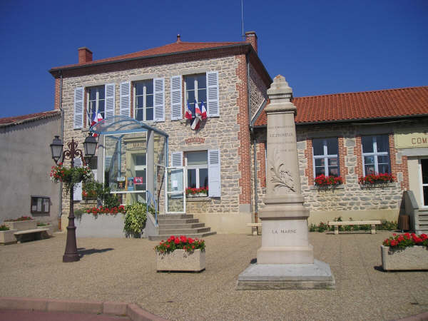
Champdieu
- commune in Loire, France
- Country:
- Postal Code: 42600
- Coordinates: 45° 38' 41" N, 4° 2' 43" E
- GPS tracks (wikiloc): [Link]
- Area: 18.2 sq km
- Population: 1856
- Web site: [Link]


Périgneux
- commune in Loire, France
- Country:
- Postal Code: 42380
- Coordinates: 45° 26' 33" N, 4° 9' 18" E
- GPS tracks (wikiloc): [Link]
- Area: 32 sq km
- Population: 1467
- Web site: [Link]

Veauchette
- commune in Loire, France
- Country:
- Postal Code: 42340
- Coordinates: 45° 33' 43" N, 4° 15' 55" E
- GPS tracks (wikiloc): [Link]
- Area: 7.54 sq km
- Population: 1198


La Bénisson-Dieu
- commune in Loire, France
- Country:
- Postal Code: 42720
- Coordinates: 46° 9' 0" N, 4° 2' 44" E
- GPS tracks (wikiloc): [Link]
- AboveSeaLevel: 268 м m
- Area: 11.12 sq km
- Population: 417


Montverdun
- commune in Loire, France
- Country:
- Postal Code: 42130
- Coordinates: 45° 42' 54" N, 4° 4' 1" E
- GPS tracks (wikiloc): [Link]
- Area: 16.52 sq km
- Population: 1273

Neaux
- commune in Loire, France
- Country:
- Postal Code: 42470
- Coordinates: 45° 57' 44" N, 4° 10' 48" E
- GPS tracks (wikiloc): [Link]
- Area: 17.36 sq km
- Population: 488
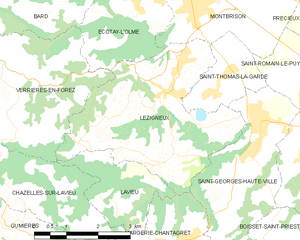
Lézigneux
- commune in Loire, France
- Country:
- Postal Code: 42600
- Coordinates: 45° 34' 2" N, 4° 3' 39" E
- GPS tracks (wikiloc): [Link]
- Area: 15.04 sq km
- Population: 1698

Luré
- commune in Loire, France
- Country:
- Postal Code: 42260
- Coordinates: 45° 52' 53" N, 3° 56' 14" E
- GPS tracks (wikiloc): [Link]
- Area: 6.23 sq km
- Population: 150


Soleymieux
- commune in Loire, France
- Country:
- Postal Code: 42560
- Coordinates: 45° 30' 32" N, 4° 2' 31" E
- GPS tracks (wikiloc): [Link]
- Area: 8.8 sq km
- Population: 644
- Web site: [Link]

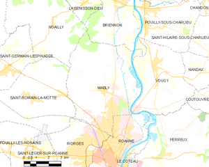
Mably
- commune in Loire, France
- Country:
- Postal Code: 42300
- Coordinates: 46° 5' 9" N, 4° 3' 53" E
- GPS tracks (wikiloc): [Link]
- Area: 32.8 sq km
- Population: 7684
- Web site: [Link]
Saint-Rirand
- commune in Loire, France
- Country:
- Postal Code: 42370
- Coordinates: 46° 4' 34" N, 3° 50' 55" E
- GPS tracks (wikiloc): [Link]
- Area: 16.43 sq km
- Population: 145
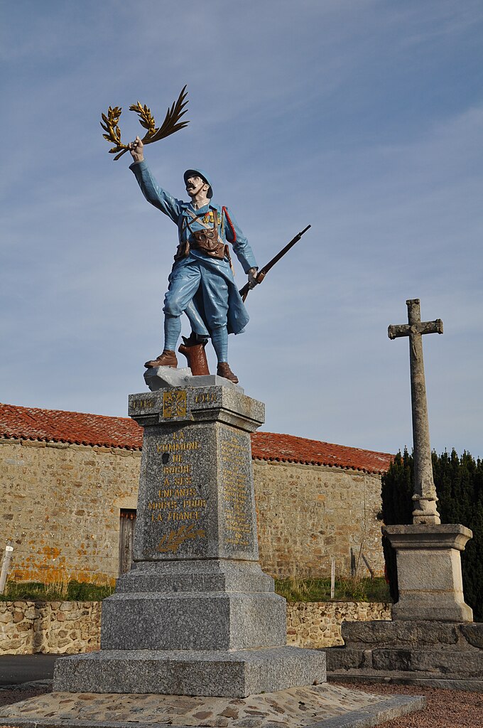

Roche
- commune in Loire, France
- Country:
- Postal Code: 42600
- Coordinates: 45° 36' 52" N, 3° 56' 43" E
- GPS tracks (wikiloc): [Link]
- Area: 23.33 sq km
- Population: 263
- Web site: [Link]

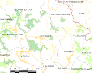
Chevrières
- commune in Loire, France
- Country:
- Postal Code: 42140
- Coordinates: 45° 35' 18" N, 4° 24' 3" E
- GPS tracks (wikiloc): [Link]
- AboveSeaLevel: 634 м m
- Area: 14.54 sq km
- Population: 1067

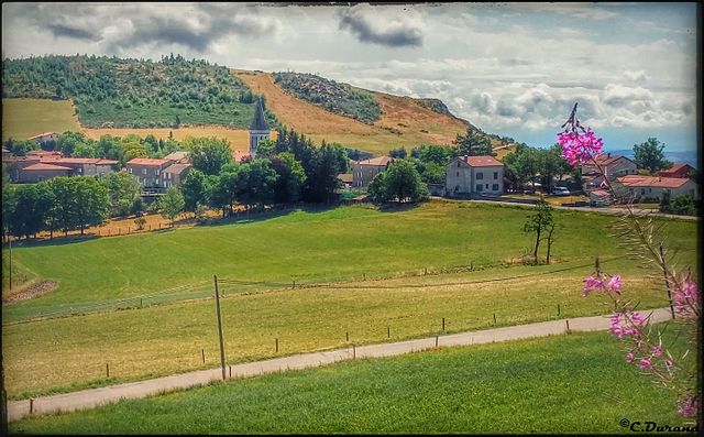
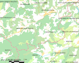
Bourg-Argental
- commune in Loire, France
- Country:
- Postal Code: 42220
- Coordinates: 45° 17' 47" N, 4° 33' 36" E
- GPS tracks (wikiloc): [Link]
- Area: 20.15 sq km
- Population: 2902
- Web site: [Link]


Maizilly
- commune in Loire, France
- Country:
- Postal Code: 42750
- Coordinates: 46° 10' 43" N, 4° 14' 41" E
- GPS tracks (wikiloc): [Link]
- Area: 5.12 sq km
- Population: 335
- Web site: [Link]


Coutouvre
- commune in Loire, France
- Country:
- Postal Code: 42460
- Coordinates: 46° 4' 22" N, 4° 12' 42" E
- GPS tracks (wikiloc): [Link]
- Area: 21.87 sq km
- Population: 1113


Véranne
- commune in Loire, France
- Country:
- Postal Code: 42520
- Coordinates: 45° 22' 6" N, 4° 39' 46" E
- GPS tracks (wikiloc): [Link]
- Area: 15.96 sq km
- Population: 829
- Web site: [Link]


Saint-Sauveur-en-Rue
- commune in Loire, France
- Country:
- Postal Code: 42220
- Coordinates: 45° 16' 10" N, 4° 29' 42" E
- GPS tracks (wikiloc): [Link]
- Area: 30.26 sq km
- Population: 1107

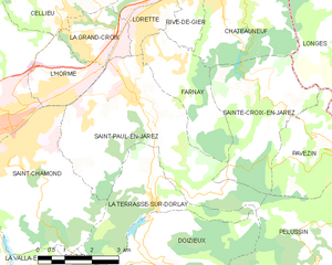
Saint-Paul-en-Jarez
- commune in Loire, France
- Country:
- Postal Code: 42740
- Coordinates: 45° 28' 59" N, 4° 34' 28" E
- GPS tracks (wikiloc): [Link]
- Area: 19.98 sq km
- Population: 4754
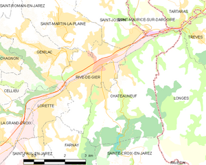
Rive-de-Gier
- commune in Loire, France
- Country:
- Postal Code: 42800
- Coordinates: 45° 31' 46" N, 4° 37' 1" E
- GPS tracks (wikiloc): [Link]
- Area: 7.33 sq km
- Population: 15182
- Web site: [Link]

Chagnon
- commune in Loire, France
- Country:
- Postal Code: 42800
- Coordinates: 45° 32' 5" N, 4° 33' 11" E
- GPS tracks (wikiloc): [Link]
- Area: 2.48 sq km
- Population: 492

arrondissement of Montbrison
- arrondissement of France
- Country:
- Capital: Montbrison
- Coordinates: 45° 36' 14" N, 4° 3' 47" E
- GPS tracks (wikiloc): [Link]
- Area: 1959 sq km
- Population: 180132

arrondissement of Roanne
- arrondissement of France
- Country:
- Capital: Roanne
- Coordinates: 46° 1' 58" N, 4° 4' 8" E
- GPS tracks (wikiloc): [Link]
- Area: 1780 sq km
- Population: 157071


arrondissement of Saint-Étienne
- arrondissement of France
- Country:
- Capital: Saint-Étienne
- Coordinates: 45° 26' 2" N, 4° 23' 10" E
- GPS tracks (wikiloc): [Link]
- Area: 1041 sq km
- Population: 422208


Saint-Pierre-de-Bœuf
- commune in Loire, France
- Country:
- Postal Code: 42520
- Coordinates: 45° 22' 58" N, 4° 44' 58" E
- GPS tracks (wikiloc): [Link]
- Area: 5.95 sq km
- Population: 1752
- Web site: [Link]

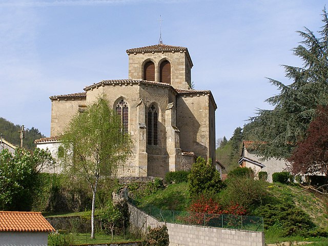
Sainte-Croix-en-Jarez
- commune in Loire, France
- Country:
- Postal Code: 42800
- Coordinates: 45° 28' 46" N, 4° 38' 50" E
- GPS tracks (wikiloc): [Link]
- Area: 12.05 sq km
- Population: 461
- Web site: [Link]


Poncins
- commune in Loire, France
- Country:
- Postal Code: 42110
- Coordinates: 45° 43' 41" N, 4° 9' 45" E
- GPS tracks (wikiloc): [Link]
- Area: 20.63 sq km
- Population: 1009
- Web site: [Link]


Montchal
- commune in Loire, France
- Country:
- Postal Code: 42360
- Coordinates: 45° 49' 33" N, 4° 18' 53" E
- GPS tracks (wikiloc): [Link]
- AboveSeaLevel: 640 м m
- Area: 8.84 sq km
- Population: 502
Chausseterre
- commune in Loire, France
- Country:
- Postal Code: 42430
- Coordinates: 45° 53' 47" N, 3° 47' 1" E
- GPS tracks (wikiloc): [Link]
- Area: 16.58 sq km
- Population: 238
Marcenod
- commune in Loire, France
- Country:
- Postal Code: 42140
- Coordinates: 45° 34' 19" N, 4° 28' 55" E
- GPS tracks (wikiloc): [Link]
- Area: 9 sq km
- Population: 708

Maclas
- commune in Loire, France
- Country:
- Postal Code: 42520
- Coordinates: 45° 21' 45" N, 4° 41' 5" E
- GPS tracks (wikiloc): [Link]
- Area: 10.15 sq km
- Population: 1817
- Web site: [Link]
La Chapelle-Villars
- commune in Loire, France
- Country:
- Postal Code: 42410
- Coordinates: 45° 28' 21" N, 4° 42' 59" E
- GPS tracks (wikiloc): [Link]
- Area: 8.25 sq km
- Population: 529


Pélussin
- commune in Loire, France
- Country:
- Postal Code: 42410
- Coordinates: 45° 25' 6" N, 4° 40' 51" E
- GPS tracks (wikiloc): [Link]
- Area: 32.16 sq km
- Population: 3757
- Web site: [Link]


Saint-Cyr-de-Valorges
- commune in Loire, France
- Country:
- Postal Code: 42114
- Coordinates: 45° 53' 29" N, 4° 18' 22" E
- GPS tracks (wikiloc): [Link]
- Area: 9.91 sq km
- Population: 306


Villemontais
- commune in Loire, France
- Country:
- Postal Code: 42155
- Coordinates: 45° 58' 45" N, 3° 57' 2" E
- GPS tracks (wikiloc): [Link]
- Area: 12.73 sq km
- Population: 1018

Saint-Laurent-Rochefort
- commune in Loire, France
- Country:
- Postal Code: 42130
- Coordinates: 45° 46' 24" N, 3° 55' 24" E
- GPS tracks (wikiloc): [Link]
- Area: 15.6 sq km
- Population: 242
- Web site: [Link]
Shares border with regions:


Isère
- French department
 Hiking in Isère
Isère, located in the Auvergne-Rhône-Alpes region of France, offers some of the most beautiful and diverse hiking opportunities in the French Alps. Known for its stunning mountain scenery, charming villages, and rich cultural heritage, Isère is a fantastic destination for hikers of all levels. Here are some highlights of hiking in Isère:...
- Country:
- Capital: Grenoble
- Coordinates: 45° 20' 0" N, 5° 30' 0" E
- GPS tracks (wikiloc): [Link]
- AboveSeaLevel: 846 м m
- Area: 7431 sq km
- Population: 1251060
- Web site: [Link]


Haute-Loire
- French department
- Country:
- Capital: Le Puy-en-Velay
- Coordinates: 45° 0' 0" N, 4° 0' 0" E
- GPS tracks (wikiloc): [Link]
- Area: 4977 sq km
- Population: 227034
- Web site: [Link]


Puy-de-Dôme
- French department
- Country:
- Capital: Clermont-Ferrand
- Coordinates: 45° 42' 0" N, 3° 13' 0" E
- GPS tracks (wikiloc): [Link]
- Area: 7970 sq km
- Population: 647501
- Web site: [Link]


Saône-et-Loire
- French department
Hiking in Saône-et-Loire
Saône-et-Loire is a beautiful department in the Bourgogne-Franche-Comté region of France, known for its rich history, stunning landscapes, and diverse trails suitable for all levels of hikers. Here’s what you can expect when hiking in this picturesque region:...
- Country:
- Capital: Mâcon
- Coordinates: 46° 40' 0" N, 4° 42' 0" E
- GPS tracks (wikiloc): [Link]
- Area: 8575 sq km
- Population: 555408
- Web site: [Link]


Allier
- French department
- Country:
- Capital: Moulins
- Coordinates: 46° 20' 0" N, 3° 10' 0" E
- GPS tracks (wikiloc): [Link]
- Area: 7340 sq km
- Population: 341613
- Web site: [Link]


Ardèche
- French department
Hiking in Ardèche
Hiking in the Ardèche region of France offers a remarkable experience for outdoor enthusiasts, with diverse landscapes ranging from dramatic gorges to tranquil forests. Here are some key aspects to consider when hiking in Ardèche:...
- Country:
- Capital: Privas
- Coordinates: 44° 40' 0" N, 4° 25' 0" E
- GPS tracks (wikiloc): [Link]
- Area: 5529 sq km
- Population: 324209
- Web site: [Link]


Rhône
- French department
Hiking in Rhône
Hiking in the Rhône department, located in the Auvergne-Rhône-Alpes region of France, offers a diverse range of landscapes and trails that cater to various skill levels. Here's a breakdown of what you can expect:...
- Country:
- Capital: Villefranche-sur-Saône
- Coordinates: 45° 59' 44" N, 4° 43' 10" E
- GPS tracks (wikiloc): [Link]
- Area: 3249 sq km
- Population: 1821995
- Web site: [Link]