Cambremer (Cambremer)

- commune in Calvados, France
- Country:

- Postal Code: 14340
- Coordinates: 49° 9' 7" N, 0° 2' 52" E


- GPS tracks (wikiloc): [Link]
- Area: 23.57 sq km
- Population: 1166
- Web site: http://www.cambremer.fr
- Wikipedia en: wiki(en)
- Wikipedia: wiki(fr)
- Wikidata storage: Wikidata: Q744896
- Wikipedia Commons Category: [Link]
- Freebase ID: [/m/02kqjd]
- Freebase ID: [/m/02kqjd]
- GeoNames ID: Alt: [6427115]
- GeoNames ID: Alt: [6427115]
- SIREN number: [211401260]
- SIREN number: [211401260]
- BnF ID: [15247540b]
- BnF ID: [15247540b]
- VIAF ID: Alt: [245236916]
- VIAF ID: Alt: [245236916]
- GND ID: Alt: [7692535-3]
- GND ID: Alt: [7692535-3]
- PACTOLS thesaurus ID: [pcrtkb0zayebNF]
- PACTOLS thesaurus ID: [pcrtkb0zayebNF]
- INSEE municipality code: 14126
- INSEE municipality code: 14126
Shares border with regions:

Notre-Dame-d'Estrées
- former commune in Calvados, France
- Country:
- Postal Code: 14340
- Coordinates: 49° 9' 0" N, 0° 1' 0" E
- GPS tracks (wikiloc): [Link]
- Population: 167

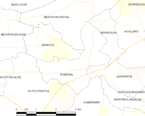
Rumesnil
- commune in Calvados, France
- Country:
- Postal Code: 14340
- Coordinates: 49° 11' 5" N, 0° 1' 46" E
- GPS tracks (wikiloc): [Link]
- Area: 5.35 sq km
- Population: 100

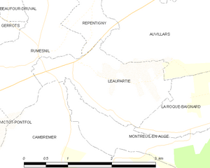
Léaupartie
- commune in Calvados, France
- Country:
- Postal Code: 14340
- Coordinates: 49° 11' 3" N, 0° 2' 30" E
- GPS tracks (wikiloc): [Link]
- Area: 3.2 sq km
- Population: 91

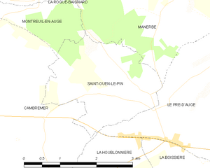
Saint-Ouen-le-Pin
- commune in Calvados, France
- Country:
- Postal Code: 14340
- Coordinates: 49° 8' 53" N, 0° 6' 24" E
- GPS tracks (wikiloc): [Link]
- Area: 5.59 sq km
- Population: 264

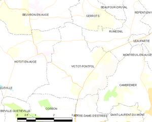
Victot-Pontfol
- commune in Calvados, France
- Country:
- Postal Code: 14430
- Coordinates: 49° 9' 47" N, 0° 1' 0" E
- GPS tracks (wikiloc): [Link]
- Area: 10.66 sq km
- Population: 115


Notre-Dame-de-Livaye
- commune in Calvados, France
- Country:
- Postal Code: 14340
- Coordinates: 49° 6' 53" N, 0° 2' 26" E
- GPS tracks (wikiloc): [Link]
- Area: 2.67 sq km
- Population: 125


Monteille
- former commune in Calvados, France
- Country:
- Postal Code: 14270
- Coordinates: 49° 6' 32" N, 0° 2' 46" E
- GPS tracks (wikiloc): [Link]
- Area: 4.53 sq km
- Population: 157

Crèvecœur-en-Auge
- former commune in Calvados, France
- Country:
- Postal Code: 14340
- Coordinates: 49° 7' 5" N, 0° 0' 53" E
- GPS tracks (wikiloc): [Link]
- Area: 2.15 sq km
- Population: 519

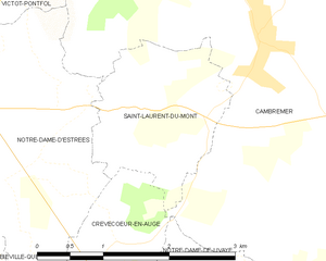
Saint-Laurent-du-Mont
- commune in Calvados, France
- Country:
- Postal Code: 14340
- Coordinates: 49° 8' 26" N, 0° 2' 12" E
- GPS tracks (wikiloc): [Link]
- Area: 3.48 sq km
- Population: 192


La Houblonnière
- commune in Calvados, France
- Country:
- Postal Code: 14340
- Coordinates: 49° 7' 29" N, 0° 6' 17" E
- GPS tracks (wikiloc): [Link]
- Area: 7.1 sq km
- Population: 327


Montreuil-en-Auge
- commune in Calvados, France
- Country:
- Postal Code: 14340
- Coordinates: 49° 10' 17" N, 0° 3' 17" E
- GPS tracks (wikiloc): [Link]
- Area: 3.37 sq km
- Population: 52