Campuzan (Campuzan)

- commune in Hautes-Pyrénées, France
- Country:

- Postal Code: 65230
- Coordinates: 43° 16' 17" N, 0° 25' 42" E


- GPS tracks (wikiloc): [Link]
- Area: 6.62 sq km
- Population: 168
- Wikipedia en: wiki(en)
- Wikipedia: wiki(fr)
- Wikidata storage: Wikidata: Q1094177
- Wikipedia Commons Category: [Link]
- Freebase ID: [/m/02prv23]
- Freebase ID: [/m/02prv23]
- SIREN number: [216501262]
- SIREN number: [216501262]
- BnF ID: [15270507f]
- BnF ID: [15270507f]
- INSEE municipality code: 65126
- INSEE municipality code: 65126
Shares border with regions:


Hachan
- commune in Hautes-Pyrénées, France
- Country:
- Postal Code: 65230
- Coordinates: 43° 17' 10" N, 0° 27' 22" E
- GPS tracks (wikiloc): [Link]
- Area: 1.86 sq km
- Population: 40
Tournous-Devant
- commune in Hautes-Pyrénées, France
- Country:
- Postal Code: 65330
- Coordinates: 43° 14' 52" N, 0° 25' 5" E
- GPS tracks (wikiloc): [Link]
- Area: 4.67 sq km
- Population: 114


Puntous
- commune in Hautes-Pyrénées, France
- Country:
- Postal Code: 65230
- Coordinates: 43° 18' 13" N, 0° 28' 13" E
- GPS tracks (wikiloc): [Link]
- Area: 8.85 sq km
- Population: 190


Libaros
- commune in Hautes-Pyrénées, France
- Country:
- Postal Code: 65330
- Coordinates: 43° 15' 13" N, 0° 23' 28" E
- GPS tracks (wikiloc): [Link]
- Area: 9.08 sq km
- Population: 134


Betpouy
- commune in Hautes-Pyrénées, France
- Country:
- Postal Code: 65230
- Coordinates: 43° 16' 30" N, 0° 27' 32" E
- GPS tracks (wikiloc): [Link]
- Area: 4.15 sq km
- Population: 78

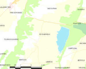
Puydarrieux
- commune in Hautes-Pyrénées, France
- Country:
- Postal Code: 65220
- Coordinates: 43° 17' 8" N, 0° 23' 8" E
- GPS tracks (wikiloc): [Link]
- Area: 13.99 sq km
- Population: 217