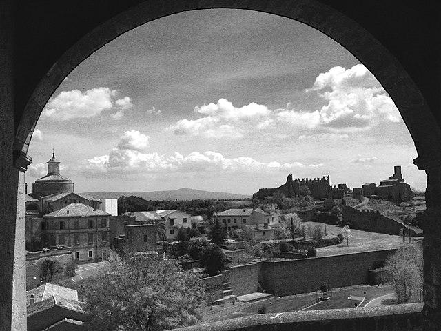
Canino (Canino)
.svg)
- Italian comune
 Hiking in Canino
Canino, a commune located in the Province of Viterbo in Italy, is known for its beautiful countryside, rolling hills, and rich historical heritage. Hiking in this area offers a unique opportunity to explore scenic landscapes, ancient ruins, and local flora and fauna.
Hiking Opportunities in Canino:
-
Nature Trails: Canino boasts several trails that weave through its picturesque landscapes. You'll find paths that take you through vineyards, olive groves, and forests, providing a chance to experience the local agriculture and wildlife.
-
Historic Routes: There are trails that connect to historical sites, such as Etruscan ruins. The area's rich history provides a cultural backdrop for your hikes, allowing you to explore ancient settlements and archaeological sites.
-
Proximity to Natural Parks: Canino is near the Cimini Mountains and the Natural Park of Bracciano-Martignano, offering even more hiking opportunities. Within these parks, you can find a variety of trails that suit different skill levels.
-
Cultural Experiences: While hiking, you may encounter local restaurants and wineries. Consider scheduling a stop to enjoy traditional Tuscan cuisine or sample local wines, enhancing your outdoor experience with a taste of local culture.
Tips for Hiking in Canino:
-
Weather: Check the weather before your hike, as conditions can change. The best times to hike are typically in spring (April to June) and fall (September to October) when temperatures are more moderate.
-
Preparation: Wear appropriate footwear and bring enough water and snacks. Some trails can be well-marked, but it's always a good idea to have a map or GPS device.
-
Local Guidance: If you're unfamiliar with the area, consider hiring a local guide or joining organized hiking groups. They can provide insights into the best trails and local history.
-
Respect Nature: Follow Leave No Trace principles while hiking. Help preserve the beauty of Canino's natural environment for future visitors.
Whether you're a seasoned hiker or a casual walker, Canino offers a variety of trails that cater to different interests and fitness levels. Enjoy your outdoor adventure!
- Country:

- Postal Code: 01011
- Local Dialing Code: 0761
- Licence Plate Code: VT
- Coordinates: 42° 27' 54" N, 11° 45' 7" E


- GPS tracks (wikiloc): [Link]
- AboveSeaLevel: 229 м m
- Area: 124.04 sq km
- Population: 5284
- Web site: http://www.comune.canino.vt.it
- Wikipedia en: wiki(en)
- Wikipedia: wiki(it)
- Wikidata storage: Wikidata: Q159710
- Wikipedia Commons Category: [Link]
- Freebase ID: [/m/077l6l]
- GeoNames ID: Alt: [6536898]
- VIAF ID: Alt: [153586422]
- OSM relation ID: [42018]
- GND ID: Alt: [4796136-3]
- Library of Congress authority ID: Alt: [n78061564]
- UN/LOCODE: [ITVB2]
- ISTAT ID: 056012
- Italian cadastre code: B604
Shares border with regions:
Cellere
- Italian comune
Hiking in Cellere
Cellere is a charming town located in the Lazio region of Italy, particularly known for its stunning landscapes and rich history. If you're considering hiking in and around Cellere, you can expect to find a variety of trails that showcase the area's natural beauty....
- Country:
- Postal Code: 01010
- Local Dialing Code: 0761
- Licence Plate Code: VT
- Coordinates: 42° 30' 41" N, 11° 46' 21" E
- GPS tracks (wikiloc): [Link]
- AboveSeaLevel: 344 м m
- Area: 37.2 sq km
- Population: 1168
- Web site: [Link]


Ischia di Castro
- Italian comune
Hiking in Ischia di Castro
Ischia di Castro, located in the Viterbo province of Italy's Lazio region, offers a variety of hiking opportunities that allow visitors to experience its beautiful landscapes, historical sites, and natural parks. Here are some highlights of hiking in this area:...
- Country:
- Postal Code: 01010
- Local Dialing Code: 0761
- Licence Plate Code: VT
- Coordinates: 42° 32' 42" N, 11° 45' 25" E
- GPS tracks (wikiloc): [Link]
- AboveSeaLevel: 384 м m
- Area: 104.95 sq km
- Population: 2285
- Web site: [Link]


Montalto di Castro
- Italian comune
Hiking in Montalto di Castro
Montalto di Castro, located in the Lazio region of Italy, offers wonderful hiking opportunities combined with stunning landscapes and rich historical context. Here are some key aspects to consider when hiking in this area:...
- Country:
- Postal Code: 01014
- Local Dialing Code: 0766
- Licence Plate Code: VT
- Coordinates: 42° 21' 5" N, 11° 36' 28" E
- GPS tracks (wikiloc): [Link]
- AboveSeaLevel: 42 м m
- Area: 189.63 sq km
- Population: 8978
- Web site: [Link]
Tessennano
- Italian comune
Hiking in Tessennano
Tessennano, a small village located in the Lazio region of Italy, is surrounded by beautiful landscapes that provide excellent opportunities for hiking and outdoor activities. The area boasts lush hills, picturesque valleys, and diverse wildlife, making it a great destination for hikers of all levels....
- Country:
- Postal Code: 01010
- Local Dialing Code: 0761
- Licence Plate Code: VT
- Coordinates: 42° 28' 45" N, 11° 47' 28" E
- GPS tracks (wikiloc): [Link]
- AboveSeaLevel: 302 м m
- Area: 14.73 sq km
- Population: 327
- Web site: [Link]

Tuscania
- Italian comune
Hiking in Tuscania
Tuscania, a charming town in the Lazio region of Italy, offers a beautiful backdrop for hiking enthusiasts. Nestled in a landscape of rolling hills, ancient ruins, and lush greenery, it provides a variety of hiking opportunities suited for different skill levels. Here are some key points about hiking in and around Tuscania:...
- Country:
- Postal Code: 01017
- Local Dialing Code: 0761
- Licence Plate Code: VT
- Coordinates: 42° 25' 17" N, 11° 52' 19" E
- GPS tracks (wikiloc): [Link]
- AboveSeaLevel: 165 м m
- Area: 208.69 sq km
- Population: 8369
- Web site: [Link]


Manciano
- Italian comune near Grosseto
Hiking in Manciano
Manciano, located in the beautiful Maremma region of Tuscany, Italy, offers stunning landscapes and a variety of hiking opportunities for outdoor enthusiasts. The countryside around Manciano is characterized by rolling hills, lush vegetation, vineyards, and olive groves, making it an ideal destination for hiking and exploring nature....
- Country:
- Postal Code: 58014
- Local Dialing Code: 0564
- Licence Plate Code: GR
- Coordinates: 42° 35' 15" N, 11° 30' 54" E
- GPS tracks (wikiloc): [Link]
- AboveSeaLevel: 444 м m
- Area: 372.51 sq km
- Population: 7309
- Web site: [Link]