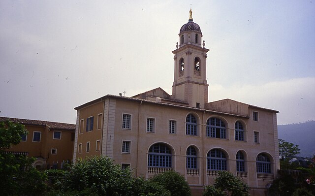
Cantaron (Cantaron)
- commune in Alpes-Maritimes, France
 Hiking in Cantaron
Cantaron is a charming village located in the Alpes-Maritimes department of southeastern France, near Nice. It's a fantastic destination for hiking enthusiasts, offering a mix of scenic trails, beautiful landscapes, and a rich cultural experience. Here are some highlights regarding hiking in and around Cantaron:
Trails and Natural Features
-
Varied Terrain: The region around Cantaron features a variety of terrain, including lush forests, rocky outcrops, and panoramic views of the Mediterranean and surrounding mountains.
-
GR5 European Long-Distance Path: One of the major hiking paths, the GR5, passes through the area, offering a well-marked route that connects the northern parts of Europe to the southern coasts. Hikers can enjoy multiple stages of the trail from Cantaron.
-
Local Trails: There are several local trails that offer shorter hikes suitable for a range of experience levels. These trails often lead to viewpoints that provide stunning vistas of the surrounding landscape.
-
Gorge de la Mescla: A popular hiking destination nearby, with trails leading through the gorge that showcase impressive rock formations and the beauty of the natural environment.
Wildlife and Flora
- The area around Cantaron is rich in biodiversity, featuring Mediterranean vegetation, including oak forests, aromatic shrubs, and various wildflowers. Keep an eye out for local wildlife, perhaps spotting birds, butterflies, and other small animals.
Cultural Exploration
- Combining hiking with a visit to the village itself can enrich your experience. Explore the narrow streets of Cantaron, admire the local architecture, and perhaps stop by a café or restaurant for some traditional cuisine.
Preparation Tips
-
Weather: The weather can vary greatly, so it’s essential to check the forecast before heading out. The best time for hiking is typically in spring and early autumn when conditions are mild.
-
Gear: Wear sturdy hiking shoes, and consider bringing water, snacks, a first-aid kit, and perhaps trekking poles if you're hiking on more rugged terrain.
-
Maps and Navigation: While trails are generally well-marked, carrying a map or using a GPS app can be helpful, particularly if you plan to explore more remote paths or create a custom hike.
Conclusion
Whether you’re an experienced hiker or just looking for a peaceful walk in nature, Cantaron’s hiking paths offer beautiful scenery and a chance to experience the unique charm of this part of France. Always remember to respect nature and leave no trace as you explore the trails. Happy hiking!
- Country:

- Postal Code: 06340
- Coordinates: 43° 45' 42" N, 7° 19' 7" E


- GPS tracks (wikiloc): [Link]
- Area: 7.38 sq km
- Population: 1337
- Web site: http://www.cantaron.fr/
- Wikipedia en: wiki(en)
- Wikipedia: wiki(fr)
- Wikidata storage: Wikidata: Q845711
- Wikipedia Commons Category: [Link]
- Freebase ID: [/m/03m4y7n]
- Freebase ID: [/m/03m4y7n]
- GeoNames ID: Alt: [6446685]
- GeoNames ID: Alt: [6446685]
- SIREN number: [210600318]
- SIREN number: [210600318]
- INSEE municipality code: 06031
- INSEE municipality code: 06031
Shares border with regions:


Tourrette-Levens
- commune in Alpes-Maritimes, France
Hiking in Tourrette-Levens
Tourrette-Levens is a charming commune located in the Alpes-Maritimes region of southeastern France, not far from Nice. It offers a delightful mix of hiking opportunities, showcasing stunning Mediterranean landscapes, hills, and views over the surrounding areas....
- Country:
- Postal Code: 06690
- Coordinates: 43° 47' 12" N, 7° 16' 33" E
- GPS tracks (wikiloc): [Link]
- Area: 16.5 sq km
- Population: 4877
- Web site: [Link]


Contes
- commune in Alpes-Maritimes, France
Hiking in Contes
Contes, located in the Alpes-Maritimes department of France, is a charming village that offers beautiful hiking opportunities amidst the stunning natural landscapes of the region. Here are some key points and tips for hiking around Contes:...
- Country:
- Postal Code: 06390
- Coordinates: 43° 48' 43" N, 7° 18' 50" E
- GPS tracks (wikiloc): [Link]
- Area: 19.47 sq km
- Population: 7412
- Web site: [Link]


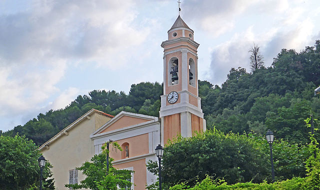
Drap
- commune in Alpes-Maritimes, France
Hiking in Drap
Hiking in Drap, Utah, offers a variety of beautiful trails and stunning scenery, suited for all levels of experience. Drap is located at the foot of the Wasatch Range, giving hikers access to diverse landscapes, from the foothills to rugged mountain trails....
- Country:
- Postal Code: 06340
- Coordinates: 43° 45' 18" N, 7° 19' 17" E
- GPS tracks (wikiloc): [Link]
- Area: 5.54 sq km
- Population: 4444
- Web site: [Link]


Nice
- city in Alpes-Maritimes, France
- Country:
- Postal Code: 06000
- Local Dialing Code: 493
- Coordinates: 43° 42' 7" N, 7° 16' 6" E
- GPS tracks (wikiloc): [Link]
- AboveSeaLevel: 10 м m
- Area: 71.92 sq km
- Population: 342522
- Web site: [Link]

La Trinité
- commune in Alpes-Maritimes, France
Hiking in La Trinité
La Trinité, located in the Alpes-Maritimes department of France, offers several beautiful hiking opportunities for outdoor enthusiasts. Nestled near Nice and the Mediterranean coast, it provides a mix of coastal views, lush greenery, and panoramic mountain scenery. Here are some highlights and considerations for hiking in this area:...
- Country:
- Postal Code: 06340
- Coordinates: 43° 44' 27" N, 7° 18' 51" E
- GPS tracks (wikiloc): [Link]
- Area: 14.9 sq km
- Population: 10222
- Web site: [Link]

Blausasc
- commune in Alpes-Maritimes, France
Hiking in Blausasc
Blausasc is a charming village located in the Alpes-Maritimes department of France, near Nice. It is known for its stunning landscapes and diverse hiking opportunities, making it a great destination for outdoor enthusiasts....
- Country:
- Postal Code: 06440
- Coordinates: 43° 48' 17" N, 7° 21' 55" E
- GPS tracks (wikiloc): [Link]
- Area: 10.21 sq km
- Population: 1448


Châteauneuf-Villevieille
- commune in Alpes-Maritimes, France
Hiking in Châteauneuf-Villevieille
Châteauneuf-Villevieille is a picturesque village located in the Provence-Alpes-Côte d'Azur region of France, nestled in the hills of the Alpes-Maritimes. It offers a range of hiking opportunities that showcase the stunning natural landscapes, Mediterranean flora, and quaint views of the surrounding countryside....
- Country:
- Postal Code: 06390
- Coordinates: 43° 48' 30" N, 7° 17' 47" E
- GPS tracks (wikiloc): [Link]
- AboveSeaLevel: 650 м m
- Area: 8.38 sq km
- Population: 913
- Web site: [Link]