
Alpes-Maritimes (Alpes-Maritimes)


- French department
 Hiking in Alpes-Maritimes
Hiking in Alpes-Maritimes, located in the Provence-Alpes-Côte d'Azur region of France, offers a diverse range of trails and stunning landscapes. From coastal paths along the Mediterranean Sea to rocky mountain trails in the Mercantour National Park, the area caters to hikers of all levels.
Key Hiking Areas:
-
Mercantour National Park:
- This national park is renowned for its breathtaking alpine scenery, diverse wildlife, and ancient rock carvings. There are numerous trails ranging from easy walks to challenging multi-day treks. Notable routes include the Vallée des Merveilles and the hike to the stunning Lac de la Moutonne.
-
Alpes d'Azur:
- This region offers beautiful trails that showcase varied terrains, including forests, meadows, and panoramic views of the surrounding mountains. Popular hikes include the ascent of Mount Bessons and trails around the charming village of Guillaumes.
-
Coastal Trails:
- The coastal paths along the Côte d'Azur provide breathtaking views of the Mediterranean Sea. The Sentier Littoral, which runs from Nice to the Italian border, features stunning coastal scenery and opportunities to explore beaches and hidden coves.
-
Gorges du Loup:
- This picturesque gorge offers several hiking possibilities, marked by waterfalls and rocky cliffs. The trails are generally moderate, making them suitable for families and those looking for a scenic day hike.
Tips for Hiking in Alpes-Maritimes:
- Trail Markings: Trails are typically well-marked with yellow or red/white blazes. Always carry a map or a GPS for less-marked areas.
- Weather: The weather can be changeable, especially in the mountains. It's essential to check forecasts and prepare for varying conditions.
- Wildlife: Keep an eye out for the diverse wildlife, including chamois, ibex, and a variety of bird species. Respect nature and observe animals from a distance.
- Local Regulations: Follow local regulations, especially in protected areas like Mercantour National Park, to help preserve the natural environment.
- Hydration and Nutrition: Carry enough water and snacks, as some trails have limited access to refreshments.
Whether you prefer rugged mountain hikes or serene coastal strolls, the Alpes-Maritimes boasts a wealth of hiking opportunities that showcase the natural beauty of southern France. Happy hiking!
- Country:

- Capital: Nice
- Coordinates: 43° 50' 0" N, 7° 10' 0" E


- GPS tracks (wikiloc): [Link]
- Area: 4299 sq km
- Population: 1082440
- Web site: https://www.departement06.fr/departement-des-alpes-maritimes-3.html
- Wikipedia en: wiki(en)
- Wikipedia: wiki(fr)
- Wikidata storage: Wikidata: Q3139
- Wikipedia Commons Category: [Link]
- Wikipedia Commons Maps Category: [Link]
- Freebase ID: [/m/0ky0b]
- GeoNames ID: Alt: [3038049]
- SIREN number: [220600019]
- BnF ID: [119369817]
- VIAF ID: Alt: [133267547]
- OSM relation ID: [7385]
- GND ID: Alt: [4117968-7]
- archINFORM location ID: [2731]
- Library of Congress authority ID: Alt: [n82031739]
- MusicBrainz area ID: [d991e40d-0a23-42f9-86e7-e43ab528fc41]
- Encyclopædia Britannica Online ID: [place/Alpes-Maritimes]
- Gran Enciclopèdia Catalana ID: [0002961]
- Twitter username: Alt: [AlpesMaritimes]
- National Library of Israel ID: [000991289]
- YouTube channel ID: [UCo1C19pQls5yvmwH3WJj4KQ]
- NUTS code: [FR823]
- NE.se ID: [alpes-maritimes]
- INSEE department code: [06]
- ISO 3166-2 code: FR-06
Includes regions:


L'Escarène
- commune in Alpes-Maritimes, France
Hiking in L'Escarène
L'Escarène is a charming village located in the Alpes-Maritimes department in southeastern France, nestled in the beautiful hills of the Côte d'Azur. The area around L'Escarène offers a variety of hiking opportunities, characterized by its picturesque landscapes, stunning views of the surrounding hills and valleys, and proximity to the Mediterranean coastline....
- Country:
- Postal Code: 06440
- Coordinates: 43° 50' 4" N, 7° 21' 24" E
- GPS tracks (wikiloc): [Link]
- Area: 10.67 sq km
- Population: 2507


Ilonse
- commune in Alpes-Maritimes, France
Hiking in Ilonse
Ilonse is a small village in the Alpes-Maritimes department of southeastern France. It's located near the French Riviera and surrounded by beautiful landscapes, making it an interesting destination for hikers. Here are some details about hiking in and around Ilonse:...
- Country:
- Postal Code: 06420
- Coordinates: 44° 1' 56" N, 7° 5' 58" E
- GPS tracks (wikiloc): [Link]
- Area: 40.59 sq km
- Population: 194
- Web site: [Link]


Valdeblore
- commune in Alpes-Maritimes, France
Hiking in Valdeblore
Valdeblore is a beautiful valley located in the French Alps, in the Alpes-Maritimes department of the Provence-Alpes-Côte d'Azur region. It's known for its stunning landscapes, diverse flora and fauna, and excellent hiking opportunities. Here are some key points about hiking in Valdeblore:...
- Country:
- Postal Code: 06420
- Coordinates: 44° 4' 15" N, 7° 10' 16" E
- GPS tracks (wikiloc): [Link]
- AboveSeaLevel: 1050 м m
- Area: 94.16 sq km
- Population: 848
- Web site: [Link]


Touët-sur-Var
- commune in Alpes-Maritimes, France
Hiking in Touët-sur-Var
Touët-sur-Var is a charming village located in the Alpes-Maritimes department of France. It is set in a beautiful mountainous region, offering various hiking opportunities for outdoor enthusiasts. Here are some aspects to consider when planning a hike in Touët-sur-Var:...
- Country:
- Postal Code: 06710
- Coordinates: 43° 56' 51" N, 7° 0' 23" E
- GPS tracks (wikiloc): [Link]
- Area: 14.98 sq km
- Population: 681


Roure
- commune in Alpes-Maritimes, France
Hiking in Roure
Roure, located in the Piedmont region of Italy, is a fantastic destination for hiking enthusiasts. Nestled within the stunning natural beauty of the Alps, this area offers a variety of trails that cater to all experience levels. Here are some key points to consider when hiking in Roure:...
- Country:
- Postal Code: 06420
- Coordinates: 44° 5' 25" N, 7° 5' 17" E
- GPS tracks (wikiloc): [Link]
- Area: 40.3 sq km
- Population: 202


Malaussène
- commune in Alpes-Maritimes, France
Hiking in Malaussène
Malaussène is a charming area located in the French region of Occitanie, known for its beautiful landscapes and hiking opportunities. While not as famous as some other hiking destinations in France, it offers a variety of trails suitable for all skill levels....
- Country:
- Postal Code: 06710
- Coordinates: 43° 55' 47" N, 7° 7' 41" E
- GPS tracks (wikiloc): [Link]
- Area: 19.48 sq km
- Population: 305
- Web site: [Link]

Utelle
- commune in Alpes-Maritimes, France
Hiking in Utelle
Utelle is a charming village in the Alpes-Maritimes department of the French Riviera, surrounded by stunning natural landscapes, making it an excellent destination for hiking enthusiasts. Here are some highlights about hiking in and around Utelle:...
- Country:
- Postal Code: 06450
- Coordinates: 43° 55' 9" N, 7° 15' 51" E
- GPS tracks (wikiloc): [Link]
- Area: 67.97 sq km
- Population: 832

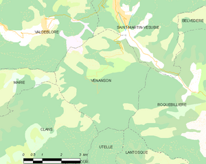
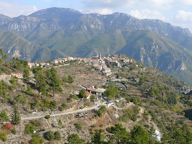
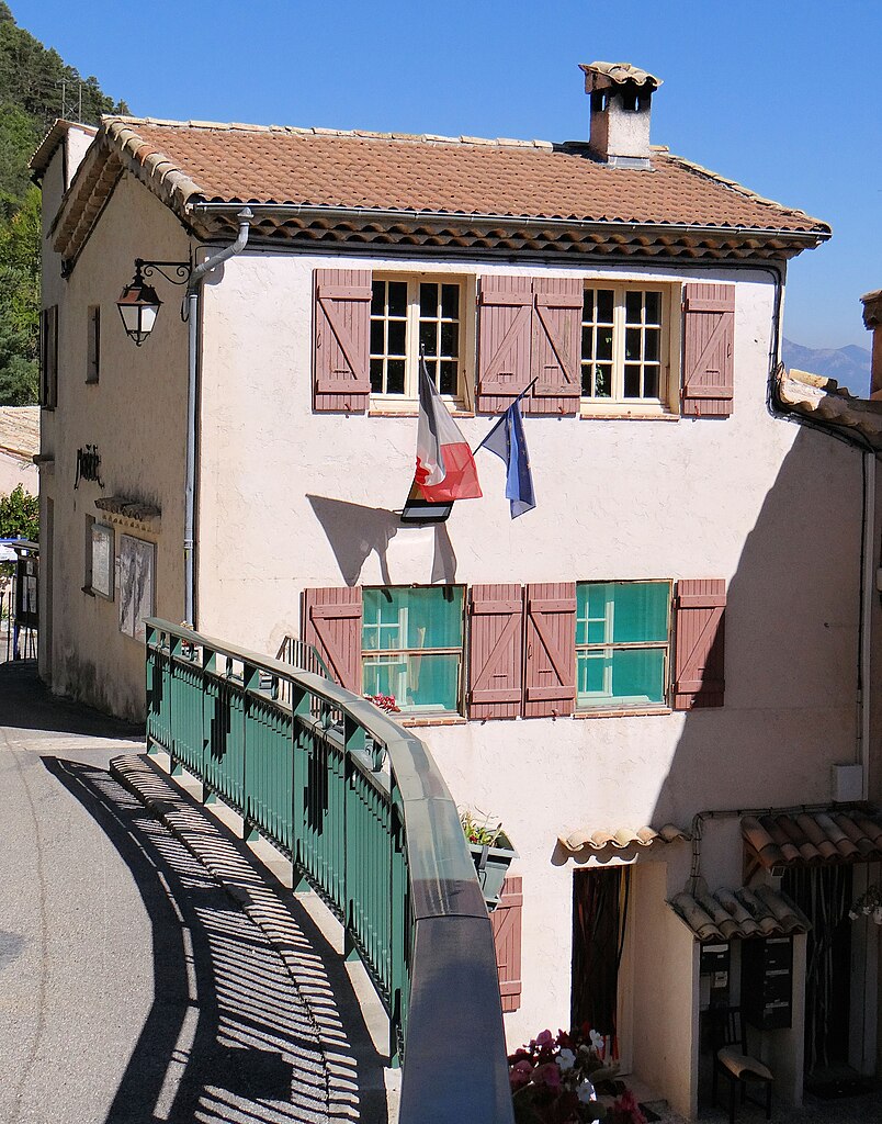
Venanson
- commune in Alpes-Maritimes, France
Hiking in Venanson
Venanson is a charming village located in the Alpes-Maritimes region of France, nestled in the heart of the Mercantour National Park. It offers breathtaking landscapes and a variety of hiking trails that cater to different skill levels. Here are some highlights for hiking in Venanson:...
- Country:
- Postal Code: 06450
- Coordinates: 44° 3' 11" N, 7° 15' 11" E
- GPS tracks (wikiloc): [Link]
- Area: 17.98 sq km
- Population: 155
- Web site: [Link]


La Tour
- commune in Alpes-Maritimes, France
Hiking in La Tour
La Tour, located in the Alpes-Maritimes region of France, is a picturesque spot for hiking enthusiasts. Nestled in the southern French Alps, the area offers stunning views, diverse landscapes, and a variety of trails suitable for different skill levels. Here are some highlights and considerations for hiking in this region:...
- Country:
- Postal Code: 06710
- Coordinates: 43° 56' 49" N, 7° 11' 3" E
- GPS tracks (wikiloc): [Link]
- AboveSeaLevel: 620 м m
- Area: 36.7 sq km
- Population: 579


Tourrette-Levens
- commune in Alpes-Maritimes, France
Hiking in Tourrette-Levens
Tourrette-Levens is a charming commune located in the Alpes-Maritimes region of southeastern France, not far from Nice. It offers a delightful mix of hiking opportunities, showcasing stunning Mediterranean landscapes, hills, and views over the surrounding areas....
- Country:
- Postal Code: 06690
- Coordinates: 43° 47' 12" N, 7° 16' 33" E
- GPS tracks (wikiloc): [Link]
- Area: 16.5 sq km
- Population: 4877
- Web site: [Link]


Contes
- commune in Alpes-Maritimes, France
Hiking in Contes
Contes, located in the Alpes-Maritimes department of France, is a charming village that offers beautiful hiking opportunities amidst the stunning natural landscapes of the region. Here are some key points and tips for hiking around Contes:...
- Country:
- Postal Code: 06390
- Coordinates: 43° 48' 43" N, 7° 18' 50" E
- GPS tracks (wikiloc): [Link]
- Area: 19.47 sq km
- Population: 7412
- Web site: [Link]


Caille
- commune in Alpes-Maritimes, France
Hiking in Caille
Caille is a charming village located in the Alpes-Maritimes department of the Provence-Alpes-Côte d'Azur region in southeastern France. It is known for its beautiful natural settings, making it a great destination for hiking enthusiasts. Here are some highlights and tips for hiking in this area:...
- Country:
- Postal Code: 06750
- Coordinates: 43° 46' 45" N, 6° 43' 52" E
- GPS tracks (wikiloc): [Link]
- Area: 16.96 sq km
- Population: 446
- Web site: [Link]

Amirat
- commune in Alpes-Maritimes, France
Hiking in Amirat
Amirat, located near Muscat in Oman, is a great destination for hiking enthusiasts. The region is characterized by its stunning mountainous landscapes, traditional Omani villages, and a rich culture. Here are some highlights and tips for hiking in Amirat:...
- Country:
- Postal Code: 06910
- Coordinates: 43° 53' 26" N, 6° 49' 27" E
- GPS tracks (wikiloc): [Link]
- Area: 12.95 sq km
- Population: 74
- Web site: [Link]


Saint-Blaise
- commune in Alpes-Maritimes, France
Hiking in Saint-Blaise
Saint-Blaise, situated in the Alpes-Maritimes region of France, offers a beautiful backdrop for hiking enthusiasts. Nestled near Nice and the Mediterranean coast, it provides not only stunning views but also a variety of trails suitable for different skill levels....
- Country:
- Postal Code: 06670
- Coordinates: 43° 49' 18" N, 7° 14' 15" E
- GPS tracks (wikiloc): [Link]
- Area: 8.04 sq km
- Population: 1013


Drap
- commune in Alpes-Maritimes, France
Hiking in Drap
Hiking in Drap, Utah, offers a variety of beautiful trails and stunning scenery, suited for all levels of experience. Drap is located at the foot of the Wasatch Range, giving hikers access to diverse landscapes, from the foothills to rugged mountain trails....
- Country:
- Postal Code: 06340
- Coordinates: 43° 45' 18" N, 7° 19' 17" E
- GPS tracks (wikiloc): [Link]
- Area: 5.54 sq km
- Population: 4444
- Web site: [Link]

Rigaud
- commune in Alpes-Maritimes, France
Hiking in Rigaud
Rigaud, located in the Alpes-Maritimes region of France, offers a lovely setting for hiking enthusiasts. Nestled in the foothills of the French Alps, this area is known for its beautiful landscapes, charming villages, and scenic trails....
- Country:
- Postal Code: 06260
- Coordinates: 43° 59' 27" N, 6° 59' 29" E
- GPS tracks (wikiloc): [Link]
- Area: 32.54 sq km
- Population: 207


Antibes
- commune in Alpes-Maritimes, France
- Country:
- Postal Code: 06160
- Coordinates: 43° 34' 48" N, 7° 7' 23" E
- GPS tracks (wikiloc): [Link]
- AboveSeaLevel: 0 м m
- Area: 26.48 sq km
- Population: 74875
- Web site: [Link]

Sainte-Agnès
- commune in Alpes-Maritimes, France
Hiking in Sainte-Agnès
Sainte-Agnès, located in the Alpes-Maritimes region of France, is a charming hilltop village that offers stunning views of the surrounding landscape, including the Mediterranean Sea. It is known for its rich history, picturesque streets, and a variety of hiking trails that cater to different skill levels....
- Country:
- Postal Code: 06500
- Coordinates: 43° 47' 21" N, 7° 28' 9" E
- GPS tracks (wikiloc): [Link]
- Area: 9.37 sq km
- Population: 1214

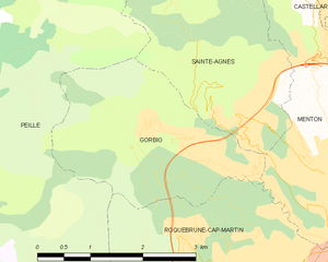
Gorbio
- commune in Alpes-Maritimes, France
Hiking in Gorbio
Gorbio is a charming village located in the Alpes-Maritimes department in the Provence-Alpes-Côte d'Azur region of southeastern France. Nestled in the foothills of the French Alps, Gorbio offers a unique blend of stunning landscapes, cultural heritage, and hiking opportunities....
- Country:
- Postal Code: 06500
- Coordinates: 43° 47' 12" N, 7° 26' 42" E
- GPS tracks (wikiloc): [Link]
- Area: 7.02 sq km
- Population: 1387
- Web site: [Link]


Grasse
- commune in Alpes-Maritimes, France
Hiking in Grasse
Grasse, located in the Alpes-Maritimes department in the Provence-Alpes-Côte d'Azur region of France, is famous for its perfume industry and beautiful landscapes. Hiking in and around Grasse offers a range of trails, stunning views, and a chance to experience the rich natural and cultural heritage of the area....
- Country:
- Postal Code: 06520; 06130
- Coordinates: 43° 39' 29" N, 6° 55' 31" E
- GPS tracks (wikiloc): [Link]
- AboveSeaLevel: 333 м m
- Area: 44.44 sq km
- Population: 50937
- Web site: [Link]

Menton
- commune in Alpes-Maritimes, France
- Country:
- Postal Code: 06500
- Licence Plate Code: 06
- Coordinates: 43° 46' 29" N, 7° 29' 59" E
- GPS tracks (wikiloc): [Link]
- AboveSeaLevel: 16 м m
- Area: 14.05 sq km
- Population: 28231
- Web site: [Link]


Vence
- commune in Alpes-Maritimes, France
Hiking in Vence
Vence, located in the Provence-Alpes-Côte d'Azur region of France, offers a fantastic blend of coastal and mountainous hiking experiences. Here are some highlights and tips for hiking in and around Vence:...
- Country:
- Postal Code: 06140
- Coordinates: 43° 43' 21" N, 7° 6' 43" E
- GPS tracks (wikiloc): [Link]
- Area: 39.23 sq km
- Population: 18393
- Web site: [Link]


Cagnes-sur-Mer
- commune in Alpes-Maritimes, France
Hiking in Cagnes-sur-Mer
Cagnes-sur-Mer, located on the French Riviera, offers a delightful blend of coastal beauty and nearby mountainous terrain, making it a geat destination for hiking enthusiasts. Here are some highlights and tips for hiking in and around Cagnes-sur-Mer:...
- Country:
- Postal Code: 06800
- Coordinates: 43° 39' 49" N, 7° 8' 54" E
- GPS tracks (wikiloc): [Link]
- AboveSeaLevel: 93 м m
- Area: 17.95 sq km
- Population: 49322
- Web site: [Link]


Villefranche-sur-Mer
- commune in Alpes-Maritimes, France
- Country:
- Postal Code: 06230
- Coordinates: 43° 42' 15" N, 7° 18' 42" E
- GPS tracks (wikiloc): [Link]
- AboveSeaLevel: 17 м m
- Area: 4.88 sq km
- Population: 5112
- Web site: [Link]

Le Cannet
- commune in Alpes-Maritimes, France
- Country:
- Postal Code: 06110
- Coordinates: 43° 34' 34" N, 7° 1' 7" E
- GPS tracks (wikiloc): [Link]
- Area: 7.71 sq km
- Population: 41571
- Web site: [Link]
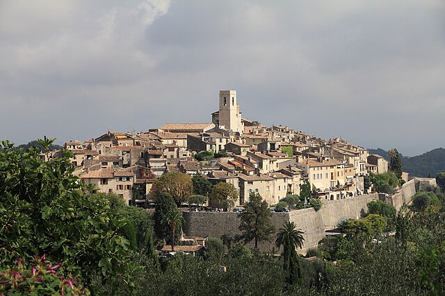

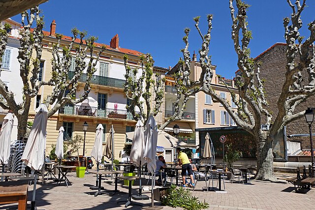
Saint-Paul-de-Vence
- commune in Alpes-Maritimes, France
Hiking in Saint-Paul-de-Vence
Saint-Paul-de-Vence is a picturesque village located in the Alpes-Maritimes department of France, near the French Riviera. Known for its stunning views, charming cobblestone streets, and rich artistic heritage, it also offers some delightful hiking opportunities in the surrounding hills and countryside....
- Country:
- Postal Code: 06570
- Coordinates: 43° 41' 47" N, 7° 7' 20" E
- GPS tracks (wikiloc): [Link]
- Area: 7.26 sq km
- Population: 3451
- Web site: [Link]


Beaulieu-sur-Mer
- commune in Alpes-Maritimes, France
- Country:
- Postal Code: 06310
- Coordinates: 43° 42' 25" N, 7° 19' 53" E
- GPS tracks (wikiloc): [Link]
- Area: 0.95 sq km
- Population: 3726
- Web site: [Link]

Saint-Laurent-du-Var
- commune in Alpes-Maritimes, France
- Country:
- Postal Code: 06700
- Coordinates: 43° 40' 24" N, 7° 11' 24" E
- GPS tracks (wikiloc): [Link]
- AboveSeaLevel: 8 м m
- Area: 10.11 sq km
- Population: 28919
- Web site: [Link]

Roquebrune-Cap-Martin
- commune in Alpes-Maritimes, France
- Country:
- Postal Code: 06190
- Coordinates: 43° 45' 26" N, 7° 28' 27" E
- GPS tracks (wikiloc): [Link]
- Area: 9.33 sq km
- Population: 12679
- Web site: [Link]
Mougins
- commune in Alpes-Maritimes, France
- Country:
- Postal Code: 06250
- Coordinates: 43° 36' 0" N, 6° 59' 41" E
- GPS tracks (wikiloc): [Link]
- Area: 25.64 sq km
- Population: 18476
- Web site: [Link]

Vallauris
- commune in Alpes-Maritimes, France
- Country:
- Postal Code: 06220
- Coordinates: 43° 34' 47" N, 7° 3' 12" E
- GPS tracks (wikiloc): [Link]
- Area: 13.04 sq km
- Population: 25966
- Web site: [Link]

Tende
- commune in Alpes-Maritimes, France
Hiking in Tende
Tende is a picturesque commune located in the Alpes-Maritimes department in the Provence-Alpes-Côte d'Azur region of southeastern France. Nestled in the Maritime Alps, it's an excellent destination for hiking enthusiasts, offering stunning landscapes, varied terrains, and rich natural and cultural heritage....
- Country:
- Postal Code: 06430
- Coordinates: 44° 5' 16" N, 7° 35' 37" E
- GPS tracks (wikiloc): [Link]
- AboveSeaLevel: 816 м m
- Area: 177.47 sq km
- Population: 2174
- Web site: [Link]


Mandelieu-la-Napoule
- commune in Alpes-Maritimes, France
- Country:
- Postal Code: 06210
- Coordinates: 43° 32' 44" N, 6° 56' 15" E
- GPS tracks (wikiloc): [Link]
- AboveSeaLevel: 300 м m
- Area: 31.37 sq km
- Population: 22360
- Web site: [Link]


Èze
- commune in Alpes-Maritimes, France
- Country:
- Postal Code: 06360
- Coordinates: 43° 43' 40" N, 7° 21' 40" E
- GPS tracks (wikiloc): [Link]
- AboveSeaLevel: 424 м m
- Area: 9.47 sq km
- Population: 2343
- Web site: [Link]


Biot
- commune in Alpes-Maritimes, France
- Country:
- Postal Code: 06410
- Coordinates: 43° 37' 43" N, 7° 5' 44" E
- GPS tracks (wikiloc): [Link]
- Area: 15.54 sq km
- Population: 9876
- Web site: [Link]

Saint-Jean-Cap-Ferrat
- commune in Alpes-Maritimes, France
- Country:
- Postal Code: 06230
- Coordinates: 43° 41' 16" N, 7° 20' 3" E
- GPS tracks (wikiloc): [Link]
- Area: 2.48 sq km
- Population: 1628
- Web site: [Link]
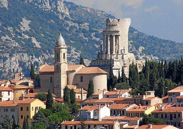
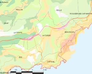
La Turbie
- commune in Alpes-Maritimes, France
- Country:
- Postal Code: 06320
- Coordinates: 43° 44' 44" N, 7° 24' 3" E
- GPS tracks (wikiloc): [Link]
- Area: 7.42 sq km
- Population: 3119
- Web site: [Link]


Levens
- commune in Alpes-Maritimes, France
Hiking in Levens
Levens, a small commune in the Alpes-Maritimes department in the Provence-Alpes-Côte d'Azur region of France, offers beautiful hiking opportunities surrounded by picturesque landscapes, including mountains and valleys. Here are some key highlights about hiking in and around Levens:...
- Country:
- Postal Code: 06670
- Coordinates: 43° 51' 39" N, 7° 13' 28" E
- GPS tracks (wikiloc): [Link]
- Area: 29.85 sq km
- Population: 4741


Gourdon
- commune in Alpes-Maritimes, France
Hiking in Gourdon
Gourdon, a picturesque village in the Alpes-Maritimes region of France, offers stunning landscapes and a variety of hiking opportunities. Perched high above the Loup River, it provides breathtaking views of the surrounding mountains and the Mediterranean coastline. Here are some key highlights and tips for hiking in the Gourdon area:...
- Country:
- Postal Code: 06620
- Coordinates: 43° 43' 13" N, 6° 58' 42" E
- GPS tracks (wikiloc): [Link]
- Area: 22.53 sq km
- Population: 396

Roquebillière
- commune in Alpes-Maritimes, France
Hiking in Roquebillière
Roquebillière is a charming village located in the Alpes-Maritimes department of the French Riviera, situated at the foot of the impressive Mercantour National Park. Hiking in and around Roquebillière offers a variety of trails with stunning views, diverse landscapes, and opportunities to encounter local flora and fauna....
- Country:
- Postal Code: 06450
- Coordinates: 44° 0' 40" N, 7° 18' 25" E
- GPS tracks (wikiloc): [Link]
- Area: 25.92 sq km
- Population: 1802
- Web site: [Link]


Beausoleil
- commune in Alpes-Maritimes, France
- Country:
- Postal Code: 06240
- Coordinates: 43° 44' 31" N, 7° 25' 25" E
- GPS tracks (wikiloc): [Link]
- Area: 2.79 sq km
- Population: 13625
- Web site: [Link]

Cap-d'Ail
- commune in Alpes-Maritimes, France
- Country:
- Postal Code: 06320
- Coordinates: 43° 43' 16" N, 7° 24' 20" E
- GPS tracks (wikiloc): [Link]
- Area: 2.04 sq km
- Population: 4709
- Web site: [Link]


Beuil
- commune in Alpes-Maritimes, France
Hiking in Beuil
Beuil is a picturesque village located in the Alpes-Maritimes region of southeastern France, known for its stunning alpine scenery and outdoor recreational opportunities. It serves as an excellent base for hiking enthusiasts, offering a variety of trails that cater to different skill levels....
- Country:
- Postal Code: 06470
- Coordinates: 44° 5' 42" N, 6° 59' 15" E
- GPS tracks (wikiloc): [Link]
- Area: 75.65 sq km
- Population: 513
- Web site: [Link]


Tourette-du-Château
- commune in Alpes-Maritimes, France
Hiking in Tourette-du-Château
Tourette-du-Château is a charming commune located in the Alpes-Maritimes department in the Provence-Alpes-Côte d'Azur region of southeastern France. This picturesque area offers a variety of hiking opportunities amidst stunning natural scenery, including beautiful landscapes, rolling hills, and rich flora and fauna....
- Country:
- Postal Code: 06830
- Coordinates: 43° 52' 56" N, 7° 8' 34" E
- GPS tracks (wikiloc): [Link]
- AboveSeaLevel: 900 м m
- Area: 9.74 sq km
- Population: 126

Castagniers
- commune in Alpes-Maritimes, France
Hiking in Castagniers
Castagniers is a charming village located in the Alpes-Maritimes region of France, not far from Nice. It offers a mix of scenic views, cultural heritage, and well-marked hiking trails that cater to all levels of hikers....
- Country:
- Postal Code: 06670
- Coordinates: 43° 47' 29" N, 7° 13' 54" E
- GPS tracks (wikiloc): [Link]
- Area: 7.52 sq km
- Population: 1575
- Web site: [Link]

Pégomas
- commune in Alpes-Maritimes, France
Hiking in Pégomas
Pégomas, a quaint commune located in the Alpes-Maritimes department in the French Riviera, offers a range of hiking opportunities that showcase its beautiful natural surroundings. Here are some key points to consider when hiking in the Pégomas area:...
- Country:
- Postal Code: 06580
- Coordinates: 43° 35' 48" N, 6° 56' 0" E
- GPS tracks (wikiloc): [Link]
- Area: 11.28 sq km
- Population: 7845
- Web site: [Link]

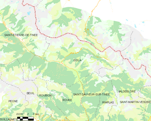
Isola
- commune in Alpes-Maritimes, France
Hiking in Isola
Isola is a charming village located in the Alpes-Maritimes region of France, renowned for its stunning natural landscapes and outdoor activities, especially hiking. Situated in the heart of the Southern Alps, Isola offers a variety of trails that cater to different skill levels, from leisurely walks to more challenging hikes....
- Country:
- Postal Code: 06420
- Coordinates: 44° 11' 9" N, 7° 3' 8" E
- GPS tracks (wikiloc): [Link]
- Area: 97.98 sq km
- Population: 693

Villeneuve-Loubet
- commune in Alpes-Maritimes, France
Hiking in Villeneuve-Loubet
Villeneuve-Loubet is a charming commune in the Alpes-Maritimes department in the Provence-Alpes-Côte d'Azur region of France. It's located between Nice and Antibes, which makes it an appealing base for hikers looking to explore both coastal and inland trails....
- Country:
- Postal Code: 06270
- Coordinates: 43° 39' 29" N, 7° 7' 17" E
- GPS tracks (wikiloc): [Link]
- Area: 19.6 sq km
- Population: 14266
- Web site: [Link]


Breil-sur-Roya
- commune in Alpes-Maritimes, France
Hiking in Breil-sur-Roya
Breil-sur-Roya, located in the Alpes-Maritimes department of France, is a charming village that serves as a gateway to some beautiful hiking trails in the surrounding area. Nestled in the Roya Valley, it offers a mix of stunning natural landscapes, historical sites, and a chance to experience the local culture....
- Country:
- Postal Code: 06540
- Coordinates: 43° 56' 14" N, 7° 30' 52" E
- GPS tracks (wikiloc): [Link]
- AboveSeaLevel: 287 м m
- Area: 81.31 sq km
- Population: 2271
- Web site: [Link]

Mouans-Sartoux
- commune in Alpes-Maritimes, France
Hiking in Mouans-Sartoux
Mouans-Sartoux is a charming village located in the Alpes-Maritimes department in the Provence-Alpes-Côte d'Azur region of France. It offers attractive hiking opportunities, primarily through its beautiful surroundings and proximity to natural parks and the Mediterranean coastline....
- Country:
- Postal Code: 06370
- Coordinates: 43° 37' 12" N, 6° 58' 19" E
- GPS tracks (wikiloc): [Link]
- Area: 13.52 sq km
- Population: 9510
- Web site: [Link]

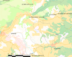
Châteauneuf-Grasse
- commune in Alpes-Maritimes, France
Hiking in Châteauneuf-Grasse
Châteauneuf-Grasse, located in the Alpes-Maritimes department of the Provence-Alpes-Côte d'Azur region in France, offers a picturesque backdrop for hiking enthusiasts. The area is characterized by its stunning landscapes, charming villages, and a mild Mediterranean climate, making it an ideal destination for outdoor activities....
- Country:
- Postal Code: 06740
- Coordinates: 43° 40' 30" N, 6° 58' 30" E
- GPS tracks (wikiloc): [Link]
- Area: 8.95 sq km
- Population: 3219
- Web site: [Link]

Peillon
- commune in Alpes-Maritimes, France
Hiking in Peillon
Peillon is a charming medieval village located in the French Riviera, not far from Nice. Nestled in the hills, it offers stunning views of the surrounding landscape, making it a wonderful destination for hiking enthusiasts....
- Country:
- Postal Code: 06440
- Coordinates: 43° 46' 7" N, 7° 22' 2" E
- GPS tracks (wikiloc): [Link]
- Area: 8.7 sq km
- Population: 1483

Aspremont
- commune in Alpes-Maritimes, France
Hiking in Aspremont
Aspremont, located in the Alpes-Maritimes department in the Provence-Alpes-Côte d'Azur region of France, offers a variety of hiking opportunities with stunning views and a rich natural environment. Nestled in the foothills near Nice, this area provides a blend of beautiful landscape, historical sites, and a taste of local culture....
- Country:
- Postal Code: 06790
- Coordinates: 43° 47' 0" N, 7° 14' 39" E
- GPS tracks (wikiloc): [Link]
- Area: 9.44 sq km
- Population: 2139
- Web site: [Link]


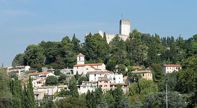
Castellar
- commune in Alpes-Maritimes, France
Hiking in Castellar
Castellar, located in the Alpes-Maritimes department of France, is a charming village that offers a variety of hiking opportunities. Nestled in the foothills of the Alps, it provides stunning views of the surrounding landscape, including both mountainous terrain and the Mediterranean Sea in the distance....
- Country:
- Postal Code: 06500
- Coordinates: 43° 48' 13" N, 7° 29' 48" E
- GPS tracks (wikiloc): [Link]
- AboveSeaLevel: 342 м m
- Area: 12.24 sq km
- Population: 1019
- Web site: [Link]


Nice
- city in Alpes-Maritimes, France
- Country:
- Postal Code: 06000
- Local Dialing Code: 493
- Coordinates: 43° 42' 7" N, 7° 16' 6" E
- GPS tracks (wikiloc): [Link]
- AboveSeaLevel: 10 м m
- Area: 71.92 sq km
- Population: 342522
- Web site: [Link]


La Bollène-Vésubie
- commune in Alpes-Maritimes, France
Hiking in La Bollène-Vésubie
La Bollène-Vésubie is a charming village located in the Alpes-Maritimes department in the Provence-Alpes-Côte d'Azur region of France. It offers access to beautiful hiking trails that showcase the stunning landscapes of the French Alps. Here are some highlights for hikers considering this area:...
- Country:
- Postal Code: 06450
- Coordinates: 43° 59' 23" N, 7° 19' 51" E
- GPS tracks (wikiloc): [Link]
- Area: 35.57 sq km
- Population: 567
- Web site: [Link]


Saint-Martin-Vésubie
- commune in Alpes-Maritimes, France
Hiking in Saint-Martin-Vésubie
Saint-Martin-Vésubie is a picturesque village located in the Alpes-Maritimes department in the Provence-Alpes-Côte d'Azur region of France. It serves as an excellent base for hiking enthusiasts due to its proximity to the Mercantour National Park and stunning alpine landscapes. Here are some key highlights about hiking in this area:...
- Country:
- Postal Code: 06450
- Coordinates: 44° 4' 6" N, 7° 15' 21" E
- GPS tracks (wikiloc): [Link]
- Area: 97.13 sq km
- Population: 1394
- Web site: [Link]

Roquefort-les-Pins
- commune in Alpes-Maritimes, France
Hiking in Roquefort-les-Pins
Roquefort-les-Pins is a charming village located in the Alpes-Maritimes department in the Provence-Alpes-Côte d'Azur region of France. It offers a variety of hiking opportunities that allow you to explore the beautiful natural surroundings, including forests, hills, and stunning views of the French Riviera....
- Country:
- Postal Code: 06330
- Coordinates: 43° 39' 56" N, 7° 3' 3" E
- GPS tracks (wikiloc): [Link]
- AboveSeaLevel: 250 м m
- Area: 21.53 sq km
- Population: 6628
- Web site: [Link]


Lantosque
- commune in Alpes-Maritimes, France
Hiking in Lantosque
Lantosque is a charming commune located in the Alpes-Maritimes department in the Provence-Alpes-Côte d'Azur region of southeastern France. It offers a range of hiking opportunities set against the stunning backdrop of the French Alps and the nearby Mercantour National Park....
- Country:
- Postal Code: 06450
- Coordinates: 43° 58' 24" N, 7° 18' 45" E
- GPS tracks (wikiloc): [Link]
- Area: 44.76 sq km
- Population: 1314
- Web site: [Link]

Valbonne
- commune in Alpes-Maritimes, France
Hiking in Valbonne
Valbonne, located in the Alpes-Maritimes department in the Provence-Alpes-Côte d'Azur region of France, is known for its picturesque ambiance and lush surroundings, making it a lovely destination for hiking enthusiasts....
- Country:
- Postal Code: 06560
- Coordinates: 43° 38' 29" N, 7° 0' 32" E
- GPS tracks (wikiloc): [Link]
- Area: 18.97 sq km
- Population: 13183

La Trinité
- commune in Alpes-Maritimes, France
Hiking in La Trinité
La Trinité, located in the Alpes-Maritimes department of France, offers several beautiful hiking opportunities for outdoor enthusiasts. Nestled near Nice and the Mediterranean coast, it provides a mix of coastal views, lush greenery, and panoramic mountain scenery. Here are some highlights and considerations for hiking in this area:...
- Country:
- Postal Code: 06340
- Coordinates: 43° 44' 27" N, 7° 18' 51" E
- GPS tracks (wikiloc): [Link]
- Area: 14.9 sq km
- Population: 10222
- Web site: [Link]

Gilette
- commune in Alpes-Maritimes, France
Hiking in Gilette
Gillette, Wyoming, is surrounded by a variety of outdoor recreational opportunities for hiking enthusiasts. The area is characterized by scenic landscapes, rolling hills, and rugged terrain typical of the high plains region. Here are a few hiking options and considerations while exploring the area:...
- Country:
- Postal Code: 06830
- Coordinates: 43° 50' 58" N, 7° 9' 49" E
- GPS tracks (wikiloc): [Link]
- Area: 10.18 sq km
- Population: 1536


La Brigue
- commune in Alpes-Maritimes, France
Hiking in La Brigue
La Brigue is a beautiful commune in the Alpes-Maritimes department of southeastern France, located near the Italian border. Nestled in the Mercantour National Park, it offers stunning landscapes, diverse flora and fauna, and various hiking trails suitable for all levels of hikers. Here are some highlights about hiking in La Brigue:...
- Country:
- Postal Code: 06430
- Coordinates: 44° 3' 45" N, 7° 36' 59" E
- GPS tracks (wikiloc): [Link]
- AboveSeaLevel: 748 м m
- Area: 91.77 sq km
- Population: 706
- Web site: [Link]
Cannes
- commune in Alpes-Maritimes, France
- Country:
- Postal Code: 06400
- Coordinates: 43° 33' 9" N, 7° 1' 17" E
- GPS tracks (wikiloc): [Link]
- AboveSeaLevel: 0 м m
- Area: 19.62 sq km
- Population: 74285
- Web site: [Link]

Rimplas
- commune in Alpes-Maritimes, France
Hiking in Rimplas
Rimplas is a charming village located in the French Alps, specifically in the Alpes-Maritimes department. This scenic area offers a variety of hiking opportunities for both novice and experienced hikers, with trails that boast stunning views, diverse landscapes, and a connection to nature....
- Country:
- Postal Code: 06420
- Coordinates: 44° 3' 49" N, 7° 7' 48" E
- GPS tracks (wikiloc): [Link]
- Area: 24.95 sq km
- Population: 108

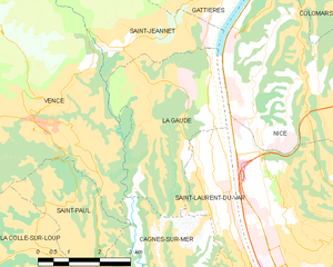
La Gaude
- commune in Alpes-Maritimes, France
Hiking in La Gaude
La Gaude is a charming village located in the Alpes-Maritimes department in the Provence-Alpes-Côte d'Azur region of France. Nestled in the hills near the French Riviera, it offers beautiful landscapes, picturesque views, and a range of hiking opportunities for outdoor enthusiasts....
- Country:
- Postal Code: 06610
- Coordinates: 43° 43' 19" N, 7° 9' 11" E
- GPS tracks (wikiloc): [Link]
- AboveSeaLevel: 236 м m
- Area: 13.1 sq km
- Population: 6415
- Web site: [Link]


Tourrettes-sur-Loup
- commune in Alpes-Maritimes, France
Hiking in Tourrettes-sur-Loup
Tourrettes-sur-Loup is a charming medieval village located in the French Riviera, known for its stunning views and picturesque scenery. The area offers a variety of hiking opportunities, catering to different skill levels. Here are some highlights for hiking in and around Tourrettes-sur-Loup:...
- Country:
- Postal Code: 06140
- Coordinates: 43° 42' 58" N, 7° 3' 36" E
- GPS tracks (wikiloc): [Link]
- Area: 29.28 sq km
- Population: 3995

Sospel
- commune in Alpes-Maritimes, France
Hiking in Sospel
Sospel is a charming village located in the Alpes-Maritimes department of France, nestled in the scenic hills near the Italian border. It's an excellent base for hikers, offering a variety of trails that showcase the stunning natural beauty of the region. Here are some highlights of hiking in Sospel:...
- Country:
- Postal Code: 06380
- Coordinates: 43° 52' 37" N, 7° 26' 54" E
- GPS tracks (wikiloc): [Link]
- AboveSeaLevel: 348 м m
- Area: 62.39 sq km
- Population: 3782
- Web site: [Link]


Théoule-sur-Mer
- commune in Alpes-Maritimes, France
- Country:
- Postal Code: 06590
- Coordinates: 43° 30' 25" N, 6° 56' 24" E
- GPS tracks (wikiloc): [Link]
- Area: 10.49 sq km
- Population: 1533

Saint-Jeannet
- commune in Alpes-Maritimes, France
Hiking in Saint-Jeannet
Saint-Jeannet, located in the Alpes-Maritimes region of France, is a charming village that offers a variety of excellent hiking opportunities. Nestled in the foothills of the French Alps, it provides stunning views, diverse terrain, and a rich natural environment that attracts outdoor enthusiasts....
- Country:
- Postal Code: 06640
- Coordinates: 43° 44' 47" N, 7° 8' 36" E
- GPS tracks (wikiloc): [Link]
- Area: 14.58 sq km
- Population: 4071

Le Rouret
- commune in Alpes-Maritimes, France
Hiking in Le Rouret
Le Rouret is a charming village located in the Alpes-Maritimes department in southeastern France, near the French Riviera. Nestled in the hills, it offers beautiful landscapes and access to several hiking trails suitable for different skill levels....
- Country:
- Postal Code: 06650
- Coordinates: 43° 40' 28" N, 7° 0' 20" E
- GPS tracks (wikiloc): [Link]
- Area: 7.1 sq km
- Population: 4003

Saint-Auban
- commune in Alpes-Maritimes, France
Hiking in Saint-Auban
Saint-Auban is a charming village located in the Alpes-Maritimes department in southeastern France, known for its beautiful landscapes and diverse hiking opportunities. The area offers various trails that cater to different skill levels, making it a perfect destination for both novice and experienced hikers....
- Country:
- Postal Code: 06850
- Coordinates: 43° 50' 54" N, 6° 43' 35" E
- GPS tracks (wikiloc): [Link]
- AboveSeaLevel: 1150 м m
- Area: 42.54 sq km
- Population: 233


Auvare
- commune in Alpes-Maritimes, France
Hiking in Auvare
Auvare is a beautiful village located in the Alpes-Maritimes department in the Provence-Alpes-Côte d'Azur region of southeastern France. Nestled in a picturesque landscape, it is an excellent spot for hiking enthusiasts looking for scenic trails and a peaceful atmosphere....
- Country:
- Postal Code: 06260
- Coordinates: 43° 59' 17" N, 6° 54' 29" E
- GPS tracks (wikiloc): [Link]
- Area: 18.27 sq km
- Population: 36


La Roquette-sur-Var
- commune in Alpes-Maritimes, France
Hiking in La Roquette-sur-Var
La Roquette-sur-Var is a charming village located in the Alpes-Maritimes department in the Provence-Alpes-Côte d'Azur region of France. It offers access to beautiful natural landscapes, making it a great spot for hiking enthusiasts. Here are some highlights and tips for hiking in and around La Roquette-sur-Var:...
- Country:
- Postal Code: 06670
- Coordinates: 43° 49' 41" N, 7° 11' 56" E
- GPS tracks (wikiloc): [Link]
- Area: 3.99 sq km
- Population: 906

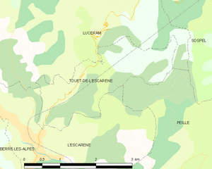
Touët-de-l'Escarène
- commune in Alpes-Maritimes, France
Hiking in Touët-de-l'Escarène
Touët-de-l'Escarène is a charming village located in the Alpes-Maritimes department of France, not far from Nice. It serves as a great base for hiking enthusiasts looking to explore the scenic beauty of the surrounding regions. Here’s what you should know about hiking around Touët-de-l'Escarène:...
- Country:
- Postal Code: 06440
- Coordinates: 43° 50' 51" N, 7° 21' 54" E
- GPS tracks (wikiloc): [Link]
- AboveSeaLevel: 415 м m
- Area: 4.57 sq km
- Population: 289


Entraunes
- commune in Alpes-Maritimes, France
Hiking in Entraunes
Entraunes, located in the Alpes-Maritimes region of France, is a beautiful destination for hiking enthusiasts. Nestled in the Mercantour National Park, it offers stunning natural landscapes, diverse flora and fauna, and a variety of trails that cater to different skill levels....
- Country:
- Postal Code: 06470
- Coordinates: 44° 11' 17" N, 6° 44' 54" E
- GPS tracks (wikiloc): [Link]
- Area: 81.45 sq km
- Population: 118


Lieuche
- commune in Alpes-Maritimes, France
Hiking in Lieuche
Lieuche, a charming village located in the Alpes-Maritimes department in the Provence-Alpes-Côte d'Azur region of France, offers a range of hiking opportunities for both beginners and experienced hikers. The natural beauty of the surrounding landscape, characterized by rolling hills, lush forests, and stunning views of the nearby mountains, makes it a wonderful destination for outdoor enthusiasts....
- Country:
- Postal Code: 06260
- Coordinates: 43° 59' 47" N, 7° 1' 1" E
- GPS tracks (wikiloc): [Link]
- Area: 13.4 sq km
- Population: 44

Cipières
- commune in Alpes-Maritimes, France
Hiking in Cipières
Cipières is a charming village located in the Alpes-Maritimes department of France, nestled in the beautiful French Riviera region. It offers access to a variety of hiking trails that showcase the stunning natural landscapes of the area, including hills, valleys, and panoramic views of the surrounding mountains and countryside....
- Country:
- Postal Code: 06620
- Coordinates: 43° 47' 0" N, 6° 57' 19" E
- GPS tracks (wikiloc): [Link]
- Area: 38.15 sq km
- Population: 387


Spéracèdes
- commune in Alpes-Maritimes, France
Hiking in Spéracèdes
Spéracèdes is a charming village located in the Alpes-Maritimes department in the Provence-Alpes-Côte d'Azur region of France. It offers a variety of hiking opportunities amidst stunning landscapes, rolling hills, and nearby natural parks. Here are some highlights and tips for hiking in and around Spéracèdes:...
- Country:
- Postal Code: 06530
- Coordinates: 43° 38' 55" N, 6° 51' 31" E
- GPS tracks (wikiloc): [Link]
- Area: 3.46 sq km
- Population: 1295

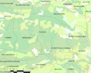
Toudon
- commune in Alpes-Maritimes, France
Hiking in Toudon
Toudon, located in the Alpes-Maritimes department of France, is a beautiful destination for hikers looking to explore the stunning landscapes of the region. Nestled in the foothills of the French Alps, Toudon offers a combination of scenic views, diverse trails, and a peaceful atmosphere....
- Country:
- Postal Code: 06830
- Coordinates: 43° 54' 2" N, 7° 6' 52" E
- GPS tracks (wikiloc): [Link]
- Area: 18.56 sq km
- Population: 332


Daluis
- commune in Alpes-Maritimes, France
Hiking in Daluis
Daluis is a beautiful area located in the Alpes-Maritimes department in southeastern France, known for its dramatic landscapes and breathtaking gorges. Hiking in Daluis can offer a variety of experiences, from gentle walks to more challenging treks. Here are some key points to consider when planning a hiking trip in this region:...
- Country:
- Postal Code: 06470
- Coordinates: 44° 1' 37" N, 6° 48' 43" E
- GPS tracks (wikiloc): [Link]
- Area: 40.03 sq km
- Population: 148

Carros
- commune in Alpes-Maritimes, France
Hiking in Carros
Carros, located in the Alpes-Maritimes region of France near Nice, offers a variety of hiking opportunities that cater to all skill levels. The area is characterized by its stunning natural landscapes, including hills, forests, and panoramic views of the Mediterranean coast....
- Country:
- Postal Code: 06510
- Coordinates: 43° 46' 21" N, 7° 11' 36" E
- GPS tracks (wikiloc): [Link]
- Area: 15.11 sq km
- Population: 12008
- Web site: [Link]

Valderoure
- commune in Alpes-Maritimes, France
Hiking in Valderoure
Valderoure is a picturesque village located in the Alpes-Maritimes department of the Provence-Alpes-Côte d'Azur region in southeastern France. It's a great destination for hiking due to its stunning natural landscapes, hills, and proximity to the mountains....
- Country:
- Postal Code: 06750
- Coordinates: 43° 47' 48" N, 6° 42' 37" E
- GPS tracks (wikiloc): [Link]
- Area: 25.34 sq km
- Population: 429

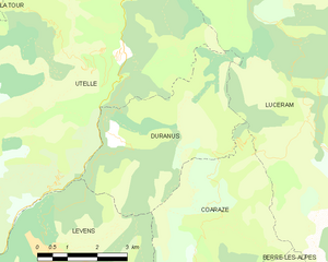
Duranus
- commune in Alpes-Maritimes, France
Hiking in Duranus
Duranus is a beautiful area located in the Alpes-Maritimes department of France, known for its stunning landscapes and rich natural scenery. Hiking in this region offers various trails that cater to different skill levels, making it an excellent destination for both beginners and experienced hikers....
- Country:
- Postal Code: 06670
- Coordinates: 43° 53' 36" N, 7° 15' 33" E
- GPS tracks (wikiloc): [Link]
- Area: 16.1 sq km
- Population: 138


Auribeau-sur-Siagne
- commune in Alpes-Maritimes, France
Hiking in Auribeau-sur-Siagne
Auribeau-sur-Siagne is a picturesque village located in the Alpes-Maritimes region of France, near the French Riviera. It's nestled in the hills and offers a variety of hiking opportunities that showcase its natural beauty and the surrounding landscape....
- Country:
- Postal Code: 06810
- Coordinates: 43° 36' 3" N, 6° 54' 40" E
- GPS tracks (wikiloc): [Link]
- Area: 5.48 sq km
- Population: 3219
- Web site: [Link]

Peymeinade
- commune in Alpes-Maritimes, France
Hiking in Peymeinade
Peymeinade, a charming village located in the Alpes-Maritimes region of France, is an excellent starting point for hiking enthusiasts. Nestled in the foothills of the picturesque Provencal countryside, it offers a variety of trails that cater to all skill levels....
- Country:
- Postal Code: 06530
- Coordinates: 43° 38' 32" N, 6° 52' 33" E
- GPS tracks (wikiloc): [Link]
- Area: 9.76 sq km
- Population: 8116
- Web site: [Link]


Le Broc
- commune in Alpes-Maritimes, France
Hiking in Le Broc
Le Broc, located in the Alpes-Maritimes region of France, is a charming village that offers a variety of hiking opportunities suitable for different skill levels. The area's natural beauty is characterized by its rocky landscapes, rolling hills, and stunning views of the surrounding mountains and valleys....
- Country:
- Postal Code: 06510
- Coordinates: 43° 48' 34" N, 7° 10' 12" E
- GPS tracks (wikiloc): [Link]
- Area: 18.65 sq km
- Population: 1401
- Web site: [Link]

Moulinet
- commune in Alpes-Maritimes, France
Hiking in Moulinet
Moulinet is a charming village located in the Alpes-Maritimes region of France, nestled in the foothills of the Alps and close to the stunning Mercantour National Park. The area is known for its beautiful landscapes, diverse flora and fauna, and numerous hiking trails suited for various skill levels. Here’s what you need to know about hiking in Moulinet:...
- Country:
- Postal Code: 06380
- Coordinates: 43° 56' 27" N, 7° 24' 46" E
- GPS tracks (wikiloc): [Link]
- Area: 41.07 sq km
- Population: 274


Gattières
- commune in Alpes-Maritimes, France
Hiking in Gattières
Gattières is a charming village located in the Alpes-Maritimes department in the Provence-Alpes-Côte d'Azur region of France, not far from Nice. The area surrounding Gattières offers a range of hiking opportunities that showcase the stunning landscapes of the French Riviera and the picturesque foothills of the Alps....
- Country:
- Postal Code: 06510
- Coordinates: 43° 45' 34" N, 7° 10' 33" E
- GPS tracks (wikiloc): [Link]
- Area: 10.03 sq km
- Population: 4111
- Web site: [Link]


Sigale
- commune in Alpes-Maritimes, France
Hiking in Sigale
Sigale is a charming village located in the Alpes-Maritimes department of France, in the Provence-Alpes-Côte d'Azur region. It is nestled in the beautiful hills of the Southern French Alps, which makes it an excellent destination for hiking enthusiasts....
- Country:
- Postal Code: 06910
- Coordinates: 43° 52' 20" N, 6° 57' 52" E
- GPS tracks (wikiloc): [Link]
- Area: 5.62 sq km
- Population: 203
La Roquette-sur-Siagne
- commune in Alpes-Maritimes, France
- Country:
- Postal Code: 06550
- Coordinates: 43° 34' 48" N, 6° 57' 20" E
- GPS tracks (wikiloc): [Link]
- Area: 6.31 sq km
- Population: 5435


Villeneuve-d'Entraunes
- commune in Alpes-Maritimes, France
Hiking in Villeneuve-d'Entraunes
Villeneuve-d'Entraunes is a charming village located in the Alpes-Maritimes department of France. It is nestled in the stunning Val d'Entraunes, which is part of the larger Mercantour National Park. This area is known for its breathtaking landscapes, rich biodiversity, and a variety of hiking opportunities suitable for all levels of hikers....
- Country:
- Postal Code: 06470
- Coordinates: 44° 7' 12" N, 6° 47' 43" E
- GPS tracks (wikiloc): [Link]
- AboveSeaLevel: 950 м m
- Area: 28.2 sq km
- Population: 68


Bendejun
- commune in Alpes-Maritimes, France
Hiking in Bendejun
Bendejun is a charming village located in the Alpes-Maritimes department in southeastern France, near Nice and the French Riviera. It's a great location for hiking enthusiasts who enjoy exploring the natural beauty of the region as well as its historical and cultural sites. Here are some points to consider when hiking in and around Bendejun:...
- Country:
- Postal Code: 06390
- Coordinates: 43° 50' 8" N, 7° 17' 42" E
- GPS tracks (wikiloc): [Link]
- Area: 6.35 sq km
- Population: 958

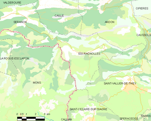
Escragnolles
- commune in Alpes-Maritimes, France
Hiking in Escragnolles
Escragnolles is a charming village located in the Alpes-Maritimes department in the Provence-Alpes-Côte d'Azur region of southern France. It's a part of the stunning French Riviera's mountainous landscape, offering numerous hiking opportunities for outdoor enthusiasts....
- Country:
- Postal Code: 06460
- Coordinates: 43° 43' 51" N, 6° 47' 0" E
- GPS tracks (wikiloc): [Link]
- Area: 25.48 sq km
- Population: 614


Gréolières
- commune in Alpes-Maritimes, France
Hiking in Gréolières
Gréolières is a charming village located in the Alpes-Maritimes region of France, in the foothills of the French Alps, and is known for its stunning landscapes and excellent hiking opportunities. Here are some details that could enhance your hiking experience in the area:...
- Country:
- Postal Code: 06620
- Coordinates: 43° 47' 45" N, 6° 56' 37" E
- GPS tracks (wikiloc): [Link]
- Area: 52.67 sq km
- Population: 606
- Web site: [Link]


Thiéry
- commune in Alpes-Maritimes, France
Hiking in Thiéry
Thiéry is a picturesque village located in the Alpes-Maritimes department of the Provence-Alpes-Côte d'Azur region in France. Nestled in the foothills of the French Alps, it offers a range of hiking opportunities with stunning views and diverse landscapes....
- Country:
- Postal Code: 06710
- Coordinates: 43° 58' 42" N, 7° 1' 50" E
- GPS tracks (wikiloc): [Link]
- Area: 22.24 sq km
- Population: 104

La Roque-en-Provence
- commune in Alpes-Maritimes, France
Hiking in La Roque-en-Provence
La Roque-en-Provence is a small village located in the beautiful Vaucluse region of southeastern France, renowned for its stunning landscapes and excellent hiking opportunities. Nestled near the Luberon Mountains and surrounded by picturesque countryside, it offers a perfect backdrop for outdoor enthusiasts....
- Country:
- Postal Code: 06910
- Coordinates: 43° 52' 15" N, 7° 0' 18" E
- GPS tracks (wikiloc): [Link]
- Area: 23.98 sq km
- Population: 77


Ascros
- commune in Alpes-Maritimes, France
Hiking in Ascros
Ascros, a charming village in the region of Provence-Alpes-Côte d'Azur in southeastern France, offers some beautiful hiking opportunities. Nestled within the picturesque landscape of the French Alps, hiking around Ascros provides a mix of nature, scenic views, and cultural exploration....
- Country:
- Postal Code: 06260
- Coordinates: 43° 55' 15" N, 7° 0' 49" E
- GPS tracks (wikiloc): [Link]
- Area: 17.74 sq km
- Population: 170
- Web site: [Link]


Villars-sur-Var
- commune in Alpes-Maritimes, France
Hiking in Villars-sur-Var
Villars-sur-Var is a picturesque village located in the Alpes-Maritimes region of southeastern France, nestled within the stunning landscapes of the French Riviera. It's a less-traveled destination compared to its neighboring tourist hotspots, which makes it a great choice for hikers looking for tranquility and natural beauty....
- Country:
- Postal Code: 06710
- Coordinates: 43° 56' 14" N, 7° 5' 50" E
- GPS tracks (wikiloc): [Link]
- Area: 25.27 sq km
- Population: 726


Sauze
- commune in Alpes-Maritimes, France
Hiking in Sauze
Sauze, located in the Alpes-Maritimes region of France, is a beautiful destination for hiking enthusiasts. Nestled in the southern Alps, it offers stunning views, diverse terrain, and various trails suitable for different skill levels....
- Country:
- Postal Code: 06470
- Coordinates: 44° 5' 16" N, 6° 50' 6" E
- GPS tracks (wikiloc): [Link]
- Area: 27.77 sq km
- Population: 78


Massoins
- commune in Alpes-Maritimes, France
Hiking in Massoins
Hiking in Massoins, a picturesque village located in the Alpes-Maritimes department of France, offers a unique blend of natural beauty, historical charm, and outdoor adventure. The region is characterized by its stunning mountainous landscapes, dense forests, and panoramic views of the surrounding countryside....
- Country:
- Postal Code: 06710
- Coordinates: 43° 56' 30" N, 7° 7' 29" E
- GPS tracks (wikiloc): [Link]
- Area: 12.13 sq km
- Population: 105

arrondissement of Grasse
- arrondissement of France
Hiking in arrondissement of Grasse
The Arrondissement of Grasse, located in the Alpes-Maritimes department in the Provence-Alpes-Côte d'Azur region of France, offers beautiful hiking opportunities characterized by scenic landscapes, charming villages, and a mix of coastal and mountainous terrain....
- Country:
- Capital: Grasse
- Coordinates: 43° 45' 0" N, 6° 55' 0" E
- GPS tracks (wikiloc): [Link]
- Area: 1231 sq km
- Population: 560764

arrondissement of Nice
- arrondissement of France
Hiking in arrondissement of Nice
The Arrondissement of Nice, located in the Alpes-Maritimes department in southeastern France, offers a stunning variety of hiking trails that showcase the region's diverse landscapes, from coastal paths along the Mediterranean Sea to rugged mountain trails in the nearby Alps. Here are some highlights and popular hiking spots in the area:...
- Country:
- Capital: Nice
- Coordinates: 44° 0' 0" N, 7° 15' 0" E
- GPS tracks (wikiloc): [Link]
- Area: 3067 sq km
- Population: 521676

Saint-Antonin
- commune in Alpes-Maritimes, France
Hiking in Saint-Antonin
Saint-Antonin is a picturesque village located in the Alpes-Maritimes department of the Provence-Alpes-Côte d'Azur region in France. This area is known for its stunning landscapes, charming villages, and a variety of outdoor activities, making it an excellent destination for hiking enthusiasts....
- Country:
- Postal Code: 06260
- Coordinates: 43° 54' 38" N, 6° 58' 48" E
- GPS tracks (wikiloc): [Link]
- Area: 6.44 sq km
- Population: 102


Le Bar-sur-Loup
- commune in Alpes-Maritimes, France
Hiking in Le Bar-sur-Loup
Le Bar-sur-Loup is a picturesque village in the Alpes-Maritimes region of France, nestled in the foothills of the French Alps. Known for its stunning scenery and proximity to nature, it offers several opportunities for hiking enthusiasts. Here are some key points to consider when planning a hike in and around Le Bar-sur-Loup:...
- Country:
- Postal Code: 06620
- Coordinates: 43° 42' 5" N, 6° 59' 20" E
- GPS tracks (wikiloc): [Link]
- AboveSeaLevel: 310 м m
- Area: 14.47 sq km
- Population: 3014
- Web site: [Link]


Briançonnet
- commune in Alpes-Maritimes, France
Hiking in Briançonnet
Briançonnet is a picturesque village located in the Alpes-Maritimes region of France, known for its stunning natural scenery and diverse hiking opportunities. Nestled in the foothills of the Alps, Briançonnet offers a range of trails that cater to different skill levels, making it an excellent destination for both beginner and experienced hikers....
- Country:
- Postal Code: 06850
- Coordinates: 43° 51' 55" N, 6° 45' 28" E
- GPS tracks (wikiloc): [Link]
- Area: 24.32 sq km
- Population: 226

Les Mujouls
- commune in Alpes-Maritimes, France
Hiking in Les Mujouls
Les Mujouls is a picturesque region located in the French Alps, specifically within the larger Vercors Massif area, which is known for its stunning landscapes, rich biodiversity, and outdoor recreational opportunities. Hiking in Les Mujouls offers a chance to explore the rugged terrain, ancient forests, and impressive rock formations, making it a favorite destination for both casual walkers and veteran hikers....
- Country:
- Postal Code: 06910
- Coordinates: 43° 53' 1" N, 6° 51' 37" E
- GPS tracks (wikiloc): [Link]
- Area: 14.55 sq km
- Population: 47

Gars
- commune in Alpes-Maritimes, France
Hiking in Gars
Gars is a picturesque village located in the Alpes-Maritimes region of southern France, nestled in the Pre-Alps near the Verdon Gorge. It offers numerous hiking opportunities that cater to various skill levels, making it a delightful destination for outdoor enthusiasts....
- Country:
- Postal Code: 06850
- Coordinates: 43° 51' 55" N, 6° 48' 13" E
- GPS tracks (wikiloc): [Link]
- Area: 15.57 sq km
- Population: 71

Cabris
- commune in Alpes-Maritimes, France
Hiking in Cabris
Cabris is a charming village located in the Alpes-Maritimes department of the Provence-Alpes-Côte d'Azur region in southeastern France. Perched on a hill, it offers stunning views of the surrounding countryside, making it a wonderful base for hiking enthusiasts. Here are some highlights of hiking in the Cabris area:...
- Country:
- Postal Code: 06530
- Coordinates: 43° 39' 22" N, 6° 52' 25" E
- GPS tracks (wikiloc): [Link]
- Area: 5.43 sq km
- Population: 1295
- Web site: [Link]
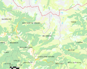
Belvédère
- commune in Alpes-Maritimes, France
Hiking in Belvédère
Belvédère is a beautiful hiking destination that is often characterized by stunning views and diverse landscapes. Although the specifics can depend on which "Belvédère" you are referring to, as the name can be found in different locations around the world, I'll provide an overview of what you typically might expect when hiking in areas known by this name....
- Country:
- Postal Code: 06450
- Coordinates: 44° 0' 53" N, 7° 19' 16" E
- GPS tracks (wikiloc): [Link]
- Area: 75.41 sq km
- Population: 660

Péone
- commune in Alpes-Maritimes, France
Hiking in Péone
Péone is a charming village located in the Alpes-Maritimes region of France, nestled in the Southern French Alps. It offers various hiking opportunities, ideal for both beginners and experienced hikers. Here are some key points about hiking in the area:...
- Country:
- Postal Code: 06470
- Coordinates: 44° 7' 3" N, 6° 54' 30" E
- GPS tracks (wikiloc): [Link]
- Area: 48.59 sq km
- Population: 866
- Web site: [Link]


Saint-André-de-la-Roche
- commune in Alpes-Maritimes, France
Hiking in Saint-André-de-la-Roche
Saint-André-de-la-Roche is a charming commune located in the Alpes-Maritimes department in the Provence-Alpes-Côte d'Azur region of France, just above Nice. The area is surrounded by beautiful natural landscapes, making it a great location for hiking enthusiasts....
- Country:
- Postal Code: 06730
- Coordinates: 43° 44' 24" N, 7° 17' 16" E
- GPS tracks (wikiloc): [Link]
- Area: 2.86 sq km
- Population: 5420

Le Mas
- commune in Alpes-Maritimes, France
Hiking in Le Mas
Le Mas, located in the beautiful region of Provence in southern France, offers a variety of hiking opportunities that showcase the area's stunning landscapes, charming villages, and rich cultural heritage. Here are some highlights and tips for hiking in Le Mas:...
- Country:
- Postal Code: 06910
- Coordinates: 43° 50' 35" N, 6° 51' 30" E
- GPS tracks (wikiloc): [Link]
- Area: 32.15 sq km
- Population: 158
- Web site: [Link]


Aiglun
- commune in Alpes-Maritimes, France
Hiking in Aiglun
Aiglun, located in the Alpes-Maritimes region of France, offers a unique and picturesque hiking experience. This charming village is perched at a high altitude in the foothills of the French Alps, providing stunning vistas of the surrounding mountains and valleys....
- Country:
- Postal Code: 06910
- Coordinates: 43° 51' 27" N, 6° 54' 52" E
- GPS tracks (wikiloc): [Link]
- Area: 15.37 sq km
- Population: 86
- Web site: [Link]


Séranon
- commune in Alpes-Maritimes, France
Hiking in Séranon
Séranon is a charming village located in the Alpes-Maritimes region of France, renowned for its beautiful landscapes and picturesque hiking trails. Surrounded by the stunning scenery of the Provence-Alpes-Côte d'Azur, hiking in Séranon offers opportunities for both novice and experienced hikers alike....
- Country:
- Postal Code: 06750
- Coordinates: 43° 46' 27" N, 6° 42' 6" E
- GPS tracks (wikiloc): [Link]
- Area: 23.28 sq km
- Population: 487

Pierrefeu
- commune in Alpes-Maritimes, France
Hiking in Pierrefeu
Pierrefeu, located in the Var department of the Provence-Alpes-Côte d'Azur region in France, is a beautiful area known for its picturesque landscapes, including hills, vineyards, and Mediterranean flora. Hiking in and around Pierrefeu offers a variety of trails catering to different levels of experience, making it a great destination for both novice and experienced hikers....
- Country:
- Postal Code: 06910
- Coordinates: 43° 51' 50" N, 7° 5' 31" E
- GPS tracks (wikiloc): [Link]
- Area: 22.27 sq km
- Population: 307

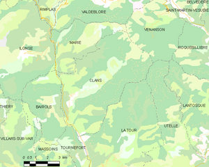
Clans
- commune in Alpes-Maritimes, France
Hiking in Clans
Clans, a picturesque village located in the Alpes-Maritimes department of the French Riviera, offers a unique hiking experience for outdoor enthusiasts. Nestled in the foothills of the Alps, Clans is surrounded by stunning mountainous landscapes, lush vegetation, and breathtaking views—perfect for nature lovers and hikers of all skill levels....
- Country:
- Postal Code: 06420
- Coordinates: 43° 59' 42" N, 7° 8' 52" E
- GPS tracks (wikiloc): [Link]
- Area: 37.79 sq km
- Population: 589

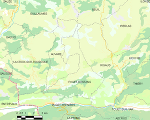
Puget-Rostang
- commune in Alpes-Maritimes, France
Hiking in Puget-Rostang
Puget-Rostang is a picturesque area in the French Alps, particularly known for its stunning landscapes, diverse trails, and rich biodiversity. While it may not be as widely known as some other hiking destinations, it offers a variety of hiking experiences suitable for different skill levels....
- Country:
- Postal Code: 06260
- Coordinates: 43° 58' 26" N, 6° 55' 4" E
- GPS tracks (wikiloc): [Link]
- AboveSeaLevel: 771 м m
- Area: 22.46 sq km
- Population: 133

Blausasc
- commune in Alpes-Maritimes, France
Hiking in Blausasc
Blausasc is a charming village located in the Alpes-Maritimes department of France, near Nice. It is known for its stunning landscapes and diverse hiking opportunities, making it a great destination for outdoor enthusiasts....
- Country:
- Postal Code: 06440
- Coordinates: 43° 48' 17" N, 7° 21' 55" E
- GPS tracks (wikiloc): [Link]
- Area: 10.21 sq km
- Population: 1448


Courmes
- commune in Alpes-Maritimes, France
Hiking in Courmes
Courmes is a charming village located in the Alpes-Maritimes region of France, in the heart of the stunning French Riviera. It is a fantastic destination for hiking enthusiasts, offering a mix of breathtaking landscapes, diverse trails, and a rich natural environment....
- Country:
- Postal Code: 06620
- Coordinates: 43° 44' 33" N, 7° 0' 32" E
- GPS tracks (wikiloc): [Link]
- Area: 15.71 sq km
- Population: 126


Saint-Vallier-de-Thiey
- commune in Alpes-Maritimes, France
Hiking in Saint-Vallier-de-Thiey
Saint-Vallier-de-Thiey is a charming village located in the Alpes-Maritimes department in southeastern France, offering a variety of hiking opportunities amidst beautiful landscapes. The region is characterized by its diverse terrain, which includes forested areas, rocky outcrops, and panoramic views of the surrounding mountains and valleys....
- Country:
- Postal Code: 06460
- Coordinates: 43° 41' 56" N, 6° 50' 52" E
- GPS tracks (wikiloc): [Link]
- Area: 50.68 sq km
- Population: 3526


Bouyon
- commune in Alpes-Maritimes, France
Hiking in Bouyon
Bouyon is a small village located in the Alpes-Maritimes region of southeastern France, nestled in the hills near Nice. The area offers stunning natural scenery and a variety of hiking opportunities, making it a great destination for outdoor enthusiasts. Here’s what you can expect while hiking in and around Bouyon:...
- Country:
- Postal Code: 06510
- Coordinates: 43° 49' 28" N, 7° 7' 23" E
- GPS tracks (wikiloc): [Link]
- Area: 12.29 sq km
- Population: 494

Coursegoules
- commune in Alpes-Maritimes, France
Hiking in Coursegoules
Coursegoules is a charming village located in the Alpes-Maritimes department in southeastern France. It lies in the foothills of the French Alps, offering stunning scenery, diverse landscapes, and a variety of hiking opportunities suitable for different skill levels....
- Country:
- Postal Code: 06140
- Coordinates: 43° 47' 36" N, 7° 2' 38" E
- GPS tracks (wikiloc): [Link]
- Area: 40.98 sq km
- Population: 524
- Web site: [Link]


Andon
- commune in Alpes-Maritimes, France
Hiking in Andon
Andon, located in the Alpes-Maritimes region of France, is a charming village that offers a range of hiking opportunities amidst stunning natural landscapes. Nestled in the foothills of the Alpes, it serves as a gateway to the surrounding mountains and valleys. Here are some highlights and tips for hiking in and around Andon:...
- Country:
- Postal Code: 06750
- Coordinates: 43° 46' 23" N, 6° 47' 11" E
- GPS tracks (wikiloc): [Link]
- Area: 54.3 sq km
- Population: 562
- Web site: [Link]

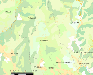
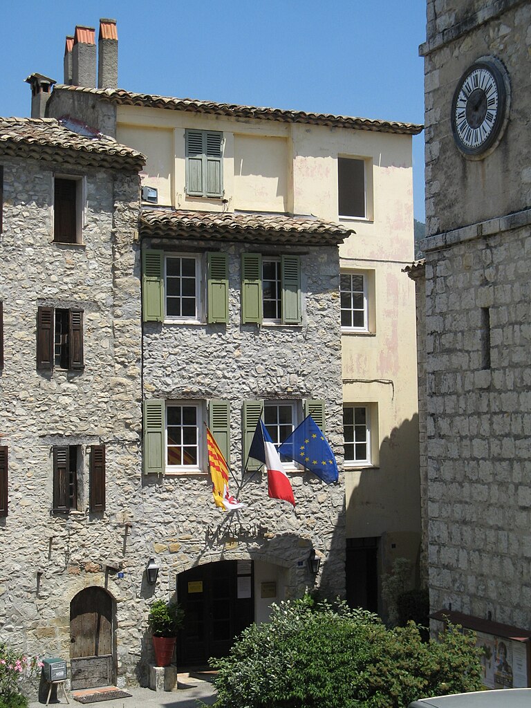
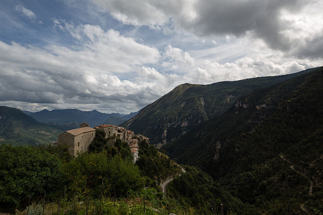
Coaraze
- commune in Alpes-Maritimes, France
Hiking in Coaraze
Coaraze, a charming village located in the Alpes-Maritimes region of France, offers beautiful hiking opportunities in a stunning natural environment. Nestled in the hills above Nice, this picturesque spot provides both scenic views and a glimpse into traditional Provencal life....
- Country:
- Postal Code: 06390
- Coordinates: 43° 51' 51" N, 7° 17' 42" E
- GPS tracks (wikiloc): [Link]
- Area: 17.14 sq km
- Population: 843


Berre-les-Alpes
- commune in Alpes-Maritimes, France
Hiking in Berre-les-Alpes
Berre-les-Alpes is a charming village located in the hills near Nice in the French Riviera, offering stunning views and diverse hiking opportunities. Here are some key points about hiking in and around Berre-les-Alpes:...
- Country:
- Postal Code: 06390
- Coordinates: 43° 49' 49" N, 7° 19' 44" E
- GPS tracks (wikiloc): [Link]
- Area: 9.58 sq km
- Population: 1270


Bézaudun-les-Alpes
- commune in Alpes-Maritimes, France
Hiking in Bézaudun-les-Alpes
Bézaudun-les-Alpes is a charming commune located in the Alpes-Maritimes department in southeastern France. The area is known for its stunning natural landscapes, historical architecture, and a variety of hiking opportunities that cater to different experience levels. Here are some highlights and tips for hiking in and around Bézaudun-les-Alpes:...
- Country:
- Postal Code: 06510
- Coordinates: 43° 48' 27" N, 7° 5' 46" E
- GPS tracks (wikiloc): [Link]
- Area: 21.44 sq km
- Population: 243
- Web site: [Link]


Collongues
- commune in Alpes-Maritimes, France
Hiking in Collongues
Collongues is a charming village located in the Alpes-Maritimes department in the southeastern region of France, nestled within the beautiful landscapes of the French Riviera. Hiking in this area offers a wonderful opportunity to explore the natural beauty and diverse terrain of the region....
- Country:
- Postal Code: 06910
- Coordinates: 43° 53' 17" N, 6° 51' 47" E
- GPS tracks (wikiloc): [Link]
- Area: 10.78 sq km
- Population: 97

Colomars
- commune in Alpes-Maritimes, France
Hiking in Colomars
Colomars is a charming commune located in the Alpes-Maritimes department in the South of France, near Nice. It’s known for its beautiful landscapes, giving hikers a variety of trails that cater to different skill levels. Here’s an overview of what you can expect when hiking in Colomars:...
- Country:
- Postal Code: 06670
- Coordinates: 43° 45' 49" N, 7° 13' 20" E
- GPS tracks (wikiloc): [Link]
- Area: 6.72 sq km
- Population: 3377

Cuébris
- commune in Alpes-Maritimes, France
Hiking in Cuébris
Cuébris is a charming village located in the Alpes-Maritimes department in the Provence-Alpes-Côte d'Azur region of France. It offers a variety of hiking opportunities for outdoor enthusiasts, with stunning views, diverse landscapes, and a pleasant Mediterranean climate....
- Country:
- Postal Code: 06910
- Coordinates: 43° 53' 13" N, 7° 1' 14" E
- GPS tracks (wikiloc): [Link]
- Area: 23.1 sq km
- Population: 151


Châteauneuf-d'Entraunes
- commune in Alpes-Maritimes, France
Hiking in Châteauneuf-d'Entraunes
Châteauneuf-d'Entraunes is a picturesque village located in the Alpes-Maritimes department of France. Nestled in the Mercantour National Park, it offers a variety of hiking opportunities suitable for different levels of experience. Here are some highlights and tips for hiking in this beautiful area:...
- Country:
- Postal Code: 06470
- Coordinates: 44° 7' 42" N, 6° 49' 56" E
- GPS tracks (wikiloc): [Link]
- Area: 29.91 sq km
- Population: 47
- Web site: [Link]

Cantaron
- commune in Alpes-Maritimes, France
Hiking in Cantaron
Cantaron is a charming village located in the Alpes-Maritimes department of southeastern France, near Nice. It's a fantastic destination for hiking enthusiasts, offering a mix of scenic trails, beautiful landscapes, and a rich cultural experience. Here are some highlights regarding hiking in and around Cantaron:...
- Country:
- Postal Code: 06340
- Coordinates: 43° 45' 42" N, 7° 19' 7" E
- GPS tracks (wikiloc): [Link]
- Area: 7.38 sq km
- Population: 1337
- Web site: [Link]


Bonson
- commune in Alpes-Maritimes, France
Hiking in Bonson
Bonson, located in the Alpes-Maritimes department of the Provence-Alpes-Côte d'Azur region in France, offers a beautiful setting for hiking enthusiasts. Nestled in the hills above the Var River, this charming village is surrounded by stunning natural landscapes and offers a variety of trails that cater to different skill levels....
- Country:
- Postal Code: 06830
- Coordinates: 43° 51' 46" N, 7° 11' 24" E
- GPS tracks (wikiloc): [Link]
- Area: 6.72 sq km
- Population: 737
- Web site: [Link]


Castillon
- commune in Alpes-Maritimes, France
Hiking in Castillon
Hiking in Castillon, Alpes-Maritimes, offers a unique blend of stunning landscapes, Mediterranean climate, and rich natural biodiversity. Nestled in the foothills of the French Riviera, Castillon is known for its picturesque views, quaint village charm, and a variety of hiking trails suitable for all levels of experience....
- Country:
- Postal Code: 06500
- Coordinates: 43° 50' 0" N, 7° 28' 20" E
- GPS tracks (wikiloc): [Link]
- Area: 7.51 sq km
- Population: 378
- Web site: [Link]


Caussols
- commune in Alpes-Maritimes, France
Hiking in Caussols
Caussols is a picturesque village located in the Alpes-Maritimes region of France, known for its stunning natural landscapes and diverse hiking opportunities. Nestled in the Provencal countryside and surrounded by beautiful forests, hills, and rocky outcrops, it offers a range of trails that cater to different skill levels....
- Country:
- Postal Code: 06460
- Coordinates: 43° 44' 29" N, 6° 54' 0" E
- GPS tracks (wikiloc): [Link]
- AboveSeaLevel: 1200 м m
- Area: 27.39 sq km
- Population: 260
- Web site: [Link]

Conségudes
- commune in Alpes-Maritimes, France
Hiking in Conségudes
It looks like there may be a typo in your query, as "Conségudes" does not appear to be a recognized hiking destination or area. However, if you're referring to a specific location in the mountains or a national park, please provide more context or check the spelling....
- Country:
- Postal Code: 06510
- Coordinates: 43° 50' 36" N, 7° 2' 55" E
- GPS tracks (wikiloc): [Link]
- Area: 12.47 sq km
- Population: 106
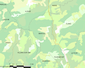
Bairols
- commune in Alpes-Maritimes, France
Hiking in Bairols
Bairols is a charming village situated in the Alpes-Maritimes region of the French Riviera, and it offers a range of beautiful hiking opportunities for both novice and experienced hikers. Nestled in the countryside, it provides stunning views of the surrounding mountains and valleys....
- Country:
- Postal Code: 06420
- Coordinates: 43° 58' 53" N, 7° 7' 38" E
- GPS tracks (wikiloc): [Link]
- Area: 15.24 sq km
- Population: 105


Fontan
- commune in Alpes-Maritimes, France
Hiking in Fontan
Fontan is a small village located in the Alpes-Maritimes department in southeastern France. Nestled in the mountains, it offers a variety of scenic hiking opportunities for outdoor enthusiasts. Here are some highlights and tips for hiking in and around Fontan:...
- Country:
- Postal Code: 06540
- Coordinates: 44° 0' 14" N, 7° 33' 13" E
- GPS tracks (wikiloc): [Link]
- Area: 49.61 sq km
- Population: 352
- Web site: [Link]

Opio
- commune in Alpes-Maritimes, France
Hiking in Opio
Hiking in Opio, located in the Alpes-Maritimes region of France, offers a wonderful mix of beautiful landscapes, charming villages, and moderate hiking trails suited for different skill levels....
- Country:
- Postal Code: 06650
- Coordinates: 43° 40' 6" N, 6° 58' 54" E
- GPS tracks (wikiloc): [Link]
- Area: 9.47 sq km
- Population: 2212

Saint-Cézaire-sur-Siagne
- commune in Alpes-Maritimes, France
Hiking in Saint-Cézaire-sur-Siagne
Saint-Cézaire-sur-Siagne is a picturesque village located in the Alpes-Maritimes department of France, near the Mediterranean coast. This area is renowned for its beautiful landscapes, lush vegetation, and proximity to the Siagne River, making it a wonderful spot for hiking enthusiasts....
- Country:
- Postal Code: 06530
- Coordinates: 43° 38' 56" N, 6° 47' 34" E
- GPS tracks (wikiloc): [Link]
- Area: 30.02 sq km
- Population: 3927
- Web site: [Link]

Roquestéron
- commune in Alpes-Maritimes, France
Hiking in Roquestéron
Roquesteron is a charming commune located in the Alpes-Maritimes department in southeastern France. It's situated in the foothills of the Alps, making it a wonderful destination for hiking enthusiasts. Here are some details to consider for a hiking adventure in Roquesteron:...
- Country:
- Postal Code: 06910
- Coordinates: 43° 52' 25" N, 7° 0' 16" E
- GPS tracks (wikiloc): [Link]
- Area: 6.47 sq km
- Population: 578

Puget-Théniers
- commune in Alpes-Maritimes, France
Hiking in Puget-Théniers
Puget-Théniers is a charming commune in the Alpes-Maritimes department in the Provence-Alpes-Côte d’Azur region of southeastern France. Nestled in the stunning landscape of the French Alps, it offers a variety of outdoor activities, including hiking, which can be an incredible way to explore the natural beauty of the area....
- Country:
- Postal Code: 06260
- Coordinates: 43° 57' 22" N, 6° 53' 37" E
- GPS tracks (wikiloc): [Link]
- Area: 21.45 sq km
- Population: 1898
- Web site: [Link]


Saint-Sauveur-sur-Tinée
- commune in Alpes-Maritimes, France
Hiking in Saint-Sauveur-sur-Tinée
Saint-Sauveur-sur-Tinée is a picturesque village located in the Alpes-Maritimes department of southeastern France. It offers an excellent setting for hiking enthusiasts, with its stunning natural landscapes, varied terrain, and a range of trails suitable for different skill levels....
- Country:
- Postal Code: 06420
- Coordinates: 44° 5' 2" N, 7° 6' 18" E
- GPS tracks (wikiloc): [Link]
- Area: 32.28 sq km
- Population: 338

Roubion
- commune in Alpes-Maritimes, France
Hiking in Roubion
Roubion is a charming village located in the Alpes-Maritimes region of southeastern France. Surrounded by stunning natural landscapes, it offers a wealth of hiking opportunities for outdoor enthusiasts. Here are some highlights and tips for hiking in and around Roubion:...
- Country:
- Postal Code: 06420
- Coordinates: 44° 5' 34" N, 7° 3' 2" E
- GPS tracks (wikiloc): [Link]
- Area: 27.26 sq km
- Population: 118


Saint-Martin-d'Entraunes
- commune in Alpes-Maritimes, France
Hiking in Saint-Martin-d'Entraunes
Saint-Martin-d'Entraunes is a beautiful village located in the Alpes-Maritimes region of France, nestled within the stunning Mercantour National Park. The area is characterized by its rugged mountains, lush valleys, and spectacular natural landscapes. Hiking in Saint-Martin-d'Entraunes offers a variety of trails suitable for all skill levels, making it a great destination for both beginners and experienced hikers....
- Country:
- Postal Code: 06470
- Coordinates: 44° 8' 31" N, 6° 45' 44" E
- GPS tracks (wikiloc): [Link]
- Area: 40.05 sq km
- Population: 121


La Colle-sur-Loup
- commune in Alpes-Maritimes, France
Hiking in La Colle-sur-Loup
La Colle-sur-Loup is a charming village located in the Provence-Alpes-Côte d'Azur region of France, near the picturesque French Riviera. The area is renowned for its stunning natural landscapes, making it an excellent spot for hiking enthusiasts. Here are some highlights of hiking in La Colle-sur-Loup:...
- Country:
- Postal Code: 06480
- Coordinates: 43° 41' 11" N, 7° 6' 14" E
- GPS tracks (wikiloc): [Link]
- Area: 9.82 sq km
- Population: 7895
- Web site: [Link]


La Croix-sur-Roudoule
- commune in Alpes-Maritimes, France
Hiking in La Croix-sur-Roudoule
La Croix-sur-Roudoule is a charming village located in the Alpes-Maritimes department in the south of France, surrounded by beautiful natural landscapes that offer excellent hiking opportunities. Here are some highlights and tips for hiking in the area:...
- Country:
- Postal Code: 06260
- Coordinates: 43° 59' 15" N, 6° 52' 30" E
- GPS tracks (wikiloc): [Link]
- Area: 30.06 sq km
- Population: 98


Saint-Martin-du-Var
- commune in Alpes-Maritimes, France
Hiking in Saint-Martin-du-Var
Saint-Martin-du-Var is a charming village located in the Alpes-Maritimes region of France, near Nice. The area is less known than more popular destinations in the French Riviera, making it a great spot for a peaceful hiking experience amidst stunning natural surroundings....
- Country:
- Postal Code: 06670
- Coordinates: 43° 49' 20" N, 7° 11' 32" E
- GPS tracks (wikiloc): [Link]
- Area: 5.59 sq km
- Population: 2882
- Web site: [Link]

Revest-les-Roches
- commune in Alpes-Maritimes, France
Hiking in Revest-les-Roches
Revest-les-Roches, located in the Provence-Alpes-Côte d'Azur region of France, is a charming destination for hikers, offering stunning landscapes, natural beauty, and rich history. Nestled in the hills near the city of Toulon, it features a mix of rugged terrain, scenic trails, and panoramic views of the surrounding countryside and the Mediterranean Sea....
- Country:
- Postal Code: 06830
- Coordinates: 43° 52' 50" N, 7° 9' 26" E
- GPS tracks (wikiloc): [Link]
- Area: 8.61 sq km
- Population: 230


Lucéram
- commune in Alpes-Maritimes, France
Hiking in Lucéram
Lucéram is a picturesque village located in the Alpes-Maritimes department of France, nestled in the hills of Provence near the French Riviera. The area surrounding Lucéram offers a variety of hiking opportunities, showcasing stunning landscapes, rich flora, and charming rural architecture....
- Country:
- Postal Code: 06440
- Coordinates: 43° 52' 57" N, 7° 21' 38" E
- GPS tracks (wikiloc): [Link]
- Area: 65.52 sq km
- Population: 1261


Marie
- commune in Alpes-Maritimes, France
Hiking in Marie
Marie, situated in the Alpes-Maritimes region of France, offers a range of hiking opportunities that showcase the stunning natural beauty of the French Riviera and the surrounding Alpine landscapes. The area is characterized by diverse terrains, including mountains, valleys, and coastal views, making it ideal for hikers of varying skill levels....
- Country:
- Postal Code: 06420
- Coordinates: 44° 1' 55" N, 7° 8' 4" E
- GPS tracks (wikiloc): [Link]
- Area: 14.77 sq km
- Population: 107


Tournefort
- commune in Alpes-Maritimes, France
Hiking in Tournefort
Tournefort, located in the Alpes-Maritimes region of France, is a small village that offers access to beautiful hiking opportunities in the surrounding natural environment. The Alpes-Maritimes is known for its stunning landscapes, with a mix of mountains, hills, and Mediterranean coastlines....
- Country:
- Postal Code: 06420
- Coordinates: 43° 56' 48" N, 7° 9' 4" E
- GPS tracks (wikiloc): [Link]
- Area: 10.13 sq km
- Population: 162


Saint-Léger
- commune in Alpes-Maritimes, France
Hiking in Saint-Léger
Saint-Léger, located in the Alpes-Maritimes region of France, is a lesser-known gem that offers a variety of hiking opportunities amidst stunning alpine scenery. The area is characterized by its beautiful landscapes, including mountains, forests, and valleys, making it ideal for outdoor enthusiasts and hikers of all levels....
- Country:
- Postal Code: 06260
- Coordinates: 43° 59' 59" N, 6° 49' 42" E
- GPS tracks (wikiloc): [Link]
- Area: 4.61 sq km
- Population: 63

Pierlas
- commune in Alpes-Maritimes, France
Hiking in Pierlas
Pierlas is a charming village located in the Alpes-Maritimes department of France, nestled in the scenic region of Provence-Alpes-Côte d'Azur. It's a great place for hiking enthusiasts looking to explore nature and enjoy breathtaking views of the surrounding mountains and valleys....
- Country:
- Postal Code: 06260
- Coordinates: 44° 1' 54" N, 7° 2' 8" E
- GPS tracks (wikiloc): [Link]
- Area: 31.31 sq km
- Population: 97

Peille
- commune in Alpes-Maritimes, France
Hiking in Peille
Peille is a charming village located in the Alpes-Maritimes department in the Provence-Alpes-Côte d'Azur region of France. Nestled in the hills above the Mediterranean, it offers a variety of hiking opportunities with stunning views, lush vegetation, and a rich history....
- Country:
- Postal Code: 06440
- Coordinates: 43° 48' 9" N, 7° 24' 6" E
- GPS tracks (wikiloc): [Link]
- Area: 43.16 sq km
- Population: 2353
- Web site: [Link]

Saint-Dalmas-le-Selvage
- commune in Alpes-Maritimes, France
Hiking in Saint-Dalmas-le-Selvage
Saint-Dalmas-le-Selvage is a beautiful village located in the Alpes-Maritimes department in southeastern France, known for its stunning mountain scenery and access to numerous hiking trails. Here are some highlights and tips for hiking in the area:...
- Country:
- Postal Code: 06660
- Coordinates: 44° 17' 5" N, 6° 51' 58" E
- GPS tracks (wikiloc): [Link]
- Area: 81.03 sq km
- Population: 122


Falicon
- commune in Alpes-Maritimes, France
Hiking in Falicon
Falicon is a charming village located in the Alpes-Maritimes department in the Provence-Alpes-Côte d'Azur region of France, just northeast of Nice. It is known for its picturesque landscapes and beautiful views of the French Riviera. Hiking in and around Falicon offers a wonderful opportunity to explore nature, enjoy stunning vistas, and experience the local environment....
- Country:
- Postal Code: 06950
- Coordinates: 43° 44' 56" N, 7° 16' 47" E
- GPS tracks (wikiloc): [Link]
- Area: 5.17 sq km
- Population: 1974
- Web site: [Link]


Châteauneuf-Villevieille
- commune in Alpes-Maritimes, France
Hiking in Châteauneuf-Villevieille
Châteauneuf-Villevieille is a picturesque village located in the Provence-Alpes-Côte d'Azur region of France, nestled in the hills of the Alpes-Maritimes. It offers a range of hiking opportunities that showcase the stunning natural landscapes, Mediterranean flora, and quaint views of the surrounding countryside....
- Country:
- Postal Code: 06390
- Coordinates: 43° 48' 30" N, 7° 17' 47" E
- GPS tracks (wikiloc): [Link]
- AboveSeaLevel: 650 м m
- Area: 8.38 sq km
- Population: 913
- Web site: [Link]
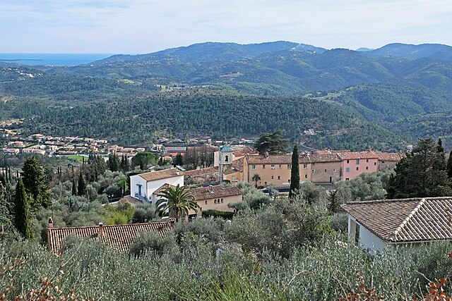

Le Tignet
- commune in Alpes-Maritimes, France
Hiking in Le Tignet
Le Tignet is a charming village located in the Alpes-Maritimes region of France, not far from the French Riviera. It's known for its beautiful landscapes, picturesque views, and proximity to the Verdon Gorge and the hills of the Provence hinterlands. Here are some key aspects of hiking in this area:...
- Country:
- Postal Code: 06530
- Coordinates: 43° 37' 45" N, 6° 50' 37" E
- GPS tracks (wikiloc): [Link]
- Area: 11.26 sq km
- Population: 3311
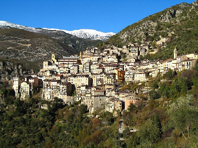

Saorge
- commune in Alpes-Maritimes, France
Hiking in Saorge
Saorge is a picturesque village located in the Alpes-Maritimes region of France, not far from the Italian border. The area is known for its stunning landscapes, charming architecture, and an array of hiking opportunities that cater to different skill levels. Here are some highlights and trails to consider when hiking in and around Saorge:...
- Country:
- Postal Code: 06540
- Coordinates: 43° 59' 14" N, 7° 33' 9" E
- GPS tracks (wikiloc): [Link]
- AboveSeaLevel: 513 м m
- Area: 86.78 sq km
- Population: 455
- Web site: [Link]

La Penne
- commune in Alpes-Maritimes, France
Hiking in La Penne
La Penne is a picturesque village located in the Var department of France, nestled within the stunning landscape of the Provence region. This area offers a variety of hiking opportunities that cater to different skill levels and preferences. Here are some things to know about hiking in La Penne:...
- Country:
- Postal Code: 06260
- Coordinates: 43° 55' 41" N, 6° 56' 56" E
- GPS tracks (wikiloc): [Link]
- Area: 18.08 sq km
- Population: 263


Les Ferres
- commune in Alpes-Maritimes, France
Hiking in Les Ferres
Les Ferres is a picturesque village located in the Alpes-Maritimes region of France, near the French Riviera. It sits at an elevation of about 800 meters in the hills above Nice, making it an excellent starting point for various hiking adventures. The area is known for its beautiful landscapes, stunning views, and diverse flora and fauna....
- Country:
- Postal Code: 06510
- Coordinates: 43° 50' 49" N, 7° 5' 39" E
- GPS tracks (wikiloc): [Link]
- Area: 13.7 sq km
- Population: 106


Sallagriffon
- commune in Alpes-Maritimes, France
Hiking in Sallagriffon
Sallagriffon is not widely recognized as a well-known hiking destination. However, if you meant a specific area or region, I’d be happy to provide information about hiking in that location!...
- Country:
- Postal Code: 06910
- Coordinates: 43° 53' 0" N, 6° 54' 26" E
- GPS tracks (wikiloc): [Link]
- AboveSeaLevel: 720 м m
- Area: 9.59 sq km
- Population: 45


Guillaumes
- small village in the south-east of France department of Alpes-Maritimes
Hiking in Guillaumes
Guillaumes is a charming village located in the Alpes-Maritimes department in southeastern France. It’s nestled in the Mercantour National Park, making it a fantastic base for hikers and nature enthusiasts. Here are some highlights and tips for hiking in the Guillaumes area:...
- Country:
- Postal Code: 06470
- Coordinates: 44° 5' 26" N, 6° 51' 13" E
- GPS tracks (wikiloc): [Link]
- Area: 87.02 sq km
- Population: 640

Saint-Étienne-de-Tinée
- commune in Alpes-Maritimes, France
Hiking in Saint-Étienne-de-Tinée
Saint-Étienne-de-Tinée is a charming village located in the Alpes-Maritimes region of southeastern France, nestled in the Tinée Valley. It serves as a great base for hikers looking to explore the stunning natural landscapes of the surrounding area, including the Mercantour National Park, which is renowned for its dramatic scenery and diverse wildlife....
- Country:
- Postal Code: 06660
- Coordinates: 44° 15' 25" N, 6° 55' 29" E
- GPS tracks (wikiloc): [Link]
- AboveSeaLevel: 1139 м m
- Area: 173.81 sq km
- Population: 1468
Shares border with regions:

Piedmont
- region in North-West Italy
Hiking in Piedmont
Hiking in the Piedmont region offers a wonderful blend of natural beauty, diverse landscapes, and rich cultural heritage. This area, which generally encompasses the foothills of the Appalachian Mountains and stretches across parts of Virginia, North Carolina, South Carolina, and more, features rolling hills, lush forests, and scenic views. Here are some highlights and tips for hiking in Piedmont:...
- Country:

- Capital: Turin
- Coordinates: 45° 15' 0" N, 7° 55' 0" E
- GPS tracks (wikiloc): [Link]
- AboveSeaLevel: 421 м m
- Area: 25402 sq km
- Population: 4367559
- Web site: [Link]

Liguria
- Italian region
Hiking in Liguria
Hiking in Liguria, a stunning region located in northwestern Italy, is a fantastic experience due to its diverse landscapes, coastal views, and charming villages. Here are some key highlights:...
- Country:
- Capital: Genoa
- Coordinates: 44° 27' 0" N, 8° 46' 0" E
- GPS tracks (wikiloc): [Link]
- AboveSeaLevel: 250 м m
- Area: 5422.0 sq km
- Population: 1558812
- Web site: [Link]


Var
- department in France
Hiking in Var
Hiking in the Var department, located in the Provence-Alpes-Côte d'Azur region of southeastern France, offers a diverse range of landscapes and trails suitable for hikers of varying skill levels. Here are some key highlights and tips for hiking in Var:...
- Country:
- Capital: Toulon
- Coordinates: 43° 24' 3" N, 6° 12' 36" E
- GPS tracks (wikiloc): [Link]
- Area: 5973 sq km
- Population: 1048652
- Web site: [Link]


Province of Cuneo
- province in Italy
Hiking in Province of Cuneo
The Province of Cuneo, located in the Piedmont region of northwestern Italy, is a fantastic destination for hiking enthusiasts. This area is known for its stunning alpine landscapes, diverse ecosystems, and charming villages, making it an ideal spot for outdoor activities. Here are some highlights and key information about hiking in the Province of Cuneo:...
- Country:
- Capital: Cuneo
- Postal Code: 12100
- Licence Plate Code: CN
- Coordinates: 44° 23' 0" N, 7° 33' 0" E
- GPS tracks (wikiloc): [Link]
- Area: 6902.65 sq km
- Web site: [Link]
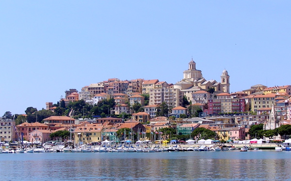

Province of Imperia
- province of Italy
Hiking in Province of Imperia
The Province of Imperia, located in the Liguria region of Italy, is renowned for its stunning coastal scenery, charming villages, and mountainous landscapes, making it a fantastic destination for hiking enthusiasts. Here are some highlights and tips about hiking in this beautiful area:...
- Country:
- Capital: Imperia
- Postal Code: 18100, 18010-18039
- Licence Plate Code: IM
- Coordinates: 43° 53' 11" N, 8° 1' 47" E
- GPS tracks (wikiloc): [Link]
- Area: 1156.13 sq km
- Web site: [Link]
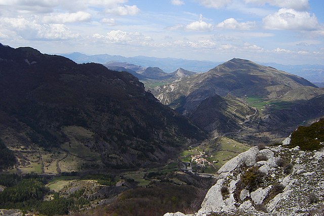
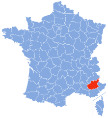
Alpes-de-Haute-Provence
- French department
Hiking in Alpes-de-Haute-Provence
Hiking in the Alpes-de-Haute-Provence region of southeastern France offers a unique blend of stunning landscapes, diverse ecosystems, and charming villages. Here are some key points to consider if you’re planning a hiking trip in this area:...
- Country:
- Capital: Digne-les-Bains
- Coordinates: 44° 5' 43" N, 6° 14' 24" E
- GPS tracks (wikiloc): [Link]
- Area: 6925 sq km
- Population: 161799
- Web site: [Link]