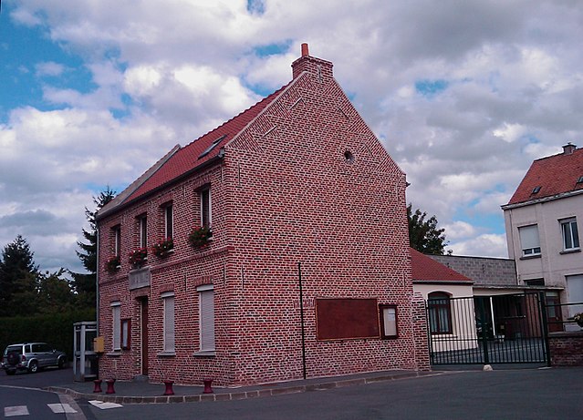
Cantin (Cantin)
- commune in Nord, France
- Country:

- Postal Code: 59169
- Coordinates: 50° 18' 33" N, 3° 7' 33" E


- GPS tracks (wikiloc): [Link]
- Area: 9.32 sq km
- Population: 1521
- Web site: http://www.ville-cantin.fr/
- Wikipedia en: wiki(en)
- Wikipedia: wiki(fr)
- Wikidata storage: Wikidata: Q672549
- Wikipedia Commons Category: [Link]
- Freebase ID: [/m/03qfgf5]
- Freebase ID: [/m/03qfgf5]
- GeoNames ID: Alt: [3028767]
- GeoNames ID: Alt: [3028767]
- SIREN number: [215901265]
- SIREN number: [215901265]
- BnF ID: [152667015]
- BnF ID: [152667015]
- VIAF ID: Alt: [139713272]
- VIAF ID: Alt: [139713272]
- GND ID: Alt: [4315259-4]
- GND ID: Alt: [4315259-4]
- Library of Congress authority ID: Alt: [n95002187]
- Library of Congress authority ID: Alt: [n95002187]
- INSEE municipality code: 59126
- INSEE municipality code: 59126
Shares border with regions:


Gœulzin
- commune in Nord, France
- Country:

- Postal Code: 59169
- Coordinates: 50° 19' 3" N, 3° 5' 41" E


- GPS tracks (wikiloc): [Link]
- Area: 4.79 sq km
- Population: 1019
- Web site: [Link]


Erchin
- commune in Nord, France
- Country:

- Postal Code: 59169
- Coordinates: 50° 19' 5" N, 3° 10' 1" E


- GPS tracks (wikiloc): [Link]
- Area: 5.28 sq km
- Population: 702


Dechy
- commune in Nord, France
- Country:

- Postal Code: 59187
- Coordinates: 50° 21' 9" N, 3° 7' 42" E


- GPS tracks (wikiloc): [Link]
- Area: 9.27 sq km
- Population: 5299


Roucourt
- commune in Nord, France
- Country:

- Postal Code: 59169
- Coordinates: 50° 19' 41" N, 3° 8' 54" E


- GPS tracks (wikiloc): [Link]
- Area: 3.19 sq km
- Population: 447
- Web site: [Link]


Arleux
- commune in Nord, France
- Country:

- Postal Code: 59151
- Coordinates: 50° 16' 49" N, 3° 6' 23" E


- GPS tracks (wikiloc): [Link]
- Area: 11.1 sq km
- Population: 3031
- Web site: [Link]


Bugnicourt
- commune in Nord, France
- Country:

- Postal Code: 59151
- Coordinates: 50° 17' 27" N, 3° 9' 21" E


- GPS tracks (wikiloc): [Link]
- Area: 6.28 sq km
- Population: 956


Estrées
- commune in Nord, France
- Country:

- Postal Code: 59151
- Coordinates: 50° 18' 1" N, 3° 4' 11" E


- GPS tracks (wikiloc): [Link]
- Area: 5.82 sq km
- Population: 1111
