canton of Allanche (canton d'Allanche)
- canton of France (until March 2015)
- Country:

- Capital: Allanche
- Coordinates: 45° 13' 48" N, 2° 56' 7" E


- GPS tracks (wikiloc): [Link]
- Wikidata storage: Wikidata: Q1251820
- INSEE canton code: [1501]
Includes regions:


Sainte-Anastasie
- former commune in Cantal, France
- Country:
- Postal Code: 15170
- Coordinates: 45° 10' 21" N, 2° 58' 12" E
- GPS tracks (wikiloc): [Link]
- Area: 15.88 sq km
- Population: 141


Vèze
- commune in Cantal, France
- Country:
- Postal Code: 15160
- Coordinates: 45° 16' 0" N, 2° 59' 37" E
- GPS tracks (wikiloc): [Link]
- Area: 25.46 sq km
- Population: 60

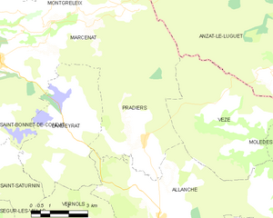
Pradiers
- commune in Cantal, France
- Country:
- Postal Code: 15160
- Coordinates: 45° 16' 11" N, 2° 55' 28" E
- GPS tracks (wikiloc): [Link]
- Area: 23.61 sq km
- Population: 94


Vernols
- commune in Cantal, France
- Country:
- Postal Code: 15160
- Coordinates: 45° 13' 34" N, 2° 53' 25" E
- GPS tracks (wikiloc): [Link]
- Area: 24.2 sq km
- Population: 66
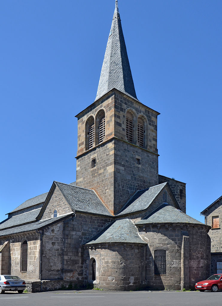

Allanche
- commune in Cantal, France
- Country:
- Postal Code: 15160
- Coordinates: 45° 13' 45" N, 2° 56' 4" E
- GPS tracks (wikiloc): [Link]
- Area: 49.89 sq km
- Population: 759
- Web site: [Link]


Saint-Saturnin
- commune in Cantal, France
- Country:
- Postal Code: 15190
- Coordinates: 45° 15' 19" N, 2° 47' 42" E
- GPS tracks (wikiloc): [Link]
- Area: 38.71 sq km
- Population: 207


Ségur-les-Villas
- commune in Cantal, France
- Country:
- Postal Code: 15300
- Coordinates: 45° 13' 32" N, 2° 49' 3" E
- GPS tracks (wikiloc): [Link]
- Area: 26.69 sq km
- Population: 205


Peyrusse
- commune in Cantal, France
- Country:
- Postal Code: 15170
- Coordinates: 45° 12' 8" N, 3° 1' 43" E
- GPS tracks (wikiloc): [Link]
- Area: 29.26 sq km
- Population: 155


Charmensac
- commune in Cantal, France
- Country:
- Postal Code: 15500
- Coordinates: 45° 13' 0" N, 3° 5' 17" E
- GPS tracks (wikiloc): [Link]
- Area: 15.17 sq km
- Population: 83


Joursac
- commune in Cantal, France
- Country:
- Postal Code: 15170
- Coordinates: 45° 8' 31" N, 3° 0' 20" E
- GPS tracks (wikiloc): [Link]
- AboveSeaLevel: 625 м m
- Area: 21.11 sq km
- Population: 147
Landeyrat
- commune in Cantal, France
- Country:
- Postal Code: 15160
- Coordinates: 45° 16' 26" N, 2° 51' 51" E
- GPS tracks (wikiloc): [Link]
- Area: 21.28 sq km
- Population: 94