canton of Combronde (canton de Combronde)
- canton of France (until March 2015)
- Country:

- Capital: Combronde
- Coordinates: 45° 59' 4" N, 3° 5' 22" E


- GPS tracks (wikiloc): [Link]
- Wikidata storage: Wikidata: Q285980
- INSEE canton code: [6314]
Includes regions:
Beauregard-Vendon
- commune in Puy-de-Dôme, France
- Country:
- Postal Code: 63460
- Coordinates: 45° 57' 34" N, 3° 6' 37" E
- GPS tracks (wikiloc): [Link]
- Area: 7.33 sq km
- Population: 1172


Gimeaux
- commune in Puy-de-Dôme, France
- Country:
- Postal Code: 63200
- Coordinates: 45° 57' 0" N, 3° 5' 37" E
- GPS tracks (wikiloc): [Link]
- Area: 2.19 sq km
- Population: 401

Teilhède
- commune in Puy-de-Dôme, France
- Country:
- Postal Code: 63460
- Coordinates: 45° 57' 21" N, 3° 4' 19" E
- GPS tracks (wikiloc): [Link]
- Area: 11.82 sq km
- Population: 429


Yssac-la-Tourette
- commune in Puy-de-Dôme, France
- Country:
- Postal Code: 63200
- Coordinates: 45° 56' 6" N, 3° 5' 34" E
- GPS tracks (wikiloc): [Link]
- Area: 2.14 sq km
- Population: 376


Jozerand
- commune in Puy-de-Dôme, France
- Country:
- Postal Code: 63460
- Coordinates: 46° 1' 32" N, 3° 5' 49" E
- GPS tracks (wikiloc): [Link]
- Area: 10.76 sq km
- Population: 547


Saint-Myon
- commune in Puy-de-Dôme, France
- Country:
- Postal Code: 63460
- Coordinates: 45° 59' 36" N, 3° 7' 50" E
- GPS tracks (wikiloc): [Link]
- Area: 5.51 sq km
- Population: 467
- Web site: [Link]


Combronde
- commune in Puy-de-Dôme, France
- Country:
- Postal Code: 63460
- Coordinates: 45° 58' 52" N, 3° 5' 17" E
- GPS tracks (wikiloc): [Link]
- Area: 18 sq km
- Population: 2170


Davayat
- commune in Puy-de-Dôme, France
- Country:
- Postal Code: 63200
- Coordinates: 45° 56' 50" N, 3° 6' 31" E
- GPS tracks (wikiloc): [Link]
- Area: 2.33 sq km
- Population: 596
- Web site: [Link]
Montcel
- commune in Puy-de-Dôme, France
- Country:
- Postal Code: 63460
- Coordinates: 46° 0' 53" N, 3° 3' 58" E
- GPS tracks (wikiloc): [Link]
- Area: 9.43 sq km
- Population: 475
Saint-Hilaire-la-Croix
- commune in Puy-de-Dôme, France
- Country:
- Postal Code: 63440
- Coordinates: 46° 2' 48" N, 3° 2' 44" E
- GPS tracks (wikiloc): [Link]
- Area: 16.21 sq km
- Population: 334
- Web site: [Link]


Prompsat
- commune in Puy-de-Dôme, France
- Country:
- Postal Code: 63200
- Coordinates: 45° 56' 58" N, 3° 4' 42" E
- GPS tracks (wikiloc): [Link]
- Area: 4.23 sq km
- Population: 421

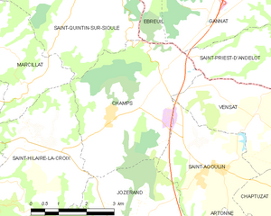
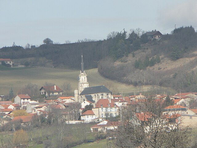
Champs
- commune in Puy-de-Dôme, France
- Country:
- Postal Code: 63440
- Coordinates: 46° 3' 31" N, 3° 5' 6" E
- GPS tracks (wikiloc): [Link]
- Area: 15.13 sq km
- Population: 394