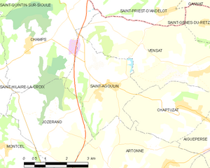
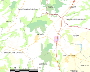
Jozerand (Jozerand)

- commune in Puy-de-Dôme, France
- Country:

- Postal Code: 63460
- Coordinates: 46° 1' 32" N, 3° 5' 49" E


- GPS tracks (wikiloc): [Link]
- Area: 10.76 sq km
- Population: 547
- Wikipedia en: wiki(en)
- Wikipedia: wiki(fr)
- Wikidata storage: Wikidata: Q1218441
- Wikipedia Commons Category: [Link]
- Freebase ID: [/m/03qhbc2]
- GeoNames ID: Alt: [6440056]
- SIREN number: [216301812]
- VIAF ID: Alt: [242320119]
- INSEE municipality code: 63181
Shares border with regions:


Artonne
- commune in Puy-de-Dôme, France
- Country:
- Postal Code: 63460
- Coordinates: 46° 0' 12" N, 3° 8' 38" E
- GPS tracks (wikiloc): [Link]
- Area: 17.48 sq km
- Population: 882

Saint-Agoulin
- commune in Puy-de-Dôme, France
- Country:
- Postal Code: 63260
- Coordinates: 46° 2' 27" N, 3° 8' 9" E
- GPS tracks (wikiloc): [Link]
- Area: 9.34 sq km
- Population: 333


Combronde
- commune in Puy-de-Dôme, France
- Country:
- Postal Code: 63460
- Coordinates: 45° 58' 52" N, 3° 5' 17" E
- GPS tracks (wikiloc): [Link]
- Area: 18 sq km
- Population: 2170
Montcel
- commune in Puy-de-Dôme, France
- Country:
- Postal Code: 63460
- Coordinates: 46° 0' 53" N, 3° 3' 58" E
- GPS tracks (wikiloc): [Link]
- Area: 9.43 sq km
- Population: 475
Saint-Hilaire-la-Croix
- commune in Puy-de-Dôme, France
- Country:
- Postal Code: 63440
- Coordinates: 46° 2' 48" N, 3° 2' 44" E
- GPS tracks (wikiloc): [Link]
- Area: 16.21 sq km
- Population: 334
- Web site: [Link]

Champs
- commune in Puy-de-Dôme, France
- Country:
- Postal Code: 63440
- Coordinates: 46° 3' 31" N, 3° 5' 6" E
- GPS tracks (wikiloc): [Link]
- Area: 15.13 sq km
- Population: 394