canton of Condat (canton de Condat)
- canton of France (until March 2015)
- Country:

- Capital: Condat
- Coordinates: 45° 20' 30" N, 2° 45' 27" E


- GPS tracks (wikiloc): [Link]
- Wikidata storage: Wikidata: Q60079
- INSEE canton code: [1506]
Includes regions:


Saint-Amandin
- commune in Cantal, France
- Country:
- Postal Code: 15190
- Coordinates: 45° 20' 34" N, 2° 41' 41" E
- GPS tracks (wikiloc): [Link]
- Area: 31.89 sq km
- Population: 222
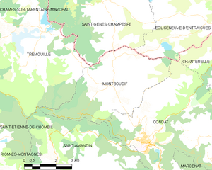
Montboudif
- commune in Cantal, France
- Country:
- Postal Code: 15190
- Coordinates: 45° 22' 17" N, 2° 43' 53" E
- GPS tracks (wikiloc): [Link]
- Area: 20.42 sq km
- Population: 190


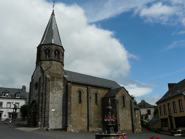
Condat
- commune in Cantal, France
- Country:
- Postal Code: 15190
- Coordinates: 45° 20' 27" N, 2° 45' 24" E
- GPS tracks (wikiloc): [Link]
- AboveSeaLevel: 700 м m
- Area: 40.24 sq km
- Population: 1017
- Web site: [Link]


Saint-Bonnet-de-Condat
- commune in Cantal, France
- Country:
- Postal Code: 15190
- Coordinates: 45° 16' 48" N, 2° 47' 18" E
- GPS tracks (wikiloc): [Link]
- Area: 17.32 sq km
- Population: 116


Marcenat
- commune in Cantal, France
- Country:
- Postal Code: 15190
- Coordinates: 45° 18' 25" N, 2° 49' 36" E
- GPS tracks (wikiloc): [Link]
- Area: 51.47 sq km
- Population: 505
- Web site: [Link]


Marchastel
- commune in Cantal, France
- Country:
- Postal Code: 15400
- Coordinates: 45° 16' 59" N, 2° 43' 30" E
- GPS tracks (wikiloc): [Link]
- Area: 22.92 sq km
- Population: 151


Chanterelle
- commune in Cantal, France
- Country:
- Postal Code: 15190
- Coordinates: 45° 22' 47" N, 2° 48' 51" E
- GPS tracks (wikiloc): [Link]
- Area: 19.72 sq km
- Population: 93
- Web site: [Link]


Lugarde
- commune in Cantal, France
- Country:
- Postal Code: 15190
- Coordinates: 45° 17' 17" N, 2° 45' 38" E
- GPS tracks (wikiloc): [Link]
- Area: 13.43 sq km
- Population: 149


Montgreleix
- commune in Cantal, France
- Country:
- Postal Code: 15190
- Coordinates: 45° 20' 41" N, 2° 52' 13" E
- GPS tracks (wikiloc): [Link]
- Area: 17.63 sq km
- Population: 42