canton of Cordes-sur-Ciel (canton de Cordes-sur-Ciel)
- canton of France
- Country:

- Capital: Cordes-sur-Ciel
- Coordinates: 44° 3' 51" N, 1° 56' 44" E


- GPS tracks (wikiloc): [Link]
- Wikidata storage: Wikidata: Q1725037
- INSEE canton code: [8109]
Includes regions:


Amarens
- commune in Tarn, France
- Country:
- Postal Code: 81170
- Coordinates: 44° 2' 16" N, 1° 54' 50" E
- GPS tracks (wikiloc): [Link]
- Area: 4.88 sq km
- Population: 69


Frausseilles
- commune in Tarn, France
- Country:
- Postal Code: 81170
- Coordinates: 44° 1' 41" N, 1° 55' 48" E
- GPS tracks (wikiloc): [Link]
- Area: 5.87 sq km
- Population: 89


Donnazac
- commune in Tarn, France
- Country:
- Postal Code: 81170
- Coordinates: 44° 0' 52" N, 1° 56' 42" E
- GPS tracks (wikiloc): [Link]
- Area: 4.74 sq km
- Population: 77


Les Cabannes
- commune in Tarn, France
- Country:
- Postal Code: 81170
- Coordinates: 44° 4' 1" N, 1° 56' 26" E
- GPS tracks (wikiloc): [Link]
- Area: 6.16 sq km
- Population: 371
- Web site: [Link]


Bournazel
- commune in Tarn, France
- Country:
- Postal Code: 81170
- Coordinates: 44° 5' 31" N, 1° 58' 6" E
- GPS tracks (wikiloc): [Link]
- AboveSeaLevel: 325 м m
- Area: 7.41 sq km
- Population: 182
- Web site: [Link]


Souel
- commune in Tarn, France
- Country:
- Postal Code: 81170
- Coordinates: 44° 1' 49" N, 1° 57' 20" E
- GPS tracks (wikiloc): [Link]
- AboveSeaLevel: 298 м m
- Area: 9.7 sq km
- Population: 176


Vindrac-Alayrac
- commune in Tarn, France
- Country:
- Postal Code: 81170
- Coordinates: 44° 3' 55" N, 1° 54' 46" E
- GPS tracks (wikiloc): [Link]
- Area: 9.82 sq km
- Population: 165

Mouzieys-Panens
- commune in Tarn, France
- Country:
- Postal Code: 81170
- Coordinates: 44° 5' 32" N, 1° 55' 57" E
- GPS tracks (wikiloc): [Link]
- Area: 13.13 sq km
- Population: 247
Labarthe-Bleys
- commune in Tarn, France
- Country:
- Postal Code: 81170
- Coordinates: 44° 4' 37" N, 1° 54' 27" E
- GPS tracks (wikiloc): [Link]
- Area: 9.06 sq km
- Population: 75


Loubers
- commune in Tarn, France
- Country:
- Postal Code: 81170
- Coordinates: 44° 2' 33" N, 1° 53' 40" E
- GPS tracks (wikiloc): [Link]
- Area: 4.23 sq km
- Population: 81
Noailles
- commune in Tarn, France
- Country:
- Postal Code: 81170
- Coordinates: 44° 0' 37" N, 1° 59' 5" E
- GPS tracks (wikiloc): [Link]
- Area: 11.59 sq km
- Population: 219
Livers-Cazelles
- commune in Tarn, France
- Country:
- Postal Code: 81170
- Coordinates: 44° 3' 8" N, 1° 59' 54" E
- GPS tracks (wikiloc): [Link]
- AboveSeaLevel: 315 м m
- Area: 13.05 sq km
- Population: 221
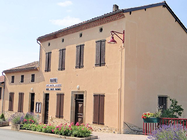

Saint-Martin-Laguépie
- commune in Tarn, France
- Country:
- Postal Code: 81170
- Coordinates: 44° 8' 32" N, 1° 58' 25" E
- GPS tracks (wikiloc): [Link]
- Area: 21.51 sq km
- Population: 405


Lacapelle-Ségalar
- commune in Tarn, France
- Country:
- Postal Code: 81170
- Coordinates: 44° 6' 55" N, 1° 59' 32" E
- GPS tracks (wikiloc): [Link]
- Area: 6.83 sq km
- Population: 99
- Web site: [Link]
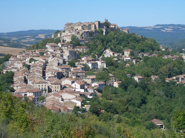
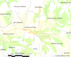
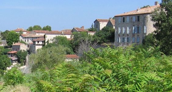
Cordes-sur-Ciel
- commune in Tarn, France
- Country:
- Postal Code: 81170
- Coordinates: 44° 3' 48" N, 1° 57' 10" E
- GPS tracks (wikiloc): [Link]
- Area: 8.27 sq km
- Population: 952
- Web site: [Link]
Tonnac
- commune in Tarn, France
- Country:
- Postal Code: 81170
- Coordinates: 44° 3' 50" N, 1° 52' 4" E
- GPS tracks (wikiloc): [Link]
- Area: 11.23 sq km
- Population: 123


Saint-Marcel-Campes
- commune in Tarn, France
- Country:
- Postal Code: 81170
- Coordinates: 44° 4' 48" N, 1° 59' 22" E
- GPS tracks (wikiloc): [Link]
- AboveSeaLevel: 400 м m
- Area: 22.34 sq km
- Population: 206