canton of Cunlhat (canton de Cunlhat)
- canton of France (until March 2015)
- Country:

- Capital: Cunlhat
- Coordinates: 45° 37' 3" N, 3° 32' 31" E


- GPS tracks (wikiloc): [Link]
- Wikidata storage: Wikidata: Q285747
- INSEE canton code: [6316]
Includes regions:
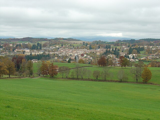
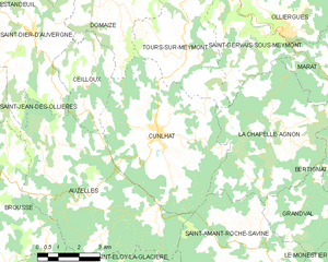
Cunlhat
- commune in Puy-de-Dôme, France
- Country:
- Postal Code: 63590
- Coordinates: 45° 37' 55" N, 3° 33' 33" E
- GPS tracks (wikiloc): [Link]
- Area: 29.55 sq km
- Population: 1248
- Web site: [Link]


Auzelles
- commune in Puy-de-Dôme, France
- Country:
- Postal Code: 63590
- Coordinates: 45° 36' 7" N, 3° 30' 34" E
- GPS tracks (wikiloc): [Link]
- Area: 33.42 sq km
- Population: 354


La Chapelle-Agnon
- commune in Puy-de-Dôme, France
- Country:
- Postal Code: 63590
- Coordinates: 45° 38' 0" N, 3° 38' 16" E
- GPS tracks (wikiloc): [Link]
- AboveSeaLevel: 700 м m
- Area: 26.08 sq km
- Population: 367


Brousse
- commune in Puy-de-Dôme, France
- Country:
- Postal Code: 63490
- Coordinates: 45° 36' 6" N, 3° 27' 32" E
- GPS tracks (wikiloc): [Link]
- Area: 22.45 sq km
- Population: 346