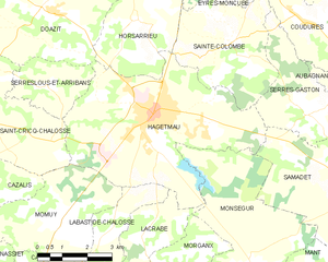
canton of Hagetmau (canton de Hagetmau)
- canton of France (until March 2015)
- Country:

- Capital: Hagetmau
- Coordinates: 43° 37' 21" N, 0° 34' 43" E


- GPS tracks (wikiloc): [Link]
- Wikidata storage: Wikidata: Q598341
- INSEE canton code: [4008]
Includes regions:

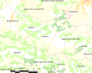
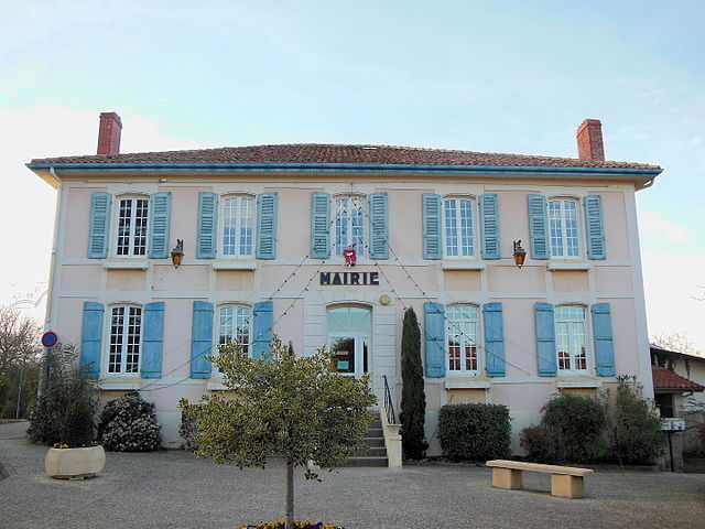
Momuy
- commune in Landes, France
- Country:
- Postal Code: 40700
- Coordinates: 43° 36' 51" N, 0° 38' 8" E
- GPS tracks (wikiloc): [Link]
- Area: 13.3 sq km
- Population: 465


Lacrabe
- commune in Landes, France
- Country:
- Postal Code: 40700
- Coordinates: 43° 36' 55" N, 0° 35' 26" E
- GPS tracks (wikiloc): [Link]
- Area: 6.27 sq km
- Population: 259


Cazalis
- commune in Landes, France
- Country:
- Postal Code: 40700
- Coordinates: 43° 37' 29" N, 0° 39' 42" E
- GPS tracks (wikiloc): [Link]
- Area: 5.13 sq km
- Population: 136

Sainte-Colombe
- commune in Landes, France
- Country:
- Postal Code: 40700
- Coordinates: 43° 40' 54" N, 0° 33' 24" E
- GPS tracks (wikiloc): [Link]
- Area: 12.79 sq km
- Population: 684


Mant
- commune in Landes, France
- Country:
- Postal Code: 40700
- Coordinates: 43° 35' 8" N, 0° 30' 32" E
- GPS tracks (wikiloc): [Link]
- Area: 19.34 sq km
- Population: 277

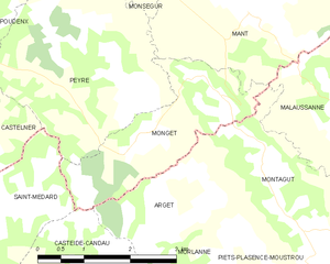
Monget
- commune in Landes, France
- Country:
- Postal Code: 40700
- Coordinates: 43° 33' 58" N, 0° 31' 14" E
- GPS tracks (wikiloc): [Link]
- Area: 5.64 sq km
- Population: 93


Peyre
- commune in Landes, France
- Country:
- Postal Code: 40700
- Coordinates: 43° 34' 1" N, 0° 32' 49" E
- GPS tracks (wikiloc): [Link]
- Area: 10.25 sq km
- Population: 254


Morganx
- commune in Landes, France
- Country:
- Postal Code: 40700
- Coordinates: 43° 36' 22" N, 0° 34' 12" E
- GPS tracks (wikiloc): [Link]
- Area: 5.22 sq km
- Population: 180

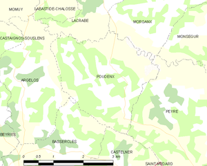
Poudenx
- commune in Landes, France
- Country:
- Postal Code: 40700
- Coordinates: 43° 34' 38" N, 0° 34' 58" E
- GPS tracks (wikiloc): [Link]
- Area: 7.46 sq km
- Population: 228


Castelner
- commune in Landes, France
- Country:
- Postal Code: 40700
- Coordinates: 43° 33' 9" N, 0° 34' 58" E
- GPS tracks (wikiloc): [Link]
- Area: 5.73 sq km
- Population: 112


Aubagnan
- commune in Landes, France
- Country:
- Postal Code: 40700
- Coordinates: 43° 40' 1" N, 0° 29' 19" E
- GPS tracks (wikiloc): [Link]
- Area: 3.4 sq km
- Population: 249
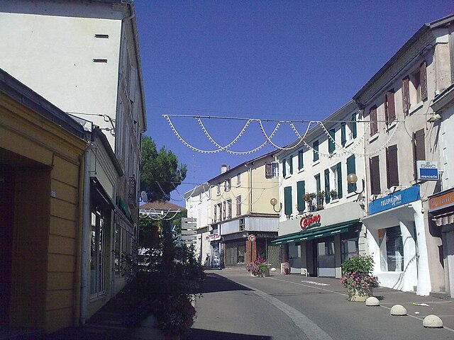
Hagetmau
- commune in Landes, France
- Country:
- Postal Code: 40700
- Coordinates: 43° 39' 19" N, 0° 35' 37" E
- GPS tracks (wikiloc): [Link]
- Area: 28.37 sq km
- Population: 4616
- Web site: [Link]


Labastide-Chalosse
- commune in Landes, France
- Country:
- Postal Code: 40700
- Coordinates: 43° 36' 43" N, 0° 36' 36" E
- GPS tracks (wikiloc): [Link]
- Area: 4.56 sq km
- Population: 150
Serres-Gaston
- commune in Landes, France
- Country:
- Postal Code: 40700
- Coordinates: 43° 39' 25" N, 0° 30' 59" E
- GPS tracks (wikiloc): [Link]
- Area: 8.88 sq km
- Population: 390

Serreslous-et-Arribans
- commune in Landes, France
- Country:
- Postal Code: 40700
- Coordinates: 43° 39' 47" N, 0° 38' 45" E
- GPS tracks (wikiloc): [Link]
- Area: 5.46 sq km
- Population: 195


Saint-Cricq-Chalosse
- commune in Landes, France
- Country:
- Postal Code: 40700
- Coordinates: 43° 39' 16" N, 0° 41' 5" E
- GPS tracks (wikiloc): [Link]
- Area: 20.23 sq km
- Population: 636
- Web site: [Link]


Horsarrieu
- commune in Landes, France
- Country:
- Postal Code: 40700
- Coordinates: 43° 40' 59" N, 0° 35' 51" E
- GPS tracks (wikiloc): [Link]
- Area: 11.02 sq km
- Population: 689


Monségur
- commune in Landes, France
- Country:
- Postal Code: 40700
- Coordinates: 43° 36' 16" N, 0° 32' 29" E
- GPS tracks (wikiloc): [Link]
- AboveSeaLevel: 110 м m
- Area: 19.69 sq km
- Population: 401