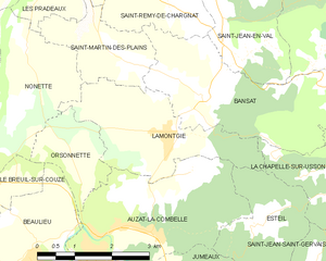
canton of Jumeaux (canton de Jumeaux)
- canton of France (until March 2015)
- Country:

- Capital: Jumeaux
- Coordinates: 45° 26' 0" N, 3° 21' 0" E


- GPS tracks (wikiloc): [Link]
- Wikidata storage: Wikidata: Q285764
- INSEE canton code: [6320]
Includes regions:


Champagnat-le-Jeune
- commune in Puy-de-Dôme, France
- Country:

- Postal Code: 63580
- Coordinates: 45° 27' 0" N, 3° 25' 36" E


- GPS tracks (wikiloc): [Link]
- Area: 9.39 sq km
- Population: 141
Valz-sous-Châteauneuf
- commune in Puy-de-Dôme, France
- Country:

- Postal Code: 63580
- Coordinates: 45° 26' 0" N, 3° 25' 0" E


- GPS tracks (wikiloc): [Link]
- AboveSeaLevel: 543 м m
- Area: 5.14 sq km
- Population: 52
Saint-Martin-d'Ollières
- commune in Puy-de-Dôme, France
- Country:

- Postal Code: 63580
- Coordinates: 45° 25' 18" N, 3° 26' 59" E


- GPS tracks (wikiloc): [Link]
- Area: 14.47 sq km
- Population: 148


Lamontgie
- commune in Puy-de-Dôme, France
- Country:

- Postal Code: 63570
- Coordinates: 45° 28' 28" N, 3° 20' 1" E


- GPS tracks (wikiloc): [Link]
- Area: 7.09 sq km
- Population: 641
La Chapelle-sur-Usson
- commune in Puy-de-Dôme, France
- Country:

- Postal Code: 63580
- Coordinates: 45° 27' 59" N, 3° 24' 1" E


- GPS tracks (wikiloc): [Link]
- Area: 6.78 sq km
- Population: 62


Jumeaux
- commune in Puy-de-Dôme, France
- Country:

- Postal Code: 63570
- Coordinates: 45° 25' 52" N, 3° 20' 24" E


- GPS tracks (wikiloc): [Link]
- Area: 7.13 sq km
- Population: 647


Esteil
- commune in Puy-de-Dôme, France
- Country:

- Postal Code: 63570
- Coordinates: 45° 27' 10" N, 3° 21' 59" E


- GPS tracks (wikiloc): [Link]
- Area: 4.55 sq km
- Population: 64


Brassac-les-Mines
- commune in Puy-de-Dôme, France
- Country:

- Postal Code: 63570
- Coordinates: 45° 24' 51" N, 3° 19' 44" E


- GPS tracks (wikiloc): [Link]
- Area: 7.2 sq km
- Population: 3300
- Web site: [Link]


Saint-Jean-Saint-Gervais
- commune in Puy-de-Dôme, France
- Country:

- Postal Code: 63570
- Coordinates: 45° 24' 52" N, 3° 22' 33" E


- GPS tracks (wikiloc): [Link]
- Area: 14.39 sq km
- Population: 123


Peslières
- commune in Puy-de-Dôme, France
- Country:

- Postal Code: 63580
- Coordinates: 45° 26' 23" N, 3° 27' 40" E


- GPS tracks (wikiloc): [Link]
- Area: 6.86 sq km
- Population: 69


Auzat-la-Combelle
- commune in Puy-de-Dôme, France
- Country:

- Postal Code: 63570
- Coordinates: 45° 27' 8" N, 3° 19' 6" E


- GPS tracks (wikiloc): [Link]
- Area: 12.74 sq km
- Population: 2108
- Web site: [Link]