canton of Lubersac (canton de Lubersac)
- canton of France
- Country:

- Capital: Lubersac
- Coordinates: 45° 26' 34" N, 1° 24' 14" E


- GPS tracks (wikiloc): [Link]
- Wikidata storage: Wikidata: Q1726001
- INSEE canton code: [1915]
Includes regions:


Lubersac
- commune in Corrèze, France
- Country:
- Postal Code: 19210
- Coordinates: 45° 26' 41" N, 1° 24' 16" E
- GPS tracks (wikiloc): [Link]
- Area: 57.46 sq km
- Population: 2226
- Web site: [Link]
Montgibaud
- commune in Corrèze, France
- Country:
- Postal Code: 19210
- Coordinates: 45° 31' 7" N, 1° 25' 21" E
- GPS tracks (wikiloc): [Link]
- Area: 13.99 sq km
- Population: 240
Saint-Sornin-Lavolps
- commune in Corrèze, France
- Country:
- Postal Code: 19230
- Coordinates: 45° 22' 41" N, 1° 22' 58" E
- GPS tracks (wikiloc): [Link]
- Area: 15.36 sq km
- Population: 868
- Web site: [Link]
Saint-Pardoux-Corbier
- commune in Corrèze, France
- Country:
- Postal Code: 19210
- Coordinates: 45° 25' 54" N, 1° 27' 4" E
- GPS tracks (wikiloc): [Link]
- Area: 17.44 sq km
- Population: 414


Saint-Éloy-les-Tuileries
- commune in Corrèze, France
- Country:
- Postal Code: 19210
- Coordinates: 45° 26' 49" N, 1° 17' 33" E
- GPS tracks (wikiloc): [Link]
- Area: 9.13 sq km
- Population: 107

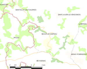
Ségur-le-Château
- commune in Corrèze, France
- Country:
- Postal Code: 19230
- Coordinates: 45° 25' 46" N, 1° 18' 18" E
- GPS tracks (wikiloc): [Link]
- Area: 9.48 sq km
- Population: 184
- Web site: [Link]

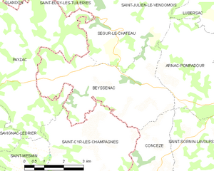
Beyssenac
- commune in Corrèze, France
- Country:
- Postal Code: 19230
- Coordinates: 45° 24' 15" N, 1° 17' 10" E
- GPS tracks (wikiloc): [Link]
- Area: 18.3 sq km
- Population: 372


Saint-Julien-le-Vendômois
- commune in Corrèze, France
- Country:
- Postal Code: 19210
- Coordinates: 45° 27' 42" N, 1° 19' 42" E
- GPS tracks (wikiloc): [Link]
- Area: 23.29 sq km
- Population: 254
Saint-Martin-Sepert
- commune in Corrèze, France
- Country:
- Postal Code: 19210
- Coordinates: 45° 26' 4" N, 1° 28' 17" E
- GPS tracks (wikiloc): [Link]
- Area: 15.71 sq km
- Population: 292
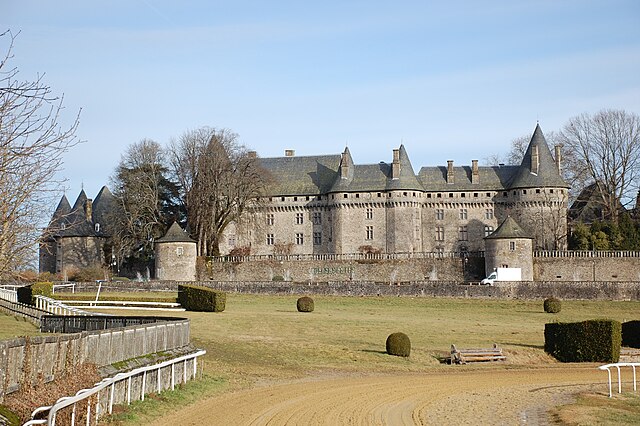

Arnac-Pompadour
- commune in Corrèze, France
- Country:
- Postal Code: 19230
- Coordinates: 45° 23' 47" N, 1° 22' 52" E
- GPS tracks (wikiloc): [Link]
- Area: 15.09 sq km
- Population: 1135
- Web site: [Link]


Benayes
- commune in Corrèze, France
- Country:
- Postal Code: 19510
- Coordinates: 45° 31' 11" N, 1° 28' 15" E
- GPS tracks (wikiloc): [Link]
- Area: 23.12 sq km
- Population: 235


Beyssac
- commune in Corrèze, France
- Country:
- Postal Code: 19230
- Coordinates: 45° 22' 17" N, 1° 24' 14" E
- GPS tracks (wikiloc): [Link]
- Area: 21.32 sq km
- Population: 626
- Web site: [Link]