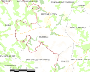
Ségur-le-Château (Ségur-le-Château)

- commune in Corrèze, France
- Country:

- Postal Code: 19230
- Coordinates: 45° 25' 46" N, 1° 18' 18" E


- GPS tracks (wikiloc): [Link]
- Area: 9.48 sq km
- Population: 184
- Web site: http://www.ségur-le-château.fr/
- Wikipedia en: wiki(en)
- Wikipedia: wiki(fr)
- Wikidata storage: Wikidata: Q181804
- Wikipedia Commons Category: [Link]
- Freebase ID: [/m/03cbv2b]
- GeoNames ID: Alt: [2975298]
- SIREN number: [211925409]
- BnF ID: [152498906]
- VIAF ID: Alt: [247369316]
- WOEID: [621597]
- INSEE municipality code: 19254
Shares border with regions:


Saint-Éloy-les-Tuileries
- commune in Corrèze, France
- Country:
- Postal Code: 19210
- Coordinates: 45° 26' 49" N, 1° 17' 33" E
- GPS tracks (wikiloc): [Link]
- Area: 9.13 sq km
- Population: 107

Beyssenac
- commune in Corrèze, France
- Country:
- Postal Code: 19230
- Coordinates: 45° 24' 15" N, 1° 17' 10" E
- GPS tracks (wikiloc): [Link]
- Area: 18.3 sq km
- Population: 372


Saint-Julien-le-Vendômois
- commune in Corrèze, France
- Country:
- Postal Code: 19210
- Coordinates: 45° 27' 42" N, 1° 19' 42" E
- GPS tracks (wikiloc): [Link]
- Area: 23.29 sq km
- Population: 254


Payzac
- commune in Dordogne, France
- Country:
- Postal Code: 24270
- Coordinates: 45° 24' 4" N, 1° 13' 4" E
- GPS tracks (wikiloc): [Link]
- AboveSeaLevel: 334 м m
- Area: 47.72 sq km
- Population: 985
- Web site: [Link]