canton of Massiac (canton de Massiac)
- canton of France (until March 2015)
- Country:

- Capital: Massiac
- Coordinates: 45° 15' 7" N, 3° 11' 53" E


- GPS tracks (wikiloc): [Link]
- Wikidata storage: Wikidata: Q60019
- INSEE canton code: [1508]
Includes regions:


Ferrières-Saint-Mary
- commune in Cantal, France
- Country:
- Postal Code: 15170
- Coordinates: 45° 10' 59" N, 3° 3' 30" E
- GPS tracks (wikiloc): [Link]
- Area: 19.17 sq km
- Population: 246

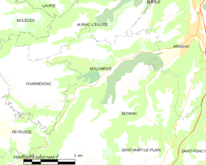
Molompize
- commune in Cantal, France
- Country:
- Postal Code: 15500
- Coordinates: 45° 13' 47" N, 3° 7' 35" E
- GPS tracks (wikiloc): [Link]
- Area: 17.12 sq km
- Population: 297
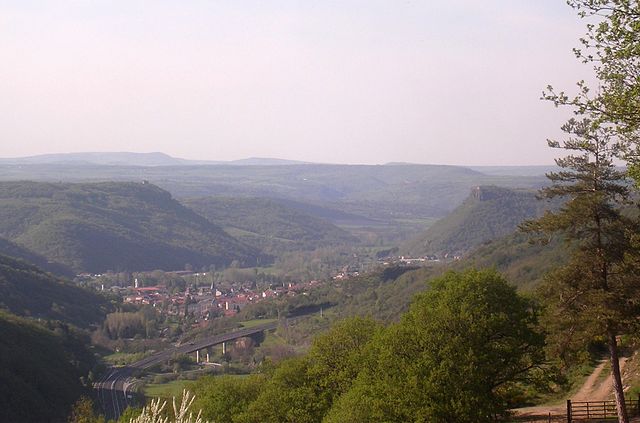

Massiac
- commune in Cantal, France
- Country:
- Postal Code: 15500
- Coordinates: 45° 15' 5" N, 3° 11' 50" E
- GPS tracks (wikiloc): [Link]
- Area: 34.78 sq km
- Population: 1727
- Web site: [Link]


Saint-Mary-le-Plain
- commune in Cantal, France
- Country:
- Postal Code: 15500
- Coordinates: 45° 11' 12" N, 3° 9' 42" E
- GPS tracks (wikiloc): [Link]
- Area: 21.8 sq km
- Population: 159


Auriac-l'Église
- commune in Cantal, France
- Country:
- Postal Code: 15500
- Coordinates: 45° 15' 52" N, 3° 7' 37" E
- GPS tracks (wikiloc): [Link]
- Area: 19.73 sq km
- Population: 163


Bonnac
- commune in Cantal, France
- Country:
- Postal Code: 15500
- Coordinates: 45° 12' 28" N, 3° 9' 30" E
- GPS tracks (wikiloc): [Link]
- Area: 22.6 sq km
- Population: 167


La Chapelle-Laurent
- commune in Cantal, France
- Country:
- Postal Code: 15500
- Coordinates: 45° 10' 40" N, 3° 14' 37" E
- GPS tracks (wikiloc): [Link]
- Area: 26.09 sq km
- Population: 298


Laurie
- commune in Cantal, France
- Country:
- Postal Code: 15500
- Coordinates: 45° 16' 36" N, 3° 6' 2" E
- GPS tracks (wikiloc): [Link]
- Area: 19.23 sq km
- Population: 95


Leyvaux
- commune in Cantal, France
- Country:
- Postal Code: 43450
- Coordinates: 45° 18' 48" N, 3° 4' 17" E
- GPS tracks (wikiloc): [Link]
- Area: 14.95 sq km
- Population: 38


Molèdes
- commune in Cantal, France
- Country:
- Postal Code: 15500
- Coordinates: 45° 15' 46" N, 3° 2' 23" E
- GPS tracks (wikiloc): [Link]
- Area: 22.38 sq km
- Population: 98


Saint-Poncy
- commune in Cantal, France
- Country:
- Postal Code: 15500
- Coordinates: 45° 9' 53" N, 3° 11' 12" E
- GPS tracks (wikiloc): [Link]
- Area: 40.37 sq km
- Population: 345


Valjouze
- commune in Cantal, France
- Country:
- Postal Code: 15170
- Coordinates: 45° 9' 46" N, 3° 3' 37" E
- GPS tracks (wikiloc): [Link]
- Area: 3.05 sq km
- Population: 23