canton of Mont-de-Marsan-Sud (canton de Mont-de-Marsan-Sud)
- canton of France
- Country:

- Capital: Mont-de-Marsan
- Coordinates: 43° 51' 54" N, 0° 29' 59" E


- GPS tracks (wikiloc): [Link]
- Wikidata storage: Wikidata: Q1726279
- INSEE canton code: [4030]
Includes regions:

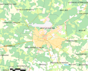
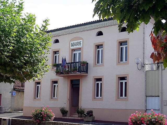
Mont-de-Marsan
- commune in Landes, France
- Country:
- Postal Code: 40000
- Coordinates: 43° 53' 25" N, 0° 30' 2" E
- GPS tracks (wikiloc): [Link]
- AboveSeaLevel: 63 м m
- Area: 36.88 sq km
- Population: 30629
- Web site: [Link]

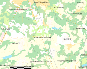
Bretagne-de-Marsan
- commune in Landes, France
- Country:
- Postal Code: 40280
- Coordinates: 43° 50' 51" N, 0° 27' 53" E
- GPS tracks (wikiloc): [Link]
- Area: 12.93 sq km
- Population: 1545
- Web site: [Link]

Benquet
- commune in Landes, France
- Country:
- Postal Code: 40280
- Coordinates: 43° 49' 48" N, 0° 30' 6" E
- GPS tracks (wikiloc): [Link]
- Area: 29.33 sq km
- Population: 1640
- Web site: [Link]

Haut-Mauco
- commune in Landes, France
- Country:
- Postal Code: 40280
- Coordinates: 43° 49' 33" N, 0° 33' 19" E
- GPS tracks (wikiloc): [Link]
- Area: 18.64 sq km
- Population: 937


Saint-Perdon
- commune in Landes, France
- Country:
- Postal Code: 40090
- Coordinates: 43° 52' 6" N, 0° 35' 31" E
- GPS tracks (wikiloc): [Link]
- Area: 30.62 sq km
- Population: 1686
- Web site: [Link]

Campagne
- commune in Landes, France
- Country:
- Postal Code: 40090
- Coordinates: 43° 51' 53" N, 0° 38' 24" E
- GPS tracks (wikiloc): [Link]
- Area: 33.91 sq km
- Population: 1022

Mazerolles
- commune in Landes, France
- Country:
- Postal Code: 40090
- Coordinates: 43° 52' 31" N, 0° 26' 11" E
- GPS tracks (wikiloc): [Link]
- AboveSeaLevel: 84 м m
- Area: 15.97 sq km
- Population: 659


Laglorieuse
- commune in Landes, France
- Country:
- Postal Code: 40090
- Coordinates: 43° 52' 1" N, 0° 24' 20" E
- GPS tracks (wikiloc): [Link]
- Area: 11.59 sq km
- Population: 544

Saint-Pierre-du-Mont
- commune in Landes, France
- Country:
- Postal Code: 40280
- Coordinates: 43° 52' 57" N, 0° 31' 10" E
- GPS tracks (wikiloc): [Link]
- Area: 26.25 sq km
- Population: 9512


Bougue
- commune in Landes, France
- Country:
- Postal Code: 40090
- Coordinates: 43° 53' 24" N, 0° 23' 33" E
- GPS tracks (wikiloc): [Link]
- Area: 21.96 sq km
- Population: 738