canton of Nérac (canton de Nérac)
- canton of France
- Country:

- Capital: Nérac
- Coordinates: 44° 8' 0" N, 0° 21' 0" E


- GPS tracks (wikiloc): [Link]
- Wikidata storage: Wikidata: Q1709514
- INSEE canton code: [4725]
Includes regions:

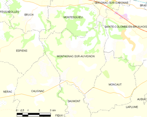
Montagnac-sur-Auvignon
- commune in Lot-et-Garonne, France
- Country:
- Postal Code: 47600
- Coordinates: 44° 9' 39" N, 0° 27' 35" E
- GPS tracks (wikiloc): [Link]
- Area: 22.69 sq km
- Population: 613


Fréchou
- commune in Lot-et-Garonne, France
- Country:
- Postal Code: 47600
- Coordinates: 44° 5' 6" N, 0° 19' 15" E
- GPS tracks (wikiloc): [Link]
- Area: 11.97 sq km
- Population: 215
- Web site: [Link]


Moncaut
- commune in Lot-et-Garonne, France
- Country:
- Postal Code: 47310
- Coordinates: 44° 8' 30" N, 0° 29' 57" E
- GPS tracks (wikiloc): [Link]
- Area: 15.76 sq km
- Population: 623
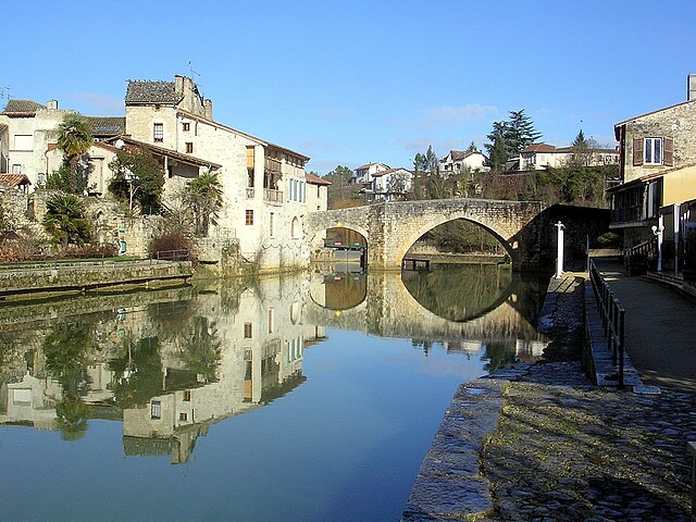

Nérac
- commune in Lot-et-Garonne, France
- Country:
- Postal Code: 47600
- Coordinates: 44° 8' 10" N, 0° 20' 22" E
- GPS tracks (wikiloc): [Link]
- AboveSeaLevel: 71 м m
- Area: 62.68 sq km
- Population: 6969
- Web site: [Link]


Espiens
- commune in Lot-et-Garonne, France
- Country:
- Postal Code: 47600
- Coordinates: 44° 10' 8" N, 0° 22' 39" E
- GPS tracks (wikiloc): [Link]
- Area: 17.48 sq km
- Population: 382


Calignac
- commune in Lot-et-Garonne, France
- Country:
- Postal Code: 47600
- Coordinates: 44° 8' 0" N, 0° 24' 54" E
- GPS tracks (wikiloc): [Link]
- Area: 18.38 sq km
- Population: 514


Andiran
- commune in Lot-et-Garonne, France
- Country:
- Postal Code: 47170
- Coordinates: 44° 5' 52" N, 0° 16' 41" E
- GPS tracks (wikiloc): [Link]
- Area: 9.89 sq km
- Population: 218
Saumont
- commune in Lot-et-Garonne, France
- Country:
- Postal Code: 47600
- Coordinates: 44° 7' 18" N, 0° 27' 28" E
- GPS tracks (wikiloc): [Link]
- Area: 6.74 sq km
- Population: 254