canton of Nivillers (canton de Nivillers)
- canton of France (until March 2015)
- Country:

- Capital: Nivillers
- Coordinates: 49° 27' 52" N, 2° 10' 1" E


- GPS tracks (wikiloc): [Link]
- Wikidata storage: Wikidata: Q625118
- INSEE canton code: [6027]
Includes regions:

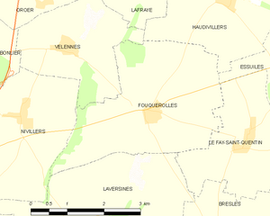
Fouquerolles
- commune in Oise, France
- Country:

- Postal Code: 60510
- Coordinates: 49° 27' 23" N, 2° 12' 54" E


- GPS tracks (wikiloc): [Link]
- Area: 10.21 sq km
- Population: 285


Haudivillers
- commune in Oise, France
- Country:

- Postal Code: 60510
- Coordinates: 49° 29' 11" N, 2° 14' 36" E


- GPS tracks (wikiloc): [Link]
- Area: 9.79 sq km
- Population: 821


Bailleul-sur-Thérain
- commune in Oise, France
- Country:

- Postal Code: 60930
- Coordinates: 49° 23' 7" N, 2° 13' 19" E


- GPS tracks (wikiloc): [Link]
- Area: 9.5 sq km
- Population: 2068


Bonlier
- commune in Oise, France
- Country:

- Postal Code: 60510
- Coordinates: 49° 28' 14" N, 2° 8' 59" E


- GPS tracks (wikiloc): [Link]
- Area: 4.47 sq km
- Population: 419


Guignecourt
- commune in Oise, France
- Country:

- Postal Code: 60480
- Coordinates: 49° 28' 57" N, 2° 7' 45" E


- GPS tracks (wikiloc): [Link]
- Area: 4.62 sq km
- Population: 379
- Web site: [Link]


Verderel-lès-Sauqueuse
- commune in Oise, France
- Country:

- Postal Code: 60112
- Coordinates: 49° 30' 11" N, 2° 5' 50" E


- GPS tracks (wikiloc): [Link]
- AboveSeaLevel: 137 м m
- Area: 12.46 sq km
- Population: 736


Troissereux
- commune in Oise, France
- Country:

- Postal Code: 60112
- Coordinates: 49° 28' 48" N, 2° 2' 34" E


- GPS tracks (wikiloc): [Link]
- Area: 14.05 sq km
- Population: 1147

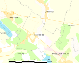
Rochy-Condé
- commune in Oise, France
- Country:

- Postal Code: 60510
- Coordinates: 49° 24' 2" N, 2° 11' 2" E


- GPS tracks (wikiloc): [Link]
- Area: 6.38 sq km
- Population: 999


Velennes
- commune in Oise, France
- Country:

- Postal Code: 60510
- Coordinates: 49° 28' 23" N, 2° 11' 1" E


- GPS tracks (wikiloc): [Link]
- Area: 6.17 sq km
- Population: 237

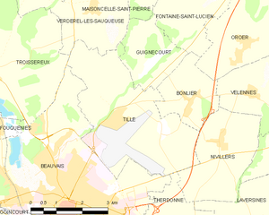
Tillé
- commune in Oise, France
- Country:

- Postal Code: 60000
- Coordinates: 49° 27' 48" N, 2° 6' 42" E


- GPS tracks (wikiloc): [Link]
- Area: 14.8 sq km
- Population: 1093


Nivillers
- commune in Oise, France
- Country:

- Postal Code: 60510
- Coordinates: 49° 27' 24" N, 2° 9' 57" E


- GPS tracks (wikiloc): [Link]
- Area: 7.65 sq km
- Population: 185


Juvignies
- commune in Oise, France
- Country:

- Postal Code: 60112
- Coordinates: 49° 31' 9" N, 2° 5' 11" E


- GPS tracks (wikiloc): [Link]
- Area: 8.09 sq km
- Population: 319


Oroër
- commune in Oise, France
- Country:

- Postal Code: 60510
- Coordinates: 49° 29' 28" N, 2° 10' 46" E


- GPS tracks (wikiloc): [Link]
- Area: 9.06 sq km
- Population: 564


Fontaine-Saint-Lucien
- commune in Oise, France
- Country:

- Postal Code: 60480
- Coordinates: 49° 29' 56" N, 2° 8' 48" E


- GPS tracks (wikiloc): [Link]
- Area: 7.25 sq km
- Population: 158


Maisoncelle-Saint-Pierre
- commune in Oise, France
- Country:

- Postal Code: 60112
- Coordinates: 49° 30' 40" N, 2° 7' 37" E


- GPS tracks (wikiloc): [Link]
- Area: 4.16 sq km
- Population: 155


Lafraye
- commune in Oise, France
- Country:

- Postal Code: 60510
- Coordinates: 49° 29' 42" N, 2° 12' 39" E


- GPS tracks (wikiloc): [Link]
- Area: 5.53 sq km
- Population: 373
- Web site: [Link]


Le Fay-Saint-Quentin
- commune in Oise, France
- Country:

- Postal Code: 60510
- Coordinates: 49° 27' 3" N, 2° 15' 4" E


- GPS tracks (wikiloc): [Link]
- Area: 7.19 sq km
- Population: 536


Bresles
- commune in Oise, France
- Country:

- Postal Code: 60510
- Coordinates: 49° 24' 37" N, 2° 15' 3" E


- GPS tracks (wikiloc): [Link]
- Area: 20.99 sq km
- Population: 4164
- Web site: [Link]
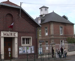

Therdonne
- commune in Oise, France
- Country:

- Postal Code: 60510
- Coordinates: 49° 25' 9" N, 2° 9' 18" E


- GPS tracks (wikiloc): [Link]
- Area: 8.98 sq km
- Population: 1047
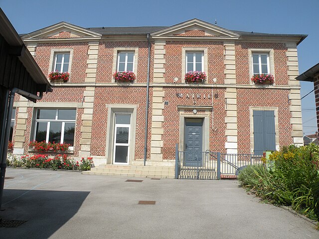

Laversines
- commune in Oise, France
- Country:

- Postal Code: 60510
- Coordinates: 49° 25' 30" N, 2° 11' 50" E


- GPS tracks (wikiloc): [Link]
- Area: 13.79 sq km
- Population: 1134