canton of Noailles (canton de Noailles)
- canton of France (until March 2015)
- Country:

- Capital: Noailles
- Coordinates: 49° 19' 28" N, 2° 10' 56" E


- GPS tracks (wikiloc): [Link]
- Area: 155.2 sq km
- Wikidata storage: Wikidata: Q625127
- INSEE canton code: [6028]
Includes regions:

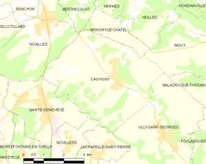
Cauvigny
- commune in Oise, France
- Country:
- Postal Code: 60730
- Coordinates: 49° 18' 3" N, 2° 14' 55" E
- GPS tracks (wikiloc): [Link]
- Area: 17.5 sq km
- Population: 1610
- Web site: [Link]

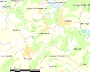
Berthecourt
- commune in Oise, France
- Country:
- Postal Code: 60370
- Coordinates: 49° 21' 2" N, 2° 13' 29" E
- GPS tracks (wikiloc): [Link]
- Area: 6.97 sq km
- Population: 1642
- Web site: [Link]

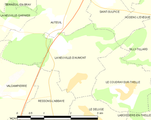
La Neuville-d'Aumont
- former commune in Oise, France
- Country:
- Postal Code: 60790
- Coordinates: 49° 18' 34" N, 2° 5' 56" E
- GPS tracks (wikiloc): [Link]
- Area: 4.75 sq km
- Population: 331


Le Déluge
- former commune in Oise, France
- Country:
- Postal Code: 60790
- Coordinates: 49° 17' 49" N, 2° 6' 36" E
- GPS tracks (wikiloc): [Link]
- Area: 3.69 sq km
- Population: 525


Hodenc-l'Évêque
- commune in Oise, France
- Country:
- Postal Code: 60430
- Coordinates: 49° 20' 12" N, 2° 8' 53" E
- GPS tracks (wikiloc): [Link]
- Area: 3.47 sq km
- Population: 253


Silly-Tillard
- commune in Oise, France
- Country:
- Postal Code: 60430
- Coordinates: 49° 19' 28" N, 2° 9' 32" E
- GPS tracks (wikiloc): [Link]
- Area: 11.14 sq km
- Population: 439

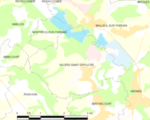
Villers-Saint-Sépulcre
- commune in Oise, France
- Country:
- Postal Code: 60134
- Coordinates: 49° 21' 56" N, 2° 12' 57" E
- GPS tracks (wikiloc): [Link]
- Area: 7.29 sq km
- Population: 957


Ponchon
- commune in Oise, France
- Country:
- Postal Code: 60430
- Coordinates: 49° 20' 48" N, 2° 11' 42" E
- GPS tracks (wikiloc): [Link]
- Area: 9.73 sq km
- Population: 1104


Montreuil-sur-Thérain
- commune in Oise, France
- Country:
- Postal Code: 60134
- Coordinates: 49° 22' 50" N, 2° 11' 36" E
- GPS tracks (wikiloc): [Link]
- Area: 1.47 sq km
- Population: 249


Mortefontaine-en-Thelle
- commune in Oise, France
- Country:
- Postal Code: 60570
- Coordinates: 49° 15' 46" N, 2° 11' 13" E
- GPS tracks (wikiloc): [Link]
- Area: 6.02 sq km
- Population: 883
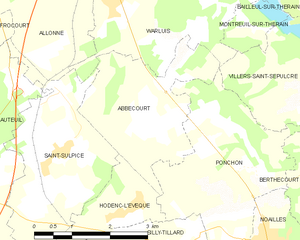
Abbecourt
- commune in Oise, France
- Country:
- Postal Code: 60430
- Coordinates: 49° 21' 20" N, 2° 9' 31" E
- GPS tracks (wikiloc): [Link]
- Area: 7.44 sq km
- Population: 760


Lachapelle-Saint-Pierre
- commune in Oise, France
- Country:
- Postal Code: 60730
- Coordinates: 49° 16' 10" N, 2° 14' 9" E
- GPS tracks (wikiloc): [Link]
- Area: 4.22 sq km
- Population: 911
- Web site: [Link]


Sainte-Geneviève
- commune in Oise, France
- Country:
- Postal Code: 60730
- Coordinates: 49° 17' 20" N, 2° 11' 56" E
- GPS tracks (wikiloc): [Link]
- Area: 8.01 sq km
- Population: 3092


Novillers
- commune in Oise, France
- Country:
- Postal Code: 60730
- Coordinates: 49° 16' 17" N, 2° 12' 52" E
- GPS tracks (wikiloc): [Link]
- AboveSeaLevel: 186 м m
- Area: 4.79 sq km
- Population: 359
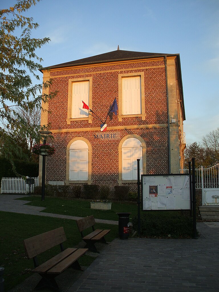
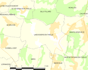
Laboissière-en-Thelle
- commune in Oise, France
- Country:
- Postal Code: 60570
- Coordinates: 49° 17' 23" N, 2° 9' 30" E
- GPS tracks (wikiloc): [Link]
- Area: 9.64 sq km
- Population: 1312

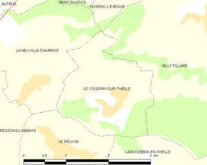
Le Coudray-sur-Thelle
- commune in Oise, France
- Country:
- Postal Code: 60430
- Coordinates: 49° 18' 21" N, 2° 7' 26" E
- GPS tracks (wikiloc): [Link]
- Area: 3.76 sq km
- Population: 534


Warluis
- commune in Oise, France
- Country:
- Postal Code: 60430
- Coordinates: 49° 23' 17" N, 2° 8' 27" E
- GPS tracks (wikiloc): [Link]
- Area: 11.44 sq km
- Population: 1168
- Web site: [Link]


Mouchy-le-Châtel
- commune in Oise, France
- Country:
- Postal Code: 60250
- Coordinates: 49° 19' 34" N, 2° 15' 1" E
- GPS tracks (wikiloc): [Link]
- Area: 3.22 sq km
- Population: 81


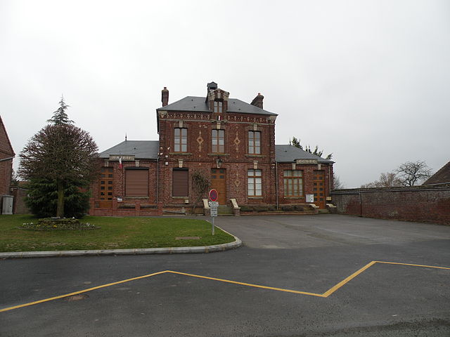
Noailles
- commune in Oise, France
- Country:
- Postal Code: 60430
- Coordinates: 49° 19' 40" N, 2° 12' 0" E
- GPS tracks (wikiloc): [Link]
- Area: 10.04 sq km
- Population: 2857


Saint-Sulpice
- commune in Oise, France
- Country:
- Postal Code: 60430
- Coordinates: 49° 21' 2" N, 2° 7' 27" E
- GPS tracks (wikiloc): [Link]
- Area: 8.88 sq km
- Population: 1001
- Web site: [Link]

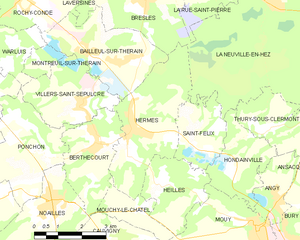
Hermes
- commune in Oise, France
- Country:
- Postal Code: 60370
- Coordinates: 49° 21' 27" N, 2° 14' 46" E
- GPS tracks (wikiloc): [Link]
- Area: 11.72 sq km
- Population: 2458