canton of Paulhaguet (canton de Paulhaguet)
- canton of France (until March 2015)
- Country:

- Capital: Paulhaguet
- Coordinates: 45° 12' 24" N, 3° 30' 55" E


- GPS tracks (wikiloc): [Link]
- Wikidata storage: Wikidata: Q276400
- INSEE canton code: [4316]
Includes regions:
Chassagnes
- commune in Haute-Loire, France
- Country:
- Postal Code: 43230
- Coordinates: 45° 12' 52" N, 3° 32' 17" E
- GPS tracks (wikiloc): [Link]
- Area: 12.24 sq km
- Population: 160

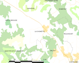
La Chomette
- commune in Haute-Loire, France
- Country:
- Postal Code: 43230
- Coordinates: 45° 13' 47" N, 3° 28' 28" E
- GPS tracks (wikiloc): [Link]
- Area: 6.9 sq km
- Population: 155


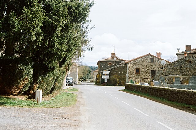
Frugières-le-Pin
- commune in Haute-Loire, France
- Country:
- Postal Code: 43230
- Coordinates: 45° 16' 5" N, 3° 29' 17" E
- GPS tracks (wikiloc): [Link]
- Area: 11.57 sq km
- Population: 155
Jax
- commune in Haute-Loire, France
- Country:
- Postal Code: 43230
- Coordinates: 45° 10' 5" N, 3° 37' 5" E
- GPS tracks (wikiloc): [Link]
- Area: 11.93 sq km
- Population: 147

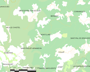
Montclard
- commune in Haute-Loire, France
- Country:
- Postal Code: 43230
- Coordinates: 45° 15' 47" N, 3° 35' 28" E
- GPS tracks (wikiloc): [Link]
- Area: 9.58 sq km
- Population: 57


Josat
- commune in Haute-Loire, France
- Country:
- Postal Code: 43230
- Coordinates: 45° 12' 46" N, 3° 36' 33" E
- GPS tracks (wikiloc): [Link]
- Area: 12.44 sq km
- Population: 76

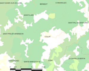
Collat
- commune in Haute-Loire, France
- Country:
- Postal Code: 43230
- Coordinates: 45° 14' 37" N, 3° 36' 41" E
- GPS tracks (wikiloc): [Link]
- Area: 10.22 sq km
- Population: 85
Sainte-Marguerite
- commune in Haute-Loire, France
- Country:
- Postal Code: 43230
- Coordinates: 45° 12' 23" N, 3° 35' 29" E
- GPS tracks (wikiloc): [Link]
- Area: 5.39 sq km
- Population: 41


Saint-Didier-sur-Doulon
- commune in Haute-Loire, France
- Country:
- Postal Code: 43440
- Coordinates: 45° 18' 2" N, 3° 32' 18" E
- GPS tracks (wikiloc): [Link]
- Area: 34.14 sq km
- Population: 196
- Web site: [Link]

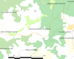
Sainte-Eugénie-de-Villeneuve
- commune in Haute-Loire, France
- Country:
- Postal Code: 43230
- Coordinates: 45° 8' 21" N, 3° 37' 24" E
- GPS tracks (wikiloc): [Link]
- Area: 6.11 sq km
- Population: 91
Saint-Préjet-Armandon
- commune in Haute-Loire, France
- Country:
- Postal Code: 43230
- Coordinates: 45° 15' 17" N, 3° 32' 29" E
- GPS tracks (wikiloc): [Link]
- Area: 8.47 sq km
- Population: 99

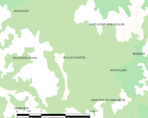
Vals-le-Chastel
- commune in Haute-Loire, France
- Country:
- Postal Code: 43230
- Coordinates: 45° 16' 15" N, 3° 31' 16" E
- GPS tracks (wikiloc): [Link]
- Area: 3.99 sq km
- Population: 44

Mazerat-Aurouze
- commune in Haute-Loire, France
- Country:
- Postal Code: 43230
- Coordinates: 45° 11' 11" N, 3° 33' 37" E
- GPS tracks (wikiloc): [Link]
- Area: 16.35 sq km
- Population: 212


Saint-Georges-d'Aurac
- commune in Haute-Loire, France
- Country:
- Postal Code: 43230
- Coordinates: 45° 9' 23" N, 3° 32' 27" E
- GPS tracks (wikiloc): [Link]
- Area: 17.42 sq km
- Population: 467
Salzuit
- commune in Haute-Loire, France
- Country:
- Postal Code: 43230
- Coordinates: 45° 12' 36" N, 3° 29' 1" E
- GPS tracks (wikiloc): [Link]
- Area: 8.05 sq km
- Population: 363


Paulhaguet
- commune in Haute-Loire, France
- Country:
- Postal Code: 43230
- Coordinates: 45° 12' 29" N, 3° 30' 48" E
- GPS tracks (wikiloc): [Link]
- Area: 11.23 sq km
- Population: 887
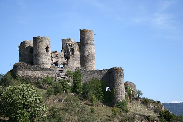

Domeyrat
- commune in Haute-Loire, France
- Country:
- Postal Code: 43230
- Coordinates: 45° 14' 57" N, 3° 30' 6" E
- GPS tracks (wikiloc): [Link]
- Area: 9.57 sq km
- Population: 194


Chavaniac-Lafayette
- commune in Haute-Loire, France
- Country:
- Postal Code: 43230
- Coordinates: 45° 9' 31" N, 3° 34' 50" E
- GPS tracks (wikiloc): [Link]
- Area: 8.41 sq km
- Population: 278
Couteuges
- commune in Haute-Loire, France
- Country:
- Postal Code: 43230
- Coordinates: 45° 11' 16" N, 3° 29' 52" E
- GPS tracks (wikiloc): [Link]
- Area: 10.34 sq km
- Population: 300