Paulhaguet (Paulhaguet)

- commune in Haute-Loire, France
- Country:

- Postal Code: 43230
- Coordinates: 45° 12' 29" N, 3° 30' 48" E


- GPS tracks (wikiloc): [Link]
- Area: 11.23 sq km
- Population: 887
- Wikipedia en: wiki(en)
- Wikipedia: wiki(fr)
- Wikidata storage: Wikidata: Q270768
- Wikipedia Commons Category: [Link]
- Freebase ID: [/m/03ntnhk]
- GeoNames ID: Alt: [6434386]
- SIREN number: [214301483]
- BnF ID: [15260052p]
- VIAF ID: Alt: [136670683]
- INSEE municipality code: 43148
Shares border with regions:
Chassagnes
- commune in Haute-Loire, France
- Country:
- Postal Code: 43230
- Coordinates: 45° 12' 52" N, 3° 32' 17" E
- GPS tracks (wikiloc): [Link]
- Area: 12.24 sq km
- Population: 160

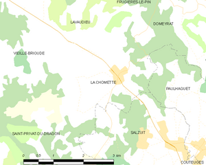
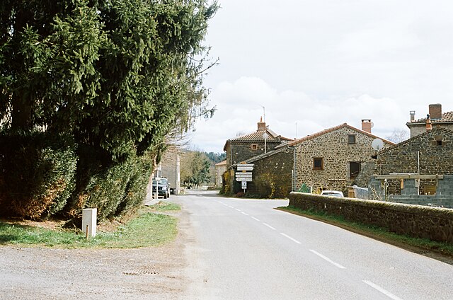
La Chomette
- commune in Haute-Loire, France
- Country:
- Postal Code: 43230
- Coordinates: 45° 13' 47" N, 3° 28' 28" E
- GPS tracks (wikiloc): [Link]
- Area: 6.9 sq km
- Population: 155
Saint-Préjet-Armandon
- commune in Haute-Loire, France
- Country:
- Postal Code: 43230
- Coordinates: 45° 15' 17" N, 3° 32' 29" E
- GPS tracks (wikiloc): [Link]
- Area: 8.47 sq km
- Population: 99

Mazerat-Aurouze
- commune in Haute-Loire, France
- Country:
- Postal Code: 43230
- Coordinates: 45° 11' 11" N, 3° 33' 37" E
- GPS tracks (wikiloc): [Link]
- Area: 16.35 sq km
- Population: 212


Saint-Georges-d'Aurac
- commune in Haute-Loire, France
- Country:
- Postal Code: 43230
- Coordinates: 45° 9' 23" N, 3° 32' 27" E
- GPS tracks (wikiloc): [Link]
- Area: 17.42 sq km
- Population: 467
Salzuit
- commune in Haute-Loire, France
- Country:
- Postal Code: 43230
- Coordinates: 45° 12' 36" N, 3° 29' 1" E
- GPS tracks (wikiloc): [Link]
- Area: 8.05 sq km
- Population: 363
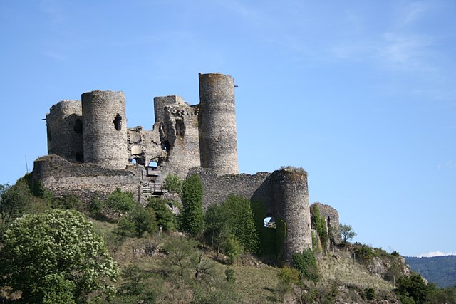

Domeyrat
- commune in Haute-Loire, France
- Country:
- Postal Code: 43230
- Coordinates: 45° 14' 57" N, 3° 30' 6" E
- GPS tracks (wikiloc): [Link]
- Area: 9.57 sq km
- Population: 194
Couteuges
- commune in Haute-Loire, France
- Country:
- Postal Code: 43230
- Coordinates: 45° 11' 16" N, 3° 29' 52" E
- GPS tracks (wikiloc): [Link]
- Area: 10.34 sq km
- Population: 300