canton of Peyrehorade (canton de Peyrehorade)
- canton of France
- Country:

- Capital: Peyrehorade
- Coordinates: 43° 34' 15" N, 1° 7' 2" E


- GPS tracks (wikiloc): [Link]
- Wikidata storage: Wikidata: Q1726670
- INSEE canton code: [4016]
Includes regions:

Hastingues
- commune in Landes, France
- Country:
- Postal Code: 40300
- Coordinates: 43° 32' 3" N, 1° 8' 57" E
- GPS tracks (wikiloc): [Link]
- Area: 14.54 sq km
- Population: 571


Orist
- commune in Landes, France
- Country:
- Postal Code: 40300
- Coordinates: 43° 38' 26" N, 1° 10' 37" E
- GPS tracks (wikiloc): [Link]
- Area: 14.76 sq km
- Population: 693
Oeyregave
- commune in Landes, France
- Country:
- Postal Code: 40300
- Coordinates: 43° 32' 2" N, 1° 5' 54" E
- GPS tracks (wikiloc): [Link]
- Area: 8.03 sq km
- Population: 348


Sorde-l'Abbaye
- commune in Landes, France
- Country:
- Postal Code: 40300
- Coordinates: 43° 31' 44" N, 1° 3' 14" E
- GPS tracks (wikiloc): [Link]
- Area: 16.34 sq km
- Population: 648


Saint-Lon-les-Mines
- commune in Landes, France
- Country:
- Postal Code: 40300
- Coordinates: 43° 36' 51" N, 1° 7' 35" E
- GPS tracks (wikiloc): [Link]
- Area: 21.82 sq km
- Population: 1182
- Web site: [Link]


Orthevielle
- commune in Landes, France
- Country:
- Postal Code: 40300
- Coordinates: 43° 33' 8" N, 1° 8' 51" E
- GPS tracks (wikiloc): [Link]
- Area: 13.94 sq km
- Population: 904
Bélus
- commune in Landes, France
- Country:
- Postal Code: 40300
- Coordinates: 43° 35' 30" N, 1° 6' 35" E
- GPS tracks (wikiloc): [Link]
- Area: 11.84 sq km
- Population: 611
- Web site: [Link]


Cauneille
- commune in Landes, France
- Country:
- Postal Code: 40300
- Coordinates: 43° 32' 48" N, 1° 3' 50" E
- GPS tracks (wikiloc): [Link]
- Area: 15.42 sq km
- Population: 814

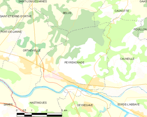
Peyrehorade
- commune in Landes, France
- Country:
- Postal Code: 40300
- Coordinates: 43° 32' 42" N, 1° 6' 0" E
- GPS tracks (wikiloc): [Link]
- Area: 16.11 sq km
- Population: 3616
- Web site: [Link]

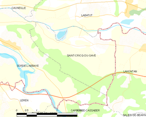
Saint-Cricq-du-Gave
- commune in Landes, France
- Country:
- Postal Code: 40300
- Coordinates: 43° 32' 1" N, 1° 0' 47" E
- GPS tracks (wikiloc): [Link]
- Area: 8.7 sq km
- Population: 412