canton of Réalmont (canton de Réalmont)
- canton of France (until March 2015)
- Country:

- Capital: Réalmont
- Coordinates: 43° 46' 38" N, 2° 11' 26" E


- GPS tracks (wikiloc): [Link]
- Wikidata storage: Wikidata: Q281902
- Library of Congress authority ID: Alt: [n85319208]
- INSEE canton code: [8126]
Includes regions:


Sieurac
- commune in Tarn, France
- Country:
- Postal Code: 81120
- Coordinates: 43° 48' 18" N, 2° 6' 8" E
- GPS tracks (wikiloc): [Link]
- Area: 8.72 sq km
- Population: 275
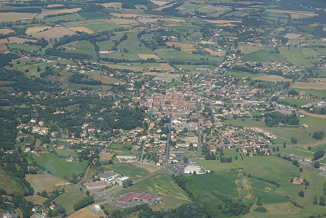

Réalmont
- commune in Tarn, France
- Country:
- Postal Code: 81120
- Coordinates: 43° 46' 35" N, 2° 11' 23" E
- GPS tracks (wikiloc): [Link]
- Area: 14.33 sq km
- Population: 3379


Lamillarié
- commune in Tarn, France
- Country:
- Postal Code: 81120
- Coordinates: 43° 50' 51" N, 2° 9' 31" E
- GPS tracks (wikiloc): [Link]
- Area: 13.95 sq km
- Population: 497


Laboutarie
- commune in Tarn, France
- Country:
- Postal Code: 81120
- Coordinates: 43° 46' 58" N, 2° 7' 5" E
- GPS tracks (wikiloc): [Link]
- Area: 5.39 sq km
- Population: 495
Terre-Clapier
- commune in Tarn, France
- Country:
- Postal Code: 81120
- Coordinates: 43° 51' 17" N, 2° 18' 1" E
- GPS tracks (wikiloc): [Link]
- AboveSeaLevel: 347 м m
- Area: 12.1 sq km
- Population: 258
Dénat
- commune in Tarn, France
- Country:
- Postal Code: 81120
- Coordinates: 43° 50' 47" N, 2° 12' 18" E
- GPS tracks (wikiloc): [Link]
- Area: 15.01 sq km
- Population: 789
- Web site: [Link]


Orban
- commune in Tarn, France
- Country:
- Postal Code: 81120
- Coordinates: 43° 50' 33" N, 2° 5' 0" E
- GPS tracks (wikiloc): [Link]
- Area: 8.76 sq km
- Population: 333


Roumégoux
- commune in Tarn, France
- Country:
- Postal Code: 81120
- Coordinates: 43° 48' 10" N, 2° 15' 41" E
- GPS tracks (wikiloc): [Link]
- Area: 13.43 sq km
- Population: 240
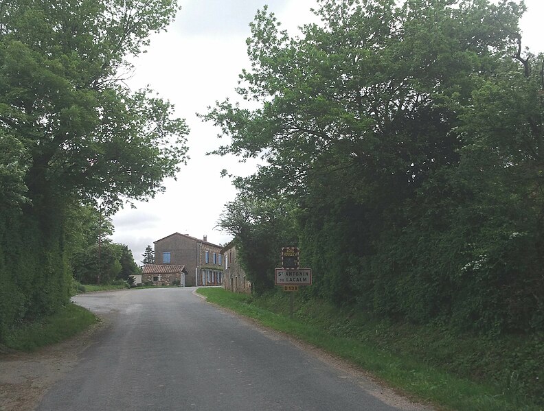

Saint-Antonin-de-Lacalm
- commune in Tarn, France
- Country:
- Postal Code: 81120
- Coordinates: 43° 47' 11" N, 2° 18' 20" E
- GPS tracks (wikiloc): [Link]
- Area: 28.09 sq km
- Population: 269

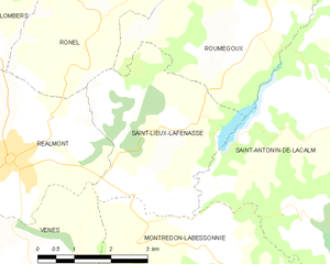
Saint-Lieux-Lafenasse
- commune in Tarn, France
- Country:
- Postal Code: 81120
- Coordinates: 43° 46' 5" N, 2° 13' 45" E
- GPS tracks (wikiloc): [Link]
- AboveSeaLevel: 320 м m
- Area: 12.19 sq km
- Population: 454
Labastide-Dénat
- former commune in Tarn, France
- Country:
- Postal Code: 81120
- Coordinates: 43° 52' 2" N, 2° 11' 30" E
- GPS tracks (wikiloc): [Link]
- Area: 7.43 sq km
- Population: 413


Fauch
- commune in Tarn, France
- Country:
- Postal Code: 81120
- Coordinates: 43° 49' 55" N, 2° 15' 13" E
- GPS tracks (wikiloc): [Link]
- Area: 17.32 sq km
- Population: 524

Poulan-Pouzols
- commune in Tarn, France
- Country:
- Postal Code: 81120
- Coordinates: 43° 51' 36" N, 2° 7' 0" E
- GPS tracks (wikiloc): [Link]
- Area: 11.86 sq km
- Population: 478


Lombers
- commune in Tarn, France
- Country:
- Postal Code: 81120
- Coordinates: 43° 48' 14" N, 2° 9' 0" E
- GPS tracks (wikiloc): [Link]
- Area: 38.79 sq km
- Population: 1121
- Web site: [Link]


Le Travet
- commune in Tarn, France
- Country:
- Postal Code: 81120
- Coordinates: 43° 48' 29" N, 2° 19' 51" E
- GPS tracks (wikiloc): [Link]
- Area: 8.44 sq km
- Population: 124


Ronel
- commune in Tarn, France
- Country:
- Postal Code: 81120
- Coordinates: 43° 48' 51" N, 2° 13' 26" E
- GPS tracks (wikiloc): [Link]
- Area: 9.89 sq km
- Population: 328