canton of Routot (canton de Routot)
- canton of France (until March 2015)
- Country:

- Capital: Routot
- Coordinates: 49° 22' 16" N, 0° 46' 1" E


- GPS tracks (wikiloc): [Link]
- Wikidata storage: Wikidata: Q1424181
- Wikipedia Commons Category: [Link]
- INSEE canton code: [2730]
Includes regions:


Valletot
- commune in Eure, France
- Country:
- Postal Code: 27350
- Coordinates: 49° 21' 50" N, 0° 37' 23" E
- GPS tracks (wikiloc): [Link]
- Area: 5.79 sq km
- Population: 391

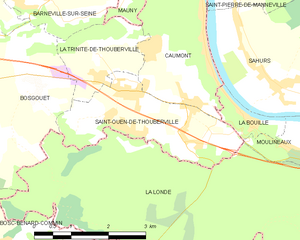
Saint-Ouen-de-Thouberville
- commune in Eure, France
- Country:
- Postal Code: 27310
- Coordinates: 49° 21' 24" N, 0° 53' 16" E
- GPS tracks (wikiloc): [Link]
- Area: 6.32 sq km
- Population: 2357


La Trinité-de-Thouberville
- commune in Eure, France
- Country:
- Postal Code: 27310
- Coordinates: 49° 21' 36" N, 0° 52' 42" E
- GPS tracks (wikiloc): [Link]
- AboveSeaLevel: 142 м m
- Area: 3.33 sq km
- Population: 443
- Web site: [Link]