canton of Saint-Florent-le-Vieil (canton de Saint-Florent-le-Vieil)
- canton of France
- Country:

- Capital: Saint-Florent-le-Vieil
- Coordinates: 47° 20' 33" N, 0° 56' 15" E


- GPS tracks (wikiloc): [Link]
- Wikidata storage: Wikidata: Q1727121
- INSEE canton code: [4925]
Includes regions:

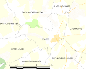
Beausse
- former commune in Maine-et-Loire, France
- Country:
- Postal Code: 49410
- Coordinates: 47° 19' 16" N, 0° 55' 37" E
- GPS tracks (wikiloc): [Link]
- Area: 5.36 sq km
- Population: 396


Bourgneuf-en-Mauges
- former commune in Maine-et-Loire, France
- Country:
- Postal Code: 49290
- Coordinates: 47° 18' 46" N, 0° 50' 7" E
- GPS tracks (wikiloc): [Link]
- Area: 11.64 sq km
- Population: 682

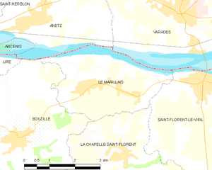
Le Marillais
- former commune in Maine-et-Loire, France
- Country:
- Postal Code: 49410
- Coordinates: 47° 21' 31" N, 1° 4' 24" E
- GPS tracks (wikiloc): [Link]
- Area: 9.47 sq km
- Population: 1156


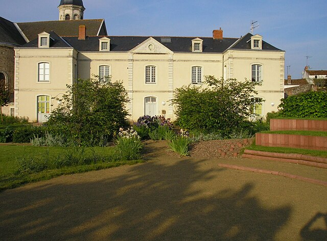
Saint-Florent-le-Vieil
- former commune in Maine-et-Loire, France
- Country:
- Postal Code: 49410
- Coordinates: 47° 21' 41" N, 1° 0' 59" E
- GPS tracks (wikiloc): [Link]
- Area: 24.7 sq km
- Population: 2847
- Web site: [Link]
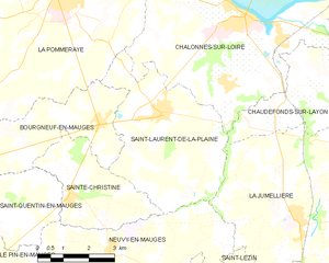
Saint-Laurent-de-la-Plaine
- former commune in Maine-et-Loire, France
- Country:
- Postal Code: 49290
- Coordinates: 47° 19' 2" N, 0° 48' 15" E
- GPS tracks (wikiloc): [Link]
- Area: 18.44 sq km
- Population: 1702

Le Mesnil-en-Vallée
- former commune in Maine-et-Loire, France
- Country:
- Postal Code: 49410
- Coordinates: 47° 21' 57" N, 0° 56' 8" E
- GPS tracks (wikiloc): [Link]
- Area: 17.72 sq km
- Population: 1464


La Pommeraye
- former commune in Maine-et-Loire, France
- Country:
- Postal Code: 49620
- Coordinates: 47° 21' 19" N, 0° 51' 37" E
- GPS tracks (wikiloc): [Link]
- Area: 39 sq km
- Population: 4030
- Web site: [Link]


Montjean-sur-Loire
- former commune in Maine-et-Loire, France
- Country:
- Postal Code: 49570
- Coordinates: 47° 23' 18" N, 0° 51' 40" E
- GPS tracks (wikiloc): [Link]
- Area: 19.33 sq km
- Population: 3093
- Web site: [Link]

Botz-en-Mauges
- former commune in Maine-et-Loire, France
- Country:
- Postal Code: 49110
- Coordinates: 47° 18' 25" N, 1° 0' 6" E
- GPS tracks (wikiloc): [Link]
- Area: 15.74 sq km
- Population: 836

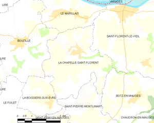
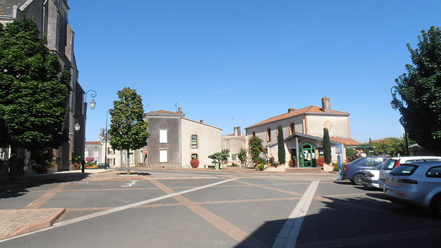
La Chapelle-Saint-Florent
- former commune in Maine-et-Loire, France
- Country:
- Postal Code: 49410
- Coordinates: 47° 20' 1" N, 1° 3' 21" E
- GPS tracks (wikiloc): [Link]
- Area: 15.84 sq km
- Population: 1393
- Web site: [Link]


Saint-Laurent-du-Mottay
- former commune in Maine-et-Loire, France
- Country:
- Postal Code: 49410
- Coordinates: 47° 21' 1" N, 0° 56' 59" E
- GPS tracks (wikiloc): [Link]
- Area: 14.63 sq km
- Population: 757