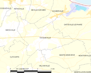
canton of Saint-Pierre-Église (canton de Saint-Pierre-Église)
- canton of France
- Country:

- Capital: Saint-Pierre-Église
- Coordinates: 49° 39' 46" N, 1° 23' 33" E


- GPS tracks (wikiloc): [Link]
- Wikidata storage: Wikidata: Q1727304
- Library of Congress authority ID: Alt: [n2013000677]
- INSEE canton code: [5038]
Includes regions:


Varouville
- commune in Manche, France
- Country:

- Postal Code: 50330
- Coordinates: 49° 40' 35" N, 1° 22' 3" E


- GPS tracks (wikiloc): [Link]
- Area: 4.19 sq km
- Population: 268


Théville
- commune in Manche, France
- Country:

- Postal Code: 50330
- Coordinates: 49° 39' 8" N, 1° 25' 20" E


- GPS tracks (wikiloc): [Link]
- Area: 7.77 sq km
- Population: 311


Tocqueville
- commune in Manche, France
- Country:

- Postal Code: 50330
- Coordinates: 49° 40' 14" N, 1° 20' 12" E


- GPS tracks (wikiloc): [Link]
- Area: 5.9 sq km
- Population: 282
- Web site: [Link]