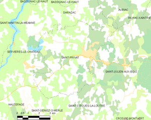
canton of Saint-Privat (canton de Saint-Privat)
- canton of France (until March 2015)
- Country:

- Capital: Saint-Privat
- Coordinates: 45° 8' 20" N, 2° 5' 59" E


- GPS tracks (wikiloc): [Link]
- Wikidata storage: Wikidata: Q1421462
- INSEE canton code: [1921]
Includes regions:


Bassignac-le-Haut
- commune in Corrèze, France
- Country:
- Postal Code: 19220
- Coordinates: 45° 12' 41" N, 2° 4' 18" E
- GPS tracks (wikiloc): [Link]
- Area: 18.37 sq km
- Population: 189
- Web site: [Link]


Darazac
- commune in Corrèze, France
- Country:
- Postal Code: 19220
- Coordinates: 45° 10' 31" N, 2° 5' 4" E
- GPS tracks (wikiloc): [Link]
- Area: 14.55 sq km
- Population: 140


Hautefage
- commune in Corrèze, France
- Country:
- Postal Code: 19400
- Coordinates: 45° 4' 57" N, 2° 0' 4" E
- GPS tracks (wikiloc): [Link]
- Area: 24.06 sq km
- Population: 310
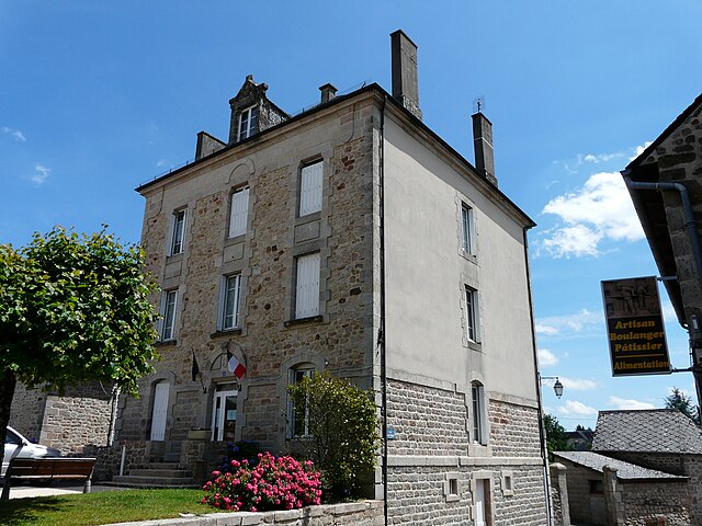
Saint-Privat
- commune in Corrèze, France
- Country:
- Postal Code: 19220
- Coordinates: 45° 8' 18" N, 2° 5' 56" E
- GPS tracks (wikiloc): [Link]
- Area: 32.85 sq km
- Population: 1085


Servières-le-Château
- commune in Corrèze, France
- Country:
- Postal Code: 19220
- Coordinates: 45° 7' 49" N, 2° 1' 30" E
- GPS tracks (wikiloc): [Link]
- Area: 24.24 sq km
- Population: 633
Saint-Julien-aux-Bois
- commune in Corrèze, France
- Country:
- Postal Code: 19220
- Coordinates: 45° 7' 48" N, 2° 8' 21" E
- GPS tracks (wikiloc): [Link]
- Area: 44.09 sq km
- Population: 466
- Web site: [Link]

Saint-Geniez-ô-Merle
- commune in Corrèze, France
- Country:
- Postal Code: 19220
- Coordinates: 45° 4' 59" N, 2° 3' 51" E
- GPS tracks (wikiloc): [Link]
- Area: 15.83 sq km
- Population: 94

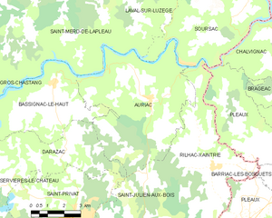
Auriac
- commune in Corrèze, France
- Country:
- Postal Code: 19220
- Coordinates: 45° 12' 14" N, 2° 8' 53" E
- GPS tracks (wikiloc): [Link]
- Area: 34.89 sq km
- Population: 234
- Web site: [Link]


Saint-Cirgues-la-Loutre
- commune in Corrèze, France
- Country:
- Postal Code: 19220
- Coordinates: 45° 4' 43" N, 2° 5' 55" E
- GPS tracks (wikiloc): [Link]
- Area: 18.41 sq km
- Population: 175


Rilhac-Xaintrie
- commune in Corrèze, France
- Country:
- Postal Code: 19220
- Coordinates: 45° 10' 1" N, 2° 11' 50" E
- GPS tracks (wikiloc): [Link]
- Area: 25.31 sq km
- Population: 305