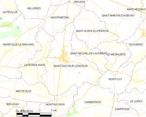
canton of Saint-Sauveur-Lendelin (canton de Saint-Sauveur-Lendelin)
- canton of France
- Country:

- Capital: Saint-Sauveur-Lendelin
- Coordinates: 49° 7' 21" N, 1° 22' 59" E


- GPS tracks (wikiloc): [Link]
- Wikidata storage: Wikidata: Q1727326
- INSEE canton code: [5040]
Includes regions:


Vaudrimesnil
- commune in Manche, France
- Country:
- Postal Code: 50490
- Coordinates: 49° 9' 12" N, 1° 24' 54" E
- GPS tracks (wikiloc): [Link]
- Area: 6.05 sq km
- Population: 432

Saint-Sauveur-Lendelin
- commune in Manche, France
- Country:
- Postal Code: 50490
- Coordinates: 49° 7' 50" N, 1° 24' 49" E
- GPS tracks (wikiloc): [Link]
- Area: 16.39 sq km
- Population: 1708


Montcuit
- commune in Manche, France
- Country:
- Postal Code: 50490
- Coordinates: 49° 7' 14" N, 1° 20' 29" E
- GPS tracks (wikiloc): [Link]
- Area: 4.79 sq km
- Population: 183