canton of Saint-Varent (canton de Saint-Varent)
- canton of France (until March 2015)
- Country:

- Capital: Saint-Varent
- Coordinates: 46° 53' 50" N, 0° 17' 30" E


- GPS tracks (wikiloc): [Link]
- Wikidata storage: Wikidata: Q1259822
- INSEE canton code: [7927]
Includes regions:

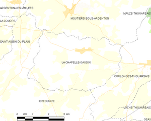
La Chapelle-Gaudin
- former commune in Deux-Sèvres, France
- Country:
- Postal Code: 79300
- Coordinates: 46° 55' 53" N, 0° 22' 54" E
- GPS tracks (wikiloc): [Link]
- Area: 17.01 sq km
- Population: 246
Luzay
- commune in Deux-Sèvres, France
- Country:
- Postal Code: 79100
- Coordinates: 46° 55' 24" N, 0° 11' 44" E
- GPS tracks (wikiloc): [Link]
- Area: 20.98 sq km
- Population: 620
Coulonges-Thouarsais
- commune in Deux-Sèvres, France
- Country:
- Postal Code: 79330
- Coordinates: 46° 55' 30" N, 0° 19' 16" E
- GPS tracks (wikiloc): [Link]
- Area: 17.26 sq km
- Population: 439
Luché-Thouarsais
- commune in Deux-Sèvres, France
- Country:
- Postal Code: 79330
- Coordinates: 46° 54' 30" N, 0° 18' 7" E
- GPS tracks (wikiloc): [Link]
- Area: 13.46 sq km
- Population: 506
Pierrefitte
- commune in Deux-Sèvres, France
- Country:
- Postal Code: 79330
- Coordinates: 46° 52' 8" N, 0° 18' 7" E
- GPS tracks (wikiloc): [Link]
- Area: 15.91 sq km
- Population: 342
Sainte-Gemme
- commune in Deux-Sèvres, France
- Country:
- Postal Code: 79330
- Coordinates: 46° 54' 2" N, 0° 17' 16" E
- GPS tracks (wikiloc): [Link]
- AboveSeaLevel: 133 м m
- Area: 8.84 sq km
- Population: 402


Geay
- commune in Deux-Sèvres, France
- Country:
- Postal Code: 79330
- Coordinates: 46° 52' 49" N, 0° 19' 34" E
- GPS tracks (wikiloc): [Link]
- AboveSeaLevel: 160 м m
- Area: 19.25 sq km
- Population: 325


Saint-Varent
- commune in Deux-Sèvres, France
- Country:
- Postal Code: 79330
- Coordinates: 46° 53' 22" N, 0° 13' 58" E
- GPS tracks (wikiloc): [Link]
- Area: 34.42 sq km
- Population: 2459

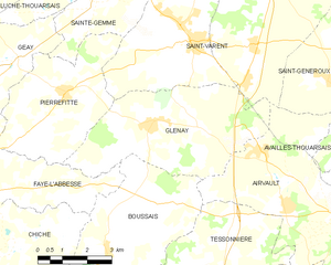
Glénay
- commune in Deux-Sèvres, France
- Country:
- Postal Code: 79330
- Coordinates: 46° 51' 37" N, 0° 15' 2" E
- GPS tracks (wikiloc): [Link]
- Area: 21.14 sq km
- Population: 567