canton of Seyches (canton de Seyches)
- canton of France
- Country:

- Capital: Seyches
- Coordinates: 44° 33' 0" N, 0° 18' 0" E


- GPS tracks (wikiloc): [Link]
- Wikidata storage: Wikidata: Q1727484
- INSEE canton code: [4731]
Includes regions:


Escassefort
- commune in Lot-et-Garonne, France
- Country:
- Postal Code: 47350
- Coordinates: 44° 32' 54" N, 0° 14' 15" E
- GPS tracks (wikiloc): [Link]
- Area: 13.92 sq km
- Population: 581
- Web site: [Link]

Lachapelle
- commune in Lot-et-Garonne, France
- Country:
- Postal Code: 47350
- Coordinates: 44° 34' 32" N, 0° 15' 46" E
- GPS tracks (wikiloc): [Link]
- Area: 4.53 sq km
- Population: 76


Seyches
- commune in Lot-et-Garonne, France
- Country:
- Postal Code: 47350
- Coordinates: 44° 32' 59" N, 0° 18' 18" E
- GPS tracks (wikiloc): [Link]
- Area: 24.69 sq km
- Population: 1016


Saint-Avit
- commune in Lot-et-Garonne, France
- Country:
- Postal Code: 47350
- Coordinates: 44° 34' 5" N, 0° 12' 45" E
- GPS tracks (wikiloc): [Link]
- Area: 8.95 sq km
- Population: 168
- Web site: [Link]

Saint-Géraud
- commune in Lot-et-Garonne, France
- Country:
- Postal Code: 47120
- Coordinates: 44° 37' 18" N, 0° 9' 10" E
- GPS tracks (wikiloc): [Link]
- Area: 5.68 sq km
- Population: 90
Saint-Barthélemy-d'Agenais
- commune in Lot-et-Garonne, France
- Country:
- Postal Code: 47350
- Coordinates: 44° 31' 21" N, 0° 22' 27" E
- GPS tracks (wikiloc): [Link]
- Area: 15.28 sq km
- Population: 503


Saint-Pierre-sur-Dropt
- commune in Lot-et-Garonne, France
- Country:
- Postal Code: 47120
- Coordinates: 44° 38' 36" N, 0° 12' 10" E
- GPS tracks (wikiloc): [Link]
- Area: 8.18 sq km
- Population: 312
Montignac-Toupinerie
- commune in Lot-et-Garonne, France
- Country:
- Postal Code: 47350
- Coordinates: 44° 32' 54" N, 0° 20' 43" E
- GPS tracks (wikiloc): [Link]
- Area: 8.31 sq km
- Population: 147


Puymiclan
- commune in Lot-et-Garonne, France
- Country:
- Postal Code: 47350
- Coordinates: 44° 30' 44" N, 0° 18' 57" E
- GPS tracks (wikiloc): [Link]
- Area: 25.74 sq km
- Population: 636


Cambes
- commune in Lot-et-Garonne, France
- Country:
- Postal Code: 47350
- Coordinates: 44° 35' 43" N, 0° 17' 19" E
- GPS tracks (wikiloc): [Link]
- Area: 9.2 sq km
- Population: 176

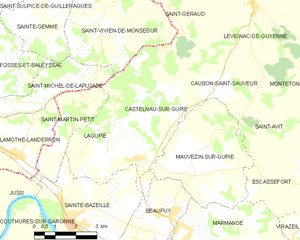
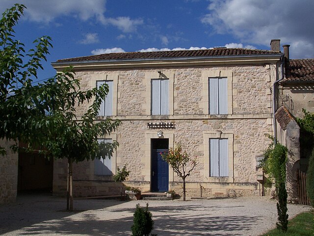
Castelnau-sur-Gupie
- commune in Lot-et-Garonne, France
- Country:
- Postal Code: 47180
- Coordinates: 44° 33' 35" N, 0° 7' 57" E
- GPS tracks (wikiloc): [Link]
- Area: 15.23 sq km
- Population: 871


Caubon-Saint-Sauveur
- commune in Lot-et-Garonne, France
- Country:
- Postal Code: 47120
- Coordinates: 44° 35' 34" N, 0° 10' 34" E
- GPS tracks (wikiloc): [Link]
- Area: 11.34 sq km
- Population: 248


Lévignac-de-Guyenne
- commune in Lot-et-Garonne, France
- Country:
- Postal Code: 47120
- Coordinates: 44° 37' 46" N, 0° 11' 57" E
- GPS tracks (wikiloc): [Link]
- Area: 25.02 sq km
- Population: 655
- Web site: [Link]


Monteton
- commune in Lot-et-Garonne, France
- Country:
- Postal Code: 47120
- Coordinates: 44° 37' 23" N, 0° 15' 23" E
- GPS tracks (wikiloc): [Link]
- Area: 13.81 sq km
- Population: 315
- Web site: [Link]

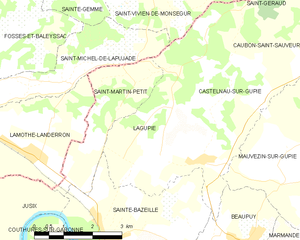
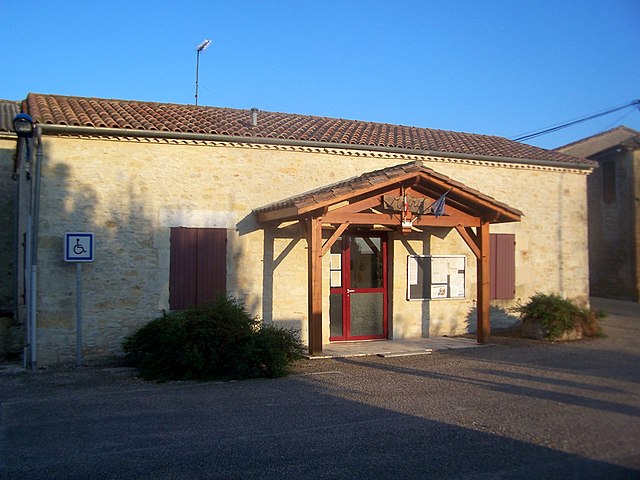
Lagupie
- commune in Lot-et-Garonne, France
- Country:
- Postal Code: 47180
- Coordinates: 44° 33' 23" N, 0° 6' 53" E
- GPS tracks (wikiloc): [Link]
- Area: 8.69 sq km
- Population: 761