Canton of Taninges (canton de Taninges)
- canton of France (until March 2015)
 Hiking in Canton of Taninges
Canton de Taninges, located in the Haute-Savoie region of the French Alps, is a fantastic destination for hiking enthusiasts. Nestled near the Mont Blanc massif and close to several ski resorts, the area offers a variety of trails that cater to different skill levels, making it suitable for both beginners and experienced hikers.
Key Highlights of Hiking in Canton de Taninges:
-
Scenic Landscapes: The region is renowned for its breathtaking alpine scenery, featuring lush valleys, towering peaks, and vibrant wildflower fields during the warmer months. Prepare to be surrounded by stunning views that vary throughout the seasons.
-
Diverse Trails: Options range from leisurely walks through charming villages like Taninges and Les Gets, to more challenging treks that lead to higher elevations. Some popular routes include:
- Les Gets to Mont Chery: A moderate hike offering panoramic views of the surrounding mountains.
- The Forclaz Pass: A more strenuous route that rewards hikers with impressive vistas.
- The Circuit of the Cretes: A scenic, circular trail that showcases the beauty of the area, suitable for families and casual hikers.
-
Wildlife and Flora: Hikers may encounter a variety of wildlife, such as chamois and golden eagles, as well as diverse flora, including alpine flowers and ancient forests.
-
Cultural Experience: Engage with the local culture as you hike through quaint Alpine villages. Charming chalets, local cuisine, and traditional festivals can enhance your hiking experience.
-
Accessibility: Many trails are accessible from various points in the Canton, making it easy to plan day hikes or longer treks. Local tourism offices can provide maps, brochures, and advice on trail conditions.
-
Safety Considerations: As with any hiking adventure, it's important to check the weather conditions, carry appropriate gear, and inform someone of your hiking plans. Certain trails may require specific gear, especially during winter months or in high-altitude areas.
-
Seasonal Variations: The best time for hiking in Canton de Taninges is typically from late spring to early autumn. However, winter hiking and snowshoeing are also popular in the colder months.
Conclusion
Canton de Taninges offers a delightful blend of natural beauty, cultural charm, and a variety of hiking experiences. Whether you're seeking a peaceful stroll or a challenging trek, you'll find ample opportunities to enjoy the great outdoors in this picturesque region of the French Alps. Remember to respect nature and follow local guidelines to keep the trails pristine and enjoyable for everyone!
- Country:

- Capital: Taninges
- Coordinates: 46° 8' 10" N, 6° 37' 4" E


- GPS tracks (wikiloc): [Link]
- Wikidata storage: Wikidata: Q1563371
Includes regions:
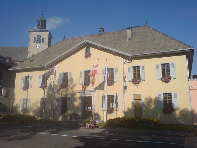

Taninges
- commune in Haute-Savoie, France
Hiking in Taninges
Taninges, located in the Haute-Savoie region of the French Alps, is an excellent destination for hiking enthusiasts. The area is known for its breathtaking landscapes, including majestic mountains, lush valleys, and beautiful alpine meadows. Here are some highlights and tips for hiking in and around Taninges:...
- Country:
- Postal Code: 74440
- Coordinates: 46° 6' 27" N, 6° 35' 29" E
- GPS tracks (wikiloc): [Link]
- Area: 42.66 sq km
- Population: 3410

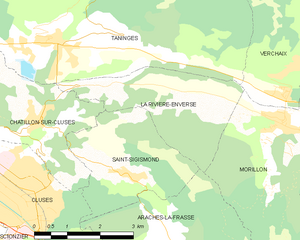
La Rivière-Enverse
- commune in Haute-Savoie, France
Hiking in La Rivière-Enverse
La Rivière-Enverse is a picturesque village located in the Haute-Savoie region of France, offering stunning scenery and a range of hiking opportunities. Nestled in the French Alps, this area boasts a mix of lush valleys, dramatic peaks, and tranquil rivers. Here’s what you need to know about hiking in and around La Rivière-Enverse:...
- Country:
- Postal Code: 74440
- Coordinates: 46° 5' 34" N, 6° 38' 11" E
- GPS tracks (wikiloc): [Link]
- Area: 7.98 sq km
- Population: 457


Mieussy
- commune in Haute-Savoie, France
Hiking in Mieussy
Mieussy, located in the Haute-Savoie region of the French Alps, offers a variety of hiking opportunities that cater to different skill levels and preferences. Here are some highlights of hiking in Mieussy:...
- Country:
- Postal Code: 74440
- Coordinates: 46° 8' 3" N, 6° 31' 22" E
- GPS tracks (wikiloc): [Link]
- Area: 44.45 sq km
- Population: 2327
- Web site: [Link]


La Côte-d'Arbroz
- commune in Haute-Savoie, France
Hiking in La Côte-d'Arbroz
La Côte-d'Arbroz is a charming commune located in the Haute-Savoie region of the French Alps. Known for its stunning landscapes and proximity to the Portes du Soleil ski area, it also offers fantastic hiking opportunities, particularly in the summer months when the snow melts and the meadows bloom....
- Country:
- Postal Code: 74110
- Coordinates: 46° 11' 16" N, 6° 40' 5" E
- GPS tracks (wikiloc): [Link]
- Area: 12.24 sq km
- Population: 323
- Web site: [Link]


Les Gets
- commune in Haute-Savoie, France
Hiking in Les Gets
Les Gets is a charming mountain resort located in the French Alps, part of the Portes du Soleil ski area. While it's well-known for its winter sports, it also offers fantastic hiking opportunities throughout the summer months. Here are some key details about hiking in Les Gets:...
- Country:
- Postal Code: 74260
- Coordinates: 46° 9' 35" N, 6° 40' 13" E
- GPS tracks (wikiloc): [Link]
- AboveSeaLevel: 1172 м m
- Area: 29.98 sq km
- Population: 1251
- Web site: [Link]