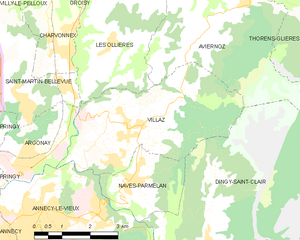
Canton of Thorens-Glières (canton de Thorens-Glières)
- canton of France (until March 2015)
 Hiking in Canton of Thorens-Glières
Canton de Thorens-Glières, located in the Haute-Savoie region of the French Alps, offers a stunning backdrop for hiking enthusiasts. Surrounded by rugged mountains, lush forests, and picturesque alpine meadows, this area is ideal for both casual walkers and experienced trekkers.
Hiking Highlights:
-
Scenic Routes: The canton features a variety of marked trails that cater to different skill levels. You can find easy walks suitable for families, as well as more challenging hikes that take you to breathtaking viewpoints.
-
Historical Significance: The area is rich in history, particularly relating to the Resistance during World War II. Hiking trails may lead you to historical sites and offer insights into the region's past.
-
Wildlife and Flora: The diverse ecosystems in the canton provide opportunities for wildlife observation. Keep an eye out for local fauna, including deer, chamois, and various bird species, as well as a wide range of alpine flowers.
-
Panoramic Views: Many trails lead to high points that offer stunning panoramas of the surrounding mountains, including the Mont Blanc massif. Sunrise and sunset hikes can provide particularly spectacular views.
-
Accessibility: Some trails start from village centers, making it easy to access the hiking routes. It's advisable to check local maps and consult with guides for the best paths, especially if you're unfamiliar with mountainous terrain.
-
Seasonal Considerations: Hiking is generally most popular from late spring to early autumn. Winter hikes may require specific gear due to snow and ice, and conditions can change rapidly in mountainous areas.
Tips for Hiking in Canton de Thorens-Glières:
- Prepare Accordingly: Bring sufficient water, snacks, and a fully charged phone or GPS device. Maps of the area are also useful.
- Dress in Layers: Weather in the mountains can be unpredictable, so wear layers to adjust to temperature changes.
- Stay Safe: Inform someone about your hiking plans, especially if you plan to go off the beaten path.
- Respect Nature: Stick to marked trails to help preserve the local environment and wildlife.
Whether you’re seeking a leisurely stroll or an adventurous climb, Canton de Thorens-Glières has something to offer every hiker. Happy trekking!
- Country:

- Capital: Thorens-Glières
- Coordinates: 45° 59' 37" N, 6° 12' 22" E


- GPS tracks (wikiloc): [Link]
- Wikidata storage: Wikidata: Q1601780
Includes regions:
Évires
- former commune in Haute-Savoie, France
Hiking in Évires
Évires is a charming commune located in the Haute-Savoie region of France, close to the scenic landscapes of the Alps. Hiking in this area can be a delightful experience as it offers a mix of natural beauty, diverse trails, and beautiful panoramic views....
- Country:
- Postal Code: 74570
- Coordinates: 46° 2' 15" N, 6° 13' 27" E
- GPS tracks (wikiloc): [Link]
- Area: 19.49 sq km
- Population: 1426
Les Ollières
- former commune in Haute-Savoie, France
Hiking in Les Ollières
Les Ollières is a picturesque area located in the Auvergne-Rhône-Alpes region of France. Known for its beautiful landscapes, Les Ollières offers a variety of hiking trails suitable for different levels of hikers, making it a fantastic destination for both beginners and experienced trekkers....
- Country:
- Postal Code: 74370
- Coordinates: 45° 58' 43" N, 6° 10' 55" E
- GPS tracks (wikiloc): [Link]
- Area: 11.64 sq km
- Population: 977
Villaz
- commune in Haute-Savoie, France
Hiking in Villaz
Villaz is a village located in the Haute-Savoie region of France, near the scenic French Alps. It's an excellent base for hikers looking to explore the surrounding mountainous terrain, enjoy breathtaking views, and experience the beauty of nature....
- Country:
- Postal Code: 74370
- Coordinates: 45° 57' 4" N, 6° 11' 23" E
- GPS tracks (wikiloc): [Link]
- Area: 15.27 sq km
- Population: 3399
- Web site: [Link]


Groisy
- commune in Haute-Savoie, France
Hiking in Groisy
Groisy is a charming commune located in the Haute-Savoie department in southeastern France, nestled amidst the picturesque landscapes of the French Alps. The area offers a variety of hiking opportunities, suitable for different skill levels and preferences. Here are some highlights and tips for hiking in Groisy:...
- Country:
- Postal Code: 74570
- Coordinates: 46° 1' 6" N, 6° 10' 17" E
- GPS tracks (wikiloc): [Link]
- Area: 21.44 sq km
- Population: 3498
- Web site: [Link]
Aviernoz
- former commune in Haute-Savoie, France
Hiking in Aviernoz
Aviernoz is a charming village located in the Haute-Savoie region of the French Alps. It's a great spot for hiking enthusiasts due to its stunning natural landscapes, including mountains, forests, and serene views of the surrounding area. Here are some key points about hiking in Aviernoz:...
- Country:
- Postal Code: 74570
- Coordinates: 45° 58' 41" N, 6° 13' 23" E
- GPS tracks (wikiloc): [Link]
- Area: 15.9 sq km
- Population: 902


Thorens-Glières
- former commune in Haute-Savoie, France
Hiking in Thorens-Glières
Thorens-Glières, located in the Haute-Savoie region of the French Alps, is a beautiful area for hiking, offering a range of trails that cater to different skill levels and experiences. The region is not only renowned for its stunning mountain landscapes but also for its historical significance, particularly related to the French Resistance during World War II....
- Country:
- Postal Code: 74570
- Coordinates: 45° 59' 49" N, 6° 14' 49" E
- GPS tracks (wikiloc): [Link]
- Area: 63.05 sq km
- Population: 3153