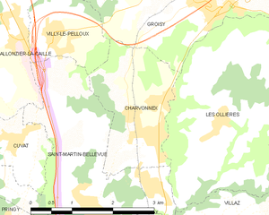
Groisy (Groisy)

- commune in Haute-Savoie, France
 Hiking in Groisy
Groisy is a charming commune located in the Haute-Savoie department in southeastern France, nestled amidst the picturesque landscapes of the French Alps. The area offers a variety of hiking opportunities, suitable for different skill levels and preferences. Here are some highlights and tips for hiking in Groisy:
Trails and Routes
-
Local Trails: Groisy offers several local trails that allow hikers to explore its beautiful countryside, forests, and meadows. These trails often provide stunning views of the surrounding mountains.
-
Elevation: Given its proximity to the Alps, many hikes in the area can involve elevation changes, providing both challenging climbs and rewarding vistas.
-
Nearby Nature Reserves: Explore trails in the nearby nature reserves or national parks, which feature rich biodiversity and stunning landscapes. The regional park of the Massif des Bauges is a great option not too far from Groisy.
Tips for Hiking in Groisy
-
Prepare for Weather: The weather in the Alps can be unpredictable, so always check the forecast and come prepared for changing conditions.
-
Stay Hydrated and Fueled: Bring enough water and snacks, especially if you’re tackling longer trails.
-
Footwear: Proper hiking boots are recommended to handle uneven terrain and ensure comfort during your trek.
-
Navigation: While many trails are marked, using a map or a GPS device is a good idea, especially if you venture off the beaten path.
-
Respect Nature: Follow Leave No Trace principles to preserve the natural beauty of the area.
Local Insights
-
Community Engagement: Check for local hiking groups or clubs that offer guided hikes, which can enhance your experience and knowledge about the flora, fauna, and geology of the area.
-
Cultural Sites: Besides hiking, Groisy also has charming architecture and local farms worth visiting. Integrating cultural exploration into your hiking trip can provide a fuller experience of the region.
Overall, Groisy is a beautiful area for hiking enthusiasts looking to enjoy the stunning landscapes of the French Alps. Whether you're a novice or an experienced hiker, there are options available for everyone. Happy hiking!
- Country:

- Postal Code: 74570
- Coordinates: 46° 1' 6" N, 6° 10' 17" E


- GPS tracks (wikiloc): [Link]
- Area: 21.44 sq km
- Population: 3498
- Web site: http://www.groisy.org
- Wikipedia en: wiki(en)
- Wikipedia: wiki(fr)
- Wikidata storage: Wikidata: Q775014
- Wikipedia Commons Category: [Link]
- Freebase ID: [/m/03ntz96]
- GeoNames ID: Alt: [3014580]
- SIREN number: [217401371]
- BnF ID: [15274395z]
- WOEID: [593842]
- INSEE municipality code: 74137
Shares border with regions:
Évires
- former commune in Haute-Savoie, France
Hiking in Évires
Évires is a charming commune located in the Haute-Savoie region of France, close to the scenic landscapes of the Alps. Hiking in this area can be a delightful experience as it offers a mix of natural beauty, diverse trails, and beautiful panoramic views....
- Country:
- Postal Code: 74570
- Coordinates: 46° 2' 15" N, 6° 13' 27" E
- GPS tracks (wikiloc): [Link]
- Area: 19.49 sq km
- Population: 1426


Villy-le-Pelloux
- commune in Haute-Savoie, France
Hiking in Villy-le-Pelloux
Villy-le-Pelloux is a charming village located in the Haute-Savoie region of France, near the city of Annecy. The area is known for its breathtaking mountain scenery, lush forests, and a range of outdoor activities, making it a great spot for hiking enthusiasts....
- Country:
- Postal Code: 74350
- Coordinates: 46° 0' 1" N, 6° 7' 59" E
- GPS tracks (wikiloc): [Link]
- Area: 2.97 sq km
- Population: 922
- Web site: [Link]
Les Ollières
- former commune in Haute-Savoie, France
Hiking in Les Ollières
Les Ollières is a picturesque area located in the Auvergne-Rhône-Alpes region of France. Known for its beautiful landscapes, Les Ollières offers a variety of hiking trails suitable for different levels of hikers, making it a fantastic destination for both beginners and experienced trekkers....
- Country:
- Postal Code: 74370
- Coordinates: 45° 58' 43" N, 6° 10' 55" E
- GPS tracks (wikiloc): [Link]
- Area: 11.64 sq km
- Population: 977


Cruseilles
- commune in Haute-Savoie, France
Hiking in Cruseilles
Cruseilles, located in the Auvergne-Rhône-Alpes region of France, offers scenic hiking opportunities with stunning views of the surrounding countryside and the nearby mountains, including the Saleve and the Bornes mountains. Here are some key points about hiking in Cruseilles:...
- Country:
- Postal Code: 74350
- Coordinates: 46° 2' 3" N, 6° 6' 27" E
- GPS tracks (wikiloc): [Link]
- Area: 25.41 sq km
- Population: 4326
- Web site: [Link]


Menthonnex-en-Bornes
- commune in Haute-Savoie, France
Hiking in Menthonnex-en-Bornes
Menthonnex-en-Bornes is a picturesque village located in the Auvergne-Rhône-Alpes region of France, near the French Alps. It offers a variety of hiking opportunities for both novice and experienced hikers, thanks to its beautiful landscapes, rolling hills, and proximity to the mountains....
- Country:
- Postal Code: 74350
- Coordinates: 46° 3' 10" N, 6° 10' 24" E
- GPS tracks (wikiloc): [Link]
- Area: 8.48 sq km
- Population: 1074
- Web site: [Link]

Charvonnex
- commune in Haute-Savoie, France
Hiking in Charvonnex
Charvonnex is a charming commune located in the Haute-Savoie department of the Auvergne-Rhône-Alpes region in southeastern France. Nestled in the foothills of the French Alps, it offers beautiful landscapes and a variety of outdoor activities, including hiking....
- Country:
- Postal Code: 74370
- Coordinates: 45° 58' 37" N, 6° 9' 26" E
- GPS tracks (wikiloc): [Link]
- Area: 4.71 sq km
- Population: 1261


Thorens-Glières
- former commune in Haute-Savoie, France
Hiking in Thorens-Glières
Thorens-Glières, located in the Haute-Savoie region of the French Alps, is a beautiful area for hiking, offering a range of trails that cater to different skill levels and experiences. The region is not only renowned for its stunning mountain landscapes but also for its historical significance, particularly related to the French Resistance during World War II....
- Country:
- Postal Code: 74570
- Coordinates: 45° 59' 49" N, 6° 14' 49" E
- GPS tracks (wikiloc): [Link]
- Area: 63.05 sq km
- Population: 3153


Villy-le-Bouveret
- commune in Haute-Savoie, France
Hiking in Villy-le-Bouveret
Villy-le-Bouveret, located in the region of Vaud in Switzerland, offers some beautiful hiking opportunities, especially given its proximity to the stunning landscapes of the Swiss Alps and Lake Geneva. The area is characterized by lush greenery, rolling hills, and scenic views, making it an ideal spot for hiking enthusiasts....
- Country:
- Postal Code: 74350
- Coordinates: 46° 2' 38" N, 6° 9' 44" E
- GPS tracks (wikiloc): [Link]
- Area: 3.49 sq km
- Population: 604
- Web site: [Link]