canton of Tournon-d'Agenais (canton de Tournon-d'Agenais)
- canton of France
- Country:

- Capital: Tournon-d'Agenais
- Coordinates: 44° 24' 0" N, 1° 0' 0" E


- GPS tracks (wikiloc): [Link]
- Wikidata storage: Wikidata: Q1727653
- INSEE canton code: [4733]
Includes regions:

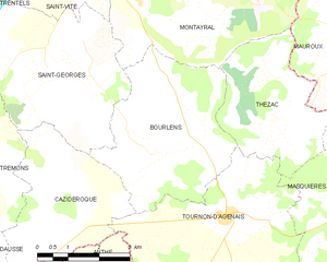
Bourlens
- commune in Lot-et-Garonne, France
- Country:
- Postal Code: 47370
- Coordinates: 44° 25' 5" N, 0° 58' 16" E
- GPS tracks (wikiloc): [Link]
- Area: 15.44 sq km
- Population: 372
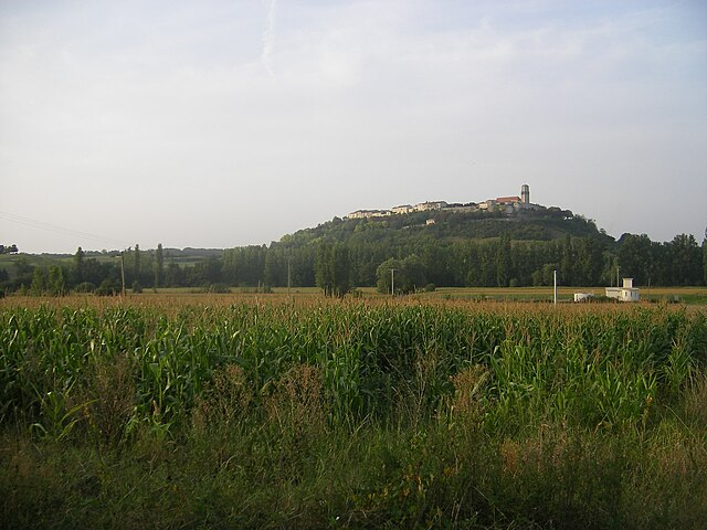

Tournon-d'Agenais
- commune in Lot-et-Garonne, France
- Country:
- Postal Code: 47370
- Coordinates: 44° 24' 0" N, 0° 59' 43" E
- GPS tracks (wikiloc): [Link]
- Area: 21.26 sq km
- Population: 715
- Web site: [Link]


Thézac
- commune in Lot-et-Garonne, France
- Country:
- Postal Code: 47370
- Coordinates: 44° 25' 45" N, 1° 0' 54" E
- GPS tracks (wikiloc): [Link]
- Area: 11.21 sq km
- Population: 190
- Web site: [Link]


Saint-Vite
- commune in Lot-et-Garonne, France
- Country:
- Postal Code: 47500
- Coordinates: 44° 28' 25" N, 0° 56' 25" E
- GPS tracks (wikiloc): [Link]
- Area: 5.47 sq km
- Population: 1171


Montayral
- commune in Lot-et-Garonne, France
- Country:
- Postal Code: 47500
- Coordinates: 44° 28' 46" N, 0° 59' 14" E
- GPS tracks (wikiloc): [Link]
- Area: 24.54 sq km
- Population: 2731


Masquières
- commune in Lot-et-Garonne, France
- Country:
- Postal Code: 47370
- Coordinates: 44° 24' 26" N, 1° 3' 13" E
- GPS tracks (wikiloc): [Link]
- Area: 12.31 sq km
- Population: 184

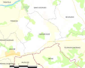
Cazideroque
- commune in Lot-et-Garonne, France
- Country:
- Postal Code: 47370
- Coordinates: 44° 23' 56" N, 0° 55' 43" E
- GPS tracks (wikiloc): [Link]
- Area: 11.94 sq km
- Population: 230
Courbiac
- commune in Lot-et-Garonne, France
- Country:
- Postal Code: 47370
- Coordinates: 44° 22' 38" N, 1° 2' 21" E
- GPS tracks (wikiloc): [Link]
- Area: 9.05 sq km
- Population: 124

Saint-Georges
- commune in Lot-et-Garonne, France
- Country:
- Postal Code: 47370
- Coordinates: 44° 26' 31" N, 0° 56' 2" E
- GPS tracks (wikiloc): [Link]
- AboveSeaLevel: 122 м m
- Area: 15.96 sq km
- Population: 550


Anthé
- commune in Lot-et-Garonne, France
- Country:
- Postal Code: 47370
- Coordinates: 44° 22' 18" N, 0° 57' 35" E
- GPS tracks (wikiloc): [Link]
- Area: 13.93 sq km
- Population: 203